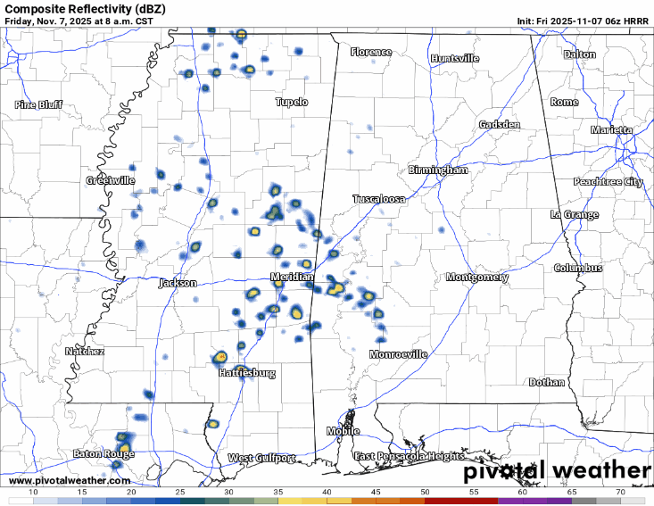
Storms have already popped up to our east around the MS/AL border and we can expect more scattered storms as we progress into the afternoon. The SPC and Jackson NWS office have rolled back severe weather outlooks for the Pine Belt and much of southeastern Mississippi. While the severe threat remains low, it isn’t totally zero. A few storms I noticed had some potential for gusty winds, lightning, and heavy rain.

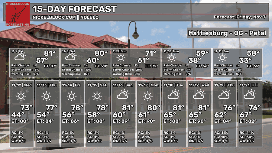
Storms should be out of here by the late afternoon, however it looks like they’ll ramp up a bit for southwestern Alabama as well. We’ll have a mild evening with lows in the low 60s and patchy dense fog possible.
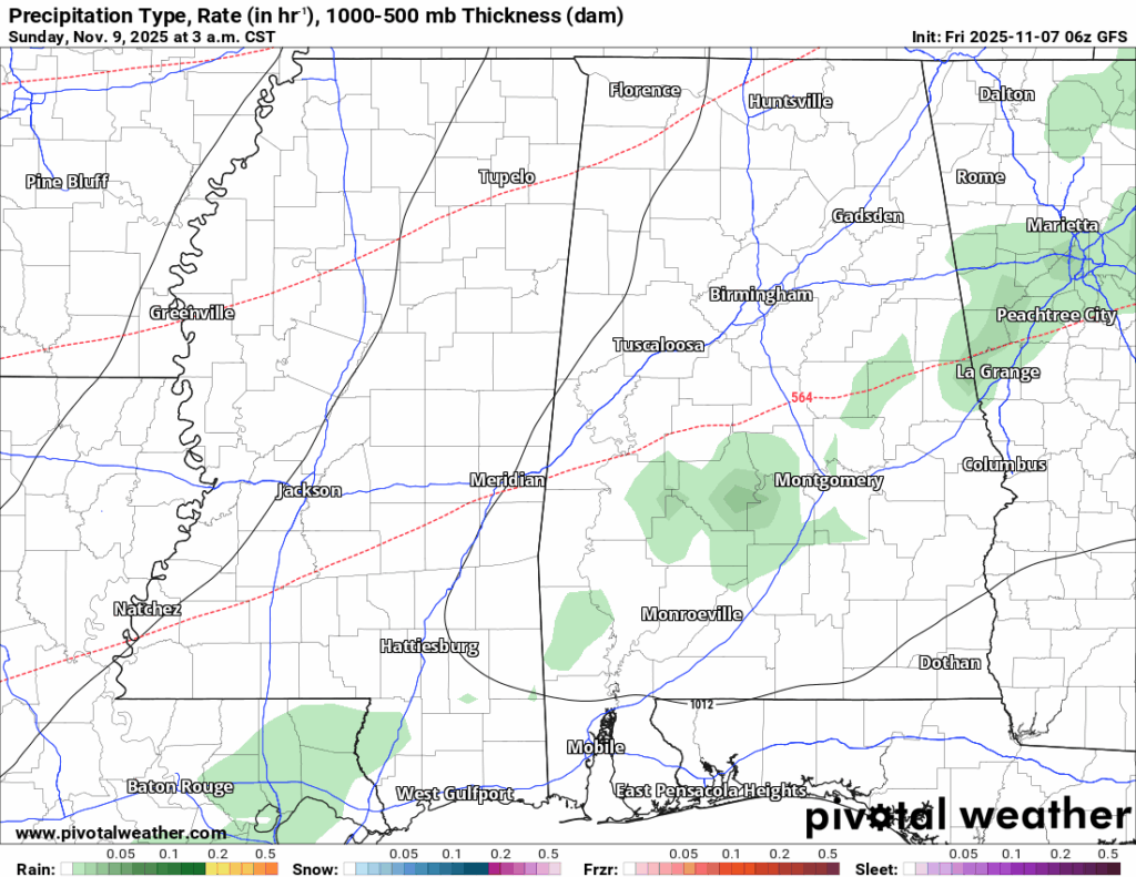
As we’re in between two fronts, it’ll be another seasonably warm Saturday with highs in the low 80s. Mostly sunny skies are expected and rain won’t arrive until closer to midnight. There’s no severe weather associated with it, but anyone traveling overnight should be careful across much of MS/AL. Lows around 60.
The “Canadian air” will move in Sunday keeping the temperature range low with highs in the upper 60s to low 70s. Bring a jacket with you because it’s going to be windy! Wind gusts from the north will reach up to 25mph and continue on into Monday. Lows in the mid 30s and it’ll be even chillier on Monday. Highs in the low 50s and lows around 30. If you have plants that are sensitive to the cold, cover them and bring pets inside.
We’ll be back to a general warming trend afterwards. Temperatures will warm from the upper 50s/mid 30s on Veterans Day to the mid 70s/upper 40s by the end of the week. We’re still fairly dry too as a large surface high pressure is residing over us for a while. Some rain is possible Friday for parts of northern MS/southern TN but we likely won’t see much of that.


Not sure how you are showing a morning low of 33 on Tuesday morning. Every other weather site I have looked at has us being in the mid to upper 20’s Tuesday morning. I sure do hope you are right!