Overall Setup
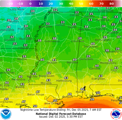
We’re approaching a few unsettled days ahead. Tomorrow, we are expecting some clouds to fill in, in preparation for a coastal low pressure system that will bring us rain for Thursday and Friday. We’ll see a drop in our temperatures tonight into tomorrow morning into the lower 30s, and maybe some upper 20s in some spots. High temperatures will stay on the cooler side for at least the next week or so.
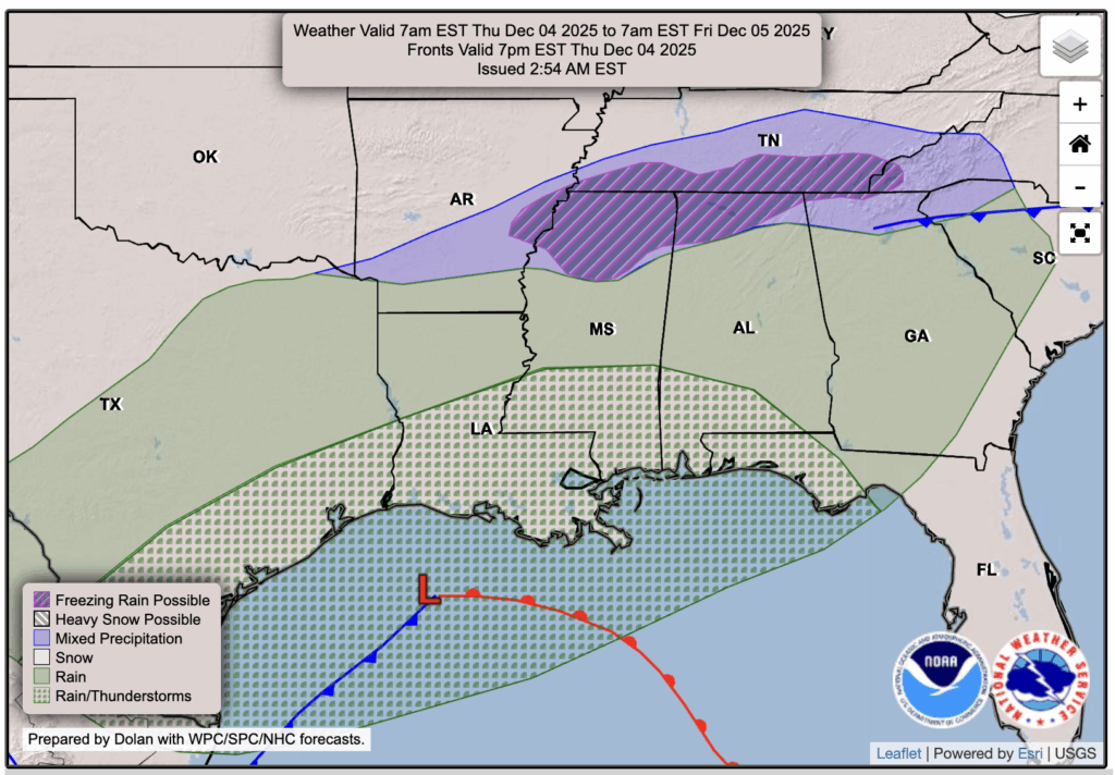
And yes, there is a chance for some mixed precipitation or freezing rain in far northern MS and AL Thursday night. The NWS looks to be overdoing that chance, though. I would say most of those spots will see just plain, cold rain, with maybe a few lucky areas seeing a few flakes or a brief period of freezing rain. It will be way too warm for any of that here. We’ll just have to wait a bit longer!

Tonight’s Forecast
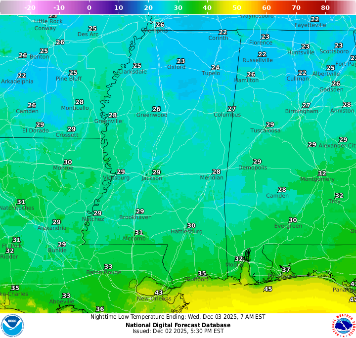
Tonight, those lows will get very, very cold. Ensure the heat in the house is set to turn on overnight and especially in the morning, as it will be a chilly wakeup for us. We’re not expecting any rain, or snow at that, so it’ll be a dry night ahead.
Tomorrow’s Forecast: Wednesday, December 3
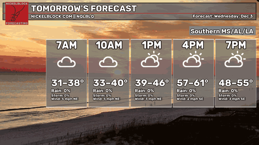
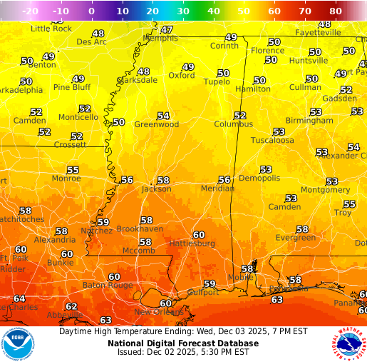
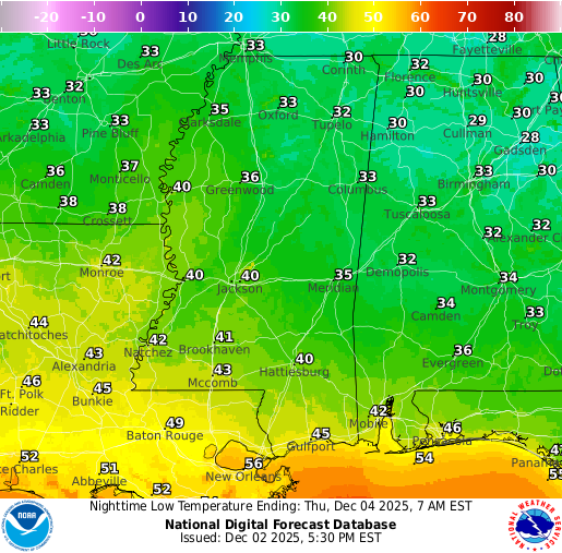
It will take some time for temperatures to warm up tomorrow, but by mid afternoon most areas should reach the upper 50s to lower 60s. Expect a mix of sun and clouds through the day, with clouds gradually increasing during the evening and into the night. Overnight lows will fall to around 40 degrees in Hattiesburg, while southern Louisiana stays a bit milder as the coastal low pulls warmer air north.
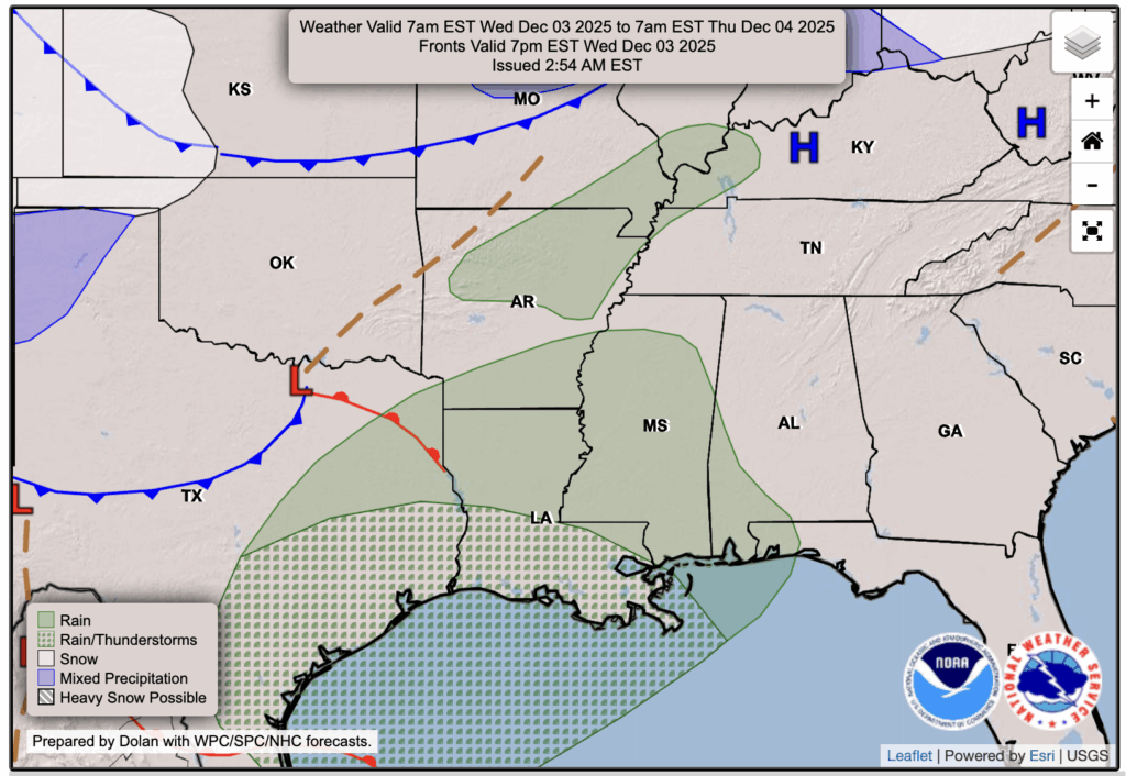
Rain is expected to begin in Louisiana around 10 to 11 PM, arriving in Mississippi closer to roughly midnight through 4 AM.
Thursday’s Forecast: December 4
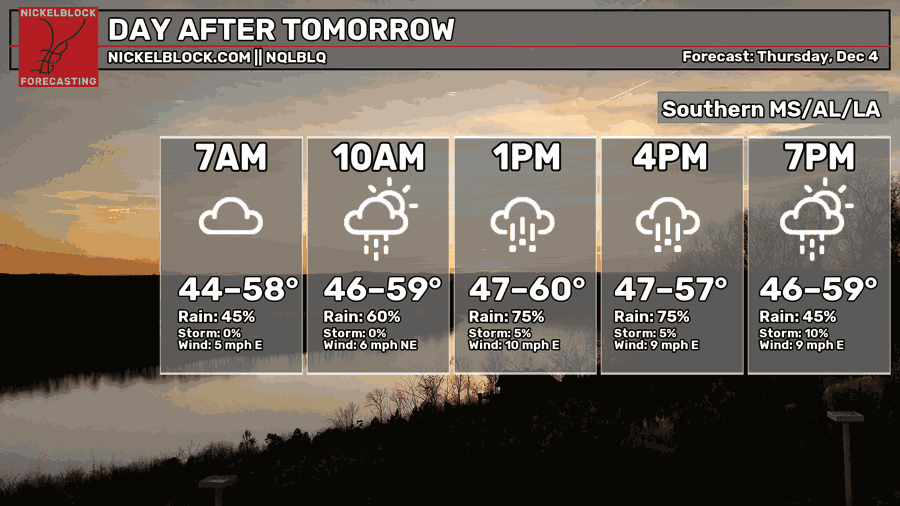
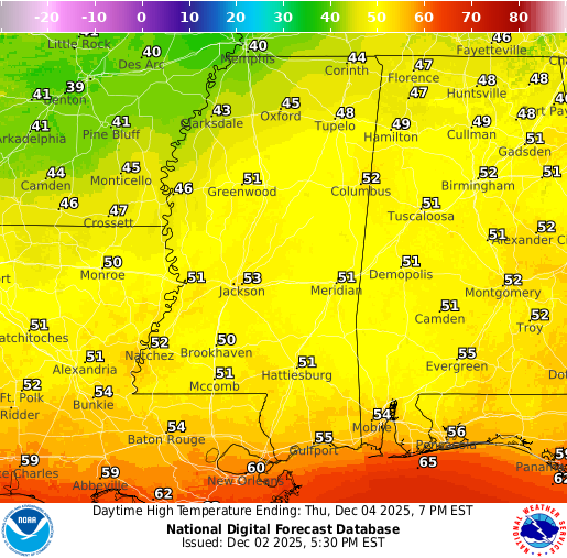
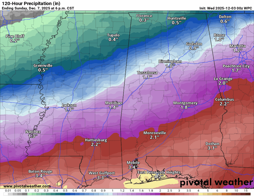
As that coastal low we talked about earlier moves up the coast on Thursday, it will keep steady rain around much of the day, so expect a cool, soggy stretch from morning through evening. Severe weather isn’t a concern, but some heavier pockets of rain with rumbles of thunder and a few flashes of lightning are possible. Highs will hold in the low to mid 50s with lows in the lower 40s, and when you combine Thursday’s rain with Friday’s showers, totals around 1 to 3 inches look likely. Higher totals will be seen closer to the coast.
Extended Local Outlook
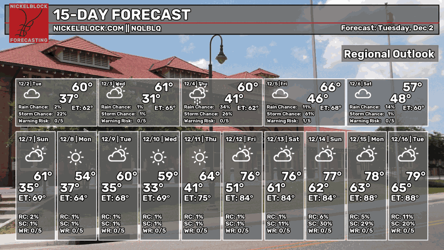
Saturday and Sunday both stay on the cool side with highs in the 50s Saturday and closer to 60 on Sunday. Conditions look fairly quiet overall with a mix of sun and clouds and only a small chance for a shower or two.
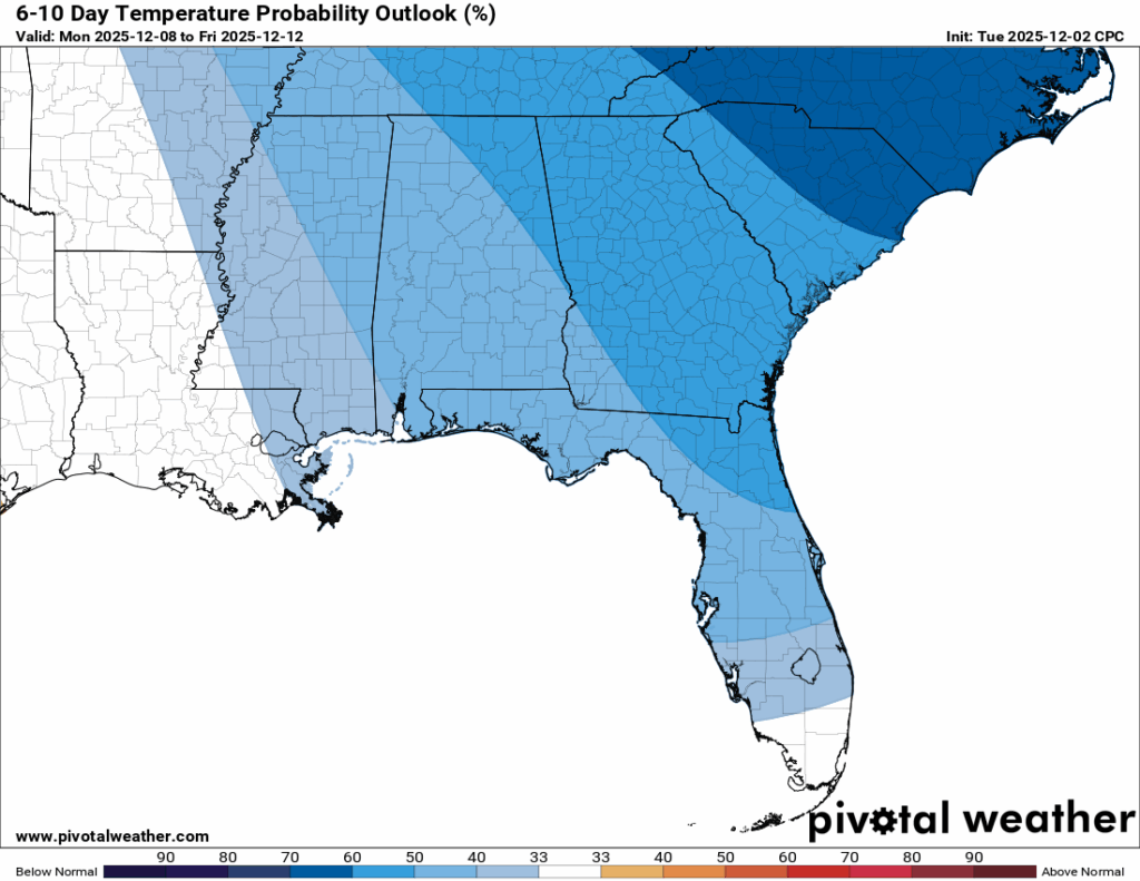
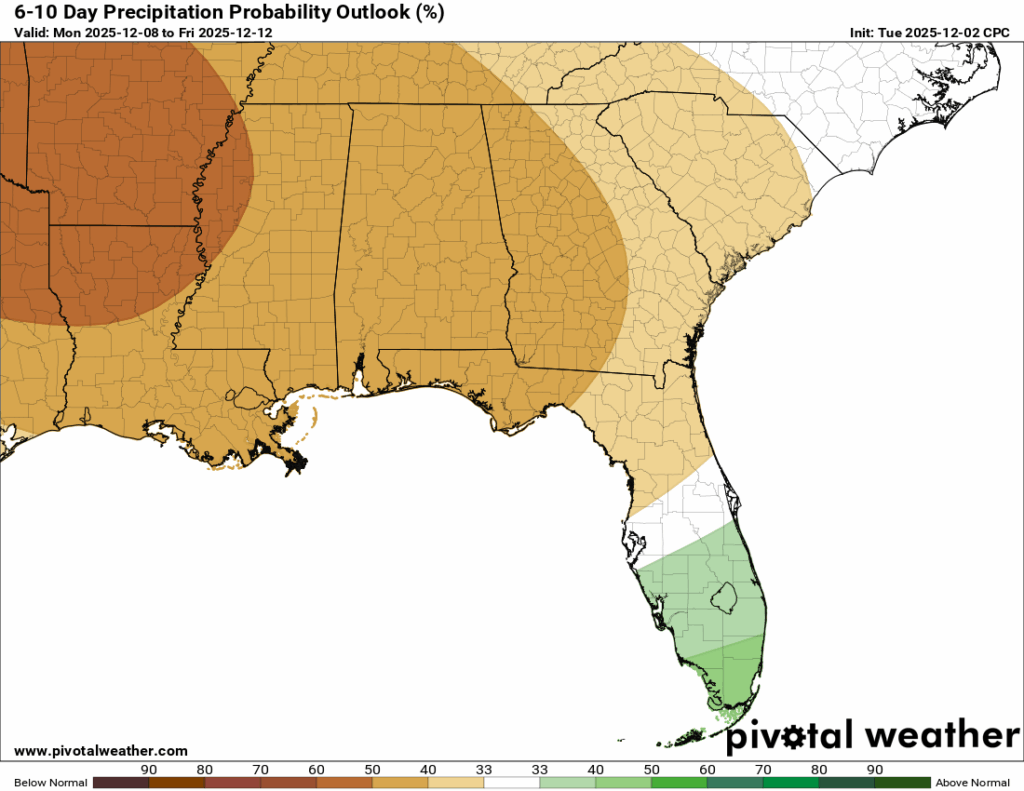
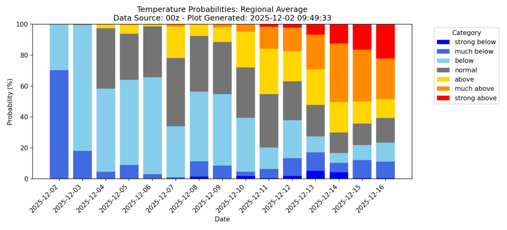
Looking farther out, the 6-10 outlook keeps temperatures running below normal, which lines up with our temperature probability chart showing a good stretch of colder days lasting at least a week or so. There are a few signs of a small warmup trying to show up closer to mid month, but the cooler pattern still looks like the main theme for now.

REGIONAL DAY TO DAY FORECAST
Tonight: Mostly cloudy. Lows in the low 30s. North wind around 5 mph becoming calm this evening.
Wednesday: Partly sunny. Highs near 60. Calm wind.
Wednesday Night: A chance of showers late. Increasing clouds. Lows around 40. Chance of rain 40 percent.
Thursday: Showers, mainly after 7 a.m. Highs in the lower 50s. Light wind becoming east-northeast around 5 mph in the morning. Chance of rain 90 percent.
Thursday Night: Showers. Lows in the lower 40s. Northeast wind around 5 mph. Chance of rain 80 percent.
Friday: Showers and possibly a thunderstorm. Highs in the low 50s. North-northeast wind around 5 mph. Chance of rain 80 percent.
Friday Night: Showers likely, mainly before midnight. Cloudy. Lows in the mid 40s. Calm wind. Chance of rain 60 percent.
Saturday: A chance of showers. Mostly cloudy. Highs in the upper 50s. Calm wind becoming north-northeast around 5 mph. Chance of rain 30 percent.
Saturday Night: A slight chance of showers before midnight. Mostly cloudy. Lows in the lower 40s. Calm wind. Chance of rain 20 percent.
Sunday: Mostly sunny. Highs in the lower 60s.
Sunday Night: A slight chance of showers. Mostly clear. Lows in the upper 30s. Chance of rain 20 percent.
Monday: Sunny. Highs in the upper 50s.
Monday Night: Partly cloudy. Lows in the mid 30s.
Tuesday: Mostly sunny. Highs near 60.


