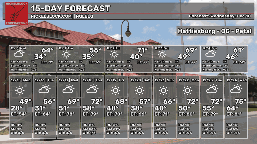
The cold front has officially passed and we’ll be in for a much cooler night ahead. The north winds have been blowing a bit from the north and will continue on through the rest of the night. Temperatures will drop into the upper 30s tonight with clear skies.

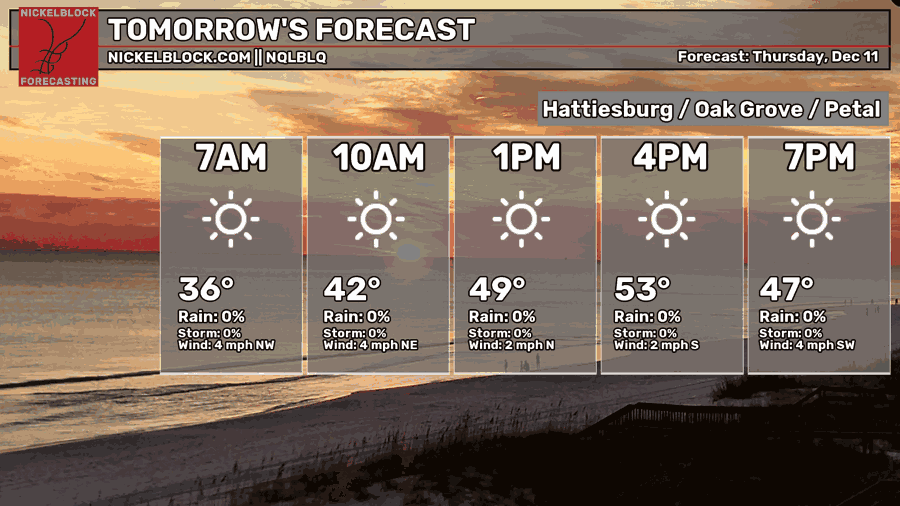
Tomorrow, we can expect clear skies across the area with highs in the low to mid 50s. I think the NQLBOT model may be under-doing it a bit on temperatures, but it’ll be a cool day overall. Lows will fall into the upper 30s with clear skies and winds calming.
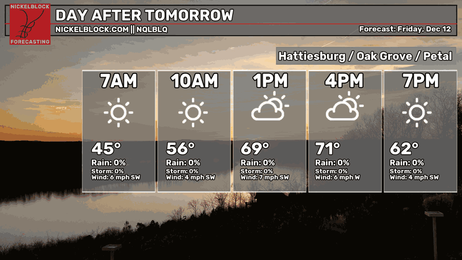
Expect much warmer conditions on Friday as a warm front creeps in from the Gulf and drives temperatures into the low 70s. Some low and mid level clouds will roll in during the early afternoon and move out by the evening hours. Temperatures will fall into the upper 40s overnight with mostly clear skies.
The Weekend
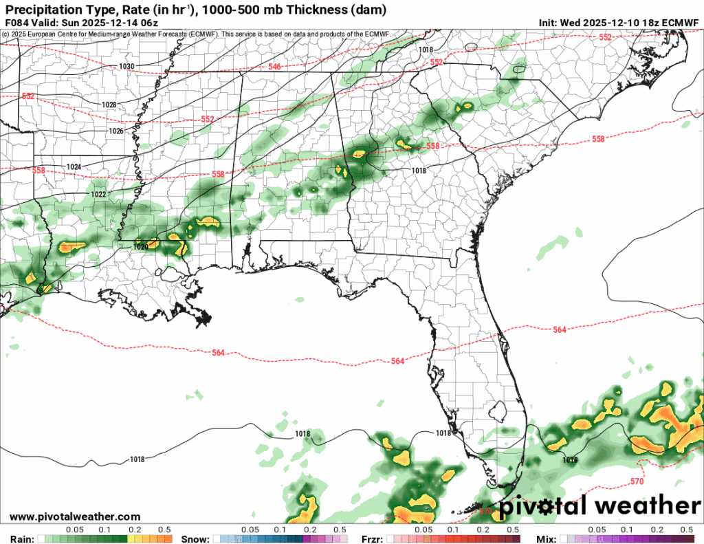
As we roll into Saturday, we’ll have a very pleasant day with highs in the upper 60s and mostly clear skies. If you’re out Christmas shopping, you probably won’t need a sweater this time around. During the overnight hours, we can expect rain to start around midnight to sunrise on Sunday. While this won’t be a lot of rain, it will at least leave things damp in the morning hours before you head to church. As we move into Sunday, we can expect clouds to move out during the day with temperatures in the low 60s. It’ll be much cooler overnight with temperatures falling into the upper 20s. If you have pets or plants, cover them and bring them inside! There will likely be a freeze warning going out for Sunday night/Monday morning.