We’re starting off above the freezing mark this morning, so thankfully, no frost on the ground or on your car windows. As we go throughout the day today, we’ll have mostly cloudy skies keeping conditions fairly mild today with a high in the low to mid 60s. We won’t have a lot of temperature variation tonight as the warm front moves in and keeps it in the low 50s overnight.

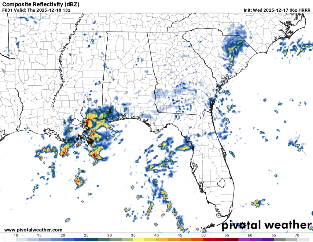
//Courtesy: Pivotal Weather
Overnight, a cluster of rain and thunderstorms will move up the MS/LA coastline from the southwest along with some scattered cells developing by the early morning hours. We can expect scattered rain and thunderstorms throughout the morning. As the cold front moves in later, another round will move in by the late afternoon hours. Overall, expect a warm but soggy day tomorrow.
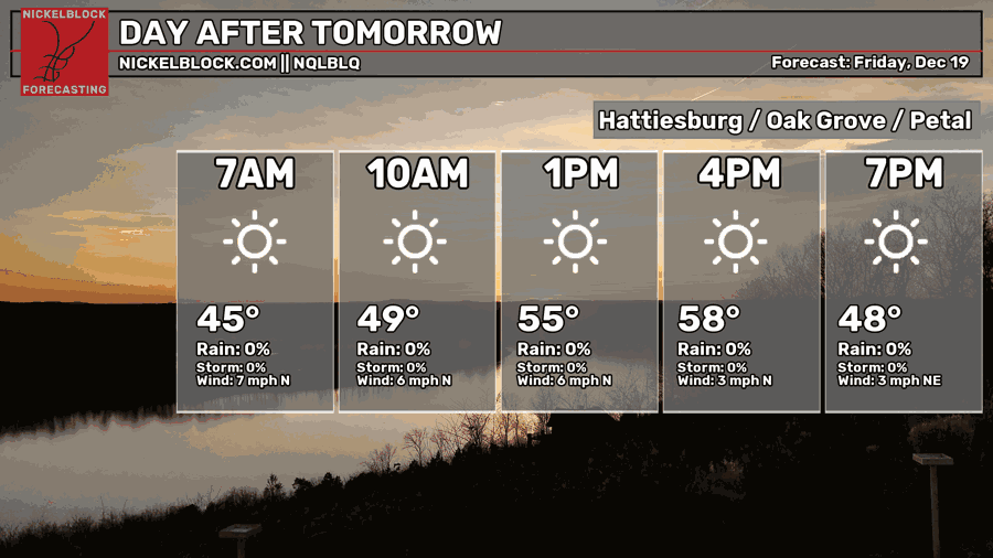
The cold front moves in and clears the clouds out for Friday. Temperatures will be in the mid 50s during the day with north winds. Overnight, we’ll be just above the freezing mark with clear skies. Saturday will be much warmer as another warm front creeps in and shifts winds to the south. We’ll reach the upper 60s to low 70s during the day with increasing clouds towards the evening. Overnight, temperatures will fall into the low 40s.
//Courtesy: Pivotal Weather
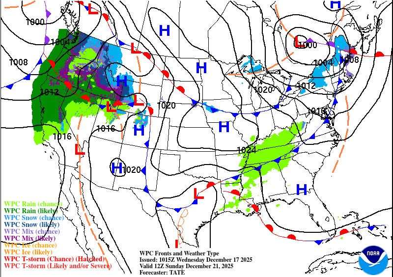
There’s a slight chance of rain Sunday morning with the warm front moving in. This looks to be fairly brief during the day, but it may affect your commute to church, so keep an umbrella handy just in case. Temperatures will reach the low 70s during the day with mostly cloudy skies. Overnight, it’ll be mild with temperatures in the low 50s.
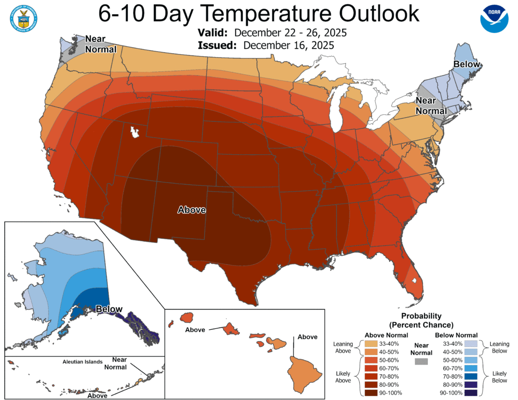
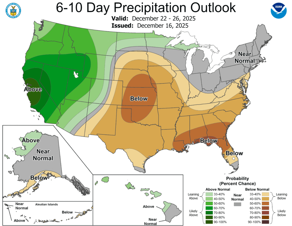
Just to take a quick look at the 6-10 day temperature outlook, no, no White Christmas. It’s gonna be warm. Barely any rain, just warm.