Not much has changed for this Christmas forecast. Santa’s still going to go for a vacation at the Gulf at this point. We’re much warmer than average for this time of year, so dress accordingly. Ditch the Christmas sweaters or just sweaters at all and find a cooler shirt to wear. We won’t get any relief from the warmer temperatures until the beginning of next week.
Christmas Eve and Christmas Day
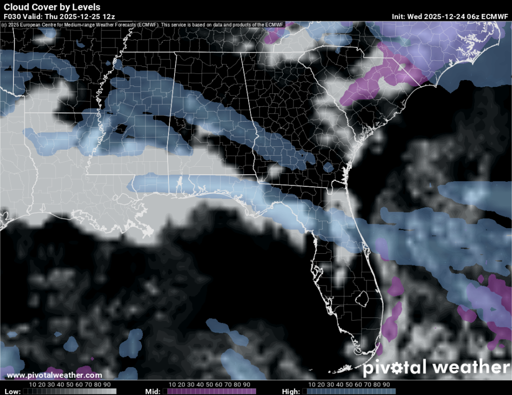
We’re starting this morning off with some dense fog possible along the Gulf coastline and the fog is expected to dissipate by mid-morning. We’ll have mostly sunny skies with highs in the mid to upper 70s. Overnight, temperatures will fall into the mid 50s with another chance for dense fog.
//Courtesy: Pivotal Weather
Christmas Day will start off foggy and eventually give way to mostly sunny skies. Southwest winds will come in, albeit around 5mph at the most. If the kids want to go out and play with their toys, they’ll have no rain to contend with. Hooray! Overnight, we’ll go back into the foggy pattern with a low in the upper 50s.
This Weekend
A dry low pressure system will move in on Friday ramping up the winds a bit. Southwest winds will prevail around 5-10mph with 25mph wind gusts possible. Otherwise, it’s another warm day with a high in the mid to upper 70s and slightly humid conditions. Lows will fall into the mid 50s with increasing clouds and fog possible.
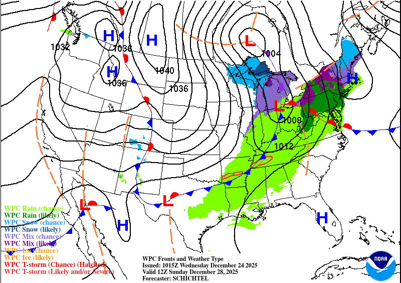
Saturday will be a similar story though not as gusty. Highs in the mid to upper 70s with a mix of clouds and sun. Overnight, more clouds will roll in and we’ll fall into the upper 50s. Sunday will be a more cloudy day as a stationary front approaches the Southeast. Rain is not expected until the overnight hours into Monday morning.
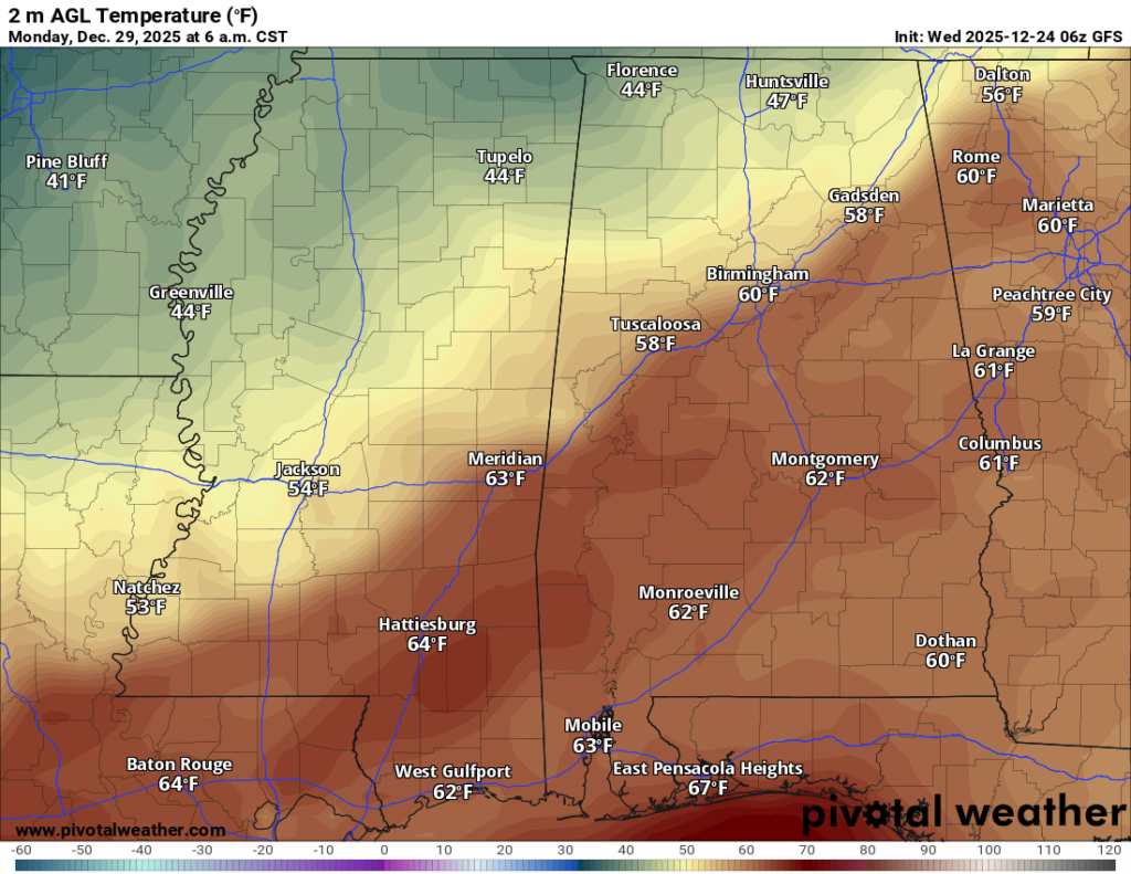
Models are still apprehensive about the drastic temperature change, but so far, our high temperature will likely be in the morning on Monday as the cold front moves in. We’ll likely see some strong northerly winds along with temperatures in the mid 40s during the day. If you’re going back to work, bring your jacket because it’ll get pretty cold by the end of the day!
I hope you all have a Merry Christmas and Happy Holidays!


