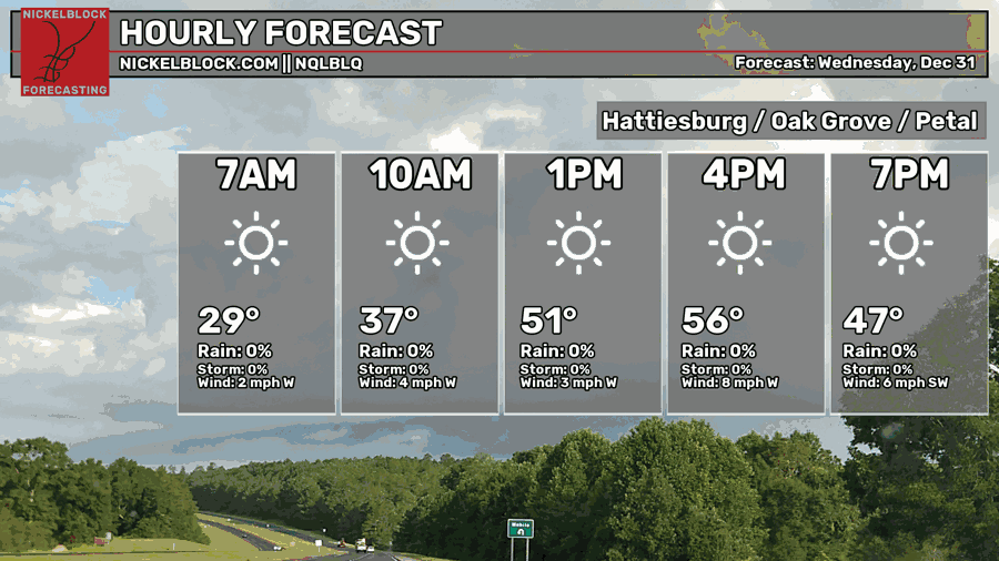
We’re starting off pretty cold this morning with some frost outside as temperatures fell into the mid 20s last night. Conditions will be a bit warmer today with our high reaching the mid to upper 50s across the area. For the next several days, we’ll go into a warmer than average pattern with temperatures moving from the mid 60s to the low 70s by the beginning of the week.

Today
New Years Eve will be a pleasant one with temperatures reaching the mid to upper 50s during the day. If you’re going to see the ball drop tonight, wear a jacket and possibly some lined pants as we’ll fall into the low 40s before midnight. Temperatures will drop into the mid 30s by Tuesday morning.
New Year’s Day
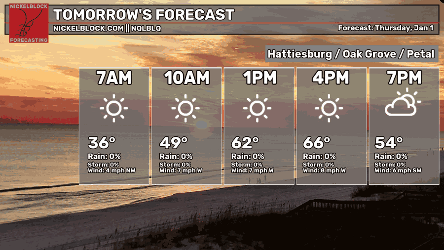
As we ring in 2026, it’s going to be a very pleasant one with hardly any clouds in the sky! Go out and enjoy it with your family and friends if you can. Winds will be from the west around 5-10mph. Overnight, temperatures will only fall into the low 50s as clouds will move in.
Friday
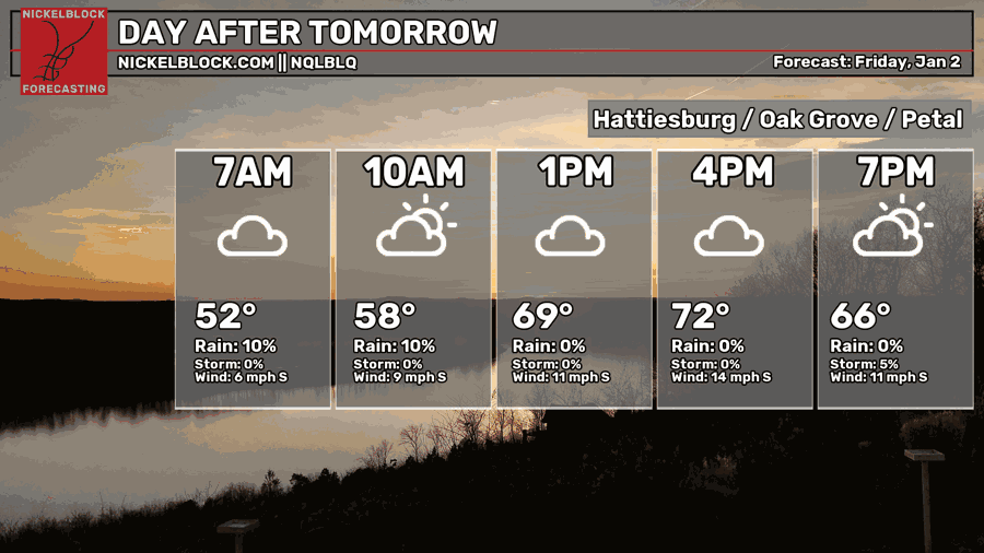
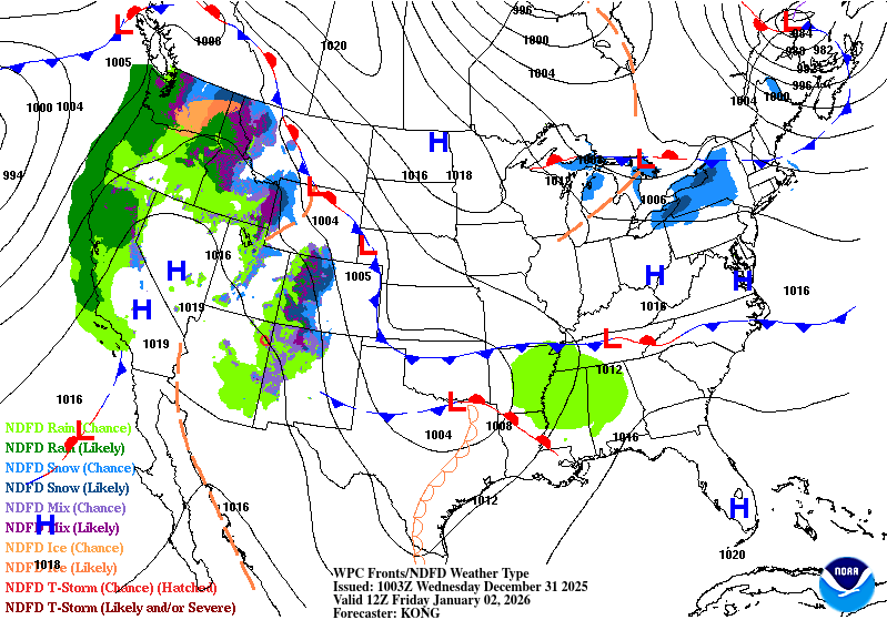
Winds will shift and blow from the south as a low pressure system moves in from Texas on Friday. It’ll be a mostly cloudy day and the rain won’t move in until after sunset. Highs in the low 70s and a low in the upper 50s/low 60s.
This Weekend
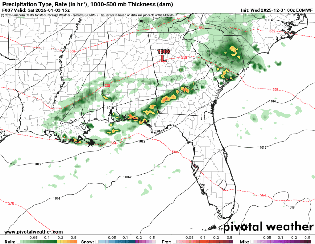
Models are still figuring out the timing of the rain, but I wouldn’t doubt we’ll have some morning rain on Saturday. Afterwards, we’ll have a mix of clouds and sun for the rest of the day with a high in the low 70s. Overnight, we’ll fall into the mid 40s as winds shift towards the north. With the cold front moving in on Sunday, we can expect some more gusty winds moving in keeping temperatures cooler overall. Highs will be in the low 60s and lows in the low 40s with mostly sunny skies.
Hope you all have a great New Year!