We’re going into another warm pattern this week as temperatures climb and eventually even out by the middle of the week. It’ll be a pretty mundane and warm week until we get a chance of showers and thunderstorms by Friday evening into Saturday morning. Let’s take a look.

Today
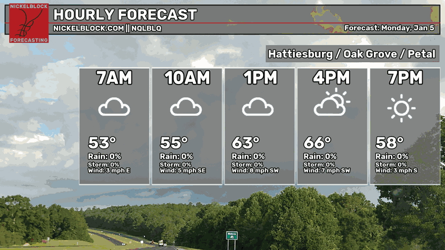
This morning, we’re starting off with some foggy conditions. If you’re on the road, drive safe and slower until the fog lifts later this morning. Afterwards, we’ll have partly cloudy skies during the day and a high in the mid 60s. Overnight, we’ll fall into the upper 40s with mostly clear skies.
Tomorrow
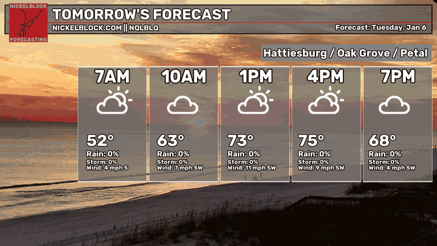
A warm front from a long low pressure system will move through the southeast on Tuesday boosting wind speeds from the southwest. Overall conditions will be warmer and more humid with mid-level clouds covering the skies. Expect temperatures in the mid 70s during the day and the low 60s overnight.
Wednesday
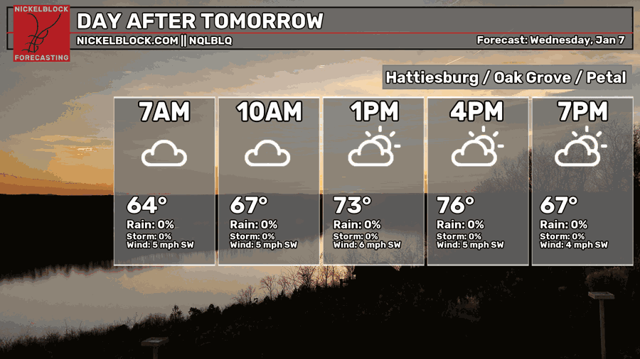
Conditions will calm down a bit on Wednesday but stay warm with a mix of clouds and sun during the day. Winds will still blow from the southwest around 5-10mph. Highs will reach the mid 70s again and lows in the low 60s.
After Hump Day
We’ll still be warm and humid as temperatures don’t fall out of the average range for Thursday and Friday. Thursday will be another warm one with some isolated and scattered showers possible during the day and into the night hours. This is gearing up for Friday, which is our main chance.
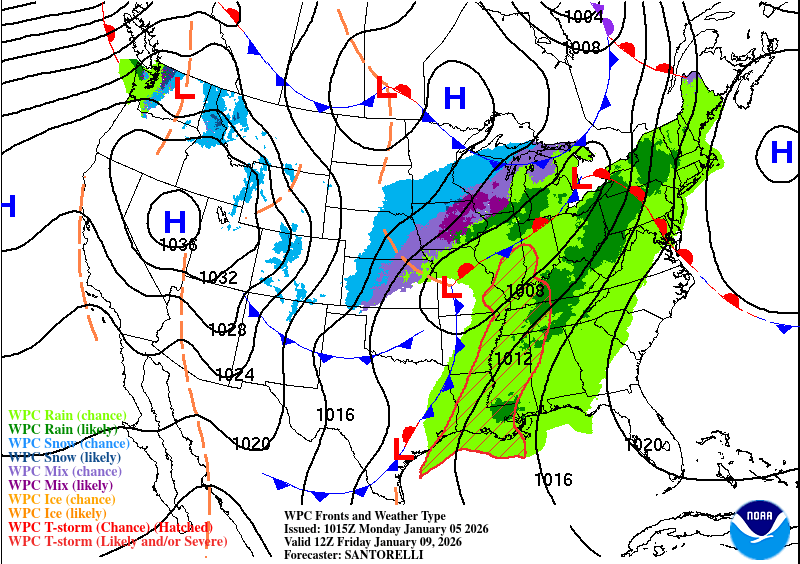
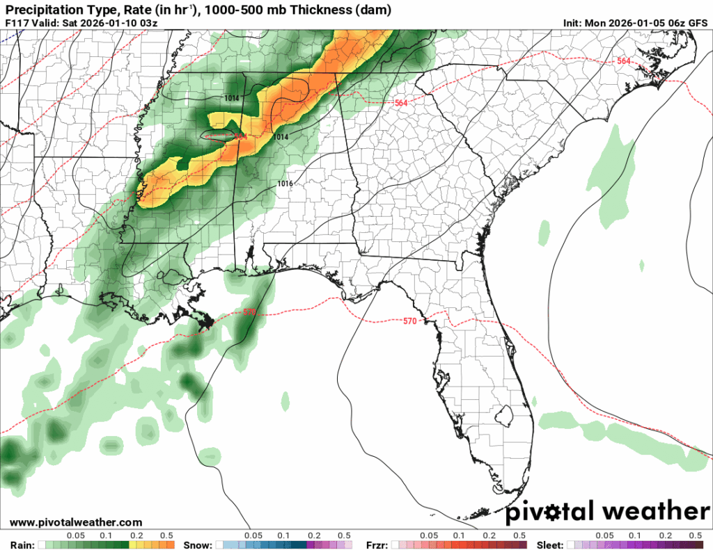
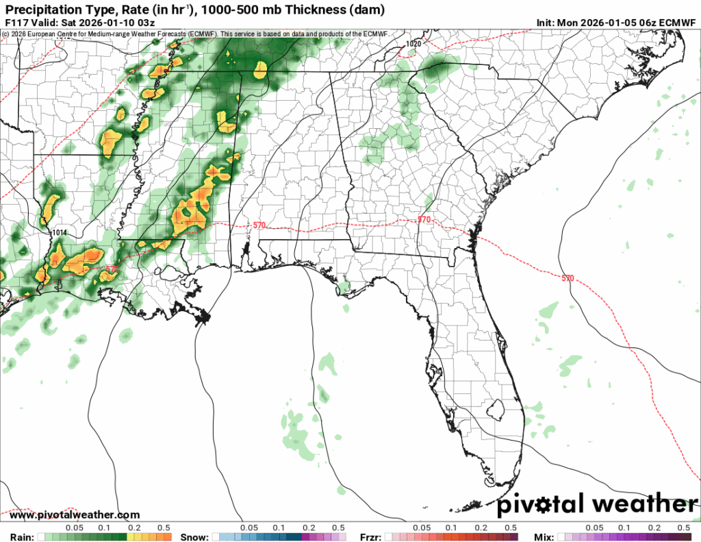
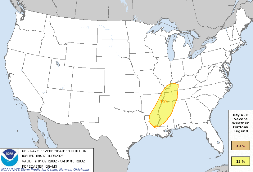
Both the GFS and ECMWF models still differ a bit on impact and severity, but it looks like there is a 15% chance of severe weather possible Friday into Saturday from the Storm Prediction Center. They have commented so far that this is modest instability so this may be a pretty limited severe weather event. However, it goes without saying that any chance of severe weather will bring at least a few strong storms with the possibility for lightning, hail, winds and maybe even a tornado. I’ll have another update on this Wednesday once model guidance comes into more agreement.
For now, showers and thunderstorms are possible from Friday afternoon to early Saturday morning. Have your umbrella and jacket ready as moderate to heavy rain is likely. It’ll also be warm and humid with a high in the mid 70s again.


