What do you get when you combine upper level cold air and surface level cold air??

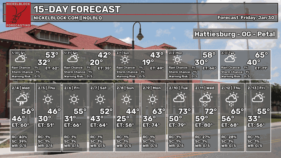
It’s going to be very cold this weekend to say the least. Not the kind you want to be outside or warm up the outdoor fire pit for either. Strong northerly winds will cut through you if you’re outdoors, so be sure to stay inside for Saturday. The rest of the week, however, is looking a little more average compared to this weekend. A chance of rain is likely on Wednesday with an incoming front, and we’ll return to more wintry-like weather by the end of the week.

This Weekend
I’ve already said it’s going to be cold, but I’ll show you just how cold it’s going to be.
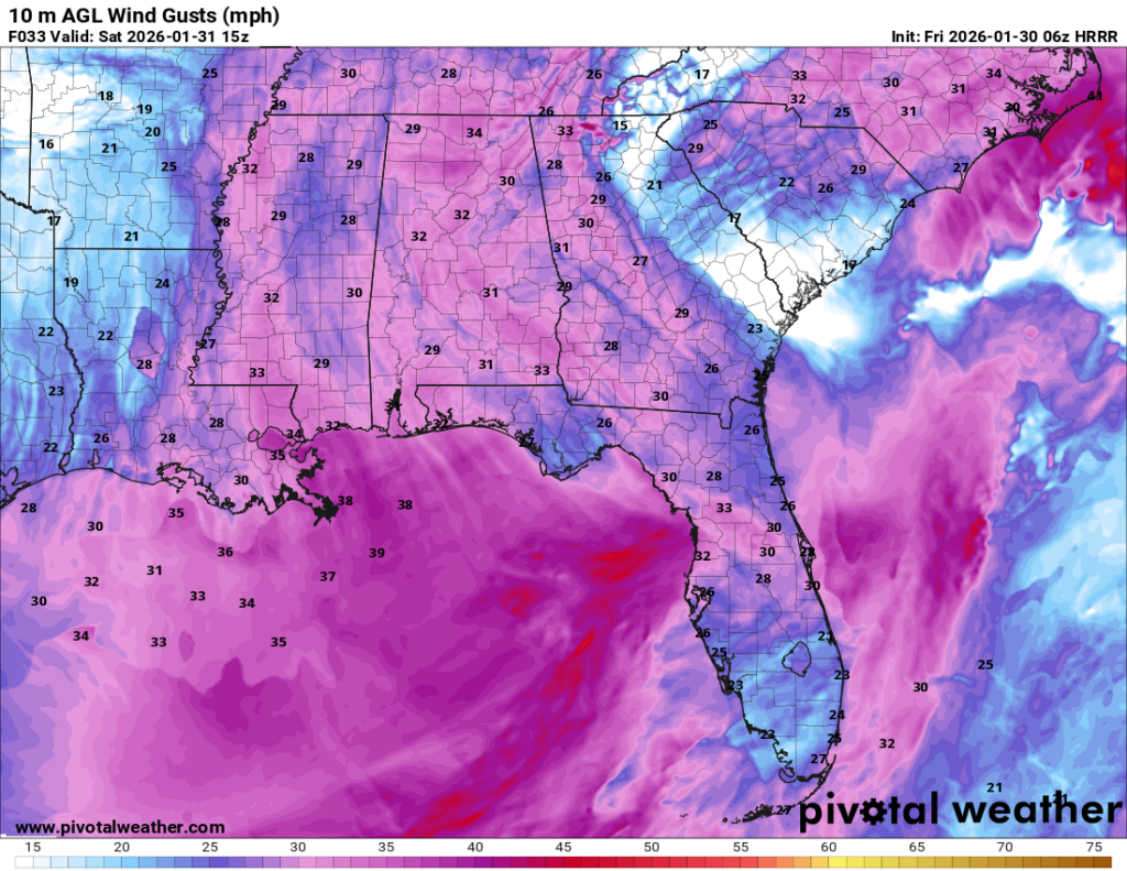
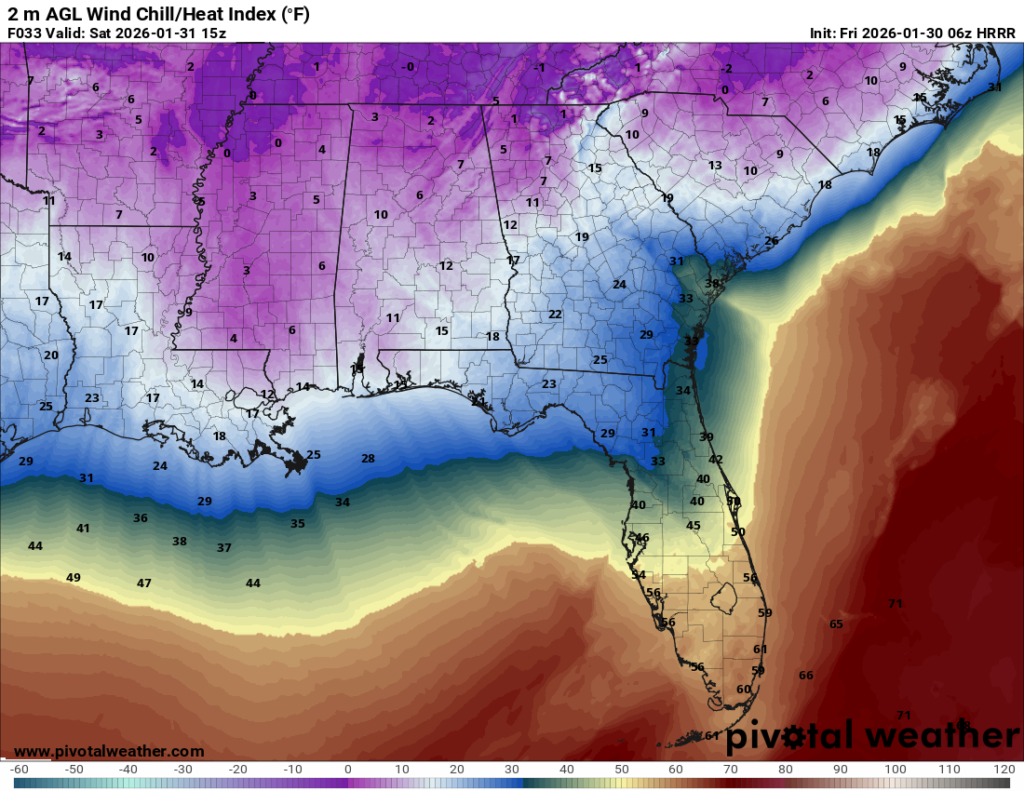
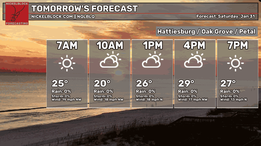
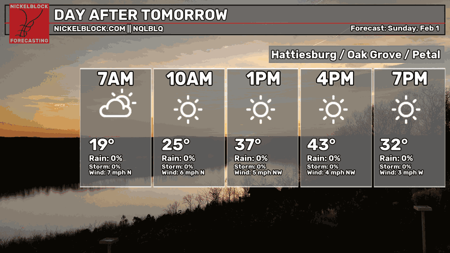
Yeah, Saturday morning is going to be extremely cold. Single digit wind chills are possible across much of Mississippi and Alabama. Most of the area won’t get out of the 10s for wind chills as northerly winds will prevail for the whole day around 15-25mph. As the sun goes down, temperatures will fall back into the upper 10s. It will be slightly warmer on Sunday with a high in the low 40s and winds will die down a bit.
Next Week
There will be a brief warm-up starting on Monday with winds shifting away from the north. Highs in the mid 50s and a low in the low 30s. Tuesday will be a good bit warmer as winds shift towards the south. Expect conditions to be a bit more humid as we’ll have a chance of rain towards the overnight hours.
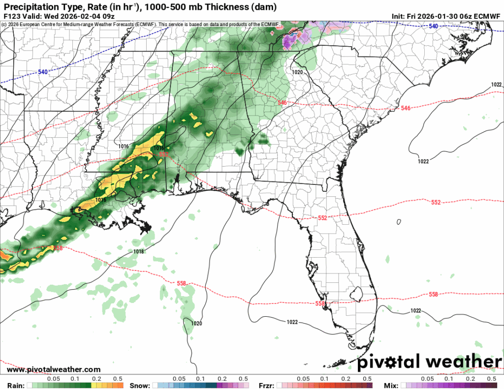
Overnight into early Wednesday morning, expect some moderate rain showers across Louisiana/Mississippi and leave into Alabama by mid-morning. A few thunderstorms are possible in southeastern Louisiana/coastal Mississippi, otherwise, this system doesn’t pose much of a threat.
After the front passes through, expect more average winter-like weather for the next few days. Thursday and Friday will both be dry and cool with temperatures in the upper 20s overnight and a high in the low to mid 50s. This trend will continue, cool a bit, and then eventually warm up by the beginning of the next week, so look forward to the warmer temperatures eventually if you’re tired of the bitter cold.
Have a good week and stay warm this weekend! Be sure to check on your neighbors to make sure they’re staying warm.