The rain is currently on its way out for most of us in Mississippi and will move out of Alabama by the early afternoon. Afterwards, we’re going to have some cooler and windier weather for the next couple of days as the cold front moves in. This weekend looks very pleasant, however, so it’s a great contrast to last weekend’s conditions.

Today and Tomorrow
While we start off in the 50s this morning, that’ll be the highest temperature for the whole day. The cold front will move in and drop temperatures into the 40s by the afternoon. Winds will shift towards the northwest and gust up to 25mph. Overnight, we’ll fall into the upper 20s to low 30s across the area.
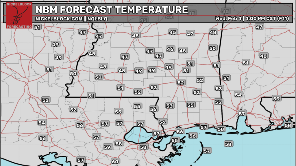
Tomorrow, expect similar conditions as we reach the 50 mark in some areas and the upper 40s for the rest. Mostly clear skies with northwesterly winds still blowing and 25mph wind gusts possible. Overnight, temperatures will fall back into the low 30s again.
This Weekend
We’ll have a beautiful day on Friday with a very nice high in the mid 60s. Very few clouds in the sky with drier conditions. Overnight, we’ll fall into the upper 30s/low 40s with mostly clear skies.
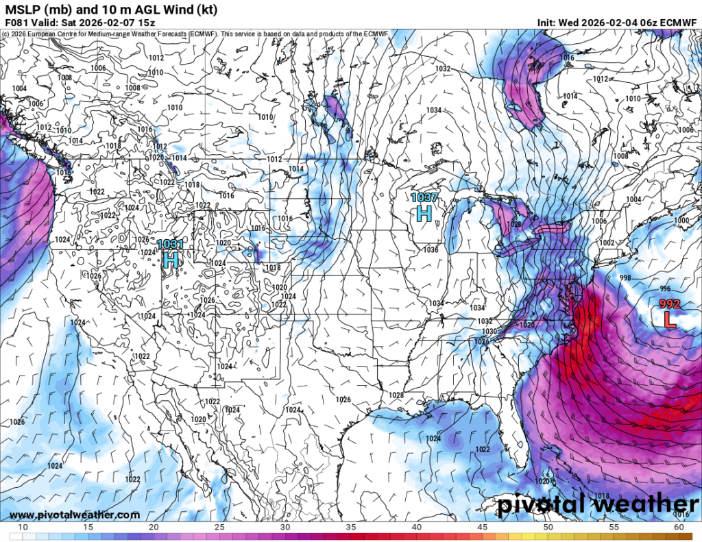
//Courtesy: Pivotal Weather
Temperatures will take a bit of a dive on Saturday as a large high pressure over the western Great Lakes brings northerly winds into the Southeast. Highs will be in the mid 50s to low 60s across the area and lows in the 40s. Sunday will be another pleasant day with temperatures in the mid to upper 60s and a low in the mid 40s. Overall, it’s going to be a nice weekend for us here in the Pine Belt!


