Severe Outlooks Ahead
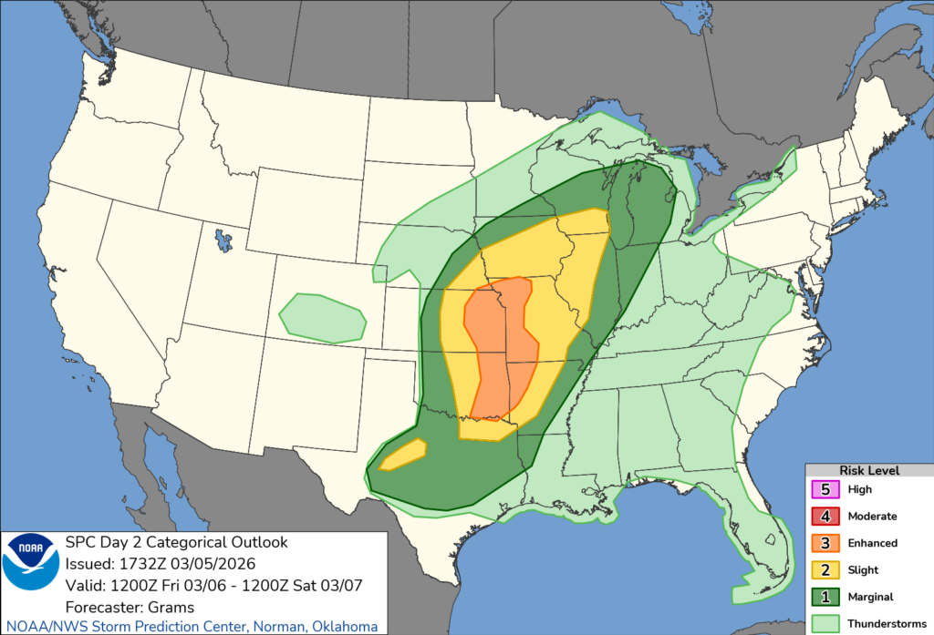
It seems like each time there’s a severe weather event, it occurs on the weekend. Don’t feel left out, the same thing happens in Jersey, it only snows on the weekend! Just in time for the new SPC graphics, there’s a good chance of severe thunderstorms tomorrow in the areas in Tornado Alley through the Upper Midwest, thanks to a system working its way through the center of the country.
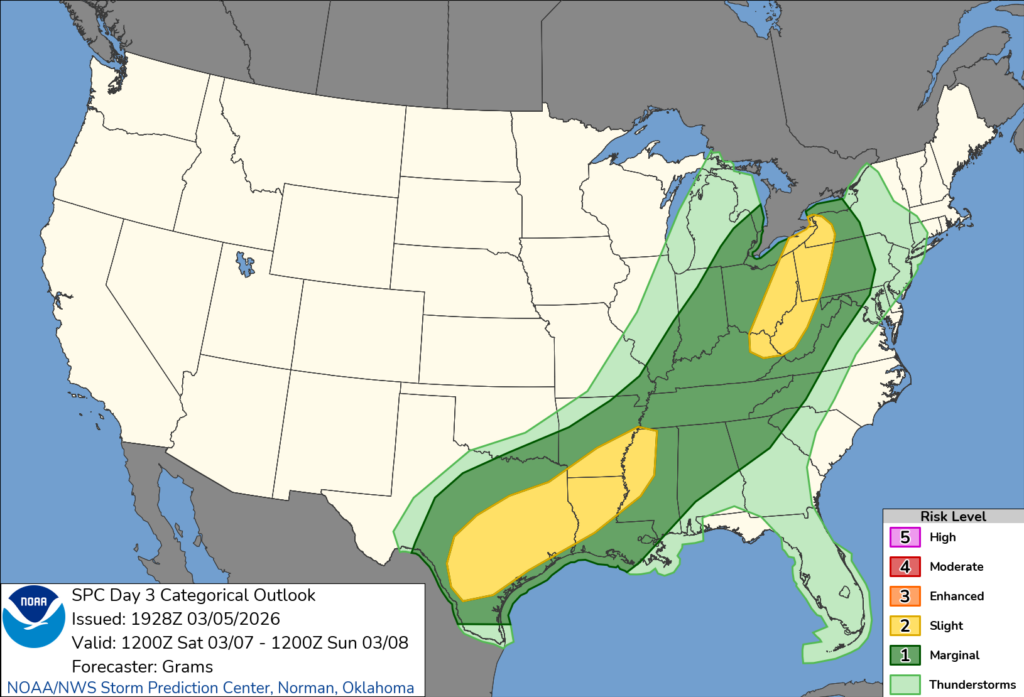
As for us, we are under a general thunderstorm risk on the outlook, so nothing severe is expected for your Friday. As the system and associated cold front move into our area on Saturday, we see that we are under a severe threat. More details will be known tomorrow, once the SPC issues its “Day 2” outlook, which outlines the specific probabilities for severe hail, winds, and tornadoes. For now, it’s not a tornado-driven threat for us, since the wind shear doesn’t look favorable. That doesn’t mean we cannot see one or two, but we’re more likely to see severe winds or large hail if anything. Check back tomorrow for the updated SPC outlook.

Tonight’s Forecast
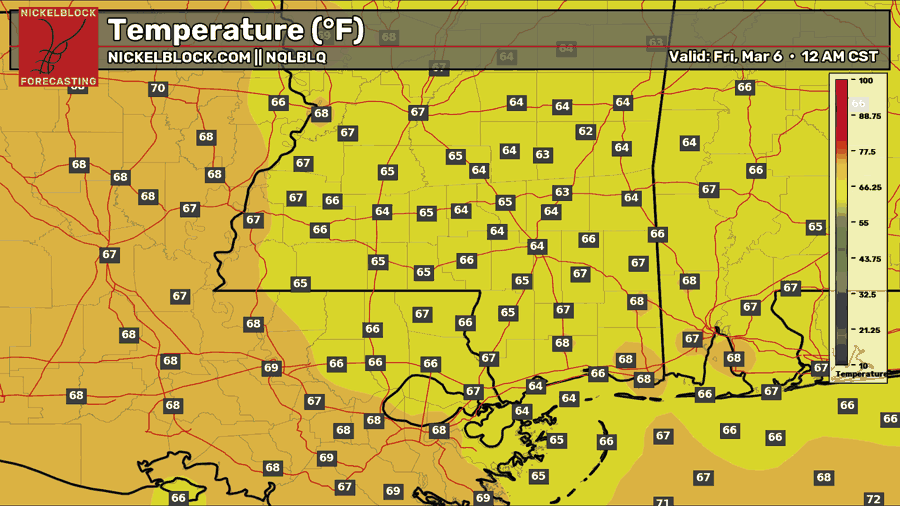
Tonight, it’s another muggy night with temperatures in the 60s. Some patchy fog will be in the area through the night, so be cautious if you will be out and about. There’s a chance we get some isolated overnight showers or a brief thunderstorm, since we have so much moisture funneling in from the Gulf, but again, it’ll be very isolated.

Tomorrow’s Forecast: Friday, March 6
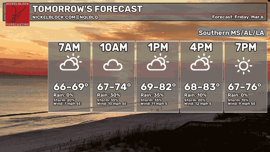
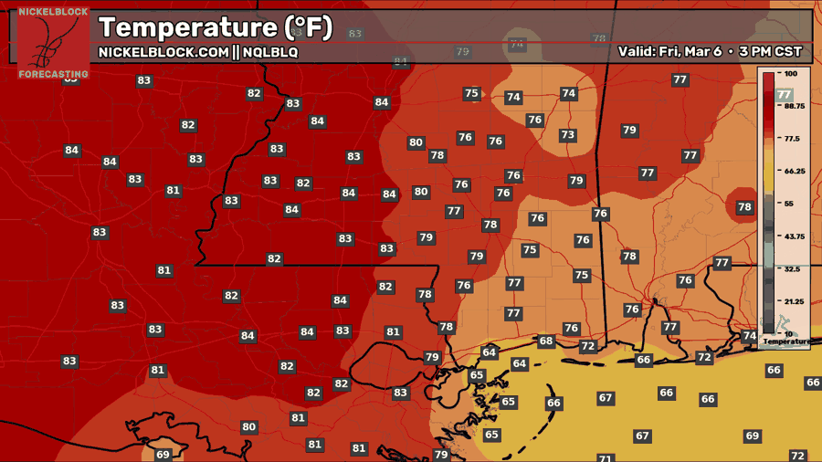
Another muggy and warm day is in store for tomorrow, Friday, with temperatures in the upper 70s and lower 80s. Through the morning and afternoon, we have a chance at some pop-up heavy downpours and thunderstorms. We will be generally cloudy all day, but the sun will try to come out in the afternoon and early evening.
This Weekend’s Forecast
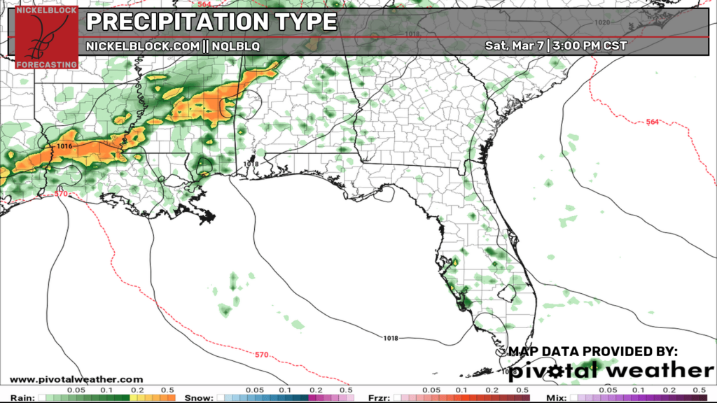
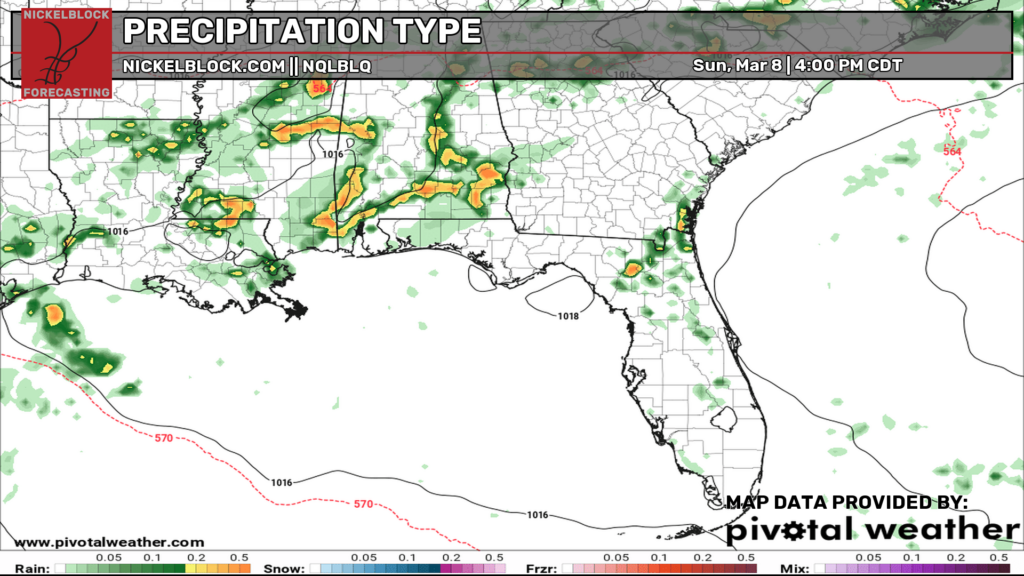
As mentioned earlier, we’ll see some strong-to-severe thunderstorms on Saturday, out ahead of a cold front, and then along it on Sunday. Right now, there’s only a severe risk for Saturday, but we will know more about a potential severe risk on Sunday by tomorrow. For now, prepare to be in a safe spot for Saturday afternoon and evening, and ensure you stay in tune with us using the NickelBlock app!

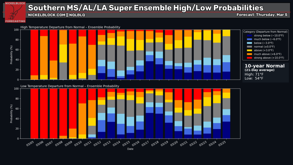
Extended Local Outlook
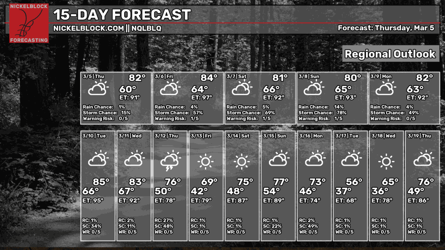
As shown by the 15-day forecast and the Super Ensemble probabilities, we’re going to keep the above-normal temperatures for about a week, after which the probabilities are still unsure between an above-average and a below-average solution. Before we get there, we will stay in the 80s through at least next Wednesday. Mid-march could get very interesting!