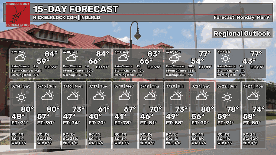
The fire weather has been mostly quenched, but now we’ve got the humidity and rain to deal with! A chance of severe weather too! The good news is that we’ll get a break by the end of the week. Starting off early, a few scattered showers and storms are possible today with a possible severe cell or two.
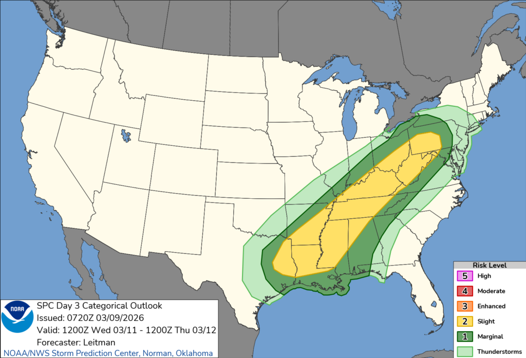
By Wednesday, another chance of severe weather is possible and we’re just on the cusp of a slight (2/5) risk. Parameters are looking a bit “meh” for us, but we’ll still have some heavy rain, lightning, and gusty winds to deal with. Afterwards, we dry up for a little while! Not just no rain, but the dewpoint is going to drop as well.

Today
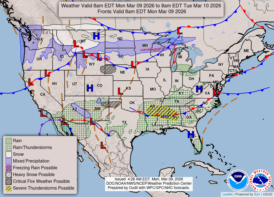
Looking at the graphic above, you’ll notice the chance for severe weather just above us in northern MS/AL. This is where our slight risk of severe weather is possible, however there are a couple of spots outside of that area closer to us that we might need to look out for. There’s a trailing stationary front pulling in Gulf moisture allowing another mesoscale convection system to develop. Along with that is a chance for a few scattered cells across south and central Mississippi/Alabama.
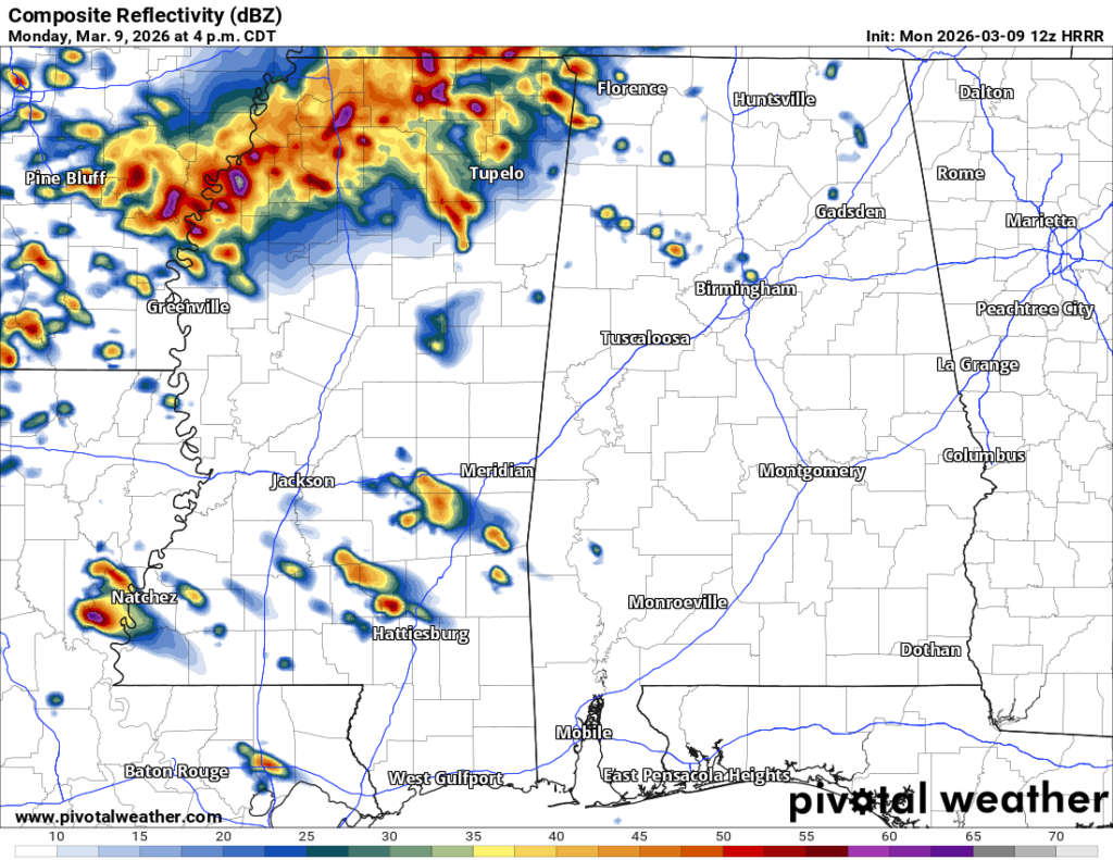
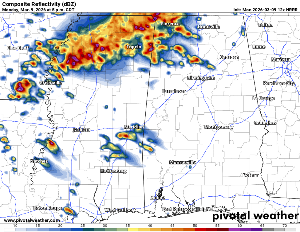
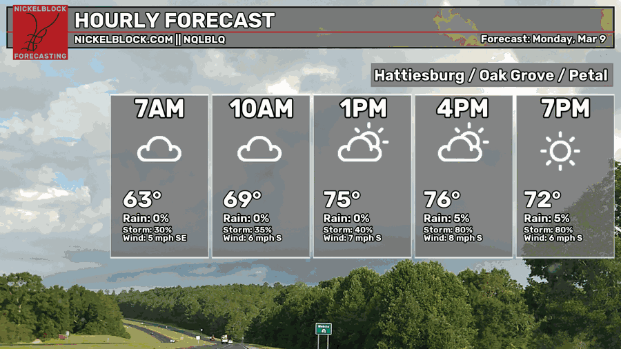
A cluster of scattered showers are likely this afternoon across the Pine Belt and central Mississippi. While the chances are low, HRRR model guidance suggests a couple of cells that meet the right conditions to become strong to severe storms. A few are possible around the 49-84 corridor and just south of I-20. Be aware of these if you are just leaving work or are commuting as this will be around the 4-5 o’clock timeframe. Otherwise, most of the severe potential is going to be north of I-20 as you can see above. Overall, it’s going to be a mostly cloudy day with a chance for scattered rain showers/thunderstorms in the afternoon. Highs will be in the mid to upper 70s with a low in the low 60s.

Tomorrow
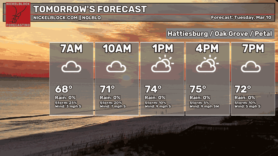
Tuesday will bring a brief break from the storms with a low chance of rain. We’ll have mostly cloudy skies with temperatures in the mid to upper 70s. A few gusty winds are possible from the south. Overnight, we’ll fall back into the mid 60s.
Wednesday and Thursday
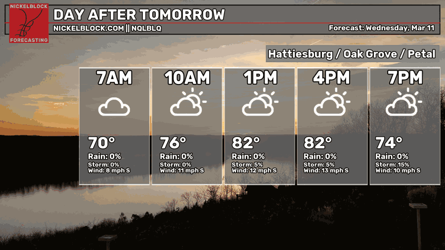
Another round of severe weather is possible on Wednesday. This one is interesting since there are two low pressure systems that we’re dealing with. One is way out in the Great Lakes while the other is going to dip further south towards LA/MS.
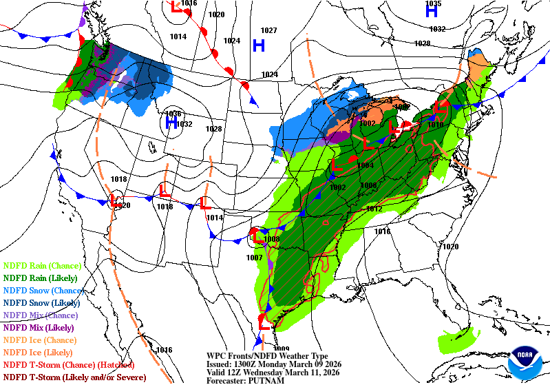
Looking at the Weather Prediction Center map above, you can see a jumble of low pressure systems across the eastern to central US. The low pressure system that is diving towards us is the one at the TX/OK border. There are a few limiting factors that may suppress some of the severe development. Cloud cover may limit instability and helicity is modest. We’ll still likely some severe weather, so keep an eye out for any potential watches/warnings on Wednesday. This looks like another late night/overnight event that will last until at least mid-morning Thursday, although I think by the morning it’ll be leftover showers from the front.
We’ll shift from warm and muggy on Wednesday to drier conditions by Thursday. The temperature will shift a bit on Thursday with the incoming cold front and will likely drop the temperature during the day. Keep your jackets with you too since it’ll be pretty windy! By Friday morning, the temperature will start off in the mid 40s before we go back to the low/mid 70s in the afternoon.