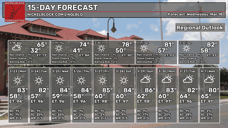
We’re past the possible last freeze yesterday and now we’re back to the warmup. This warmup is a bit anomalous due to a massive subtropical ridge in the southwestern US that’s undercutting precipitation chances for much of us in the southern US due to its size and proximity. All this to say, it’s going to be warm and dry for a little while.

Today
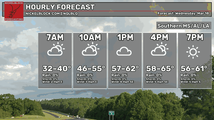
We started off pretty cool this morning! We can expect a nice day overall with partly cloudy skies and winds shifting towards the southeast. Temperatures will be in the mid 60s with a low in the upper 40s.
Tomorrow
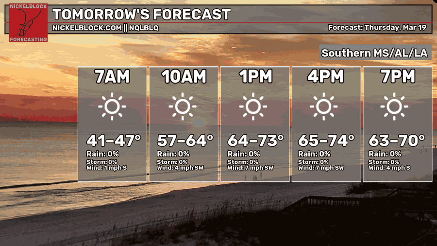
Tomorrow will be another beautiful day, honestly an almost perfect Spring day. Temperatures will reach the low 70s with a southwesterly wind prevailing. Overnight, temperatures will reach the low 50s.
Friday
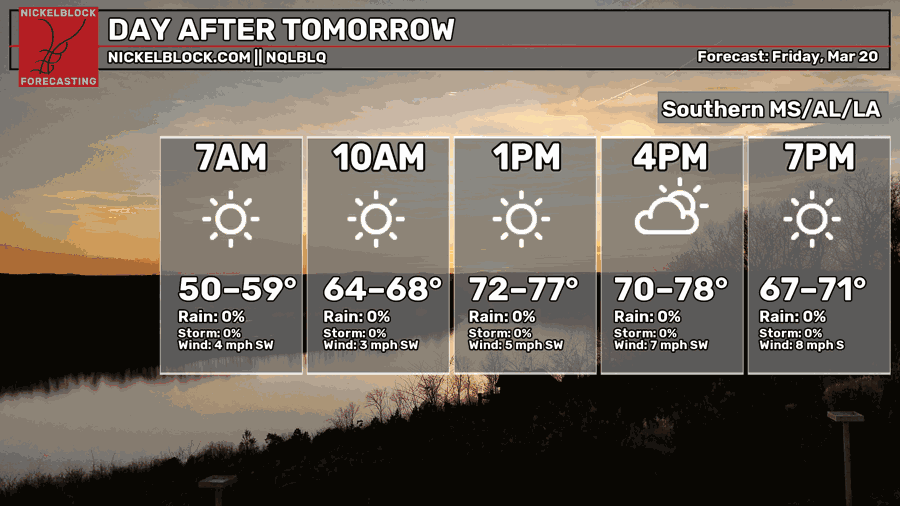
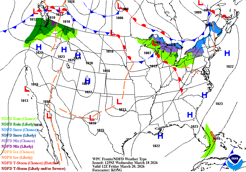
Looking at the WPC’s map above, we can see a large high pressure system spanning the Atlantic coast and the southeast. That’ll continue on before a dry front moves in from the west.
For Friday, we’re inching towards 80, however it’ll be another beautiful day. If you’re out on Friday night for a baseball game or out on a date, it’ll be a wonderful evening! Temperatures will settle into the mid 50s overnight.
This Weekend and Extended Look
Saturday and Sunday will both be warm with temperatures in the low 80s. It’ll be dry this weekend, so if you’re out taking care of projects outside or going to the baseball game, it’ll be good weather! Be sure to wear some sunscreen and a hat, too. Lows will fall into the mid 50s.
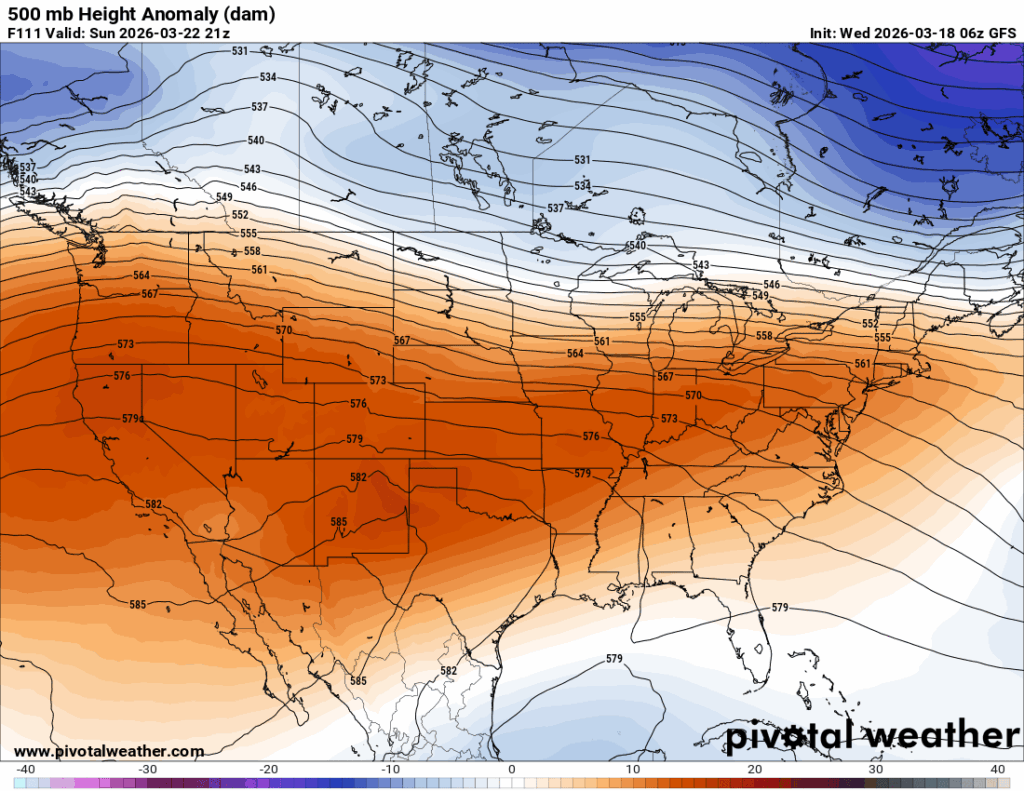
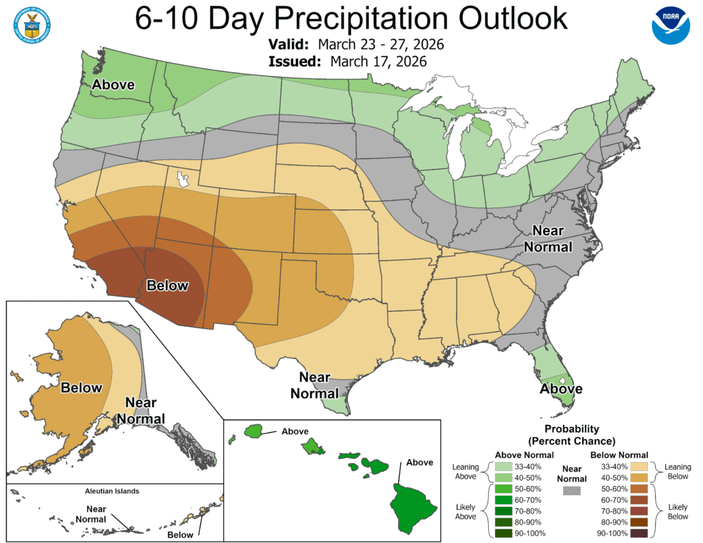
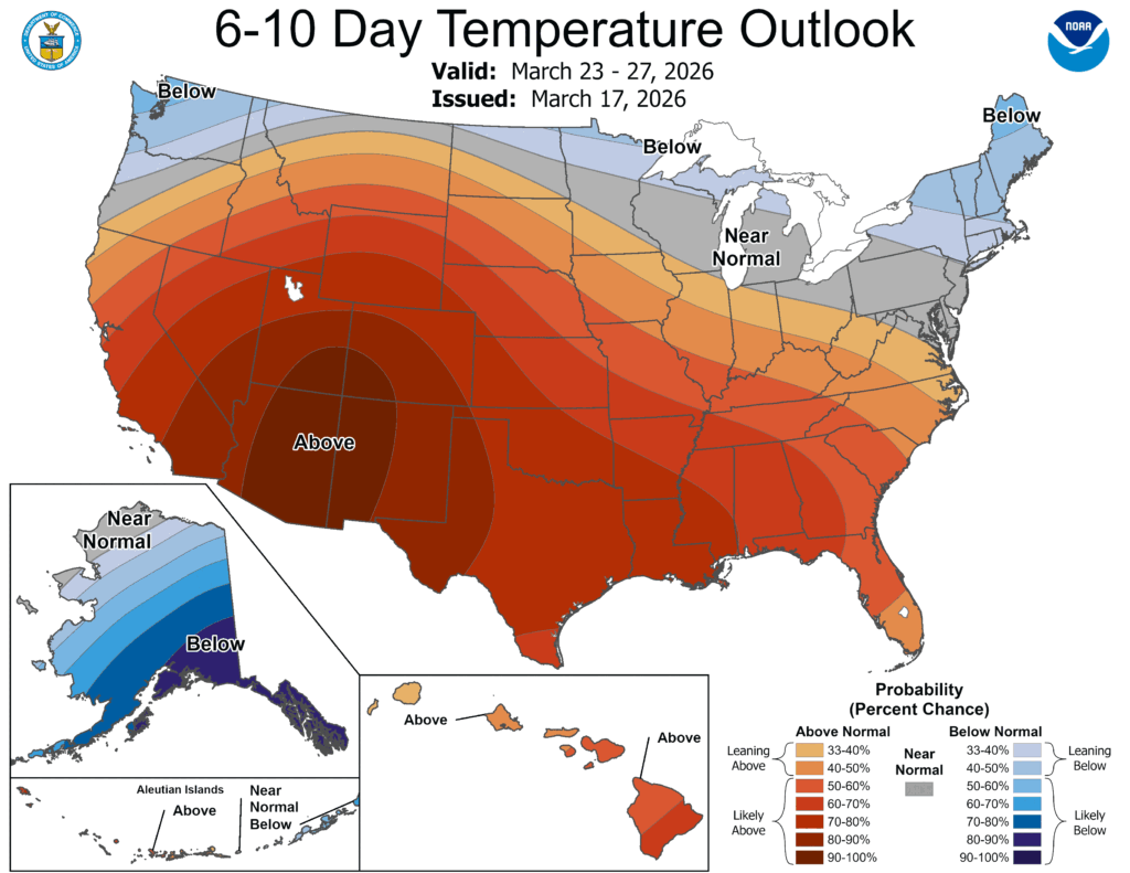
Looking at the extended outlook, there is a correlation between the above average temperatures and lower than average precipitation. We won’t have much of a chance for relief unless the GFS model is correct with the next incoming cold front late next week. The ECMWF model shows a vastly different story continuing the overall warm trend.