Current Setup
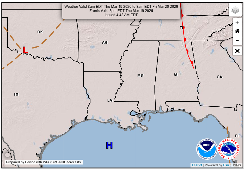
This will be one of the more boring forecasts that I will write, since there is really no weather to talk about! Aside from the clear warming trend, there’s also a period of dry weather under the subtropical ridge over the Gulf, which is promoting sinking air, warmer temperatures, and mostly clear skies. A nice time to be outside and a great weekend to look forward to!

Tonight’s Forecast
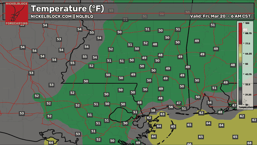
Tonight, temperatures are actually a few degrees below average, settling to near 50 by sunrise. There could be some patchy fog overnight into the morning, but nothing widespread or dense to worry about. Expect clear skies overnight.

Tomorrow’s Forecast: Friday, March 20 (First Day of Spring!)
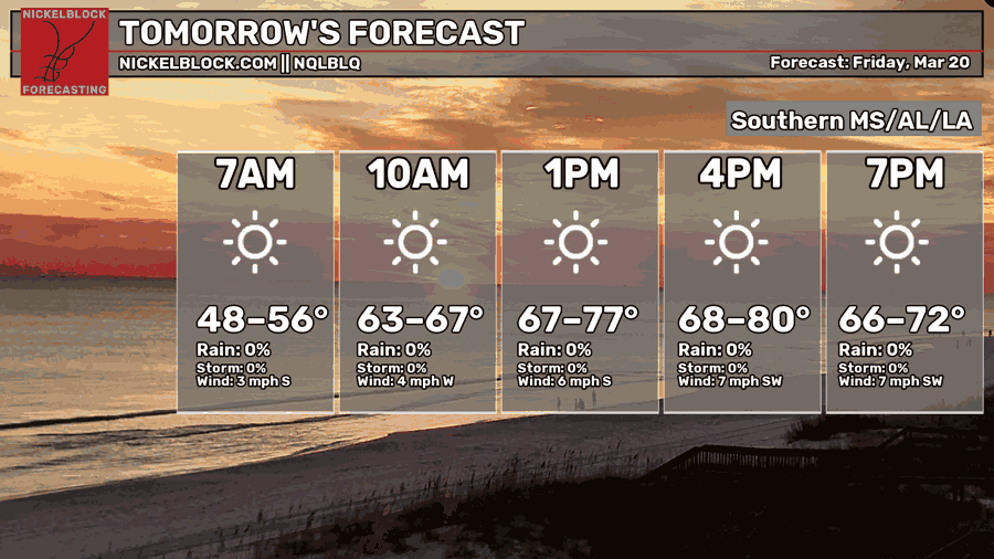
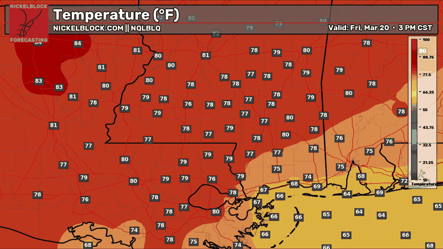
Tomorrow, which happens to be the first day of astronomical spring, will be a beautiful spring day, with temperatures in the upper 70s to near 80, with abundant sunshine. It will feel a little muggy in the morning, but the humidity is expected to decrease as the day goes on into the afternoon. Enjoy the sun, but make sure you have sunscreen on if you will be outside!
This Weekend’s Forecast
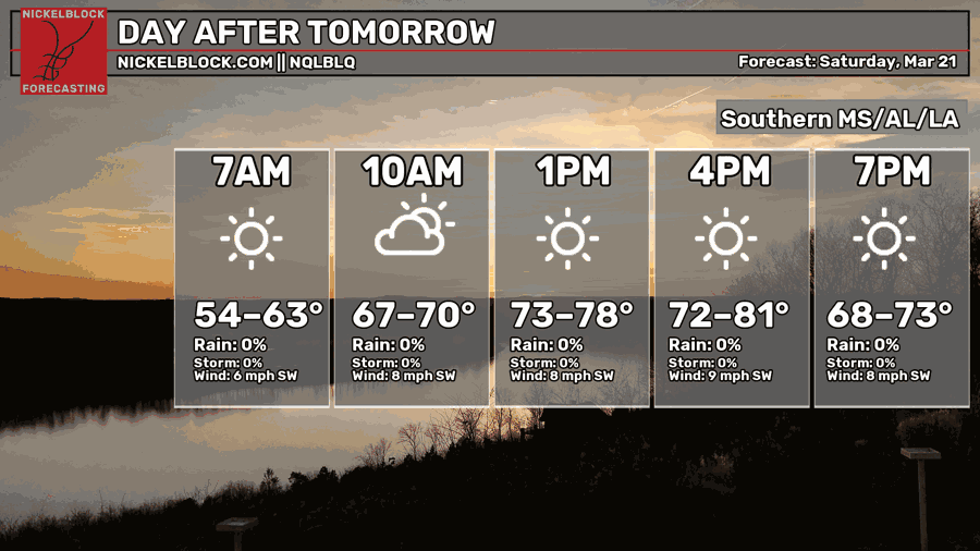
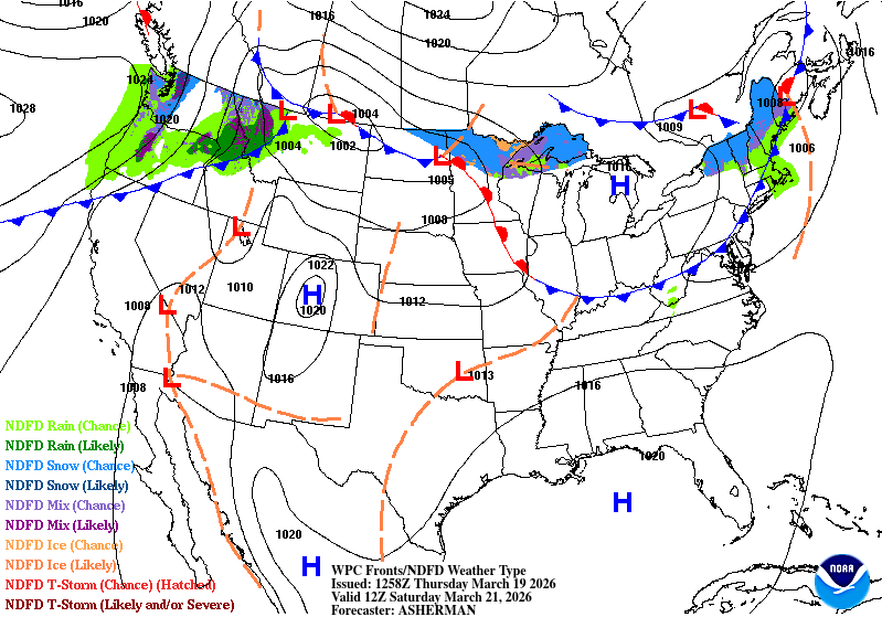
It’s been a while since there was no rain forecast for the weekend. Just in time for spring, the Gulf high-pressure system wants to stick around and continue bringing nice weather for Saturday and Sunday! Similar temperatures both days in the upper 70s and lower 80s. Humidity will make its return, though, so that is the only downside. We’re not talking about dew points in the 70s, though, only in the 50s and low 60s, which might still feel muggy, but certainly not the humidity we feel on a severe weather day!

Extended Local Outlook
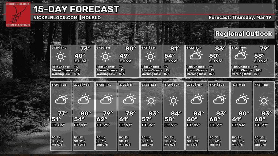
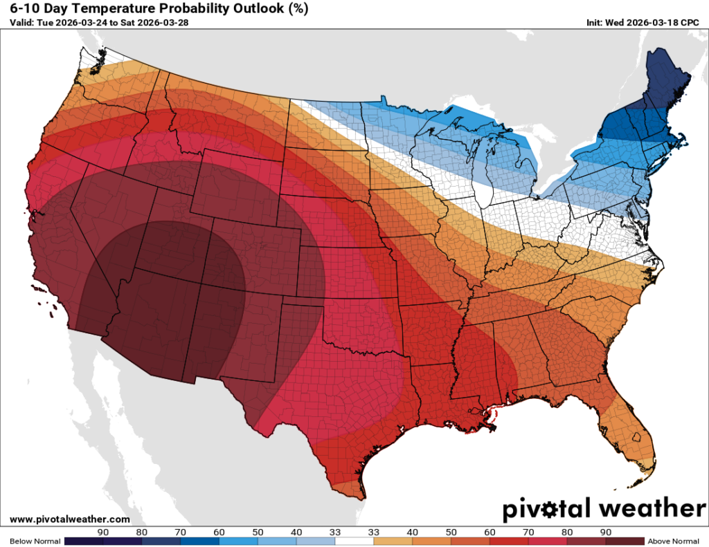
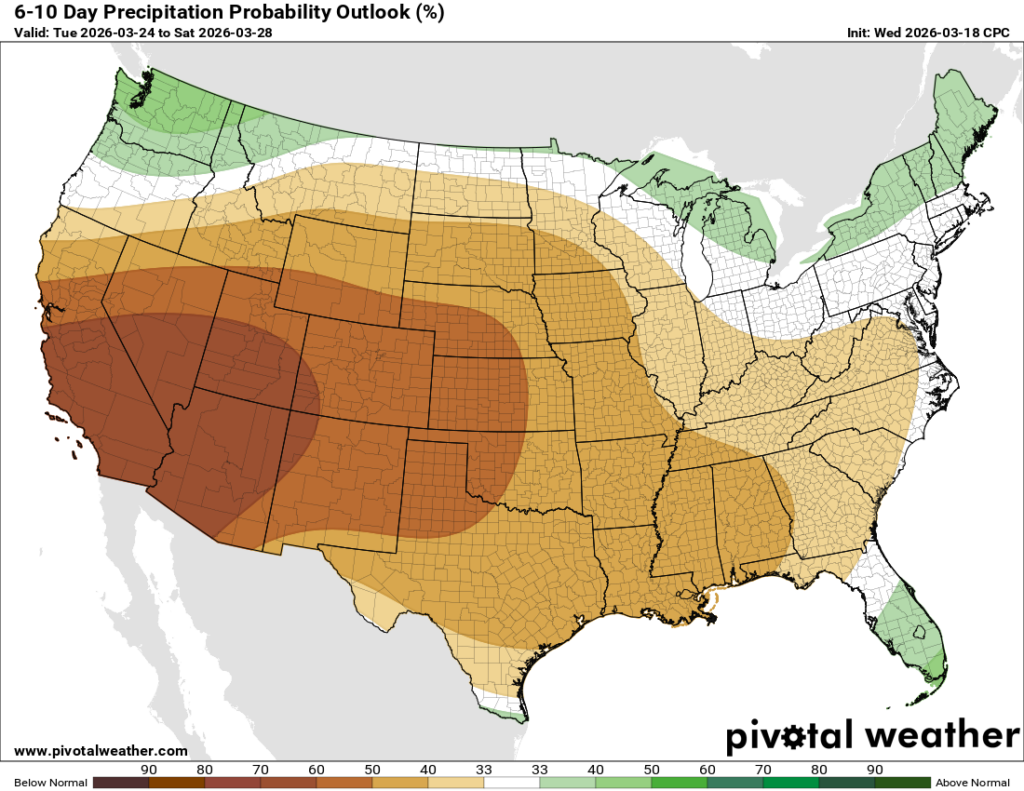
Looking ahead to next week, we are going to continue the warm and dry trend, with pretty good probabilities from the Climate Prediction Center that we will see above-normal temperatures and below-normal precipitation. You can really see where the ridge is forming and expanding in the west and just how big an influence it even has on our region. Happy spring to all who celebrate!


