Overall Setup
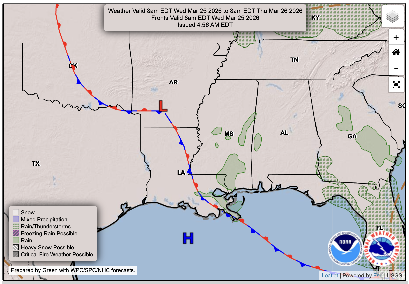
As the title mentions, there is a chance of some showers tomorrow in the area, as a stalled frontal boundary over us could provide lift for a few isolated showers, and we’ll have enough moisture to support them. We will be dry for Thursday, but may see a few showers on Friday as a weak cold front passes through. Don’t get too excited, temperatures will not drop much behind the front, but will just be there to give us a chance of showers… The good news about this front, though, is that it will lower our humidity but also bring some gusty winds.

Tonight’s Forecast
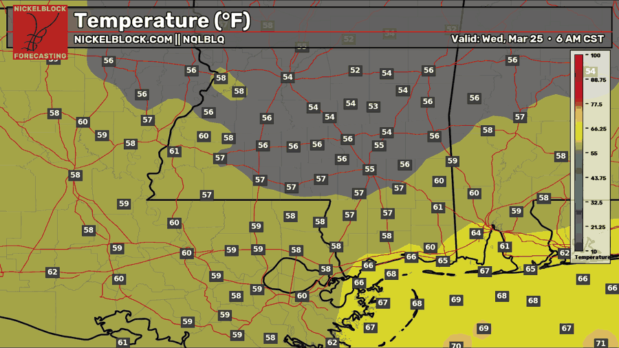
Tonight, we’ll see a low in the mid-50s with mostly clear skies. Expect calm winds.

Tomorrow’s Forecast: Wednesday, March 25
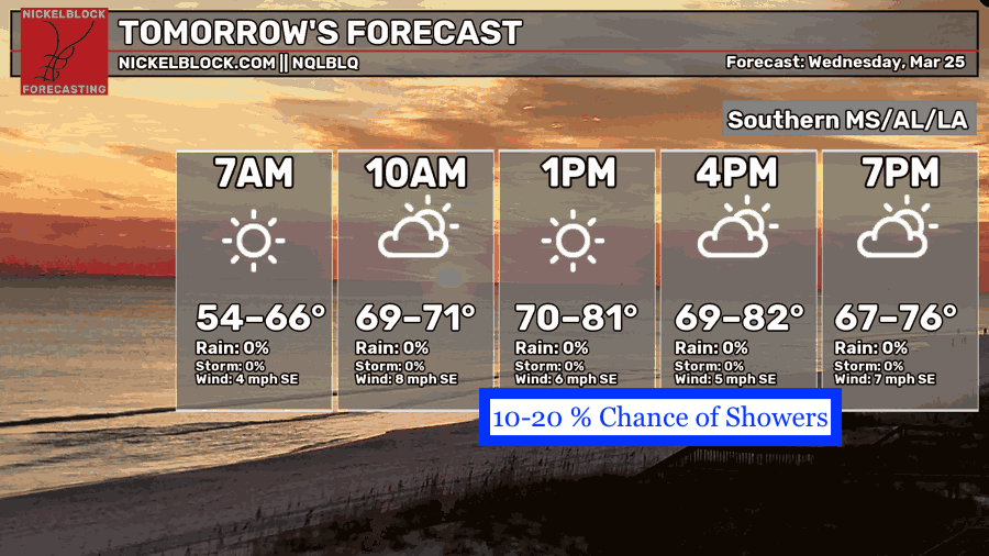
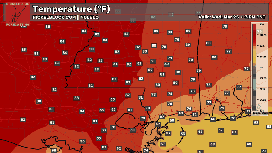
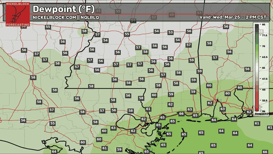
Tomorrow, we’re mostly sunny all day, with that chance of showers sometime in the afternoon. Again, there are very, very isolated showers, and most people probably won’t see any, but someone probably will! Humidity is highest the closer you are to the coast, so I would say there’s a higher chance of those showers the farther southeast you are. We’ll see a high near 80 on the mainland, and in the 70s along the coast.
Thursday’s Forecast: March 26
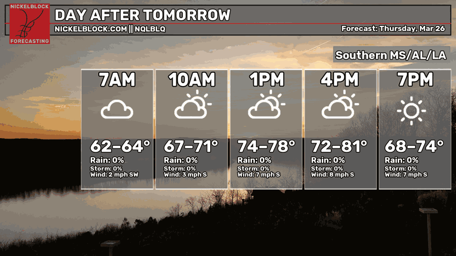
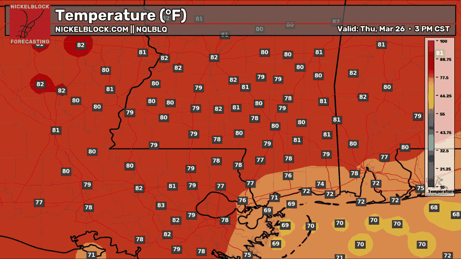
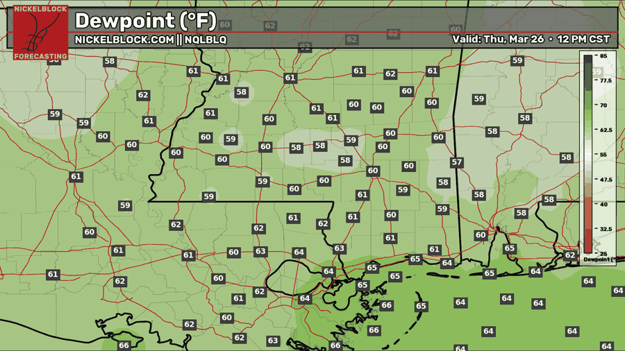
A similar day is forecast for Thursday, but with no chance of rain this time, since the stationary front will have moved away. Humidity will be higher with dew points near 60, which will feel very sticky! A similar high temperature as well, near 80 in the mainland and cooler towards the coast. Expect mostly sunny skies!

Extended Local Outlook
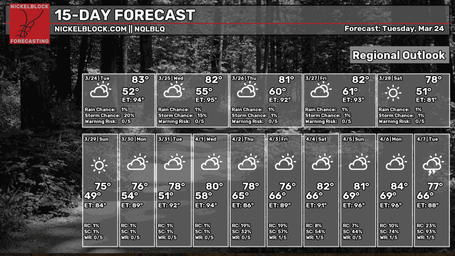
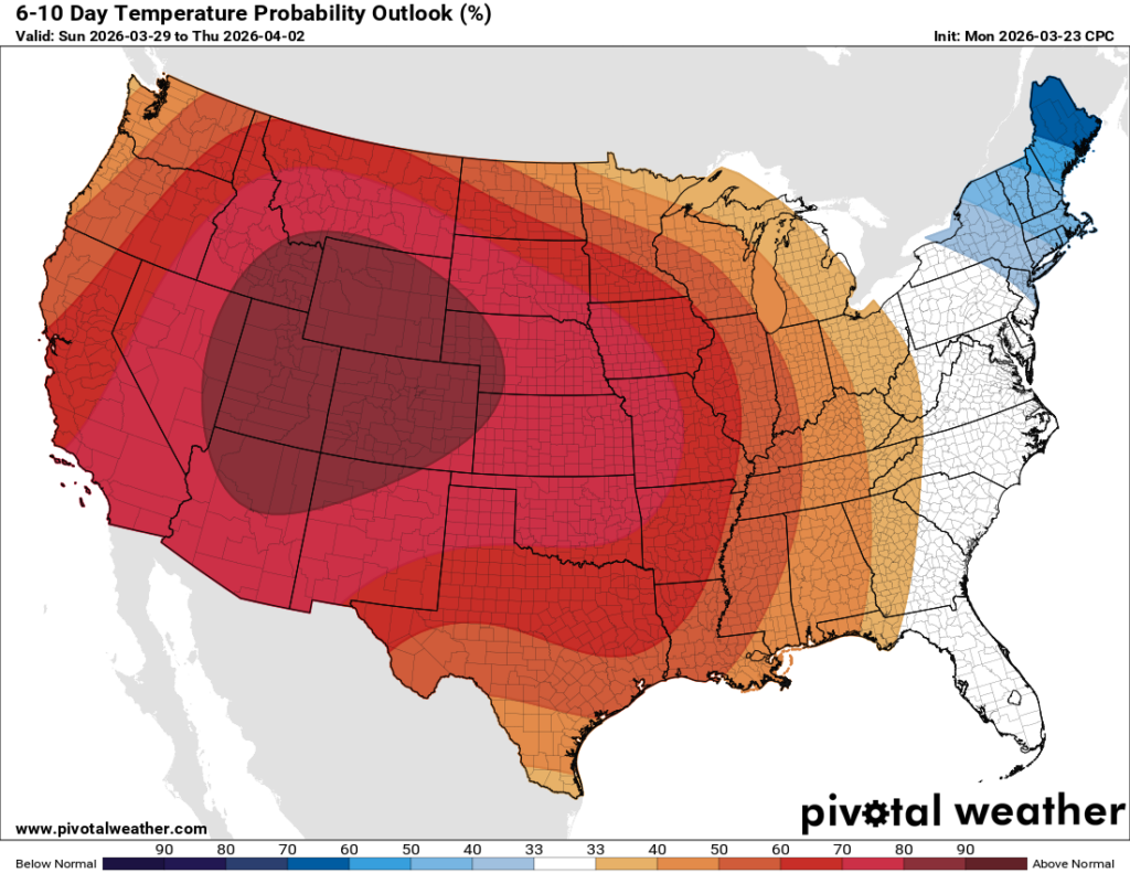
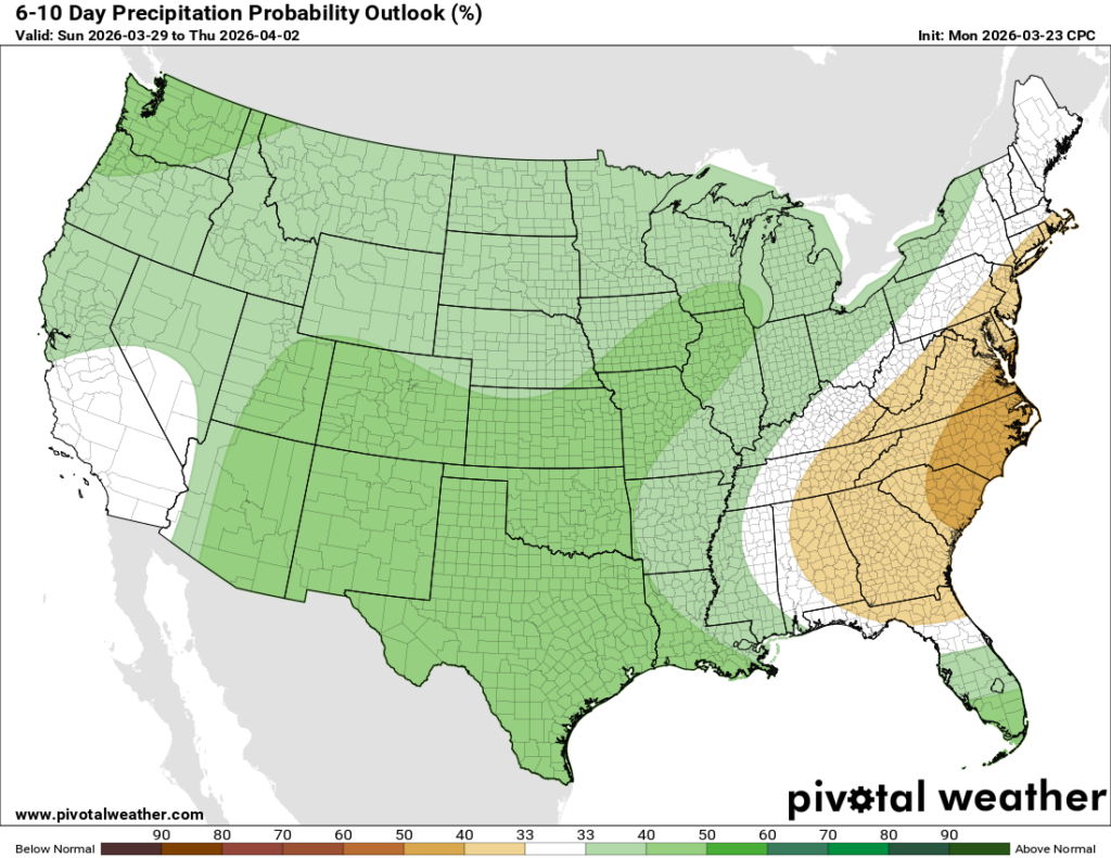
We’re still working out the forecast for Friday and whether that cold front will produce any rain, but for now, plan for a few scattered showers until we get closer. Look forward to the lower humidity on Saturday and Sunday, it will certainly feel great! Looking at the 6-10 day outlooks, the ridge is still stationed over the western states, but it will move east within the next week and really keep us warm! Average to slightly above-average rainfall is expected for the 6-10-day period.


