Scattered thunderstorms have developed in two areas in the local forecast region. Cluster number one is just to the east of Magee MS. These storms are currently producing frequent lightning, heavy rain, and potentially strong downburst winds up to 40 mph.
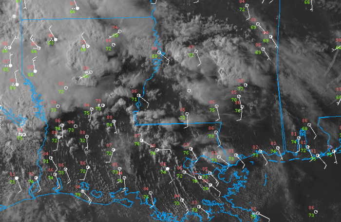
The second area of convection is located across eastern Louisiana, just southwest of Natchez MS. These storms will have similar hazards as the ones further east.
The cold front has progressed a bit further than originally expected. As of 6:15pm, it is draped across central Louisiana with numerous thunderstorms along it.
The front will slowly drift southeast throughout the next 24 hours.
Thunderstorms are expected to develop by early afternoon tomorrow and peak in coverage during the dinnertime hour.

These storms will thankfully have a very low chance of severe weather but will still be capable of frequent lightning and intense downpours. Make sure to drive slow in the rain and get inside when you hear thunder.
Not every area will get hit by these storms but they will defnitely be around.
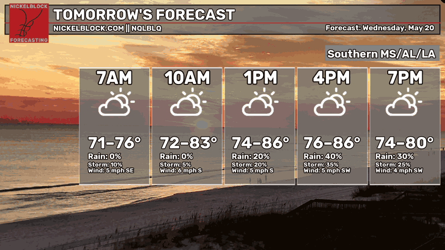
Areas behind the front (to its north and west) may experience some relief from the heat but the humidity is here to stay.
The front will likely stall in the region in the coming days allowing for numerous chances for widespread showers and thunderstorms (great news for drought relief!).


