Today marks the beginning of a very rainy week! Models are showing high chances of mainly afternoon/evening showers and storms starting today and continuing through Tuesday. Be sure to watch out for flooded roadways as total rainfall through next Tuesday could amount to around 3-6 inches. Daily highs are generally in the mid 80’s each day this week and lows are in the upper 60’s. Overall be sure to have a place to go indoors when celebrating Memorial Day weekend…better safe than sorry!

TODAY
The heat continues this evening, with current temperatures hovering around 85 degrees. The humidity is definitely not helping, making it feel nearly 10 degrees warmer. Light southeast winds continue, along with mostly sunny skies and a few scattered clouds.
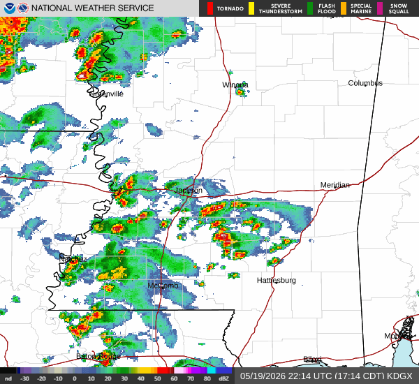
Radar below shows scattered storms near Hattiesburg moving north toward Jackson, Mississippi, along with additional storms north of Baton Rouge. The good news is the severe weather threat is expected to remain north of Jackson for the rest of the day.
TONIGHT
Tonight will be partly cloudy, with temperatures dropping into the lower 70s. Late tonight into early tomorrow morning, rain chances will increase around Baton Rouge, New Roads, and nearby areas as a storm system to our west weakens and dies out.
TOMORROW
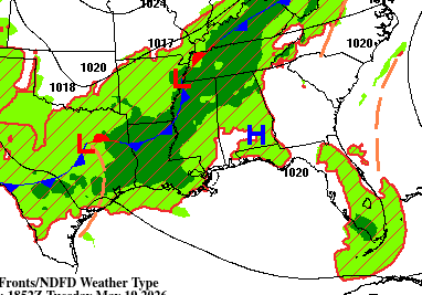
Tomorrow, rain and storm chances increase due to a low-pressure system and associated cold front approaching our area from the west as shown below.
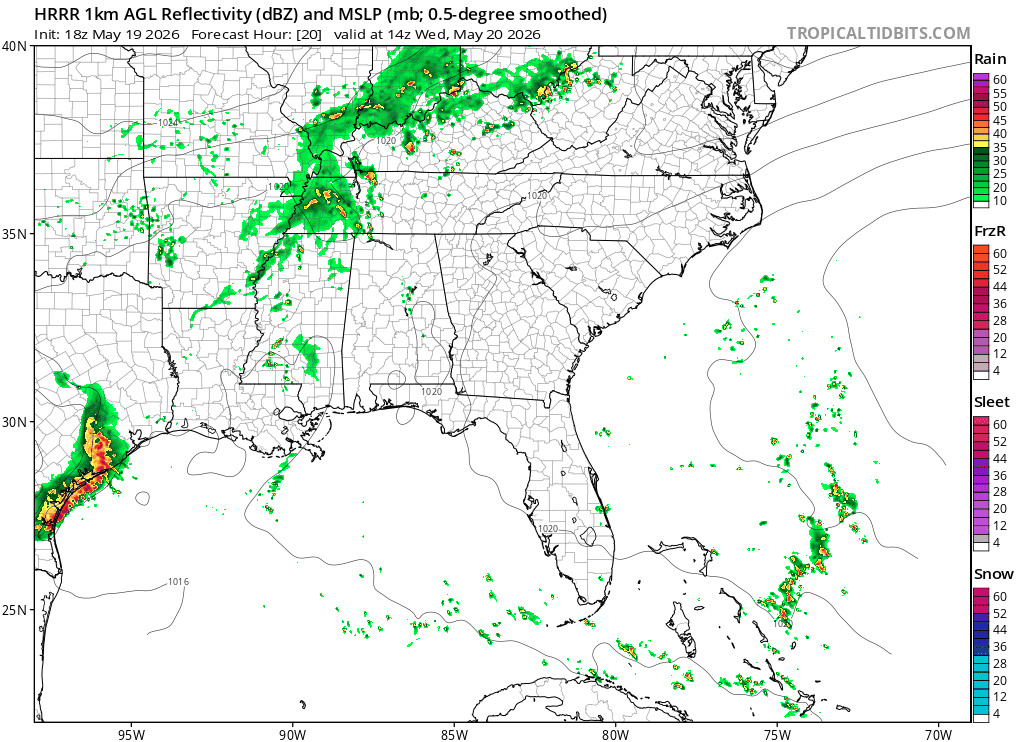
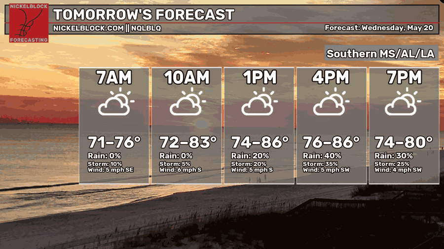
Looking at the animation above, we can see storms moving through the area during the afternoon tomorrow. This is reflected in our pinpoint forecast below, with a 40% chance of rain and a 35% of storms at 4pm. Not as hot tomorrow with highs forecasted to be in the lower 70s-80s.

DAY AFTER TOMORROW
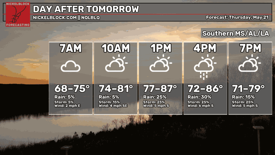
Thursday is expected to be dry early in the morning, followed by a chance of showers and thunderstorms in the evening, especially near Jackson.

EXTENDED OUTLOOK
Looking ahead, we see much of the same. This is due to southwest flow aloft, associated with the jet stream pattern overhead as shown below.
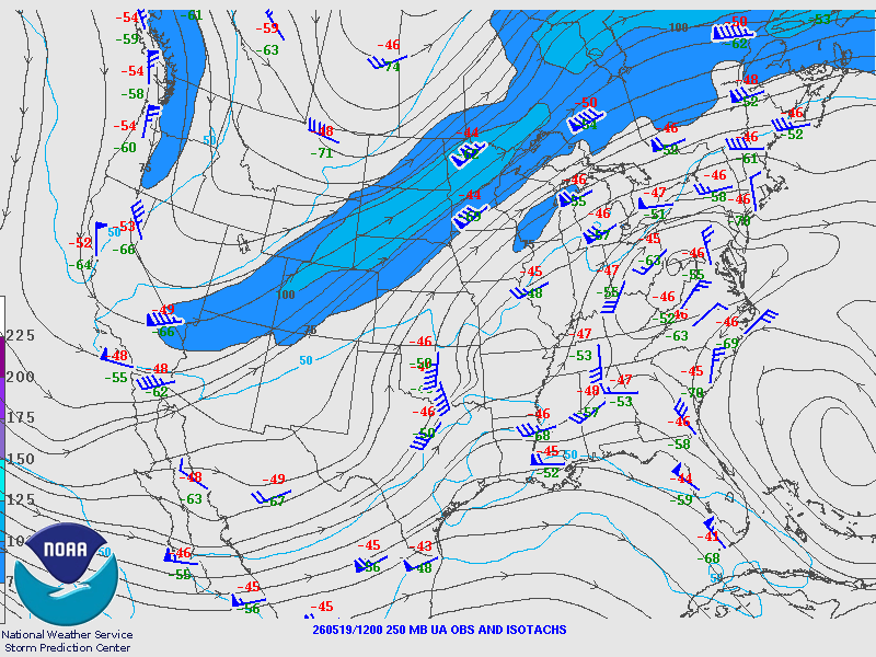
This is helping transport moisture into the region and supporting daily rain and thunderstorm chances as seen in the outlook below. Cooler-than-normal temperatures are forecasted for the evenings due to widespread rain.
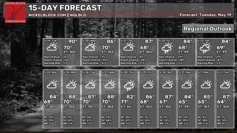
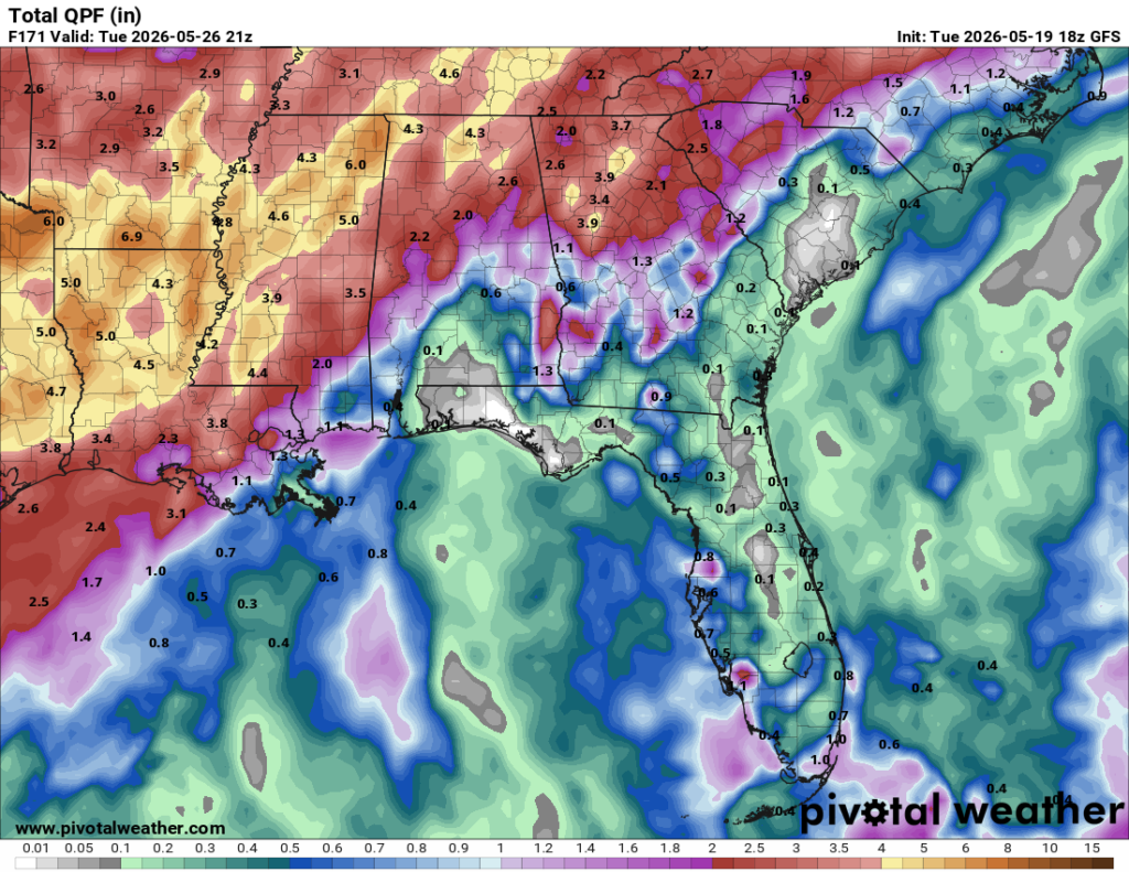
Total rainfall through next Tuesday could amount to around 3-6 inches, with the heaviest impacts near Brookhaven. Be sure to watch out for flooding!
DAY-BY-DAY FORECAST
Tonight- Mostly cloudy with lows around 70. Mostly cloudy with chance of overnight showers.
Wednesday- High chance of afternoon thunderstorms. Highs in the upper 80s. Light south wind.
Wednesday night- Chance of storms. Low around 70.
Thursday- Chances of thunderstorms. Partly sunny and humid. Light south wind. Highs in the upper 80s.
Thursday Night- Calm wind. Lower chance of thunderstorms. Lows around upper 60s and mostly cloudy.
Friday- Widespread showers and storms. Light south wind with mostly cloudy skies. Cooler highs (mid 80s).
Friday Night- Chance of thunderstorms. Calm wind and mostly cloudy. Low in the upper 60s.
Saturday- Higher chance of showers and thunderstorms (again). High in the mid 80s.
Saturday Night- Low chance for showers. Mostly cloudy with lows hovering around 70.
Sunday- Chance of showers and storms. Highs in the mid 80s with mostly cloudy skies.
Sunday night- Mostly cloudy with lows in the upper 60s.
Monday- Early morning rain chances diminishing by evening. Highs in the upper 80s.
Monday night- Mostly cloudy with lows near 70.


Rule #1 – NEVER include the word ‘Yay’ with the word ‘rain’ … that is like saying ‘Happy Monday’. Rule #2 … don’t forget Rule #1.
Good stuff!
Tell Nick to give you a raise!