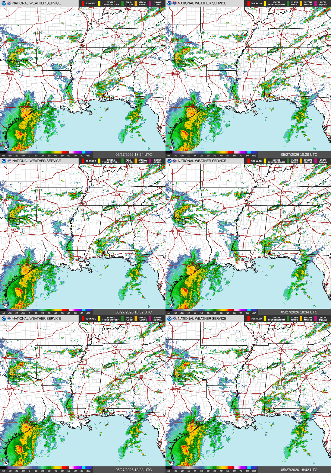
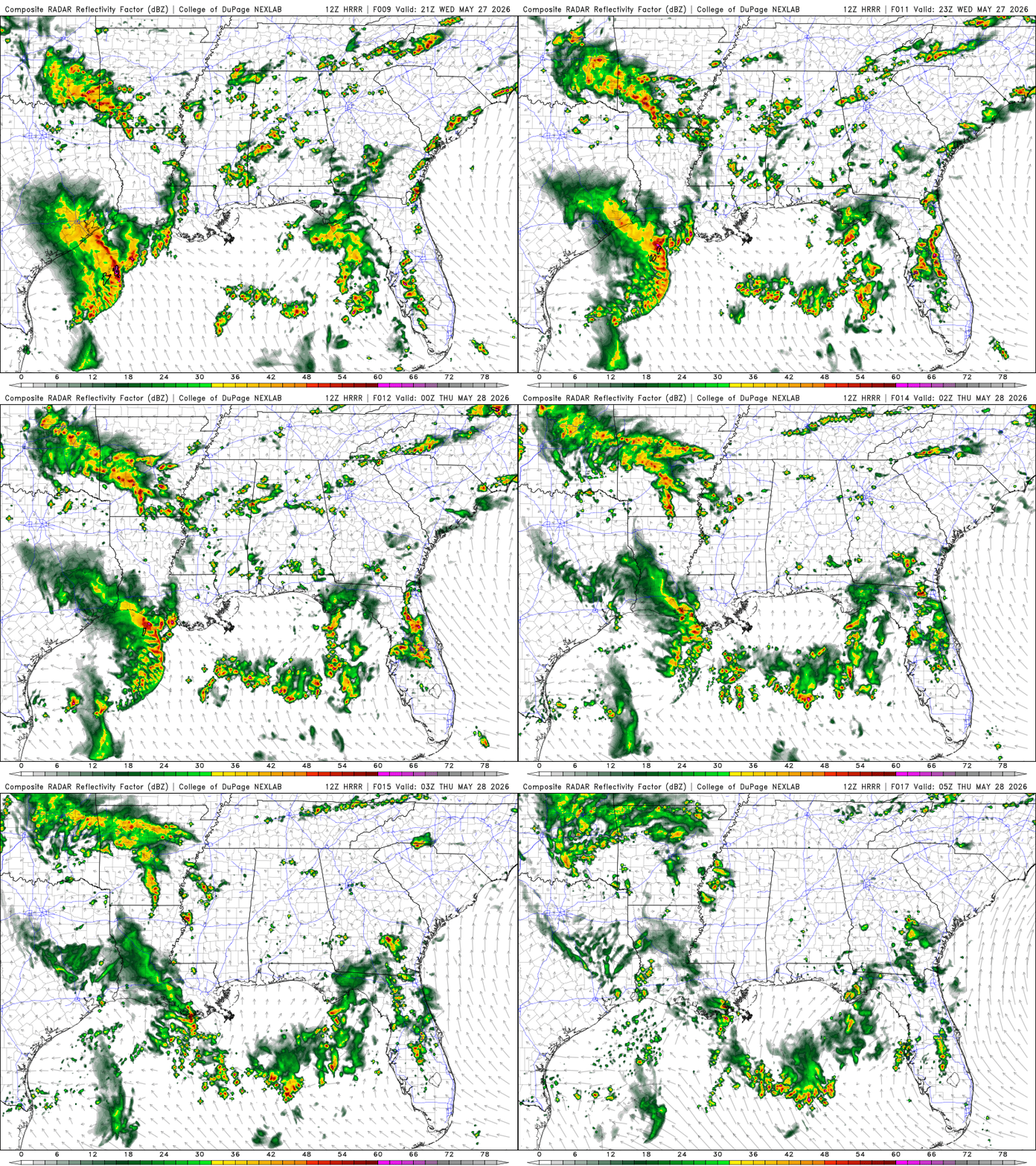
As this is being written, South AL and counties along the Southern MS border are experiencing rain that’s moving north-northeast. There’s also a line of rain and thunderstorms in Southern LA pushing into Southwest MS.
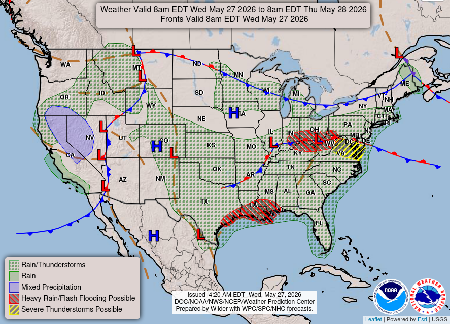
Winds coming out of the southeast and a lingering boundary have been a common combo we’ve seen a lot this past week. Not to mention the dew points being high, creating moisture in the atmosphere. Our entire area should keep an eye out for heavy rain and possible flash flooding.
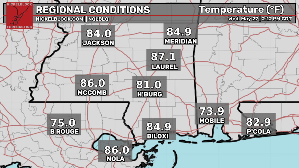
Temperatures on the coast of LA and MS are in the mid-80s, and AL coast temperatures are in the mid-70s. Still quite humid in our areas, especially in South AL, with humidity percentages in the mid-90s.
Tonight
Around 7 pm, Southern MS and AL will start to clear up. The majority of Southern LA will experience showers and thunderstorms throughout the evening and nighttime hours. By tomorrow morning, the line of showers and storms will start to dissipate.
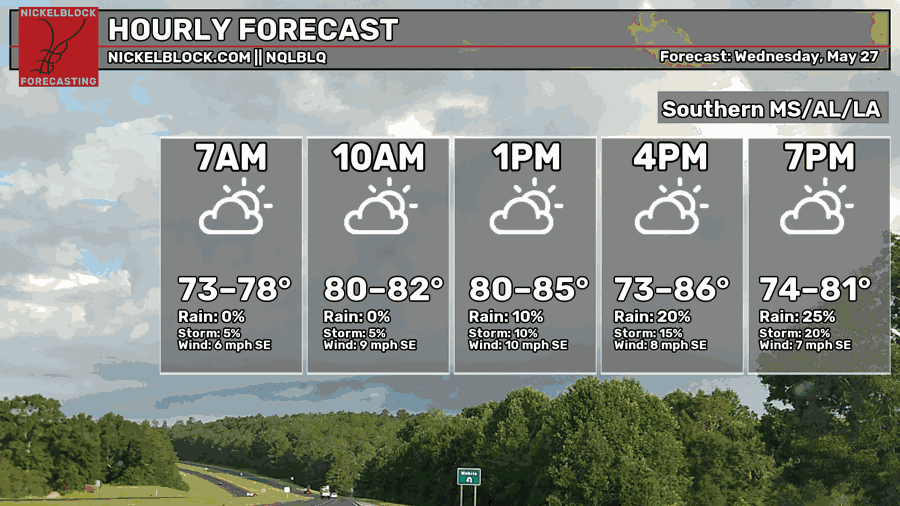
Temperatures are reaching the mid-80s with chances of rain and storms increasing in the evening and nighttime hours.
Tomorrow
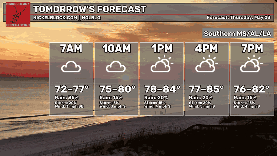
Temperatures are reaching the mid-80s, so more warm and muggy weather. Expect more scattered showers and thunderstorms throughout the day.
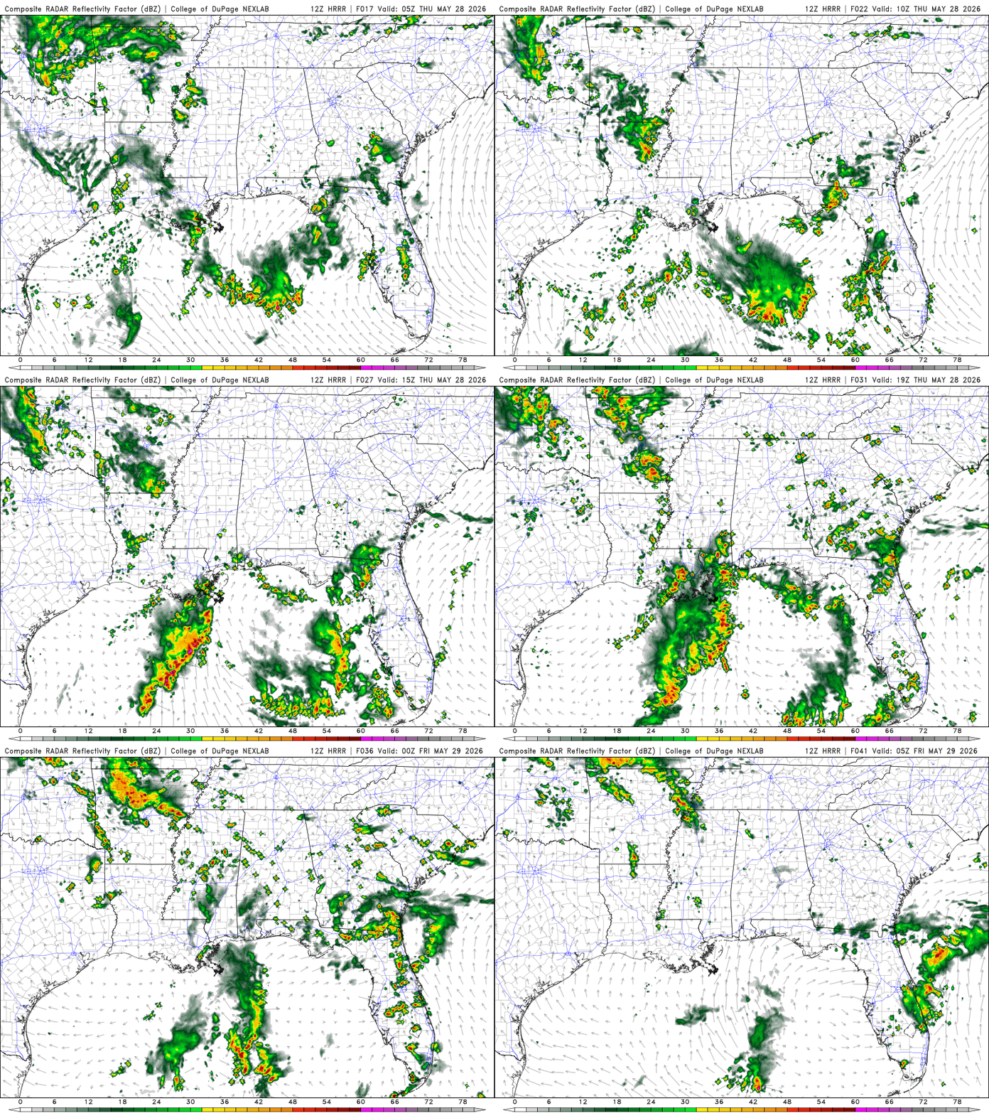
Southern LA will see mostly light rain with thunderstorms and showers popping up near the LA and MS border around 5 am. Southern MS and AL will remain dry until around 7 am when a small line of showers and thunderstorms pushes northeast until the late morning hours. Southern LA will see showers and thunderstorms starting around 9 am until around the late evening hours, with some pop-ups during the nighttime hours. During the afternoon hours, Southern MS will have showers and thunderstorms, which will clear up around the late evening. Showers and thunderstorms will reach Southern AL around 3 pm and will clear up around the same time as Southern MS.
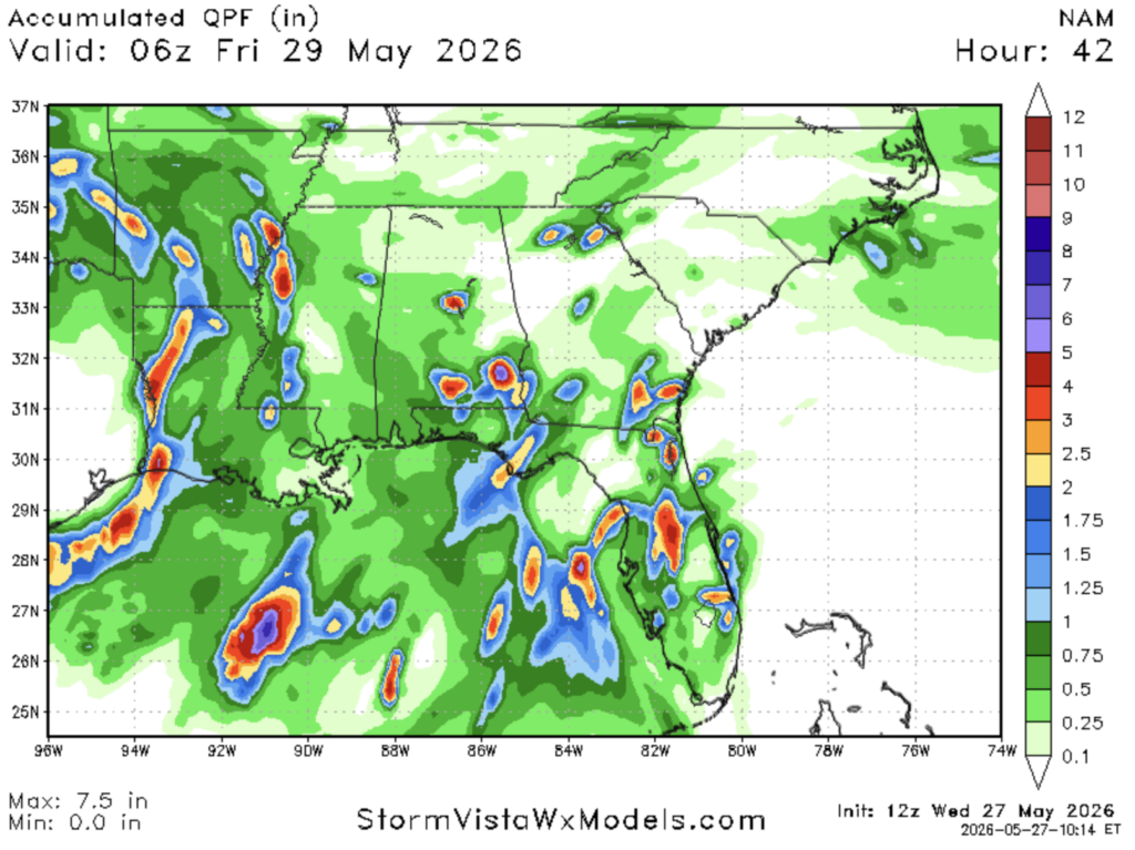
Adding on around another inch of rain throughout today and tomorrow. Some parts of the Southern region are seeing up to >3 inches.