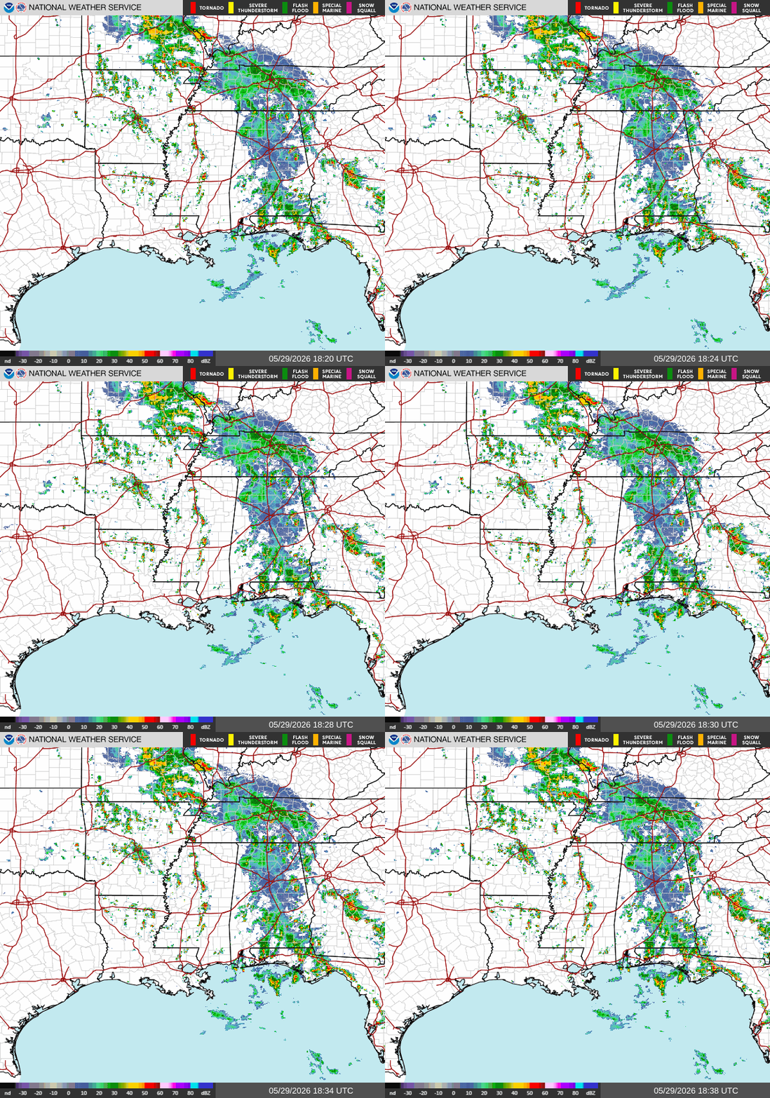
Currently, there are a few isolated strong storms moving northeast, mainly in the area east of Jackson and in the Mobile/Pensacola area. Localized amounts may be up to 2-3″. These storms are moving pretty quickly, so they won’t produce too much rain, however localized amounts may be up to 2-3″. Winds may be gusty for a bit.
This is about what I expected yesterday. The heaviest rain is more prevalent the further east you go, particularly in Alabama and the Florida panhandle, while the driest conditions are in Louisiana and Mississippi. Eventually the line of showers and storms over Alabama will stall over Georgia, leaving our area relatively dry.
Tonight
Moving into tonight, expect more of the same. Minor pop up storms will produce lightning, potential flash flooding, and gusty winds.
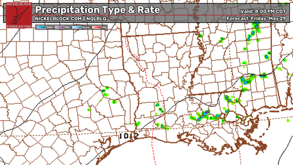
Be on the lookout for some hail as well!
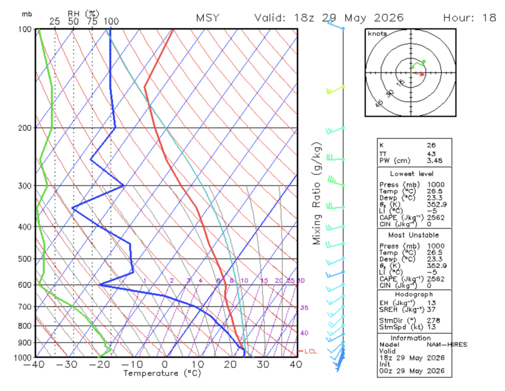
Let’s get one thing straight before I explain. If you have no idea what you’re looking at, that is perfectly fine. This is a skew-t diagram, and it helps explain why some hail might be possible tonight. In the middle of the atmosphere (where it says 600 on the y-axis), the difference between the blue line (dew point) and red line (temperature) is very large, while the difference between them is very small at the surface (bottom of the image).
What this means is that the air in the middle of the atmosphere is very dry compared to the surface. When the surface air rises and reaches the dry air, the air cools, causing the air to become dense. This air then sinks, causing the moist surface air to rapidly rise after being displaced. As this moist air reaches the upper atmosphere, the water droplets freeze and clump together, creating hail which falls down to the ground!
Tomorrow
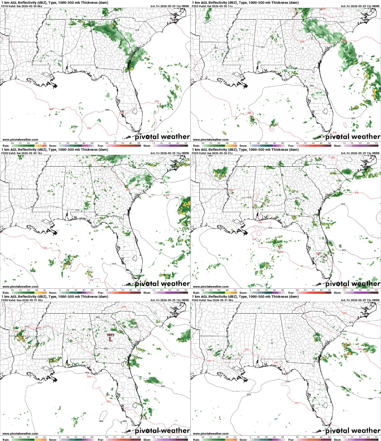
Headed into tomorrow, you can expect some isolated storms coming out of the north tomorrow afternoon into the evening. If your area is hit, expect heavy downpours, lightning, and gusty winds. Overall, the gulf coast is in for a decently dry day.
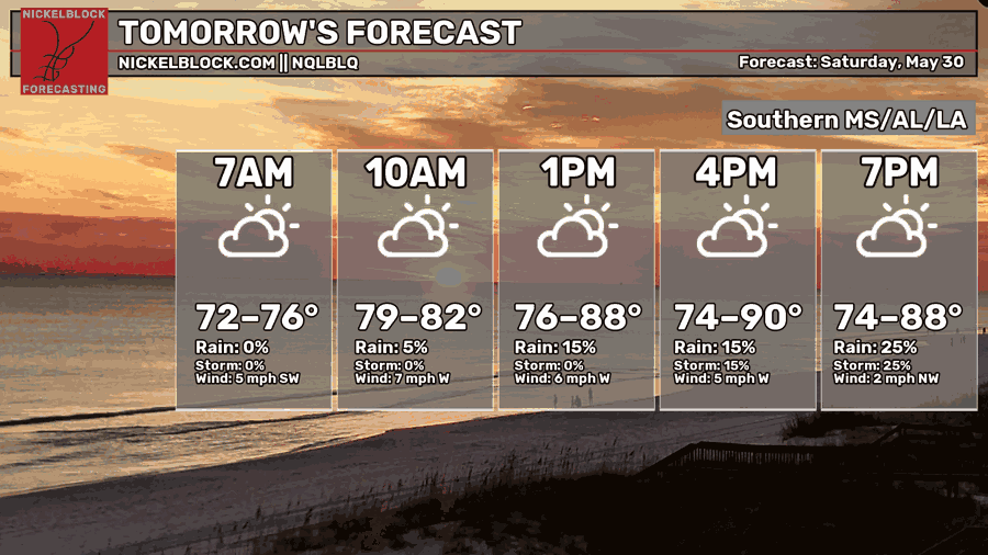
High temperatures tomorrow afternoon will range anywhere between the low 80s and low 90s, with the coolest highs further east into Alabama and Florida, and the warmest highs west in southeast Louisiana. If a storm passes through your area, your afternoon temperatures could be as low as the mid 70s.


