Howdy!
If you are anything like me and want a break from all the rain we have had recently, get excited! Moving into the weekend and into next week, we will have drier and warmer conditions. Chances of rain are still possible, but there are no chances for long, persistent and heavy rain!

TONIGHT
I always like to start my forecasts by “looking out the window”. Seeing the bigger picture of what is going on and then translating that into what that means for us locally. We still have that southerly flow and moisture being brought in from the gulf, and there is a low-pressure system present just northwest of us (can see from the counterclockwise flow from the visible satellite image below).
We can see there are more clouds present in Alabama/Florida, and currently there is some scattered showers and thunderstorms moving in the area, much near Seminole and Robertsdale (as seen below).
A stationary front has developed in association with this low pressure, extending into Georgia and the east coast. This boundary has produced storms in Georgia, and there are storms associated with the low-pressure disturbance in our area as well.
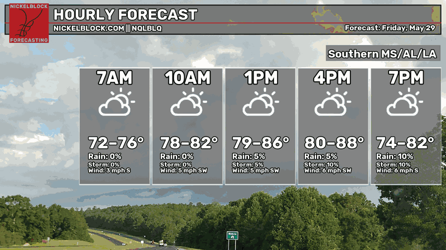
Temperatures will reach a high in the upper 80s for tonight, heat index’s reaching into the 90s in a lot of areas. It will be pretty humid out there with those slight chances of rain. The warmest temperatures will occur out in Louisiana as the shift in weather patterns occurs tonight into tomorrow. We can already see that ridging occurring in western Louisiana.

TOMORROW
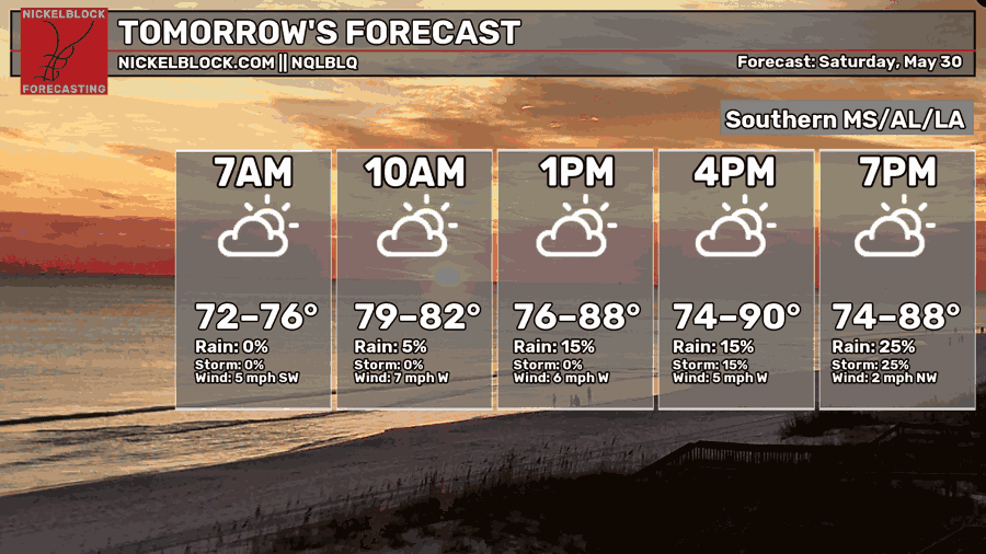
Tomorrow we can expect the shift in the weather pattern to give us warmer and drier conditions going into the weekend. High temperatures reach up to upper 80s and lower 90s. The troughing that has persisted recently will end, and a ridge will build up in our region. We will experience a more typical summer pattern tomorrow and into next week, chances of rain diminishing.
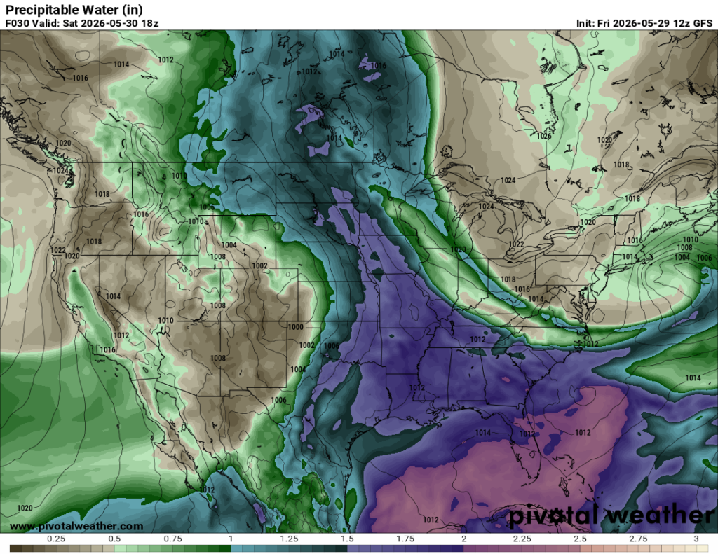
Pop up showers are still possible, but mainly more east into Alabama and the Florida Panhandle. Below, we can see that there are still higher levels of moisture in our region, supporting any development of the pop-up showers.
SUNDAY
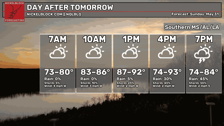
Temperatures continue to build, Sunday looking to be pretty warm. This weekend will be a good weekend to spend outside for much of the local area but make sure to keep hydrated and take care of yourself as this heat can pose a risk to your health.
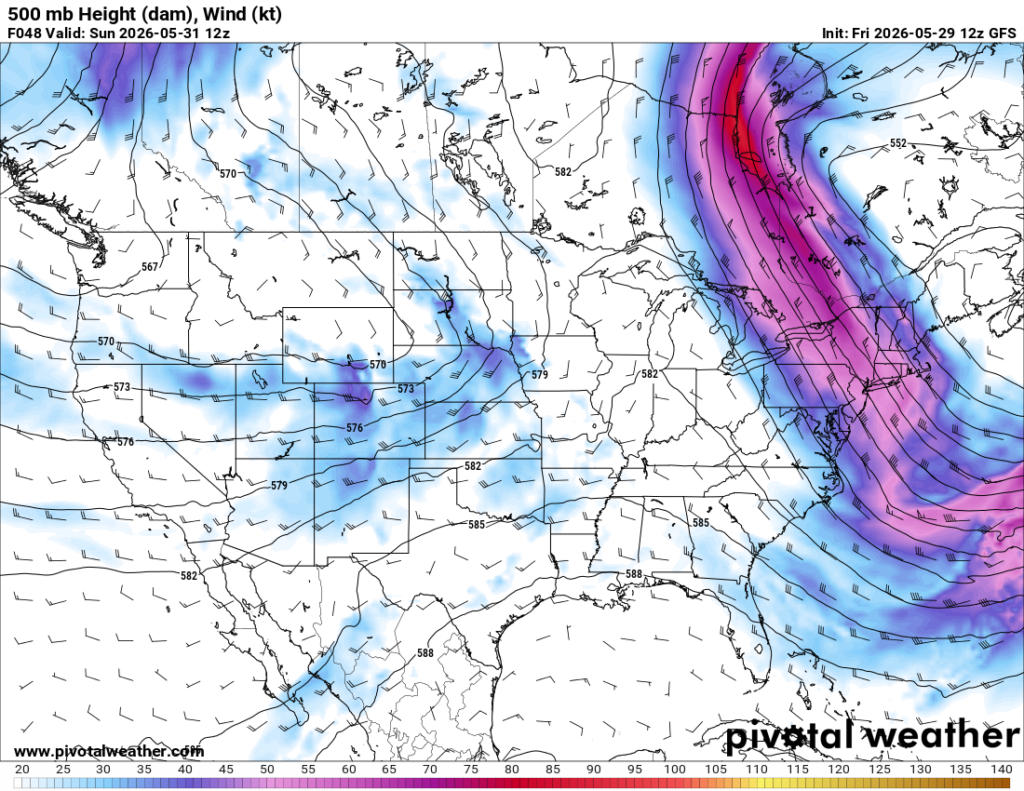
Above, we are looking at the trough/ridging patterns and can see the overall trend for MS/LA/AL. There is a broad upper-level trough to the northeast and east coast. The frontal boundary associated with this trough will linger around the coast into early next week and may push close enough to help produce scattered showers and storms especially for the eastern cities in Alabama and the Florida Panhandle for Sunday.

EXTENDED OUTLOOK
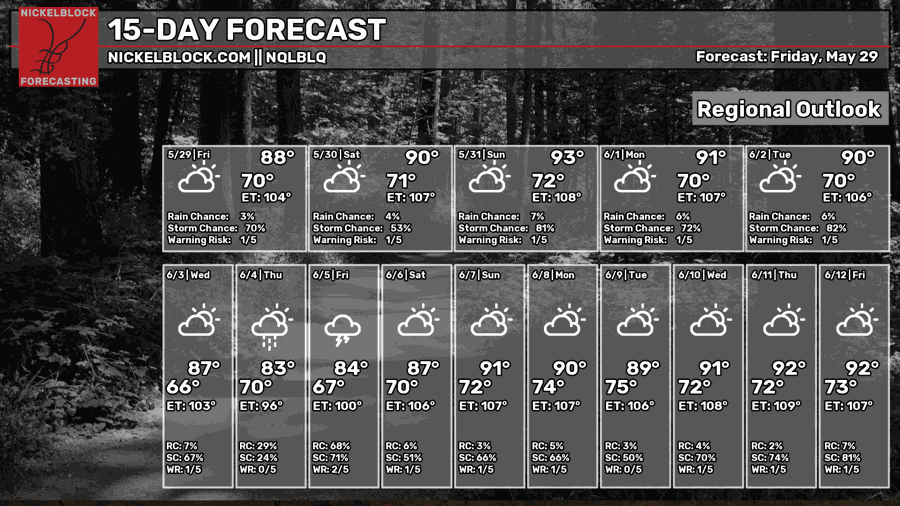
Chances for rain will decrease moving into the weekend but are still possible through instability and moisture amounts in the lower levels. Pop up showers might occur in the afternoon/early evenings. Temperatures will remain in the upper 80s and lower 90s, heat index’s reaching up to almost 100 degrees with the combination of humidity and heat.
Ridging will persist into next week, giving us those warmer and drier conditions, but the broad trough in the northeast United States has the frontal boundary with it, pushing close enough in our region to possibly produce showers and thunderstorms. Even without this boundary, moisture levels will remain elevated enough to produce showers in the afternoon into next week.
Summer-like conditions will perisist, temperatures in upper 80s, lower 90s, pop up showers possible in the afternoon. No pattern for the next two weeks implies any heavy rainfall, so make sure to take it all in!


