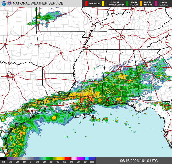
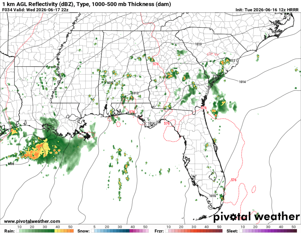
As I’m writing this at 11:30a CDT, the radar is looking like one big mess. Heavy showers and storms are all along the gulf coast, stretching from coastal Texas all the way into the Florida panhandle.
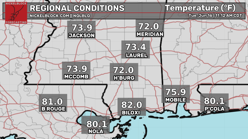
Although the rain is unpleasant, at the very least the temperatures are bearable. Current temperatures are much below normal for this time of year, with temperatures north of southeast Louisiana and southern Mississippi only in the lower 70s. As you go further south near Baton Rouge, NOLA, and Biloxi, temperatures are in the lower 80s.
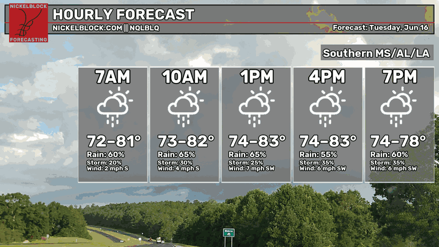
This afternoon, temperatures are forecasted to range from the mid 70s to the low 80s, with the warmest temperatures being further south. Not much in the forecast has changed since yesterday.
Tomorrow
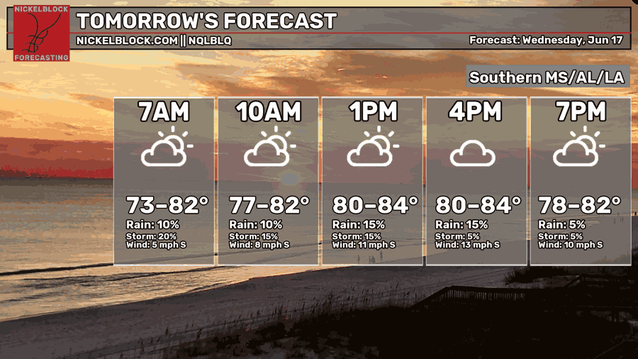
Moving into tomorrow, things are looking a bit warmer and drier. Temperatures will generally be in the low-mid 80s tomorrow afternoon.
Some scattered storms are forecasted for our area tomorrow afternoon and evening, however they won’t be nearly as widespread as today. If you look south of Louisiana, you’ll see potential tropical cyclone one in view!
Looking Ahead
The most pressing thing in the near future for our area is potential tropical cyclone one, which officially developed this morning north of Brownsville, TX.
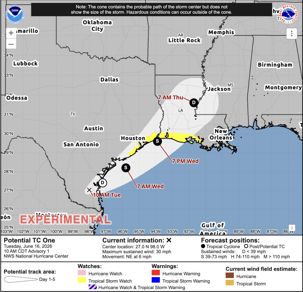
Later tonight, PTC 1 is expected to move over the Gulf of Mexico, where the NHC expects it to strengthen into a named tropical storm. On Wednesday night, it is expected to come ashore on the TX/LA border. From there it will move further north, approaching Jackson overnight from Wednesday into Thursday.
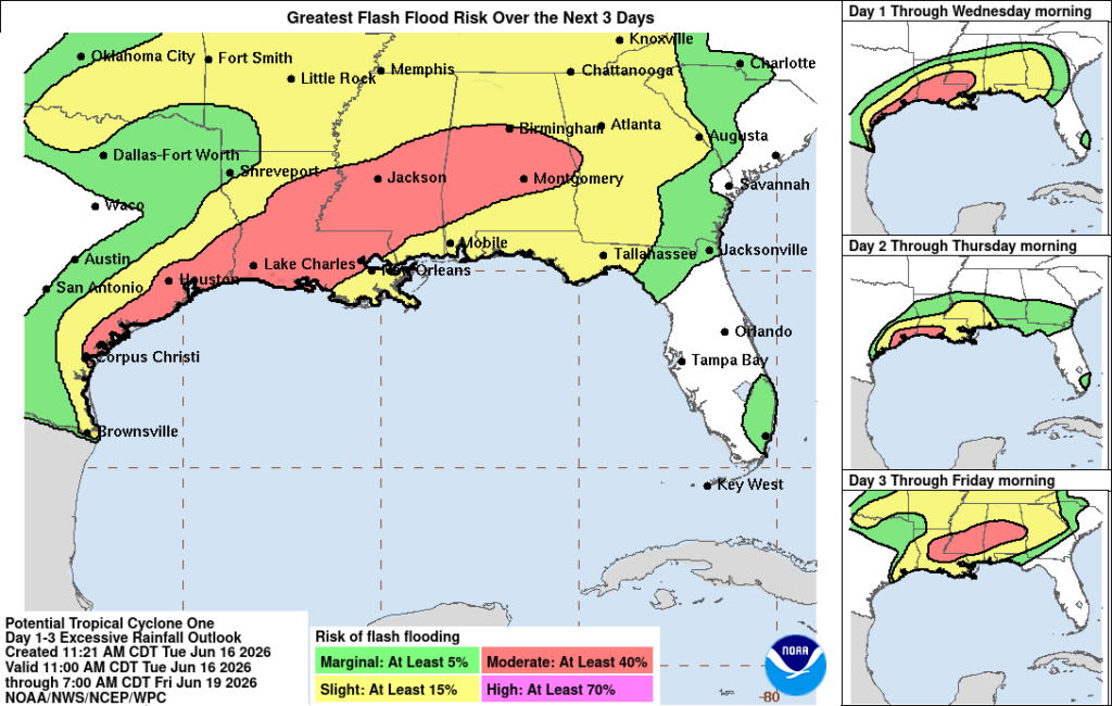
While winds will likely be gusty at times, flash flooding is going to be the biggest issue with this storm, especially since the areas with the highest risk of flash flooding are the same areas that are getting rained on currently.
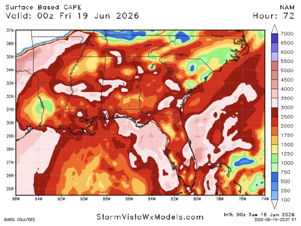
There is also a small risk of tornadoes on Wednesday night going into Thursday. This is due to there being plenty of CAPE (convective available potential energy) and wind shear, two major ingredients in tornadoes.


