What Made Hurricane Sandy Stand Out?
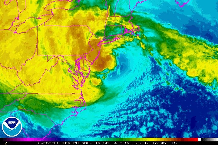
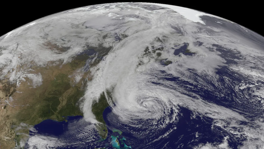
Hurricane Sandy, also known as Superstorm Sandy, made landfall in the United States as a post-tropical cyclone near Atlantic City, New Jersey on October 29th, 2012. It was estimated to be 50 billion dollars in damages and 147 direct deaths. It was the largest Atlantic hurricane on record, spanning over 1,000 miles in diameter. One of many reasons why this storm stands out.
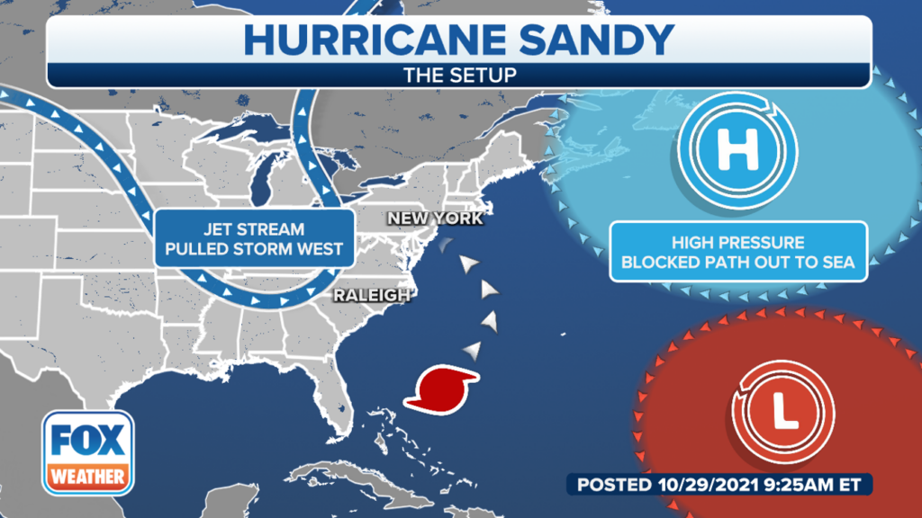
Another reason was that Sandy was not the usual hurricane seen during the late hurricane season. While most hurricanes and tropical cyclones steer northeast out to sea when coming from the Caribbean, Sandy moved up the Atlantic Coast and turned left. The reason for this westward turn was a strong high-pressure blocking pattern over Greenland known as a Greenland block.
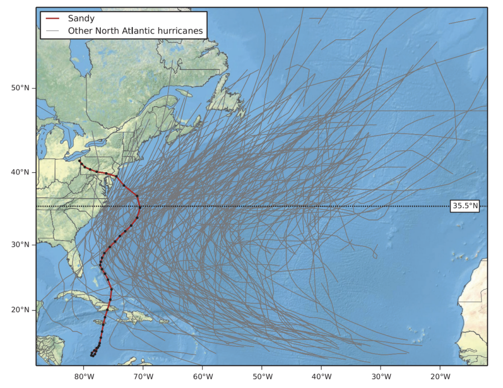
The clockwise winds of the blocking high cause storms to make a west or northwest turn. The graphic below is a comparison of Sandy’s track to other tropical cyclones that were of hurricane strength from 1948 to 2012.
The final reason as to why Sandy stood out was the cold front interaction just before landfall, making the storm become extratropical on October 29th.
The setup of Hurricane Sandy
A week before the system formed, there was already an expectation that an area of low pressure would form because of multiple factors. The two main factors were a tropical wave moving through the Atlantic and a left-behind surface trough from the leftovers of Rafael.
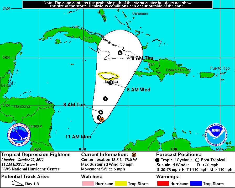
The system continued toward the western Caribbean, and on October 22nd, the surface low became Tropical Depression Eighteen. Later that day, the depression turned into a storm after moving southwest.
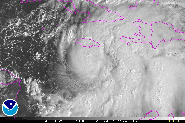
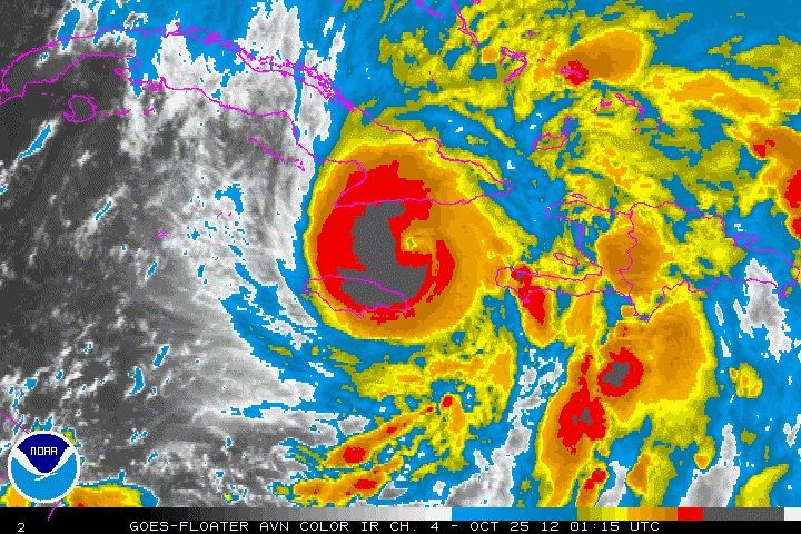
The path started north-northeast, and by October 24th, the Tropical Storm was classified as a Hurricane crossing the eastern portion of Jamaica. As Hurricane Sandy began to move back into the western Caribbean, the system strengthened to a Category 2 before making landfall in southeast Cuba on October 25th. While crossing through the Florida Straits, it was growing in size but overall weakening.
As the now Tropical Storm Sandy moved Northeast, it was following the predictable path until meeting with an area of intense high pressure near Greenland. The Greenland Blocking Index (GBI) was in the 99.8th percentile, the second-highest value in the historical record. As a result, there was a dramatic turn west toward the Northern United States.
The Aftermath
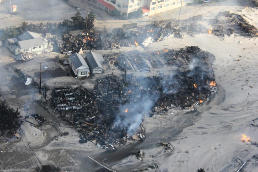
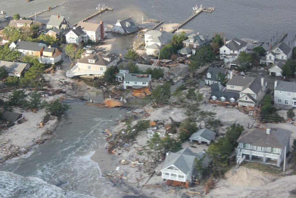
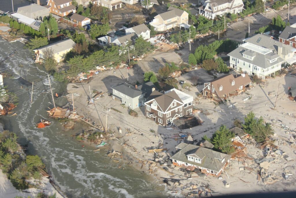
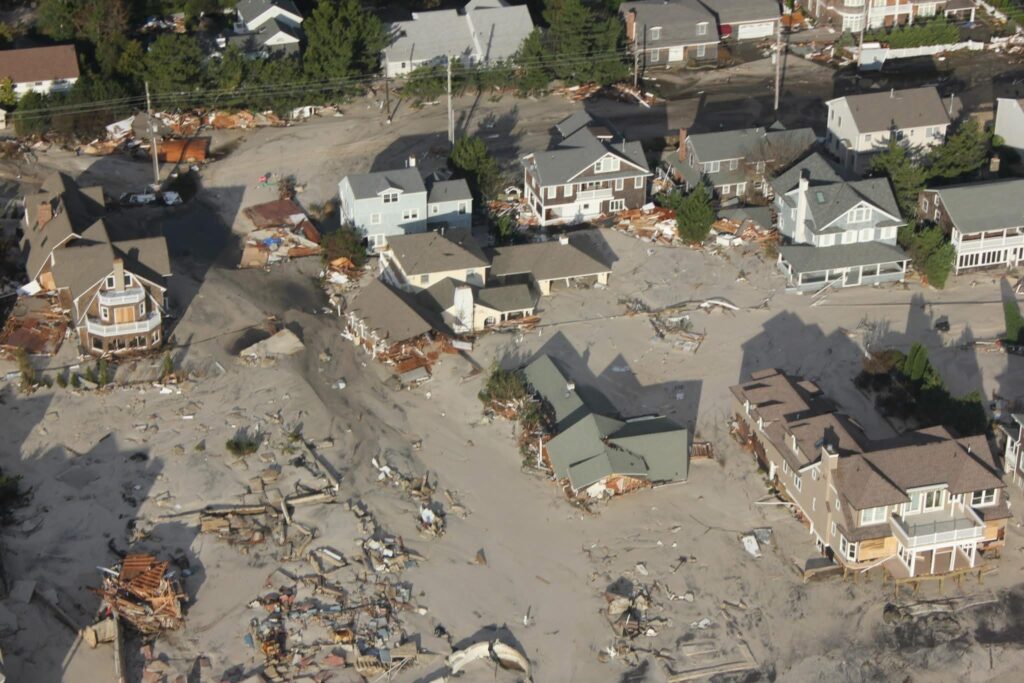
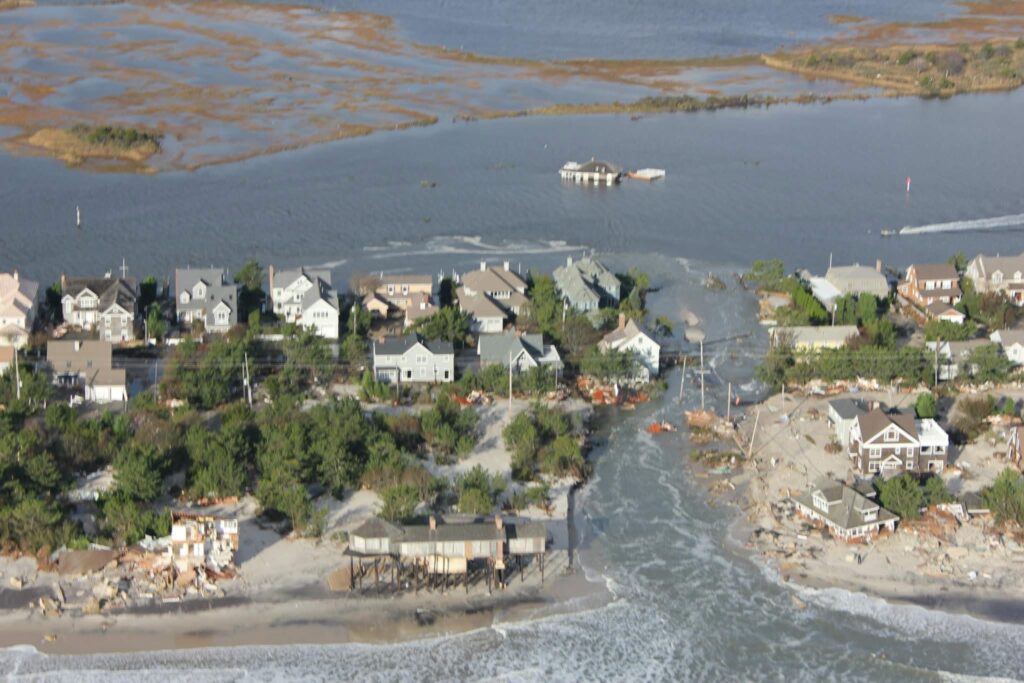
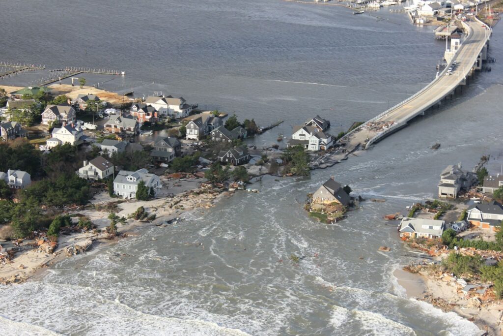
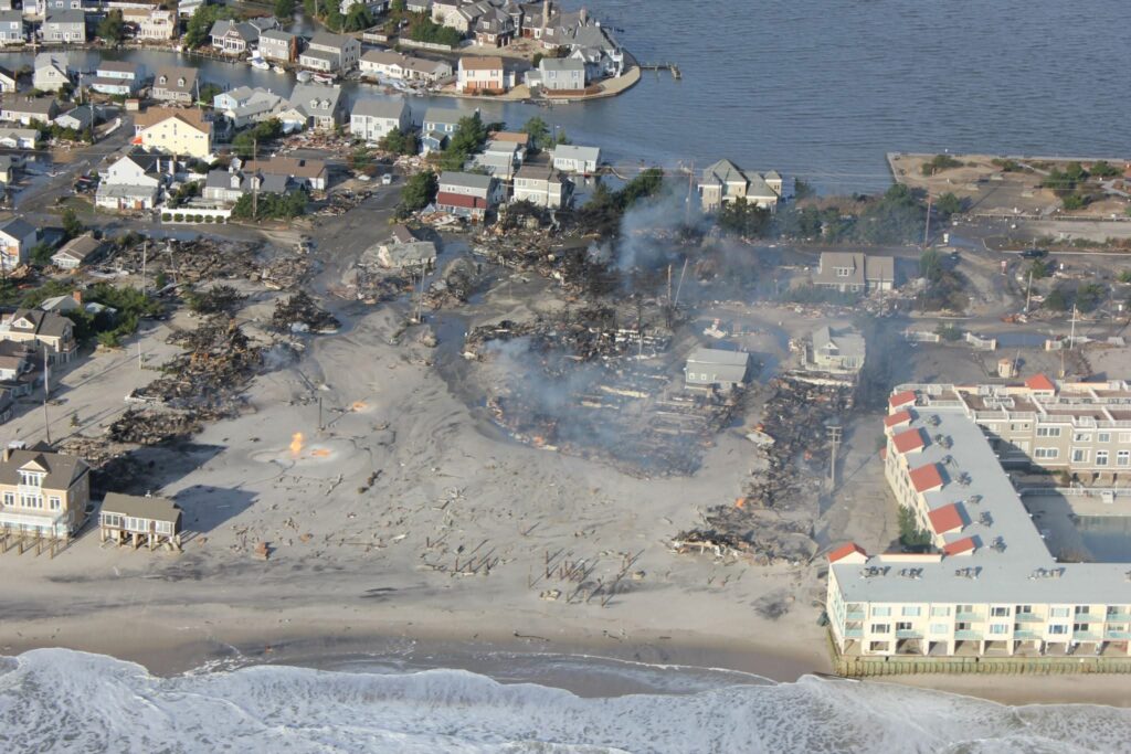
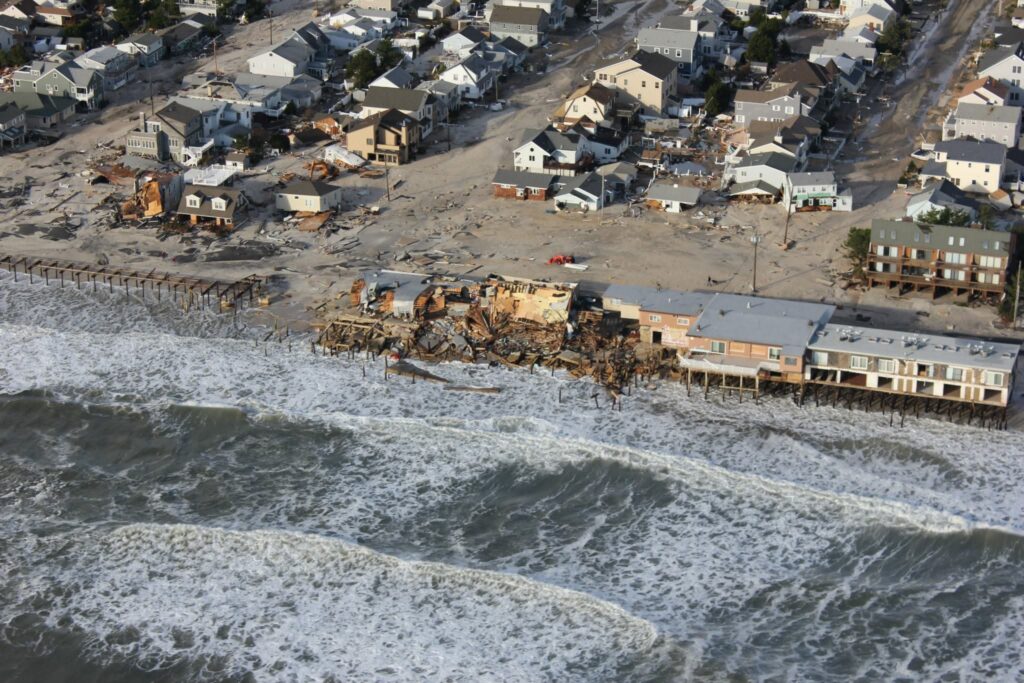
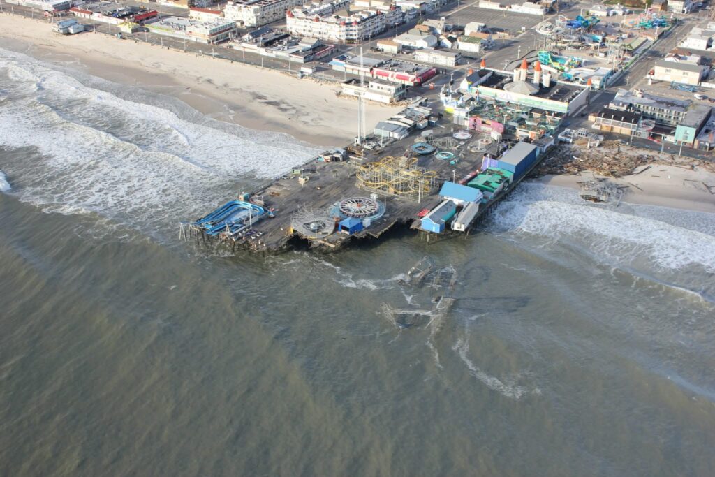
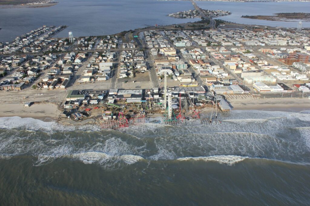
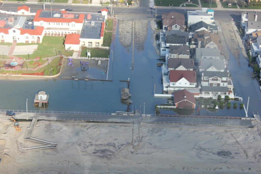
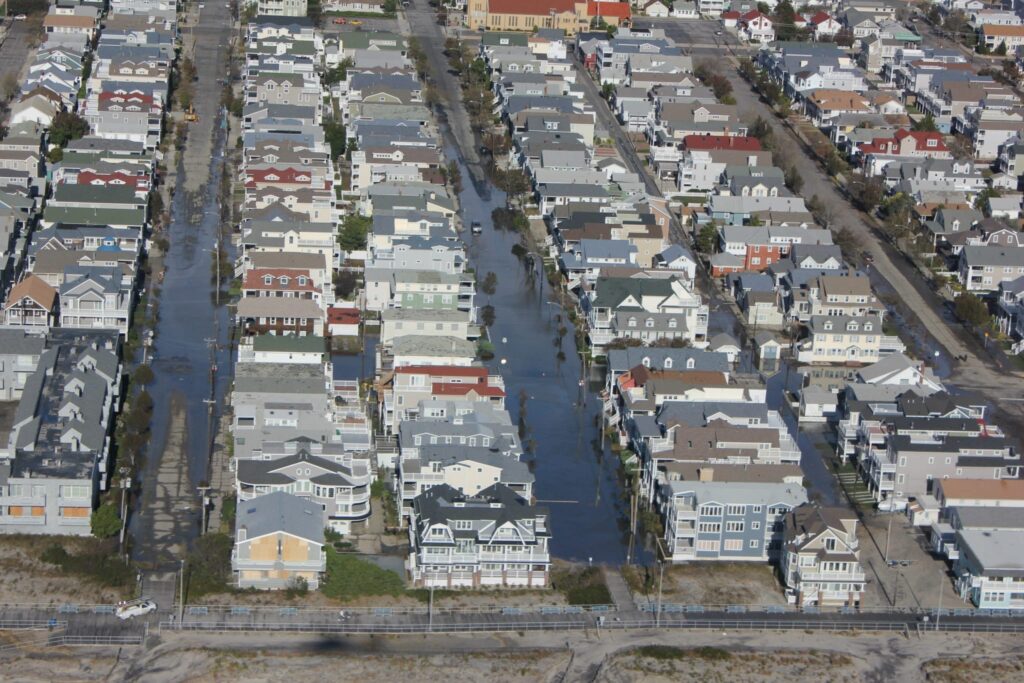
Hurricane Sandy caused between 50 and 70 billion dollars in damage, making Sandy the second-costliest hurricane in U.S. history. Damages ranged from flooding, infrastructure, to loss of power. Places such as New York and New Jersey, neighborhoods were left with thousands of damaged homes and people displaced. Emergency responders helped with evacuation and rescue efforts, receiving help from agencies such as FEMA with recovery and rebuilding. In the long term, rebuilding made communities stronger and was done to be more prepared for future weather phenomena. Rebuilding included restoring beaches, homes, and improving coastal protection systems.
Below are several photos from my father when he flew a helicopter up the Jersey Shore with the Coast Guard after Sandy passed.
References
Friedlander, Blaine. “Arctic Ice Loss Amplified Superstorm Sandy Violence | Cornell Chronicle.” Arctic Ice Loss Amplified Superstorm Sandy Violence, 4 Mar. 2013, news.cornell.edu/stories/2013/03/arctic-ice-loss-amplified-superstorm-sandy-violence.
Blake, Eric S., et al. “1 Tropical Cyclone Report Hurricane Sandy (AL182012) 22 – 29 October 2012.” Tropical Cyclone Report Hurricane Sandy (AL182012) 22 – 29 October 2012, National Hurricane Center , 12 Feb. 2013, www.nhc.noaa.gov/data/tcr/AL182012_Sandy.pdf.
Roth, David. Hurricane Sandy – October 24-31, 2012, www.wpc.ncep.noaa.gov/tropical/rain/sandy2012.html
Mattingly, Kyle S., et al. “A climatological assessment of Greenland blocking conditions associated with the track of Hurricane Sandy and historical North Atlantic hurricanes.” International Journal of Climatology, vol. 35, no. 5, 22 Apr. 2014, pp. 746–760, https://doi.org/10.1002/joc.4018.
Peer, Andrea. “Hurricane Sandy: Facts, FAQs, and How to Help | World Vision.” Hurricane Sandy: Facts, FAQs, and How to Help, World Vision, www.worldvision.org/disaster-relief-news-stories/2012-hurricane-sandy-facts. Accessed 22 June 2026.
“Hurricane Sandy Recovery.” U.S. Department of the Interior, 31 May 2015, www.doi.gov/hurricanesandy.
“An Ongoing Response to Hurricane Sandy.” National Archives and Records Administration, National Archives and Records Administration, obamawhitehouse.archives.gov/issues/hurricane/sandy


