We’ve got another shot at scattered showers and storms tomorrow before sunny skies and heat take over, bringing a return to typical summer conditions with highs in the 90s, lows in the 70s, and scattered afternoon thunderstorms. Heat will continue to build this weekend and worsen as we go into early next week, with heat indices in excess of 110 degrees possible! High humidity makes it difficult for your sweat to evaporate, which is the process that acts to cool your skin down. In short: it’s going to be uncomfortable… unless you’re in a pool!
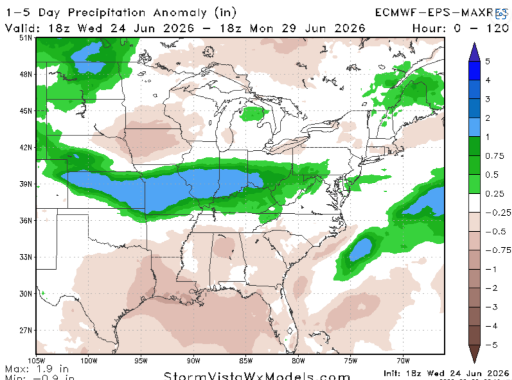
And here’s something you haven’t heard in a while: normal to below-normal precipitation is expected, as shown by the ECMWF 1–5 day precipitation anomaly forecast.

TONIGHT
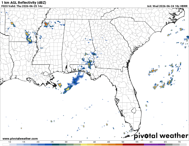
Lingering scattered storms are ongoing and will continue overnight. Short-range models show a few strong to severe storms tonight through 7 AM tomorrow morning, mainly along the Mississippi Coast. The strongest storms may bring isolated wind damage with gusts up to 60 mph, localized flash flooding, and an isolated tornado cannot be ruled out.
Otherwise, expect partly cloudy skies with lows around 70 degrees.
Patchy dense fog will be possible along and north of Jackson, Mississippi, generally after midnight through mid-morning tomorrow. Use caution when driving!
TOMORROW
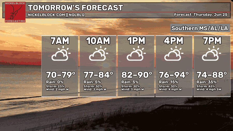
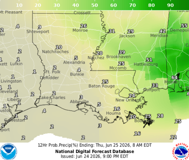
Thursday, scattered showers and thunderstorms are expected during the morning and afternoon hours. Main threats with these storms are as usual, heavy downpours, frequent lightning, and strong wind gusts. Hot and humid tomorrow, as temperatures may feel up to 10 degrees warmer than shown above.

THE DAY AFTER TOMORROW
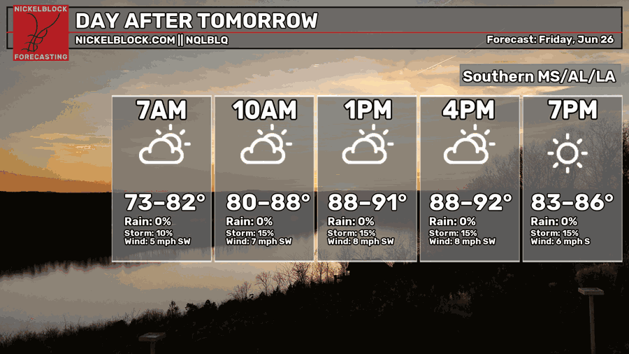
Friday will be another hot and humid day with mostly sunny skies for the area. Of course, afternoon and evening stray storms are possible along coastal cities. Heat indices nearing 110 degrees…drink water!

EXTENDED FORECAST
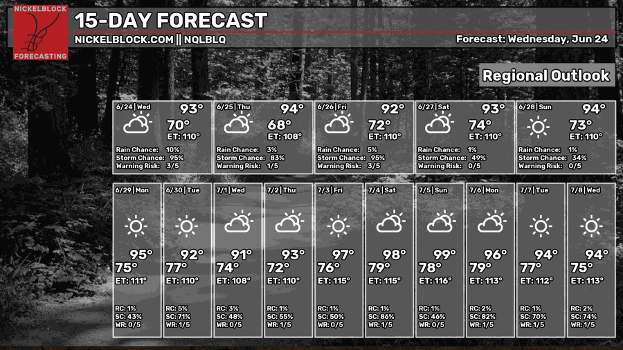
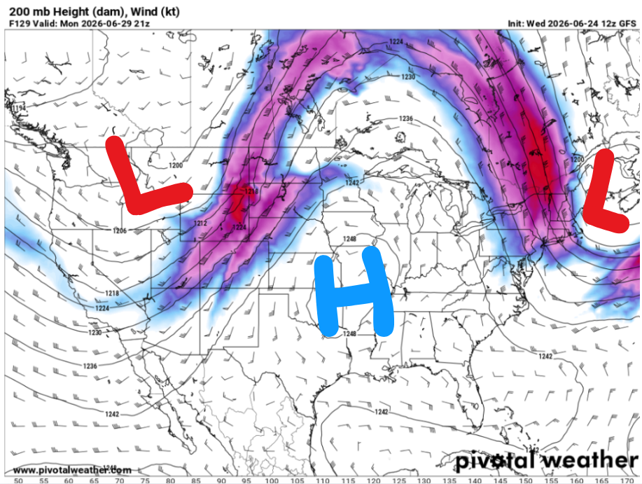
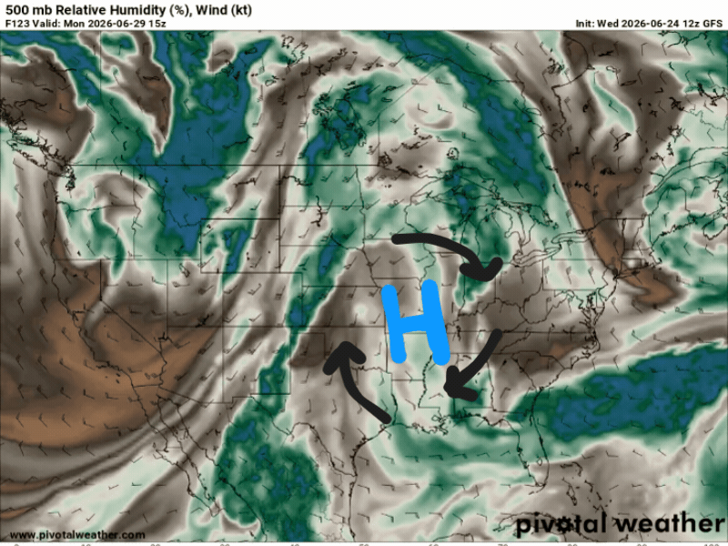
Strong ridging is set to build this weekend and remain in place through early next week. It’s going to be hot with above-normal temperatures. Mostly dry conditions expected, with storms possibly returning Tuesday due to slight weakness in the upper-level ridge. High pressure will be in place with this ridge, and with clockwise wind flow, easterly winds will transport some moisture into the area.
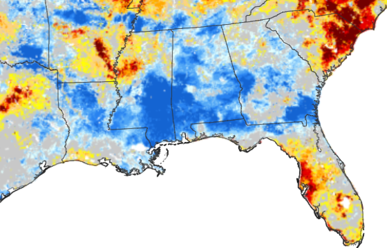
Also, the soil is still wet from previous rain, raising humidity levels. Shown below is the moisture content of the top 1 meter of soil. Red and orange hues indicate drier soils, while greens and blues indicate higher soil moisture.
DAY-BY-DAY FORECAST
Tonight – Lingering scattered storms are ongoing and will continue overnight through 7 AM tomorrow morning, highest rain totals near Hattiesburg and along the Mississippi Coast. The strongest storms may bring isolated wind damage with gusts up to 60 mph, localized flash flooding, and an isolated tornado cannot be ruled out. Otherwise, expect partly cloudy skies with lows around 70 degrees. Calm northwest wind. Rain chance: 40%
Thursday – Watch out for patchy fog near Jackson in the morning. Heat and humidity continue building with highs near 94, may feel closer to 108. An unsettled pattern with numerous showers and thunderstorms storms expected, some severe and some with intense downpours, mainly in the morning and afternoon. Rain chance: 40%. Light westerly wind.
Thursday Night – A few showers and thunderstorms will linger overnight under mostly clear skies. Lows near 72. Southwest wind around 5 mph. Chance of rain increasing as you go east towards Hattiesburg. Rain chance: 20%
Friday – Sunny, with a high near 92. Heat index values as high as 110. Calm southwest wind. Drink water!
Friday Night – Mostly clear, with lows around 72. South wind around 5 mph. Cannot rule out a stray thunderstorm near coastal cities.
Saturday – Sunny, with a high near 93, may feel like 110. Calm wind south wind around 5 mph. Drink water!
Saturday Night – Clear, with a low around 74. Calm wind becoming south around 5 mph. Cannot rule out a stray thunderstorm near coastal cities.
Sunday– Sunny, with a high near 94, may feel like 110. Calm wind. Drink water!
Sunday Night – Mostly clear, with lows around 73. South wind around 5 mph. Cannot rule out a stray thunderstorm near coastal cities.
Monday – Another sunny, hot, and humid day with highs nearing 95, may feel like 111. Calm northeasterly wind. Drink water!
Monday Night – Mostly clear, with lows around 75. South wind around 5 mph. Cannot rule out a stray thunderstorm near coastal cities.
Tuesday – Mostly sunny, with a chance of isolated showers and storms in the afternoon. Highs around 92, may feel closer to 110. Rain chance: 40%. Calm easterly winds.
Tuesday Night – Showers may linger overnight, otherwise partly cloudy with lows around 77. Calm easterly winds. Rain chance: 20%


