You guessed it, the big weather story this week is going to be the scorching heat! For the next week or so, a southeast ridge pattern will deliver very hot temperatures to our area and beyond.
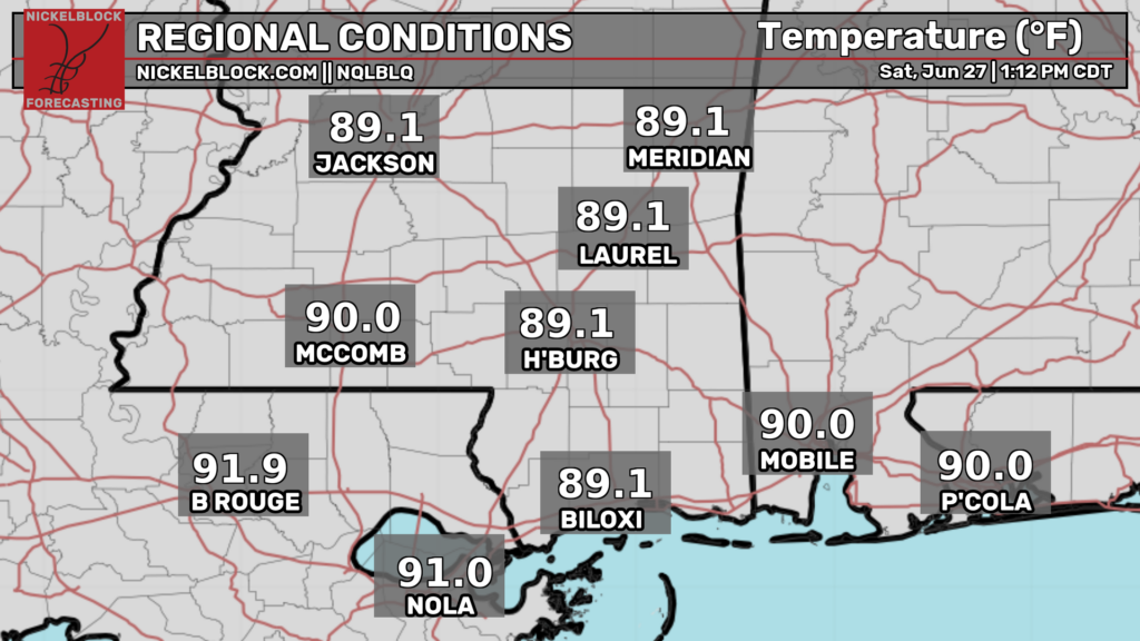
Temperatures are currently in the upper 80s and lower 90s across our region, and it’s only 1:30p CDT. There are not many thunderstorms in our area currently, as we are at the center of the ridge. Most storms are further north in Kentucky and Tennessee.
These temperatures are forecasted to rise into the hot mid 90s today, so it’s important to stay hydrated and wear cool clothing.
Some brief and weak pop up thunderstorms may develop tonight, but that high pressure is doing such a good job at providing a “lid” on the atmosphere. This will prevent storms from being an issue tonight.

Tomorrow

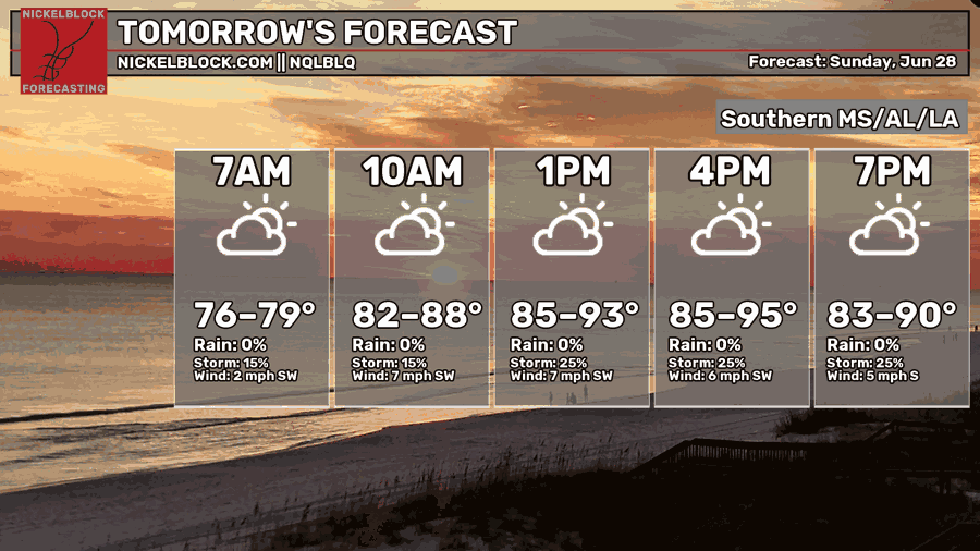
Moving into tomorrow, we’re again expected to see widespread high temperatures in the mid 90s. Morning lows will also only fall into the sultry mid-upper 70s. Morning lows play a significant role in heat safety, as the human body is more negatively impacted by extreme heat when there is little to no respite from the heat at any time of the day.
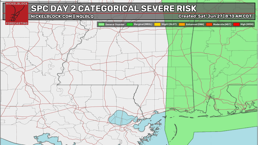
There is a very slight chance of some scattered thunderstorms tomorrow, particularly east of Hattiesburg. However, this risk is very mild and strong/widespread storms are not likely tomorrow. Storms, if any, should be gone by around 8 tomorrow night.
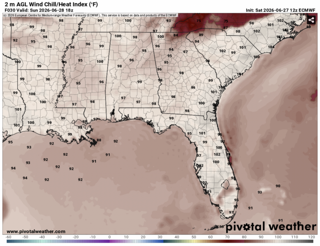
Since dew points will be in the oppressive mid 70s, the heat index tomorrow is going to make the temperature feel even hotter than it is. Some places will see the heat index climb to over 100ºF.
Monday
Out of all the days this week, Monday is likely to be the hottest.
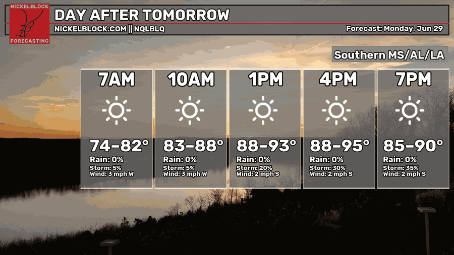
The afternoon highs will range from the upper 80s to the mid 90s, but temperatures in the 90s are going to be more common. Morning lows will again only drop into the mid 70s.
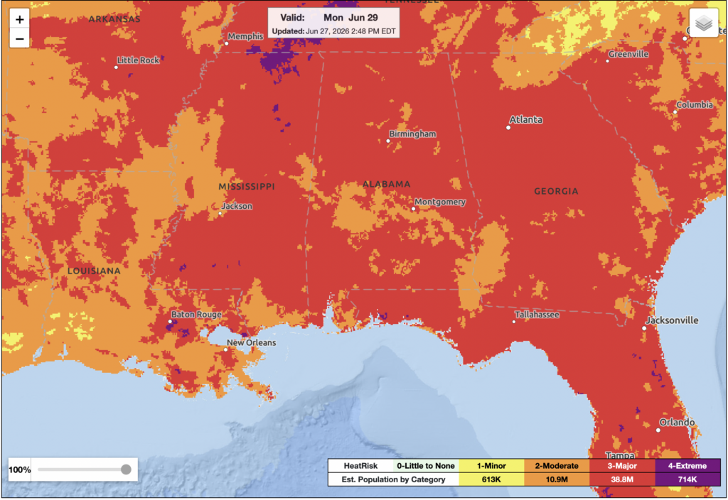
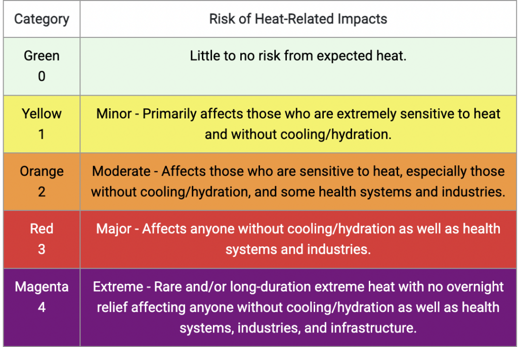
The NWS has also identified Monday as the day most likely to see extreme heat. Much of our region is covered in a category 2 and 3 heat risk, with some localized spots in a category 4 risk. Again, try to limit outdoor activity in the next few days and always stay hydrated!
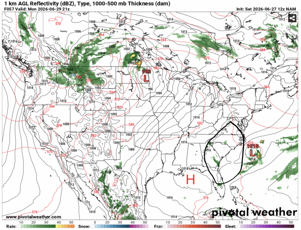
Some thunderstorms are possible Monday evening, but I suspect they will stay too far east for most of our region. This is because an area of low pressure off the coast of the Carolinas will interact with the high pressure over the gulf. The area in between, which is mostly in Georgia and the Carolinas, will likely see some storms develop due to dry air displacing moist air, causing it to rise.

Extended Outlook
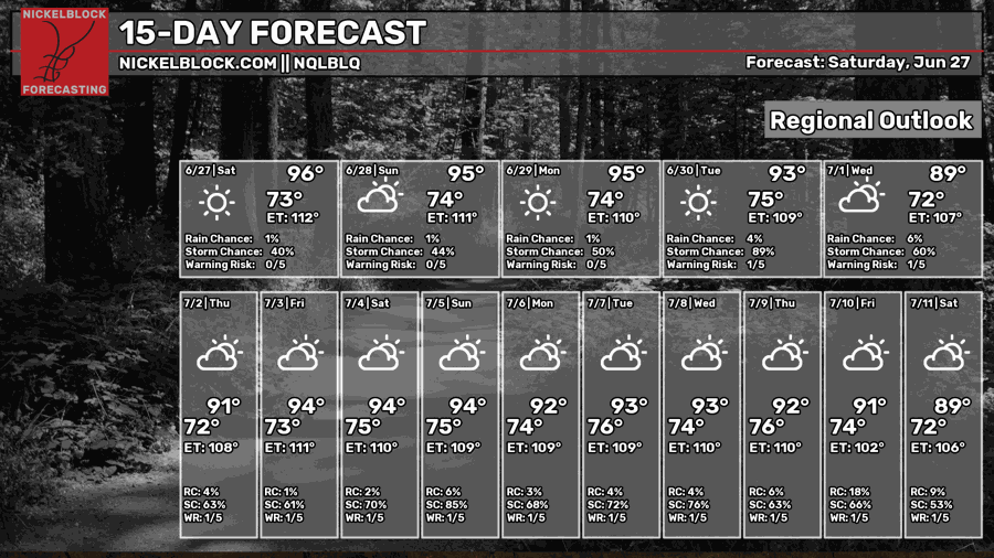
Over the next two weeks, temperatures will continue to be hot, with nearly everyday seeing a high temperature in the 90s. Most days also have at least some chance of storms, typical for summertime. I also suspect that most of these days will see dew points in the mid-upper 70s, as the heat index rises well above 100ºF on most days. Some days even see heat indices over 110ºF!
While temperatures will be hot, it’s also worth noting that they likely won’t be quite as hot as they were previously forecasted to be. The ridge of high pressure responsible for this heatwave has shifted more to the northeast instead of being directly over our region. This has spared us from some of the hottest temperatures.
It’s still summertime in the deep south, so of course the temperatures are going to be hot, but there may be some relief on the way.
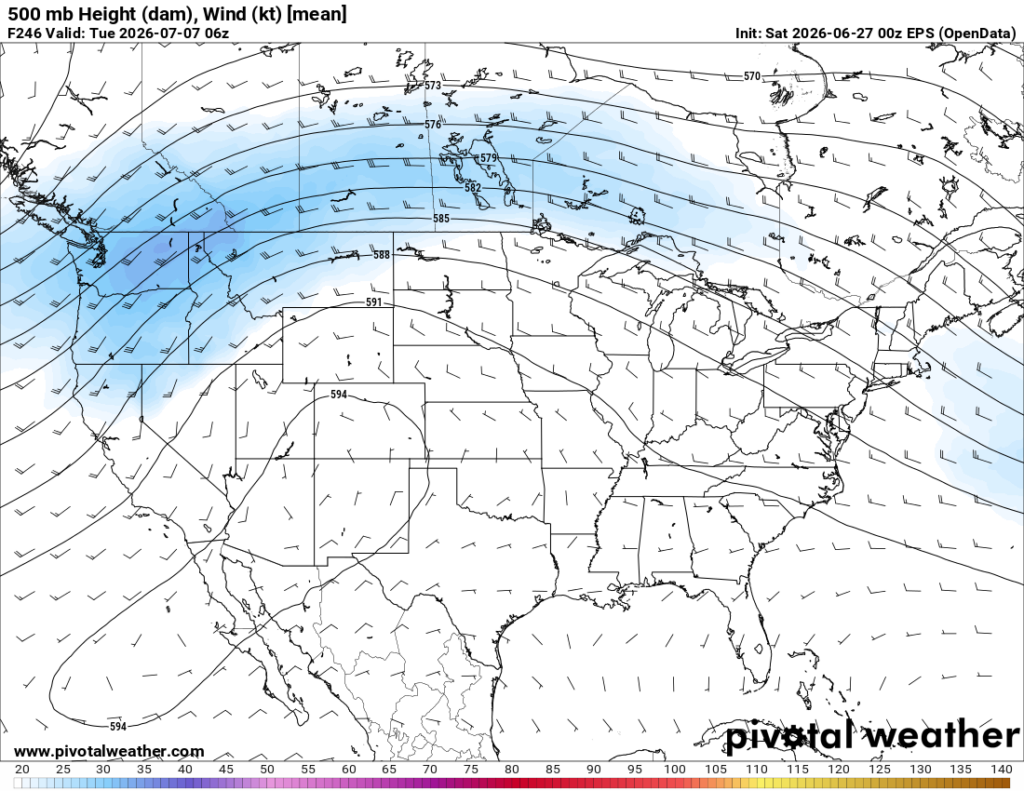
Around July 7th, the ridge of high pressure that was previously anchored over Appalachia and the mid-Atlantic will shift back to the southwestern U.S., where it is more commonly found. This will likely bring us more chances to see rain as well as slightly cooler temperatures.


