
Tomorrow’s Overall Setup
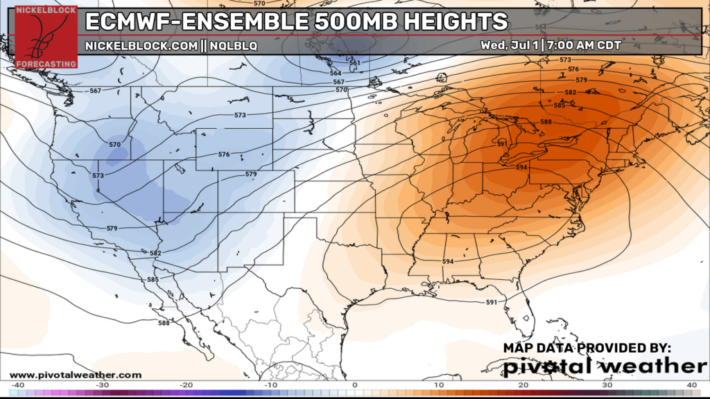
Good evening everyone! We are in the dog days of summer and the snowmen, including Olaf, are certainly melting under this heat dome. We love that buzz word btw. Seriously though, there is a large ridge of high pressure stationed over the eastern U.S., which is allowing for very hot temperatures to take over during the middle to end of the week. Heat related impacts are Major to Extreme on the NWS heat risk scale in many areas, and will only worsen as we get to the end of the week. Stay in the air conditioning if you can and stay hydrated!
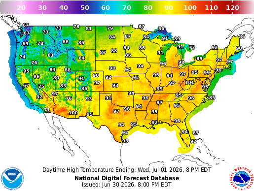
For Wednesday, the heat and humidity take over everywhere in the east. Highs in the 90s will be widespread from the Plains into the Midwest, Southeast, and East Coast, with some areas near 100°. Add in the humidity, and it will feel even hotter, especially during the afternoon hours.
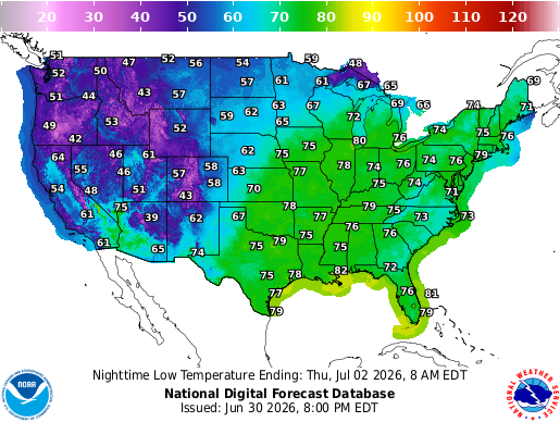
Overnight lows will also stay very warm and muggy, with many spots only dropping into the 70s and some areas near the Gulf Coast and Southeast closer to 80°, so there will not be much relief after sunset.
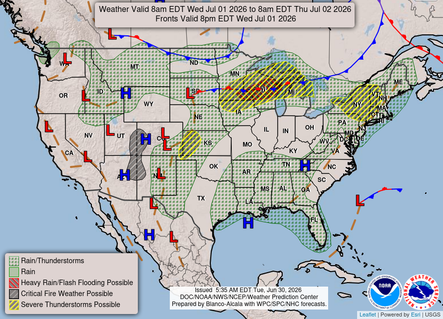
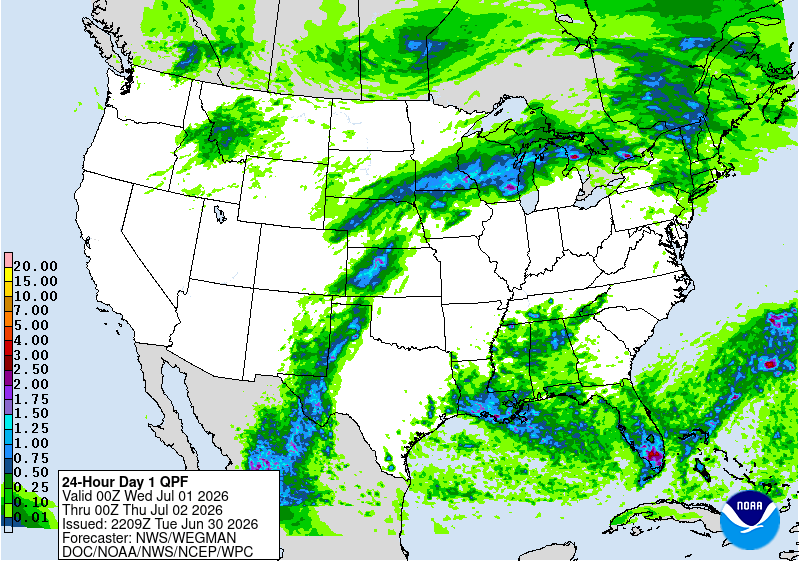
Rain and storms will be around too, mainly from the northern Plains into the Midwest, Great Lakes, and Northeast, with more scattered activity across the South and Southeast. Overall, it is a classic summer setup: a strong ridge bringing the heat, with showers and storms riding along the edges.
For severe weather, the main focus Wednesday is definitely across the Upper Midwest and Great Lakes, where an Enhanced Risk is in place from southern Minnesota into parts of Wisconsin and northern lower Michigan. This is the area where multiple rounds of storms could happen through the day and into Wednesday night.
This looks like a setup where damaging winds are the biggest concern. Some gusts could get pretty intense, possibly near 80 mph if storms organize into a bowing line or MCS. Large hail and a few tornadoes are also on the table, especially early on if storms can stay more isolated before merging together.
There are a few other areas to watch too, including the Northeast, central High Plains, and parts of the South. The southern risk is not the main show, but with all that heat, humidity, and instability in place, a few storm clusters could still produce pockets of damaging winds, especially across the Nickelblock region.
Thursday’s Weather
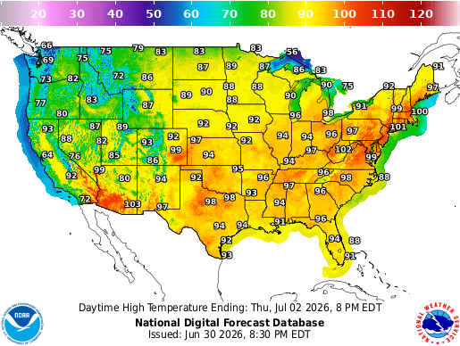
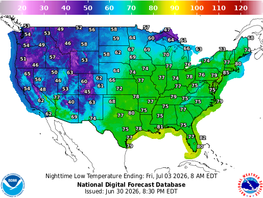
For Thursday, the heat and humidity are still locked in across a lot of the country. Highs in the 90s will be widespread again, with some spots in the Mid-Atlantic, Southeast, and southern Plains near or above 100°. Overnight lows stay very warm too, so there still will not be much relief after sunset yet again.
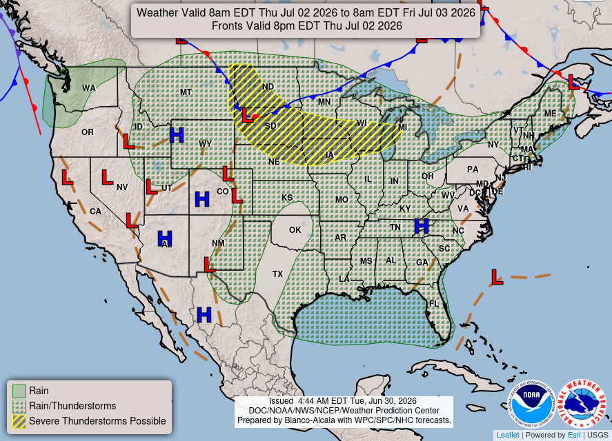
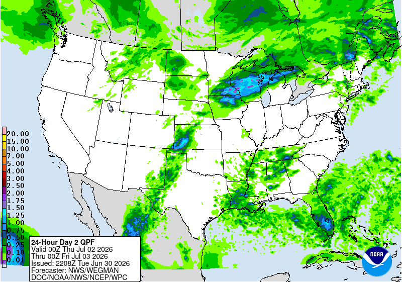
Rain and storms will continue around the edges of the ridge, especially from the northern Plains into the Upper Midwest and Great Lakes. More scattered storms are also possible farther south into the Tennessee Valley, Southeast, and Gulf Coast. To be honest, it is pretty much more of the same summer pattern: hot, humid, and unsettled in spots.
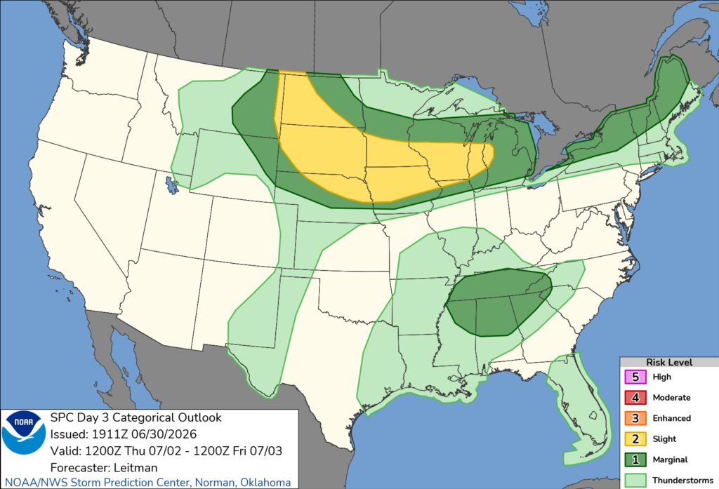
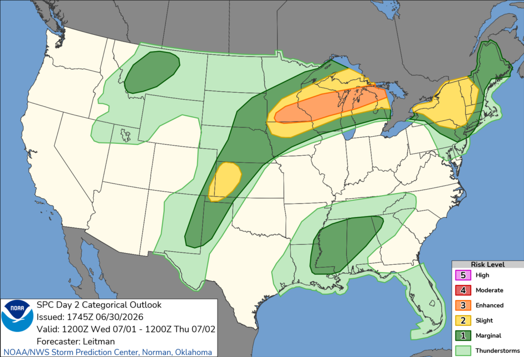
For Thursday’s severe threat, the main zone shifts from the northern Plains into the Upper Midwest and Great Lakes. A Slight Risk is in place, and this is where storms could fire along the boundaries during the afternoon and evening. To be honest, this still looks like another setup where storms could start a little more isolated, then try to grow into clusters or an MCS later on.
Damaging winds look like the main concern, especially if storms organize and start moving along the boundary. Hail and a brief tornado risk cannot be ruled out early, but the bigger story is the potential for wind as storms merge. Farther south into the Tennessee Valley/Southeast, a few storms could also pop in the very humid air and produce isolated damaging wind gusts.
CONUS Weekly Temperature & Precipitation Outlook
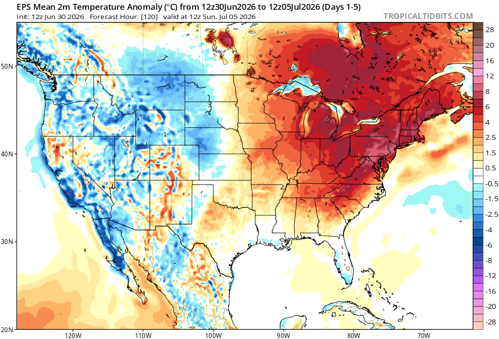
Here’s a look at the EPS modeled temperature anomalies through Sunday. Red indicates above-average temperatures on average for the week, white indicates average temperatures, and blue indicates below-average temperatures.
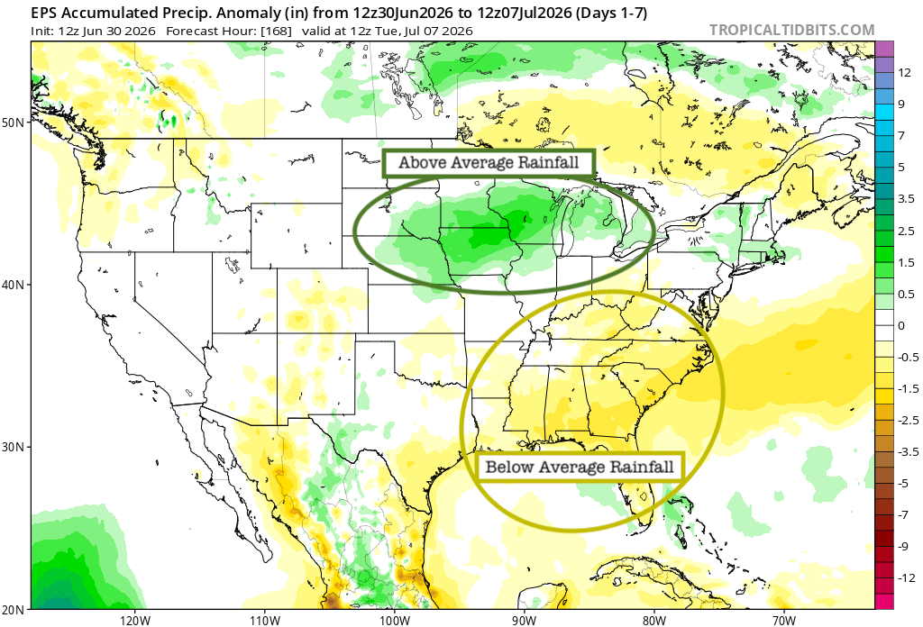
Here’s a look at the EPS modeled precipitation anomalies through next Tuesday. Green indicates above-average precipitation, white indicates average precipitation, and yellow indicates below-average precipitation. Let’s look into the details by region:
Weekly Outlook: Western & Central United States
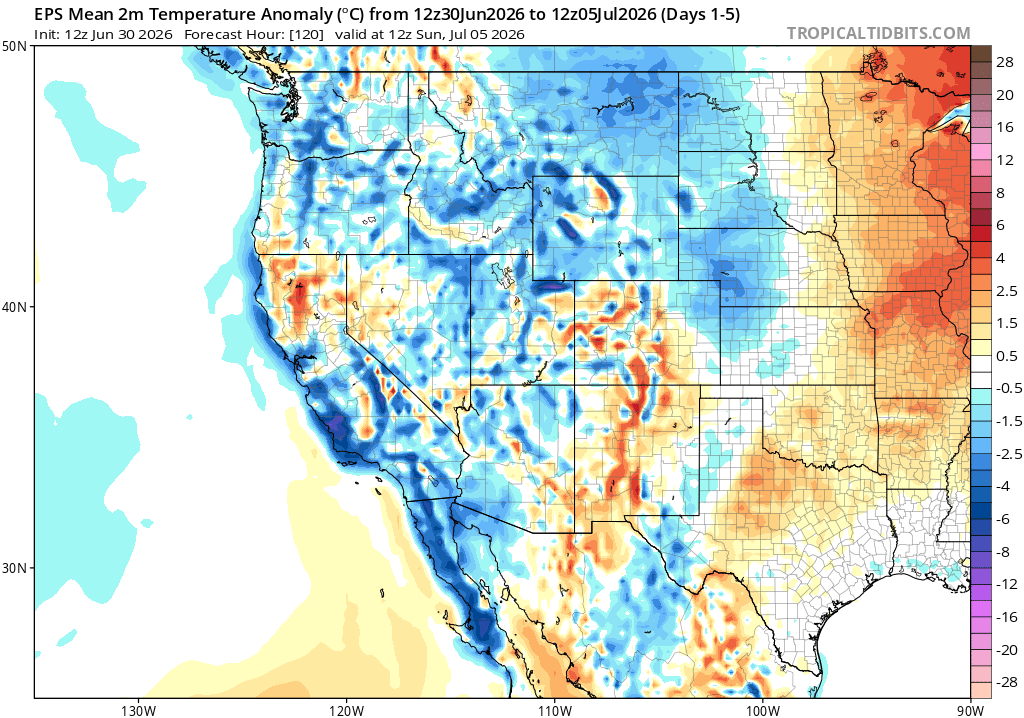
For the western and central U.S. this week, the cooler side of the pattern is focused out West, especially across California, the Great Basin, and parts of the Rockies. Farther east into the Plains, warmer and more humid air starts to build in closer to the edge of the ridge.
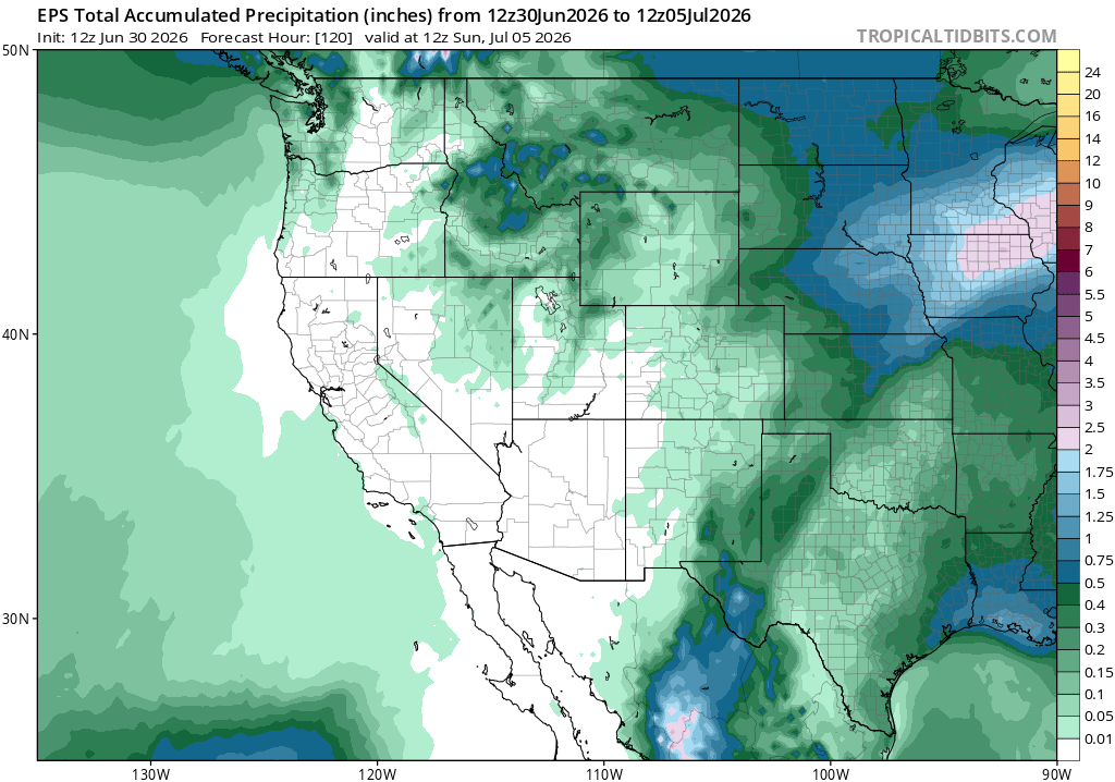
Rain chances look most active from the northern Rockies into the northern Plains and Upper Midwest, with some heavier totals possible through the end of the week. That lines up with the stormy pattern we’re seeing, as systems ride along the edge of the bigger heat dome to the east.
Weekly Outlook: Eastern United States
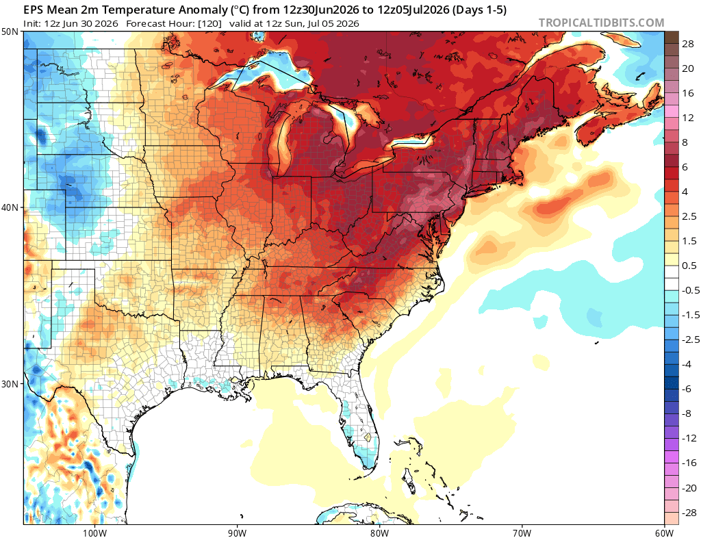
For the eastern U.S. this week, we are going to certainly be above average, with up to 15-20 degrees above average likely! There will be plenty of heat and humidity sticking around through the end of the week.
Rain chances are there, but they look more scattered outside of the Great Lakes and Northeast, where the better storm track sets up. Most of the storms will ride along the northern edge of the ridge, while the Southeast stays more hit-or-miss with daily pop-up storms in the humid air.
Extended Outlook
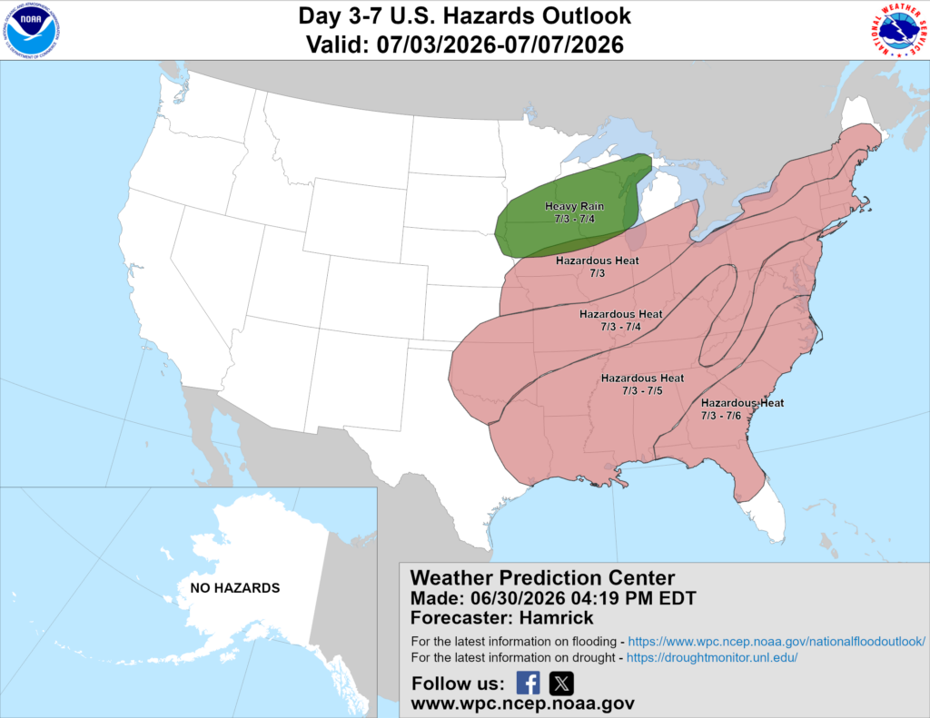
Above is a look at the U.S. Hazards Outlook from NOAA, highlighting areas of more impactful weather to be aware of over the next 3 to 7 days.
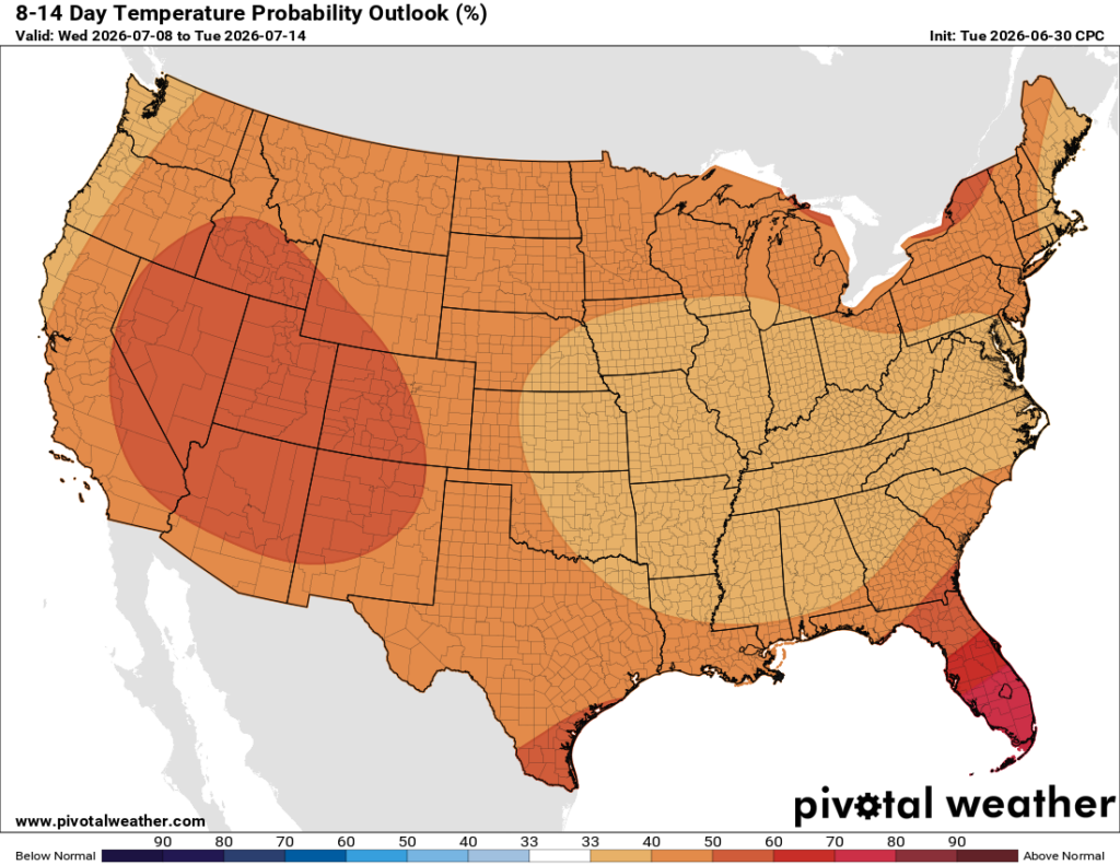
Looking ahead into the 8–14 day period, ridging looks to dominate most of the U.S., so the overall signal leans warmer than average for just about everyone. The strongest warm signal shows up across the West, Northeast, and Florida, but even the central and southern U.S. still look tilted above normal.
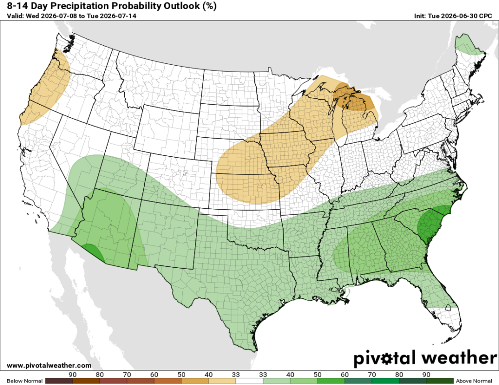
Precipitation-wise, the pattern is a little more mixed. The Southeast and parts of the southern U.S. have a better signal for above-average rainfall, likely from the continued humid and unsettled pattern. Meanwhile, parts of the Midwest and Great Lakes lean drier, which makes sense with the ridge becoming more established.
Thanks for tuning in to this National Forecast! Tune in to our local, tropical, and regional forecasts to stay updated on the latest!


