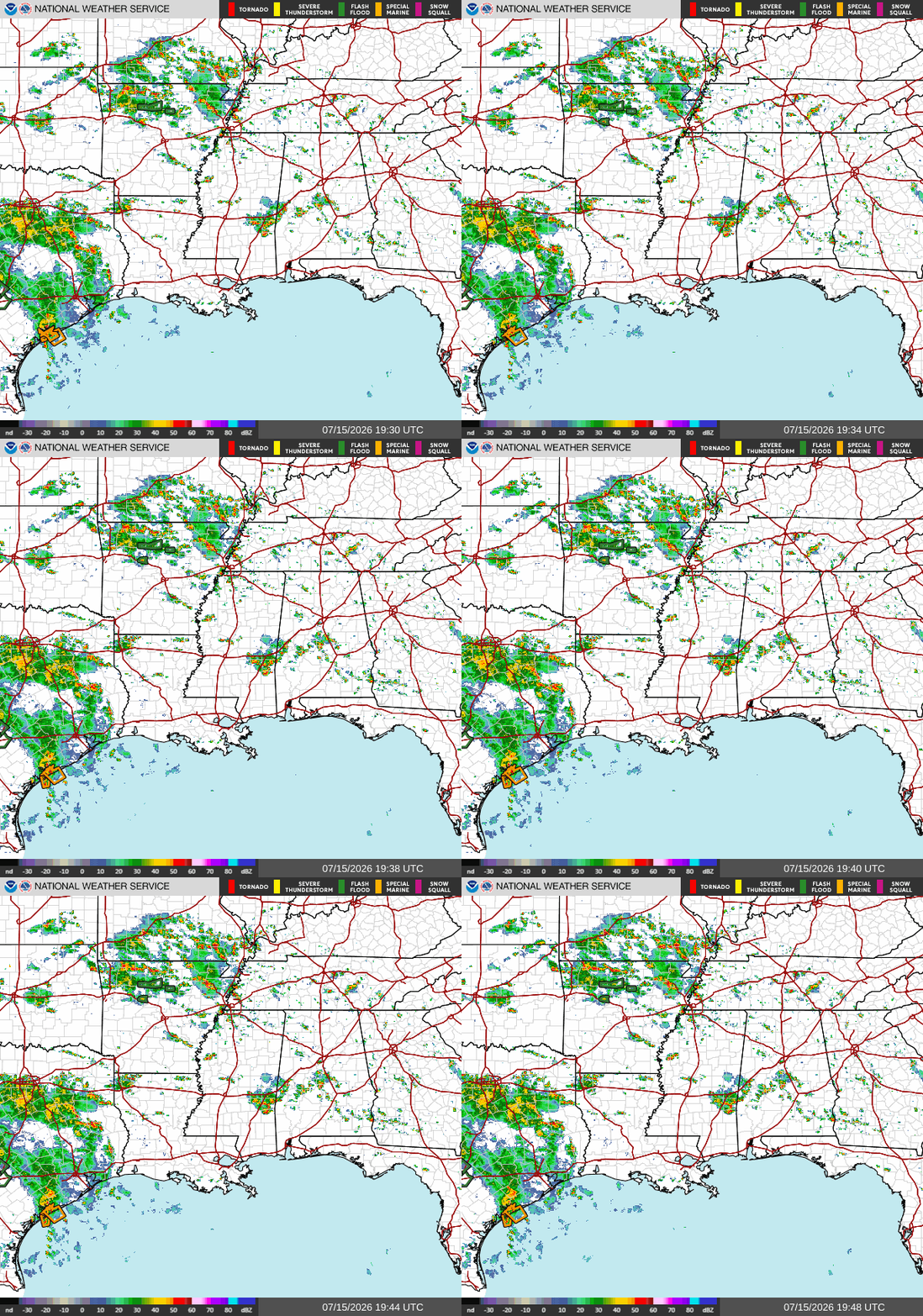
Good afternoon! As I’m writing this at 3p CDT, we have a couple areas of storminess on our radar. The main one is an area of thunderstorms (not severe) south of Meridian near Quitman, MS extending across the Alabama border all the way to Montgomery. These storms are moving east/southeast.
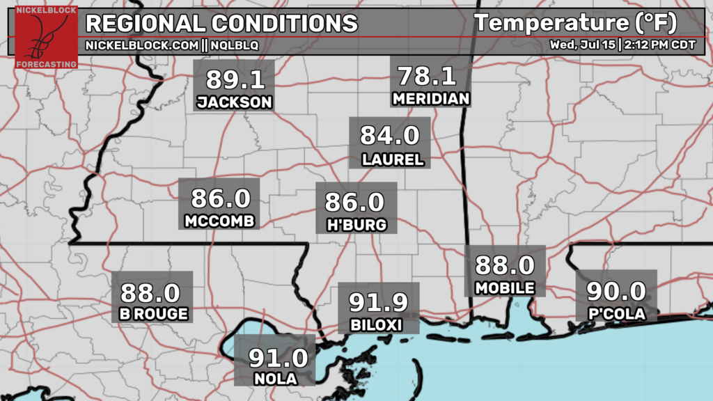
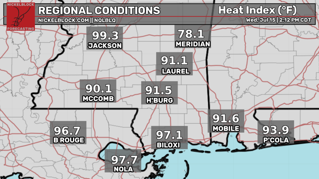
Temperatures currently range from the mid 80s to the low 90s, with warmer temperatures the further south you go. Heat index values range from the low 90s to the upper 90s, except for Meridian, which just got hit by a few thunderstorms.
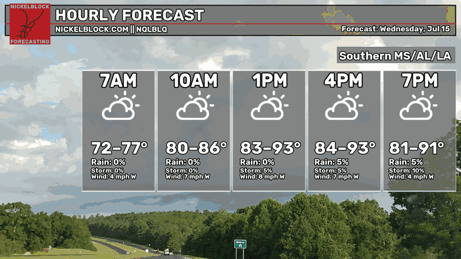
Afternoon highs this afternoon are forecasted to range from the mid 80s to the low 90s, which is below normal for this time of year.
Some minor storms are possible tonight, but they don’t look like they will be too widespread. This is partially due to the fact that a high pressure center sits just to the south of Louisiana, resulting in a “lid” being placed on the lower atmosphere, preventing warm and humid air from rising. There is also a decent amount of cloud cover today, and combined with temperatures being below average for this time of year, the sun cannot heat up the air enough for it to rise and overcome the “lid”.
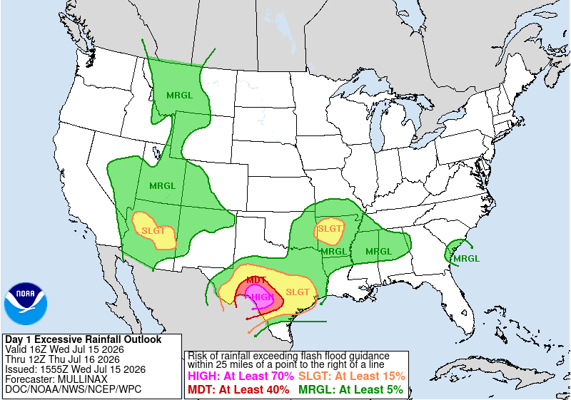
Additionally, while not in our forecast region, the weather prediction center has issued a high risk for excessive rainfall in southwestern Texas, near the U.S.-Mexico border for today. Floods have consistently been the deadliest weather related disaster in the U.S. year after year, so if you are in the high and moderate risk areas, be extra aware of your local weather alerts. Turn around and don’t drown!

Tomorrow
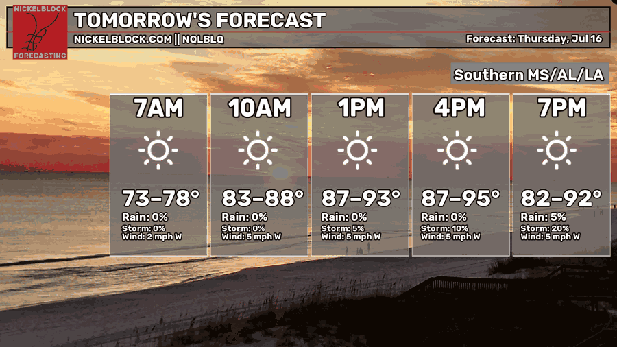
We’re in for a hotter day tomorrow than today, with afternoon high temperatures ranging from the upper 80s to the mid 90s. Skies will also be considerably more sunny than today, with sunny conditions expected all day. This is due to the high pressure situated to the south of our area, bringing dry conditions and sunny weather.
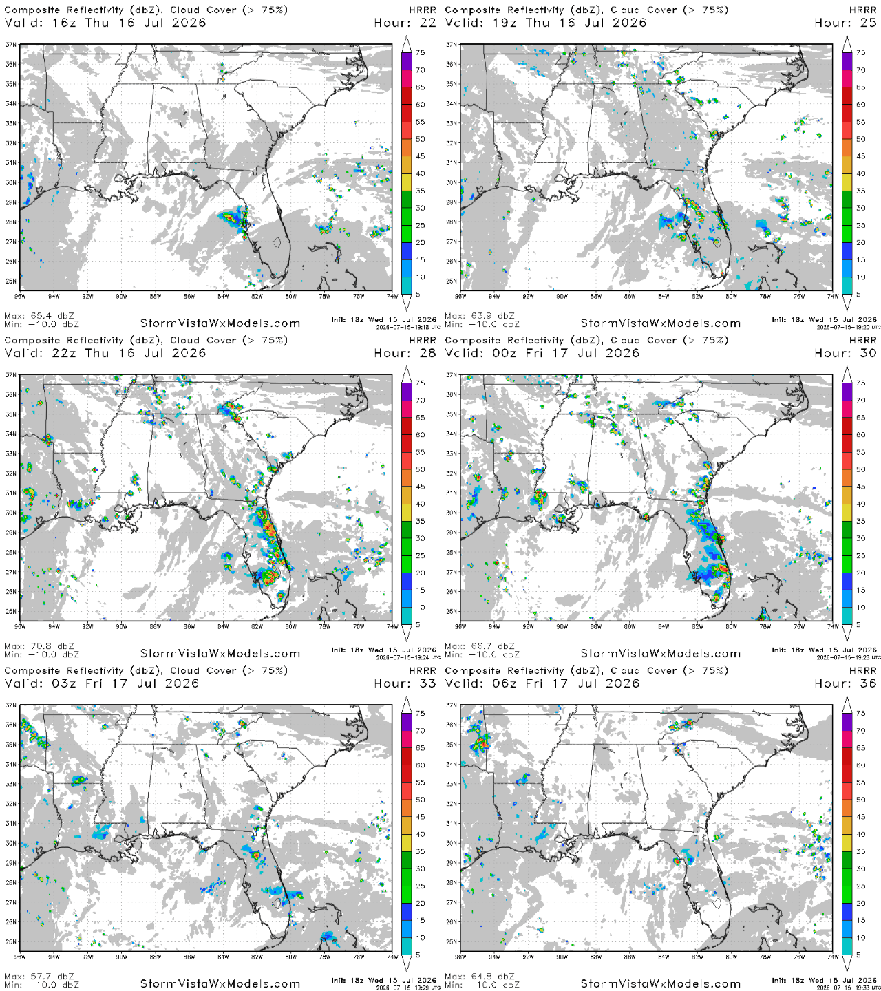
As for storms, not many are likely tomorrow. The high pressure system is directly over our area, meaning we are going to be nowhere near the boundary between two air masses, one of the most common ways to get precipitation.
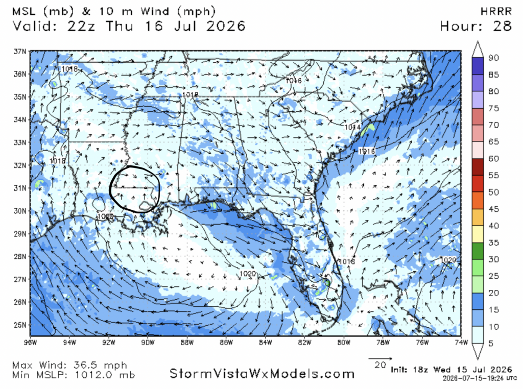
While not many storms are forecasted, some are still possible. Another way for storms to pop up in areas of high pressure is for moist air to clash with drier air, forcing the dry air to sink, and the moist air to rise, since moist air is less dense than dry air. Tomorrow, this may happen in the area between Hammond, LA and Brookhaven, MS due to the sea breeze, which brings moist gulf air north, allowing it to clash with the drier re circulated air of the ridge. Nevertheless, storms are still forecasted to be minor tomorrow.
Friday
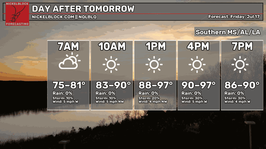
By Friday, the heat looks to ramp up pretty significantly, with afternoon high temperatures ranging from the low 90s to the upper 90s. In the morning, low temperatures are only forecasted to dip into the mid-upper 70s for most places. On days like Friday, it’s important to stay hydrated and wear sunscreen and cool clothing.
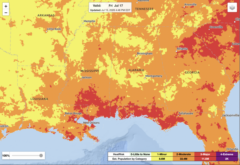
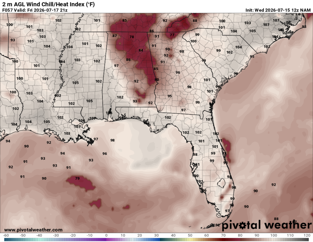
The NWS designates Friday as a category 2 (moderate) and category 3 (major) HeatRisk day for most of our region. Heat index values will climb into the sultry low-mid 100s during the late afternoon, the peak of the heat.
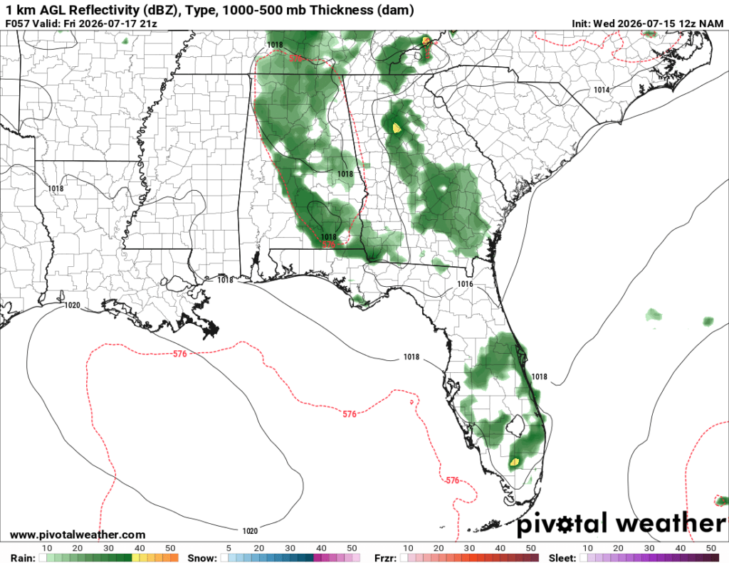
As for storms, the NAM currently shows areas to the east getting in on most of the action, mostly due to the location of the ridge. Areas in Alabama and Georgia may see some scattered storms pop up in the afternoon, lasting until the night on Friday. Unfortunately for areas to the west, little relief looks likely on Friday night to break the heat.

Extended Outlook
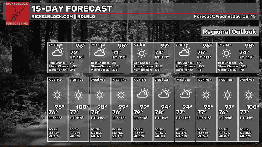
Over the next two weeks, temperatures look to be hot hot hot, with several days reaching the upper 90s and even low 100s during the afternoon, possibly ushering in the hottest stretch of the summer. For many places in the deep south and southern plains, August is climatologically the hottest month of the year, so it makes sense that this heat is building as we get closer to August.
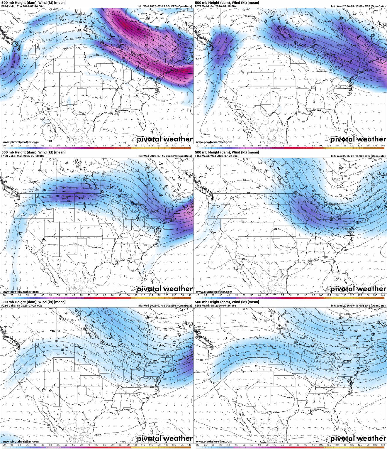
Over the next two weeks or so, a consistent ridge of high pressure centered over the southwest and southern plains looks to set up, which may bring us some hot conditions. Ridges that set up over land as opposed to over water tend to bring especially hot temperatures since water absorbs heat more effectively than land. This causes the air to heat up significantly more over land than over water.
While temperatures certainly do look hot for our region over these next 2 weeks, temperatures may be a bit hotter the further west you go into Louisiana and eastern Texas. This is because the ridge is centered well to the west of most of our forecast region.
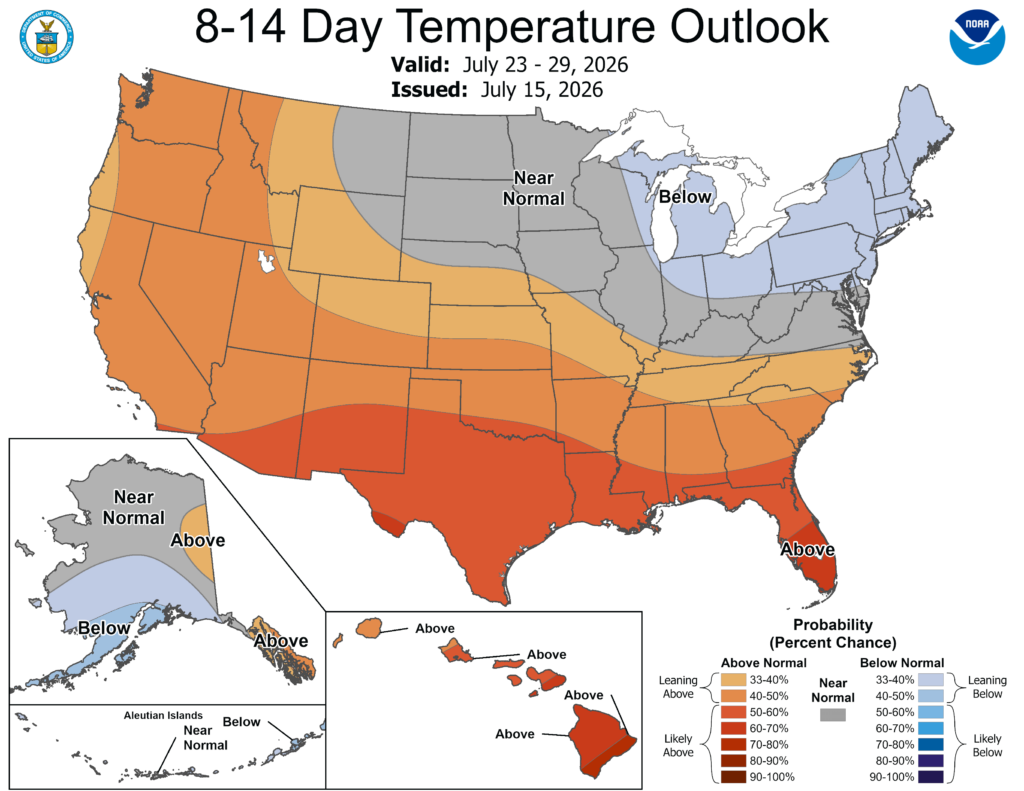
NOAA’s Climate Prediction Center is also picking up on the pattern that will take hold for the latter half of July. They have most of our region at a 40-50% or 50-60% chance of seeing above normal temperatures for the period from July 23-29.
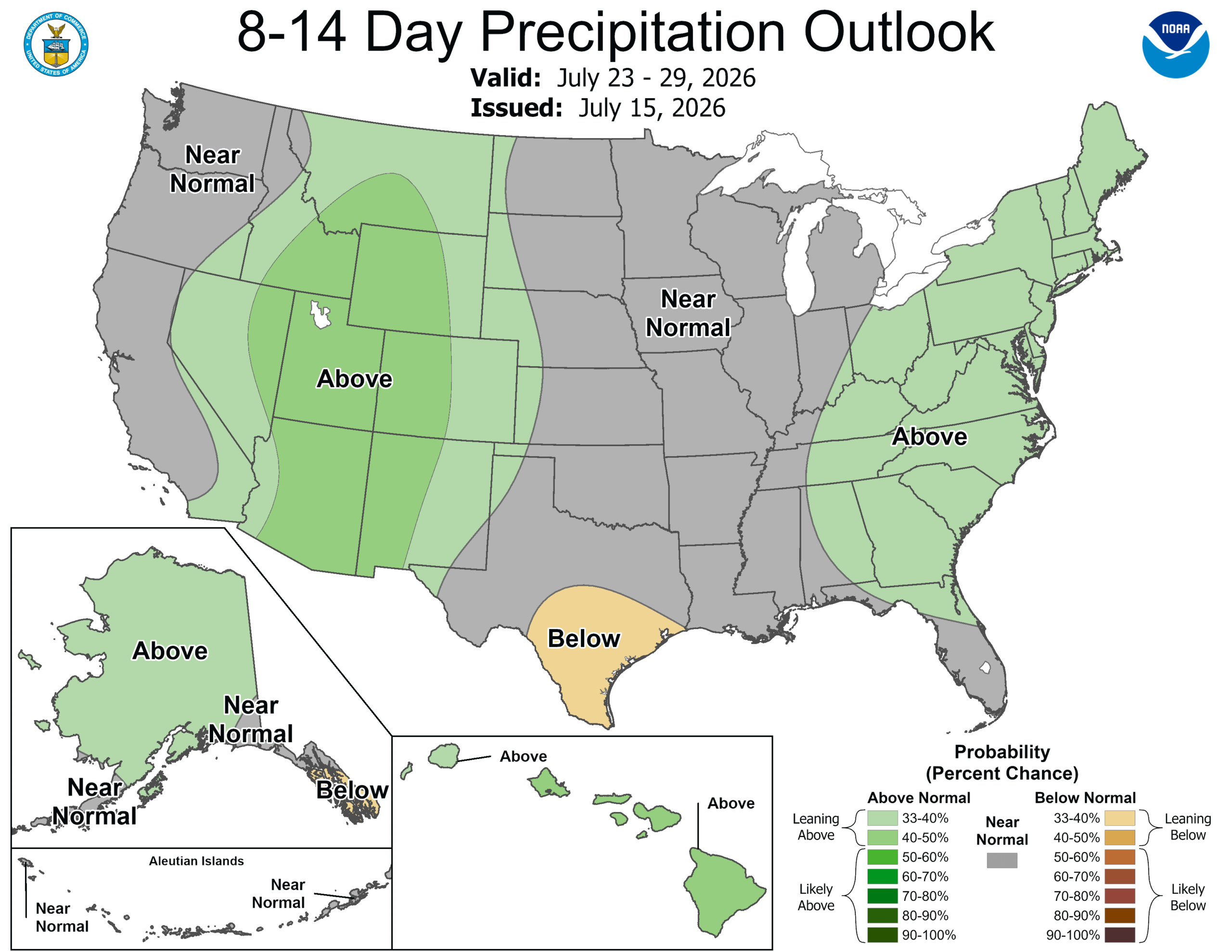
One saving grace to this heat is the precipitation, which the NOAA CPC predicts will be near to slightly above normal for the same time period. This will almost certainly come in the form of daily storms, which provide a nice break from the vicious heat of the daytime.


