Regional Outlook
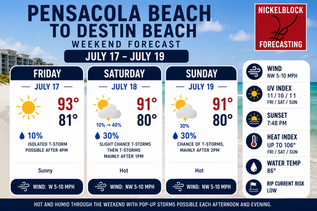
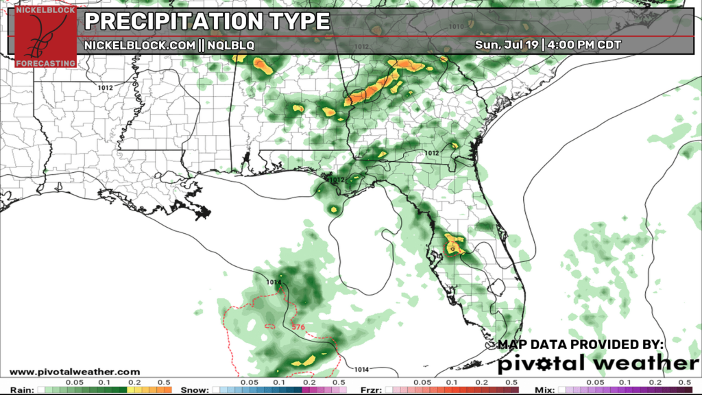
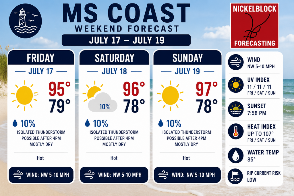
Good evening, everyone! I hope you all had a good Thursday! Are you planning to travel around to some nearby waterparks, the beach, or maybe New Orleans this weekend? If so, you’ve clicked on the right post. In short, this weekend is looking like a great weekend to go to the waterpark or the beach along the MS coast. If you are planning to go further west, say towards Destin, you may have to watch out for some increased storm coverage.
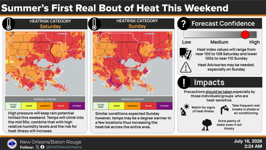
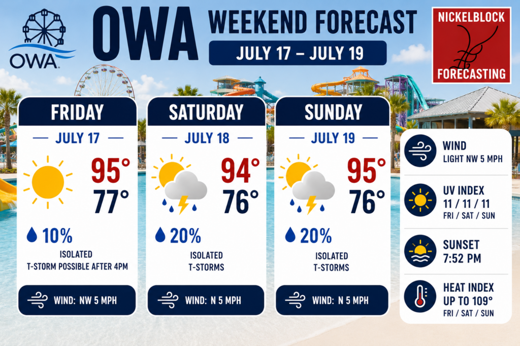
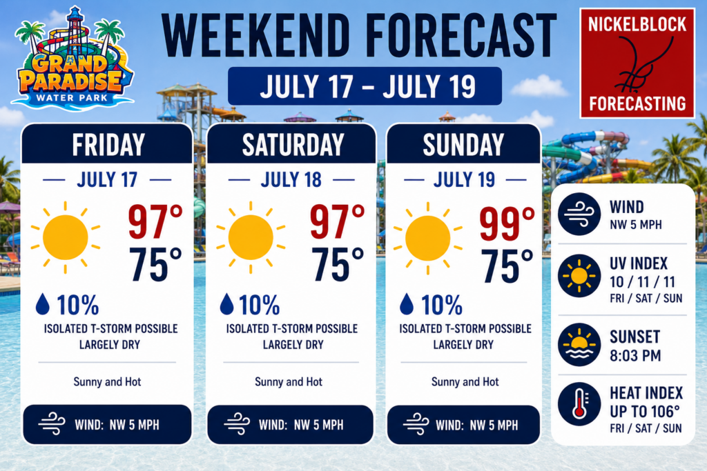
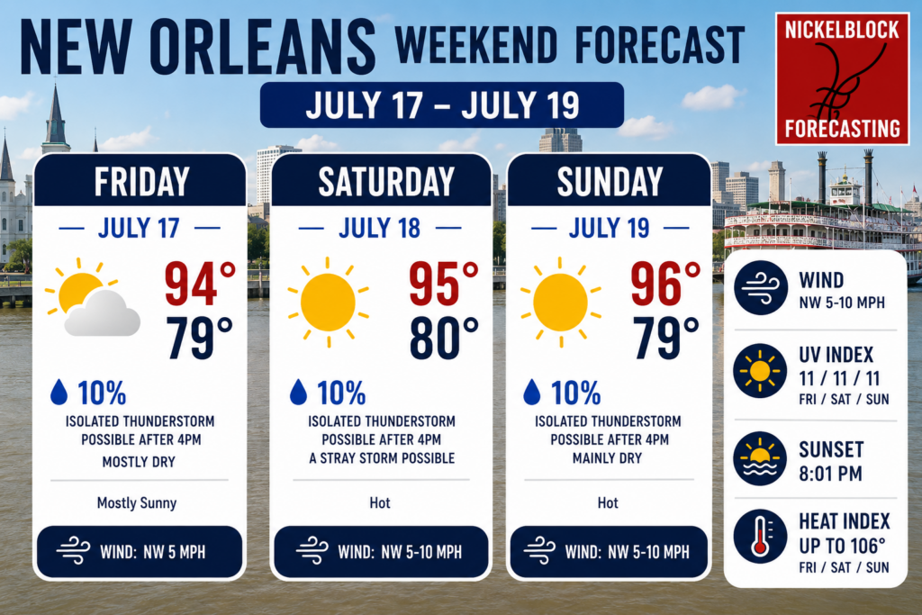
The main story this weekend is really the heat. With high pressure stationed right on over us, we’re seeing lots of sinking air, which compresses as it sinks and warms as it does so (little science lesson there). As the NWS shows in the image above, this high pressure will keep the rain potential relatively low, aside from a few isolated thunderstorms here and there, but it will also allow for some dangerous heat. Heat index values could reach up to 110 in some spots, which is outright brutal to be out in.
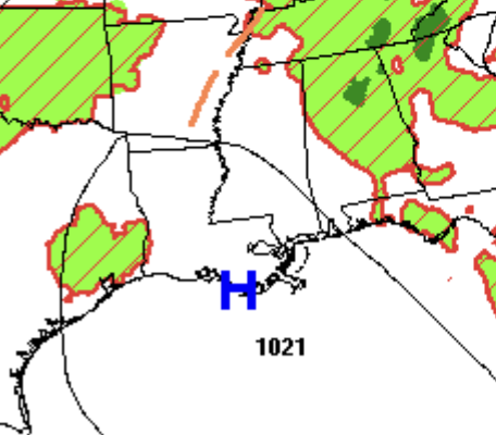
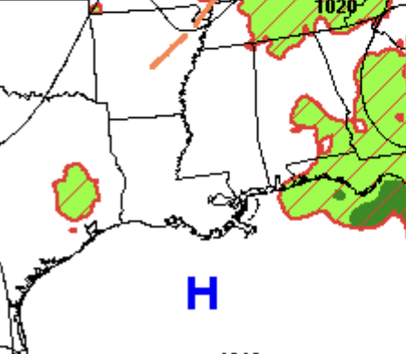
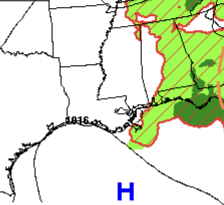
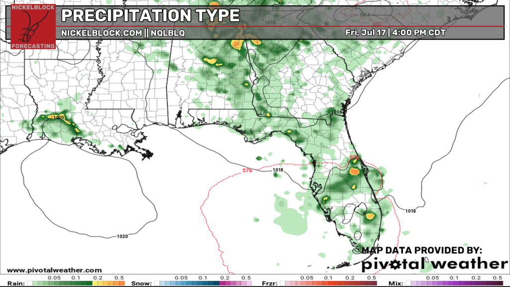
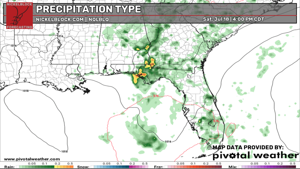
Thankfully, much of any rainfall will be very isolated, meaning only a few thundershowers will be around for each day this weekend. But as I mentioned earlier, some moisture in the northeastern Gulf might extend just far enough westward to affect the Panhandle of Florida by increasing storm coverage, especially on Saturday and Sunday. I still don’t see any washouts, but something to keep an eye on if you’ll be on the easternmost beaches of the Gulf Coast! Keep your Nickelblock radar close and ensure your notifications are turned on so you can be alerted to incoming lightning.
Check out the European models look at the rainfall coverage for each day this weekend below.
OWA Parks & Resort – Foley, Alabama
Grand Paradise Waterpark – Collins, Mississippi
New Orleans
Mississippi Coast
Pensacola Beach to Destin Beach