Regional Outlook
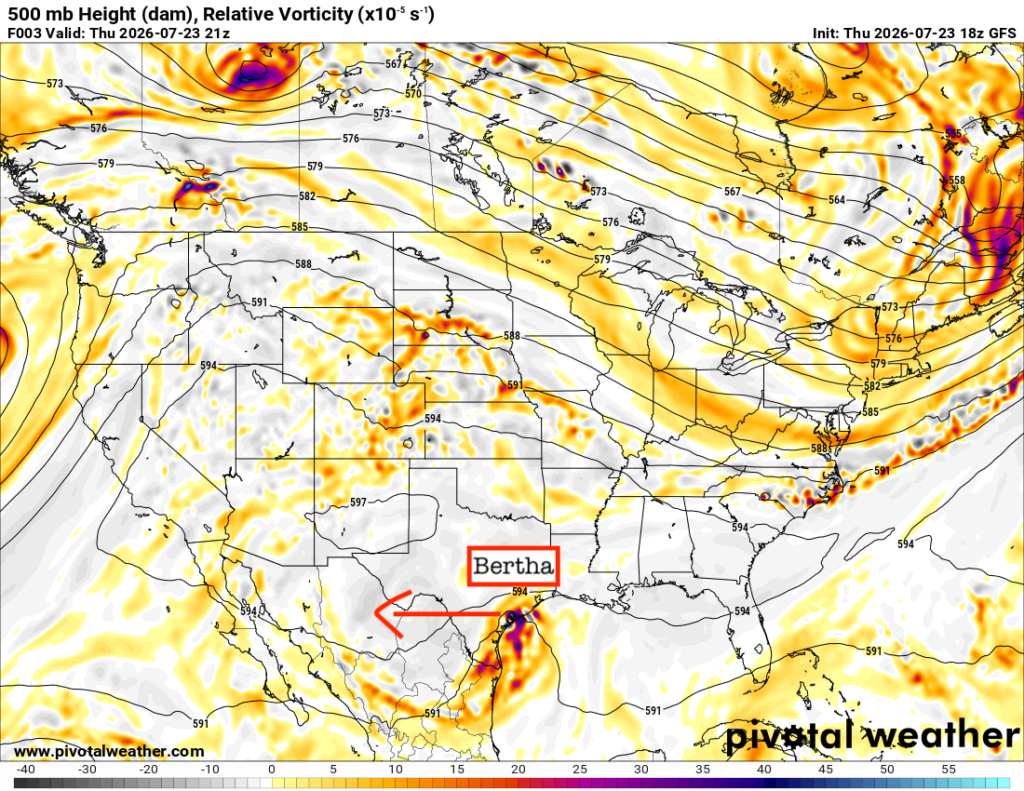
Bye bye, Bertha! I hope she didn’t have too much of an impact on your week. Thankfully, she is moving off to the west and will weaken into a tropical depression and eventually a post-tropical system by this weekend. What’s left in her wake, a nice area of high pressure! While this high pressure will keep us nice and dry, for the most part, it will also bring us very warm temperatures and high heat indices.
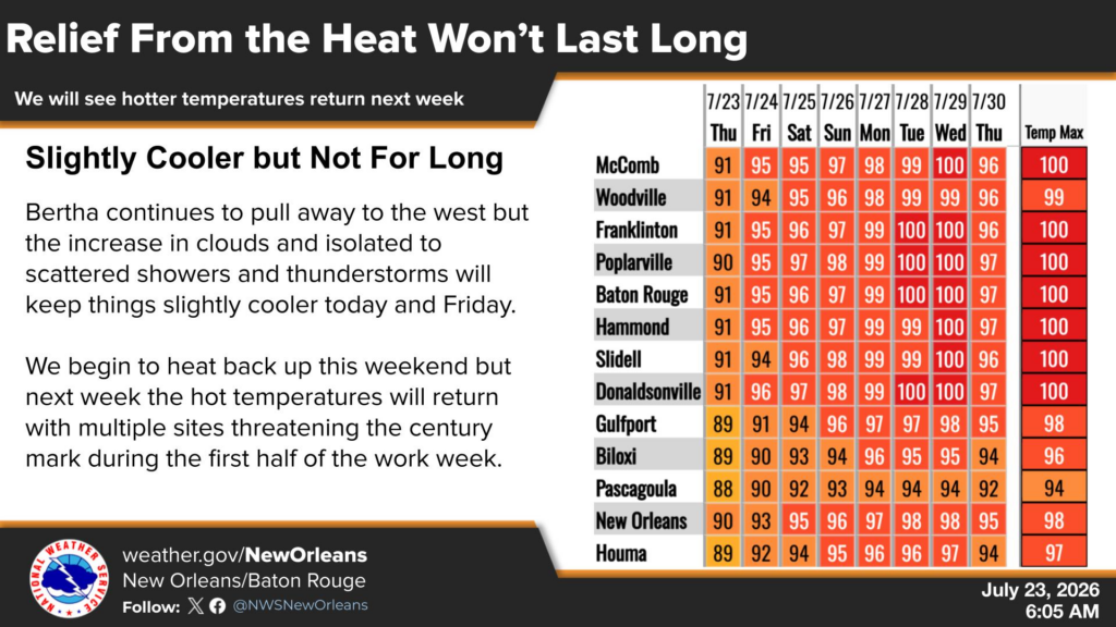
Watch out, it gets even hotter next week!
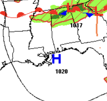
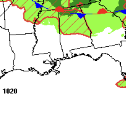
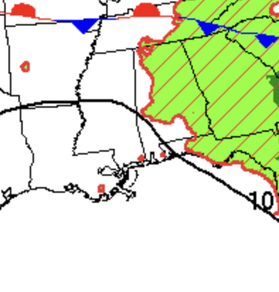
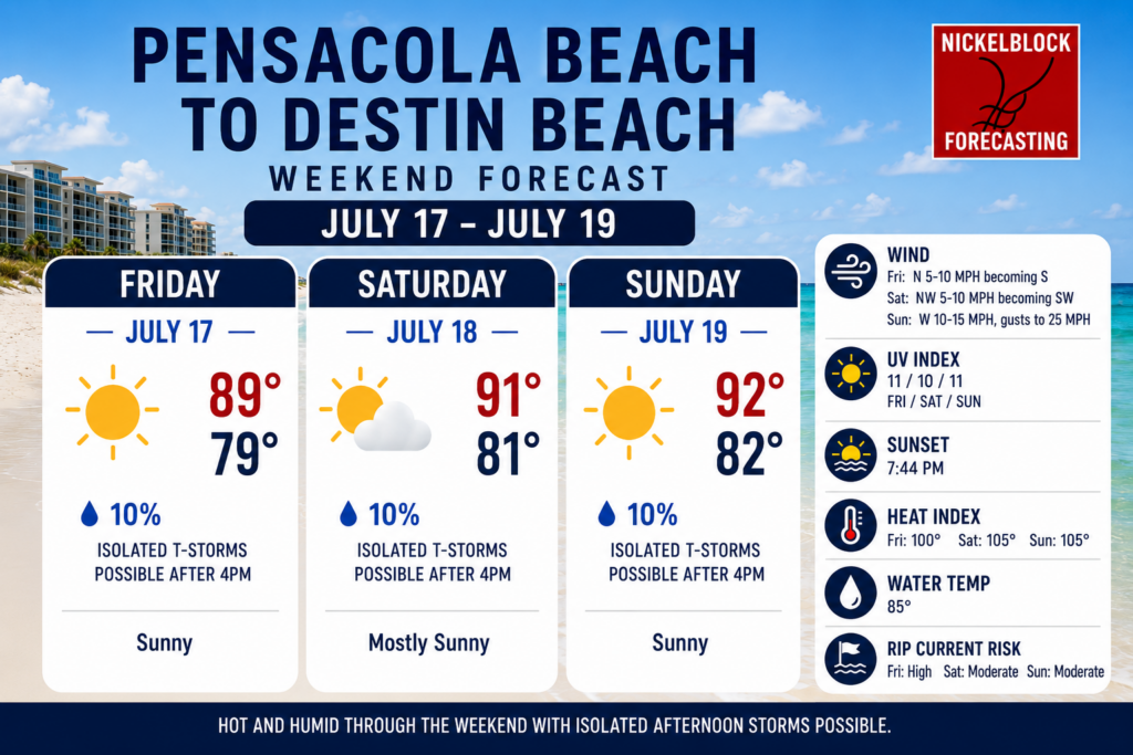
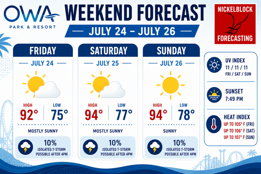
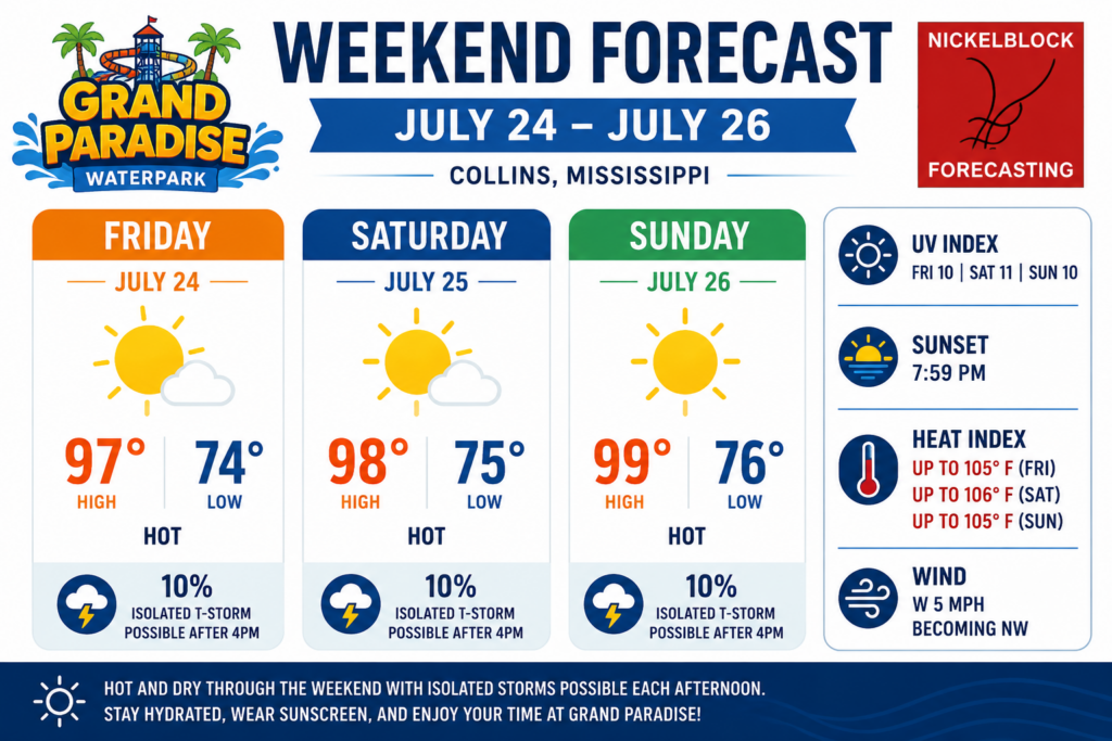
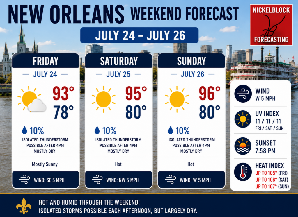
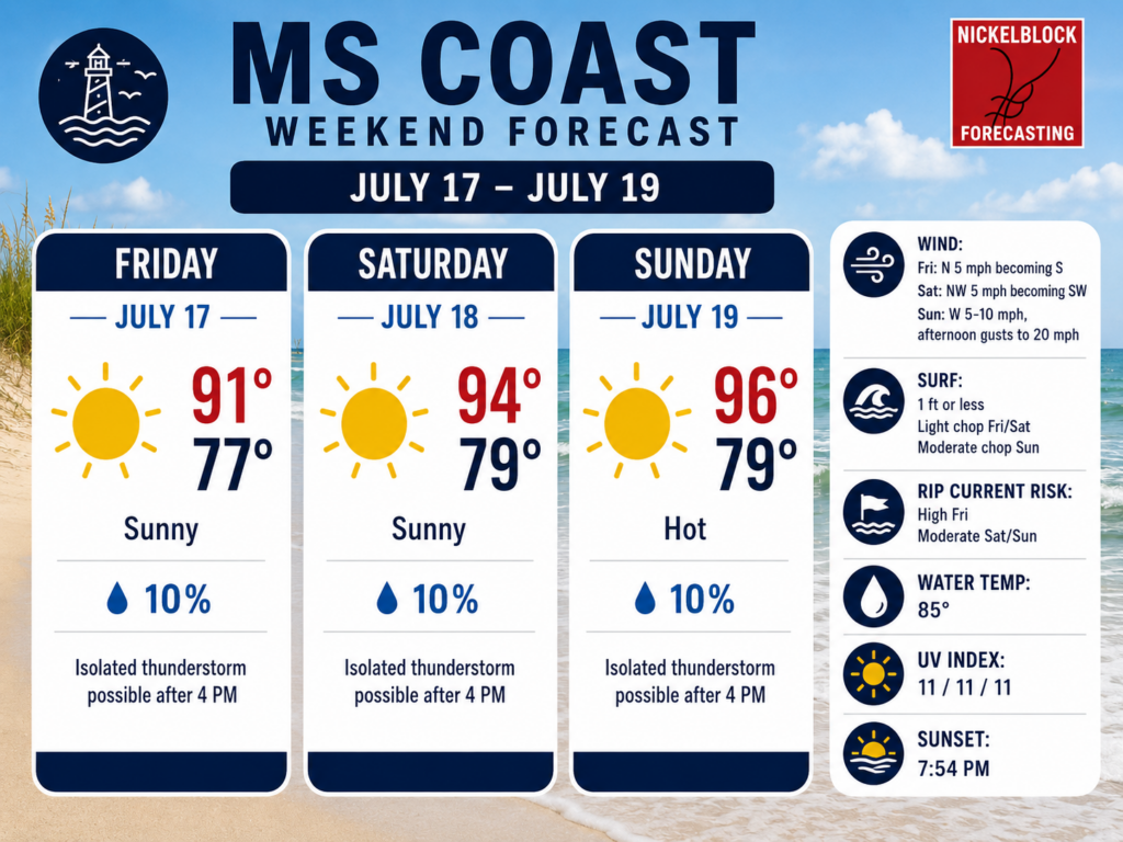
Have outdoor plans this weekend, or are you going to the waterpark or the beach? This is looking like one of the nicest weekends to go do that! There will be abundant sunshine out there each day to enjoy those outdoor activities or to travel. If you remember my forecast on Tuesday, which showed the stalled-out front over the Carolinas and mid-south, that front is still hanging around to our north and will stick around through the weekend.
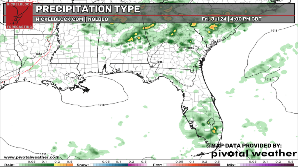
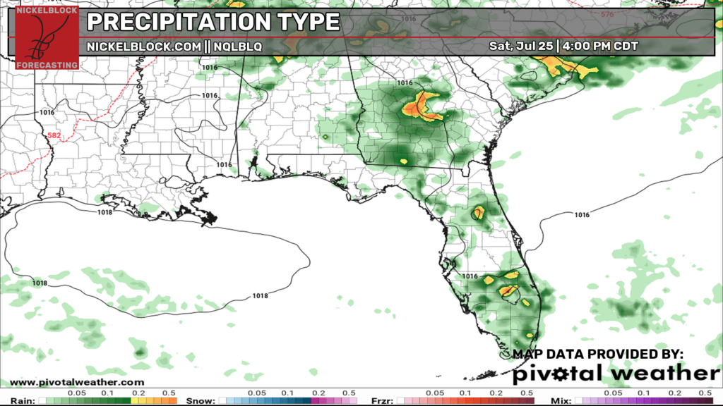
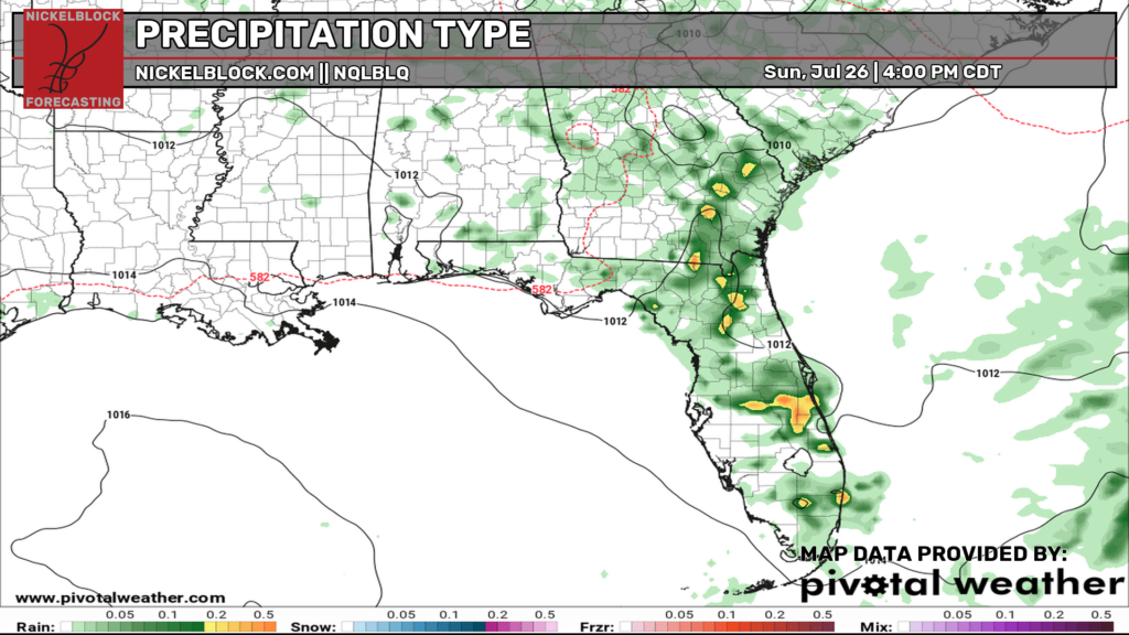
A shower or pop-up thunderstorm is possible each day for all locations in the region, but I think sunshine and dry weather will win out this weekend. It looks like the further north you go, the higher the chance of any showers or storms.
Check out the European models look at the rainfall coverage for each day this weekend below.
OWA Parks & Resort – Foley, Alabama
Grand Paradise Waterpark – Collins, Mississippi
New Orleans
Mississippi Coast
Pensacola Beach to Destin Beach