We’ll get to the heat (though some of you are still feeling it right now). Right now there is several areas of scattered convection ongoing across mainly Mississippi.
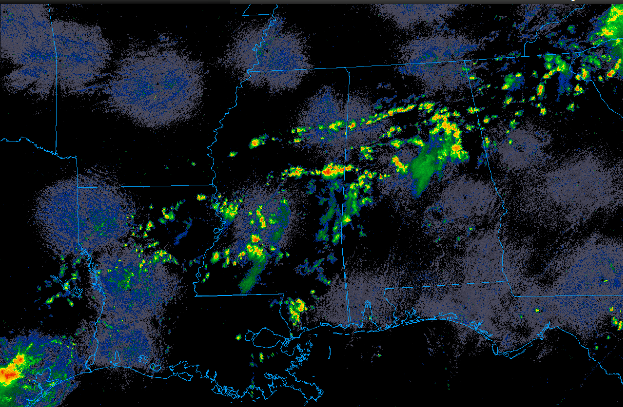
These storms will be very slow moving and outside of some heavy rain and lightning, remain fairly benign. By early next week though most of you are going to be wishing it would rain everyday.
Although there is technically a (very small) chance of rain each of the next few days, the main story will be the heat. Temperatures will peak in the upper 90s and low 100s. Given the expected long duration of this heat wave, it will be especially dangerous. Unfortunately, this is what happens with a big summer ridge.

Tonight
The good news is that the rain should clear out after sunset.
The bad news is that it will likely be extremely humid.
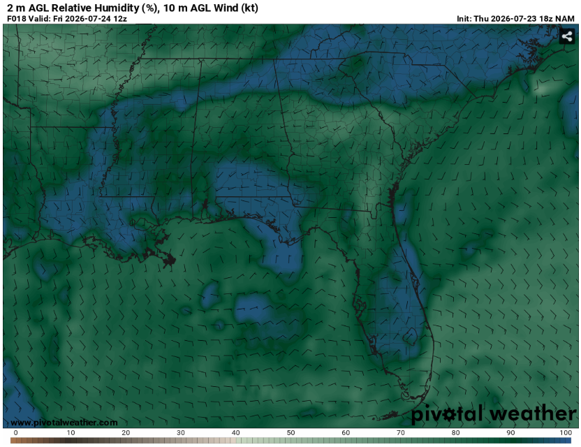
The worse news is that this could lead to fog. Given the near saturation at the surface, very light winds, and proximity of the anticyclone, some of the fog could be locally dense.
Make sure to take it slow and use caution when encountering low visibility. This will be most likely in low lying areas or places that recently received rain.
Lows will be in the mid 70s. Expect clouds to clear out with the exception of the fog.
Tomorrow
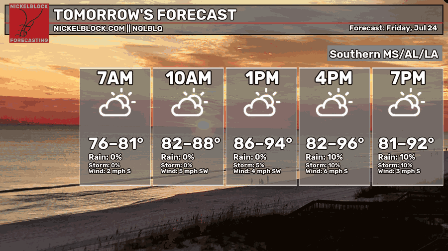
It’ll be warm. Warm might be an understatement.
Highs will likely top out near 100 degrees. This will be hazardous for everyone but especially for the very young, the elderly, and those with medical conditions. Make sure to take breaks in the AC and drink plenty of water if you must be outside.
Dew points will also be seasonably high.
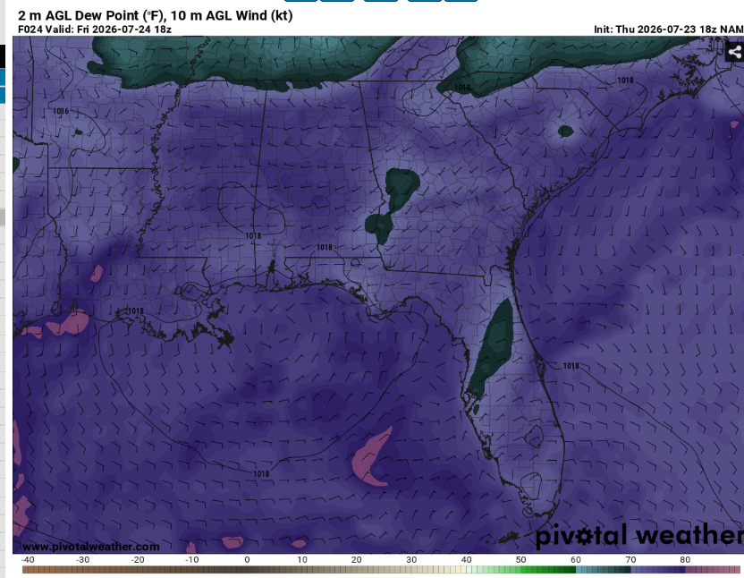
This will keep the muggy factor in play and increase the heat index. Overall not a fun day unless you’re going swimming. Speaking of swimming…
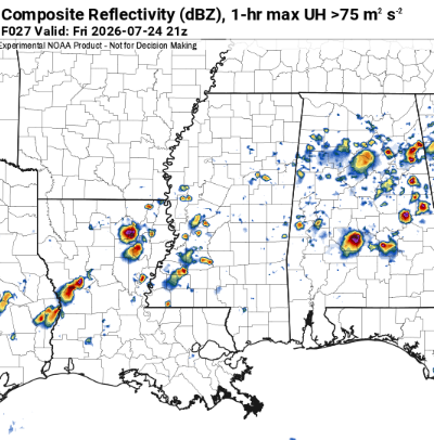
While most locations will remain dry, we can’t rule out a few isolated pulse storms. These would be most likely during the afternoon hours. These storms will be short lived and won’t move much but they’ll give a soaking downpour to those under them along with a few shocks (lightning). Again, the vast majority of locations will stay sunny but someone might win (or lose depending on you feel about heat versus rain) the lottery.

The Day After Tomorrow
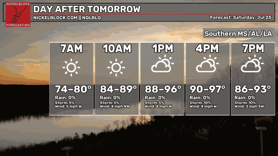
How does even hotter with a basically zero chance of rain sound?
Unfortunately, that’s what mother nature is giving us.
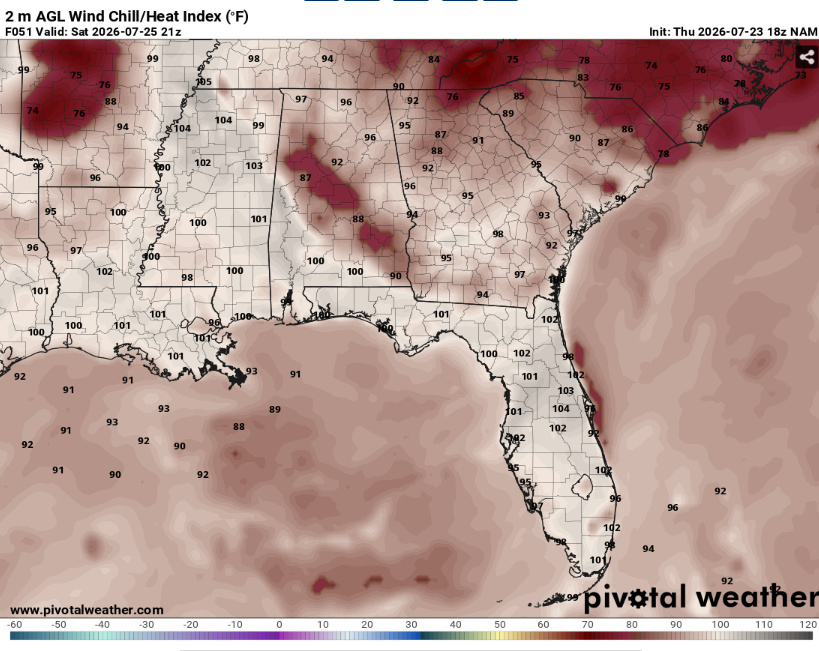
Highs will be around 100 for most locations with the heat index being a few degrees warmer. Another day to avoid being outside during peak heating. This heat is being driven by the upper air pattern.
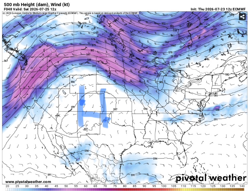
With a large asymmetrical ridge centered to our west, the south is under a weakness in the upper level winds. This means very little shear of forcing. Additionally, with hot dry air being forced down on top of us, convection will struggle to become very robust. This will keep us sunny and mostly cloud free.
Yeah, there may be one or two storms across the region, but the rest of us will be left counting down the days till December.

The Extended Outlook
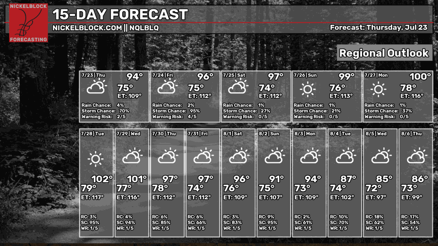
That heat might be here for a while. Large ridges are notorious for sticking around for a time and this one is no exception. The stagnant nature of the pattern will exacerbate the heat impacts given very warm and humid over night lows.
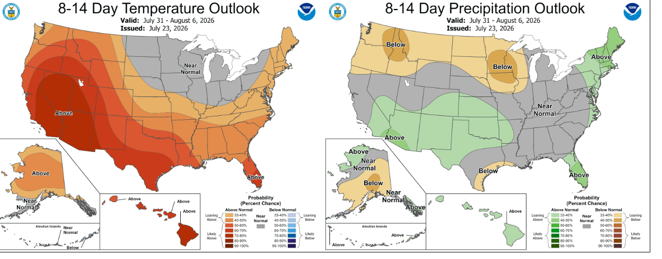
The climate prediction center expects the heat will remain in place. Precipitation outlooks are a little less certain.
It doesn’t look like we’ll get a blockbuster wet pattern but these afternoon showers can really add up if they impact the same locations repeatedly. There is also that the chance that we could get an over performing mcs from the ring of fire to the north that makes it all the way down here but those are pretty rare.
Day-By-Day Forecast
Tonight – Storms clear out early. Decreasing clouds with a low in the mid 70s. Fog is possible
Tomorrow – Sunny and hot with a high in the upper 90s. Most places will stay dry but can’t rule out an isolated storm or two.
Tomorrow Night – Partly cloudy with a low in the mid 70s. No rain.
Saturday – Sunny with a high in the upper 90s. Dry.
Saturday Night – Partly cloudy with a low in the mid 70s. No rain.
Sunday – Sunny with a high around 100. No precipitation expected.
Sunday Night – Mostly clear with a low in the mid 70s. Dry.
Monday – Sunny with a high in the low 100s. No rain.
Monday Night – Mostly clear with a low in the mid 70s. No precipitation.
Tuesday – Sunny with a high in the low 100s. Dry.
Tuesday Night – Mostly clear with a low in the upper 70s. No rain.
Wednesday – Sunny with a high in the low 100s. No precipitation expected.
Wednesday Night – Mostly clear with a low in the upper 70s. Dry.


