It’s like being in an oven with a humidifier inside.
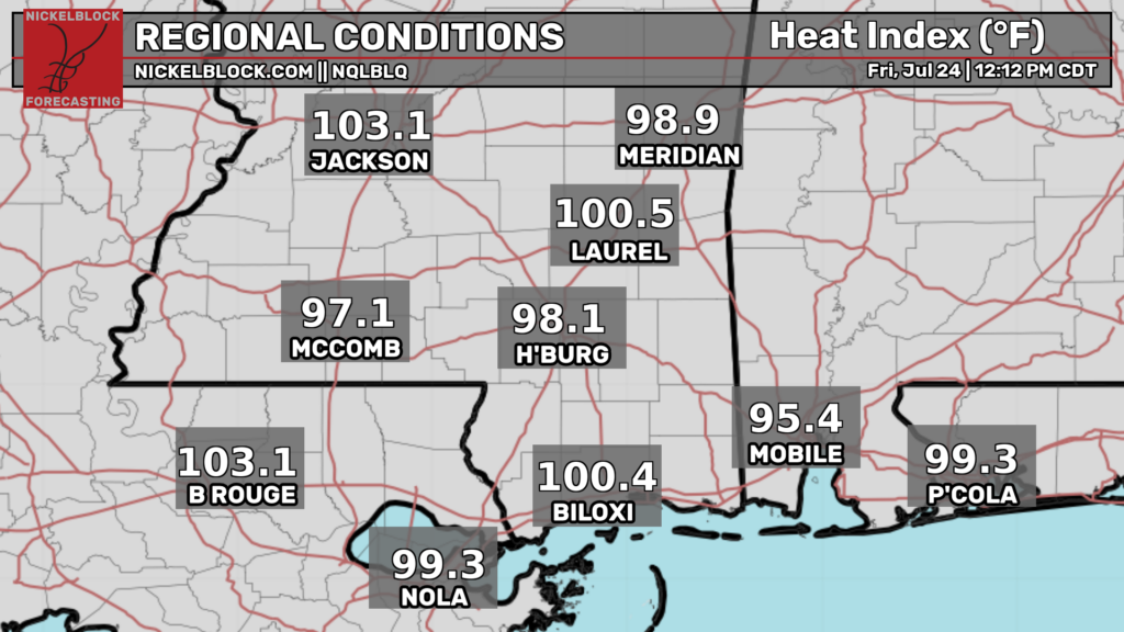
Those values will continue to rise as the sun beams down overhead. This intense heat and humidity has allowed for areas of diurnal cumulus clouds to develop. Highs may hit 100 with heat indexes peaking above 105.
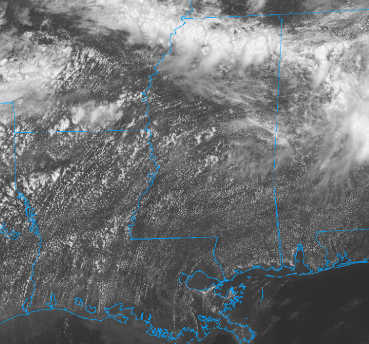
These clouds will likely have limited vertical growth due to synoptic level subsidence and the lack of surface convergence. Some models do show the potential for a few of these clouds to breach the lfc and become very brief single cell thunderstorms.
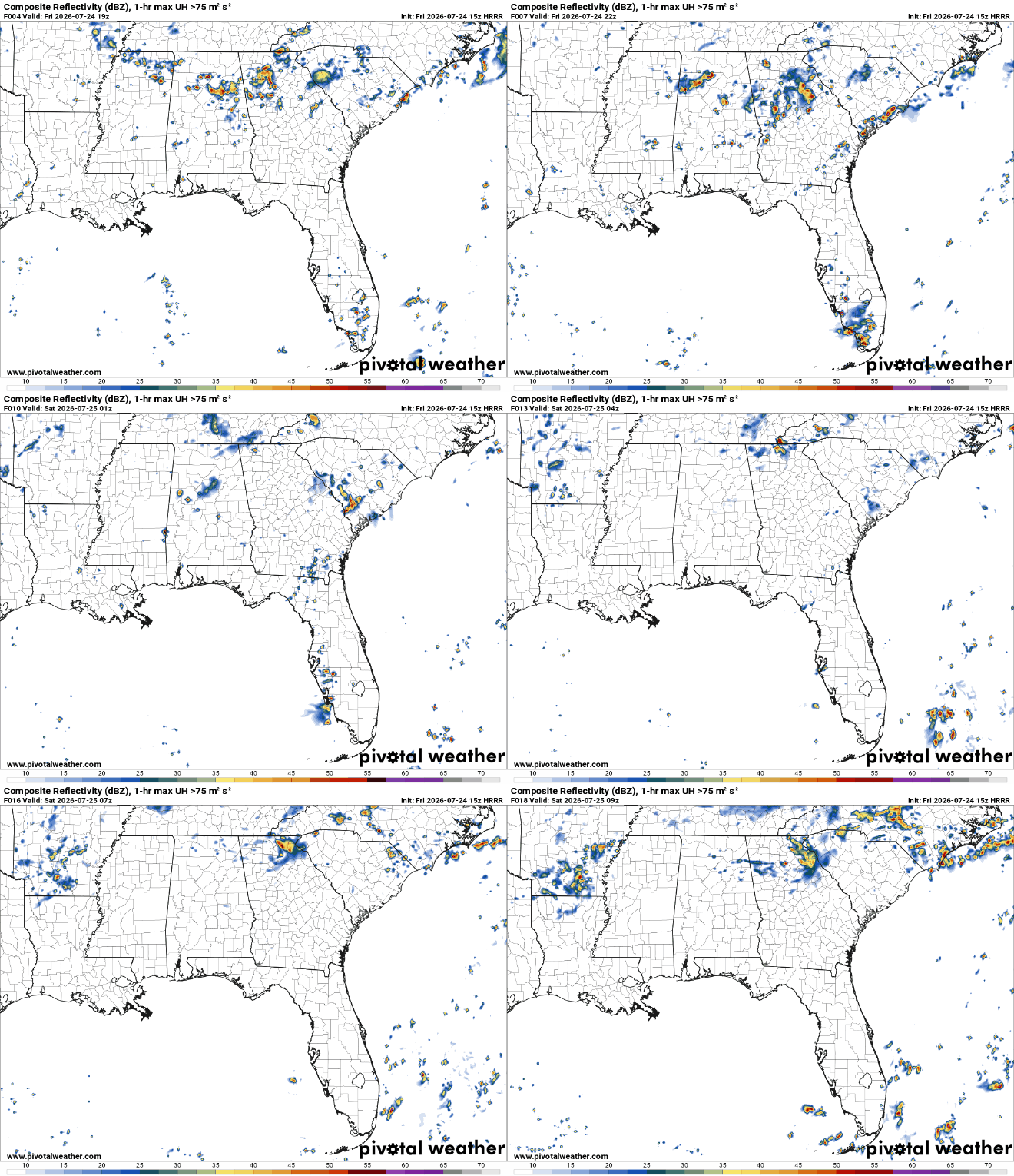
These would be capable of heavy downpours and some lightning but should remain very isolated.
The main story will be the dangers of the heat (especially to those with preexisting conditions along with the elderly and very young). Make sure to drink plenty of fluids and take frequent breaks in the AC if you must be outside. A good day to go swimming or stay inside.
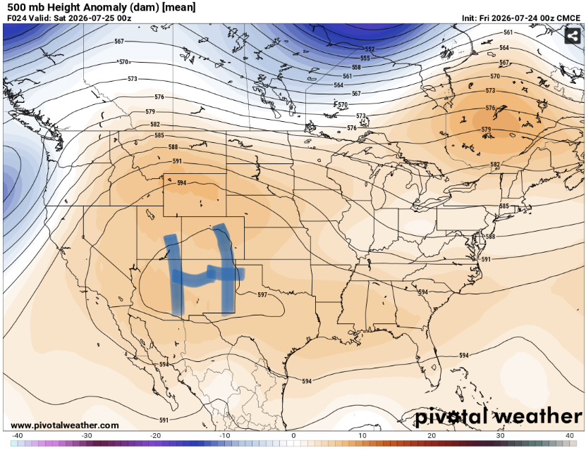
This heat is being driven by a strong ridge of high pressure with above average heights. That traps warm air and forces it down to the surface keeping our region locked in an uncomfortable regime. Unfortunately, this heat looks to stick around for a while.
Tomorrow looks to be more of the same. Another day with extreme heat and a miniscule chance of afternoon thunderstorms. Winter is only 5 months away…


