Currently, we are seeing some stronger storms moving from the Mid-South down into Alabama. Outside of that area of convection, it is set to be a warm but relatively quiet day across our region.
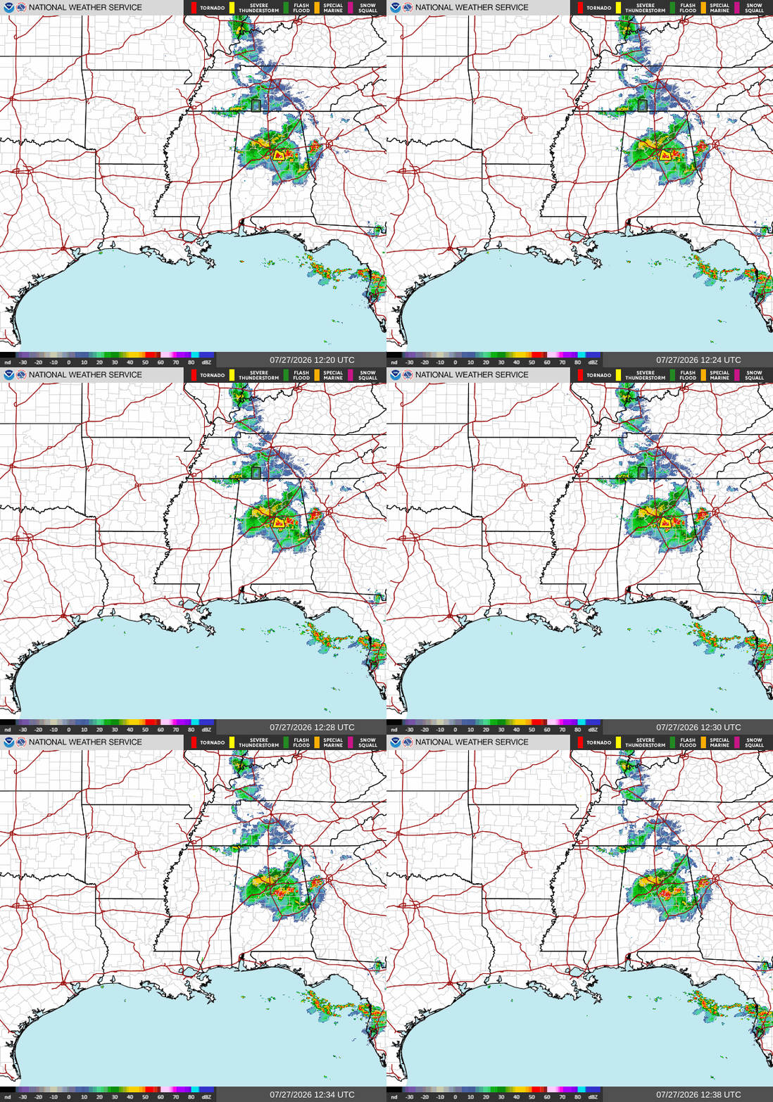
These storms over Alabama formed as part of a storm track due to a southerly flow from an area of high pressure over Oklahoma. The clockwise rotation of the high-pressure area allows for storms to develop on the outskirts, which is why we are seeing them move from north to south. I annotated the graphic below to show this better.
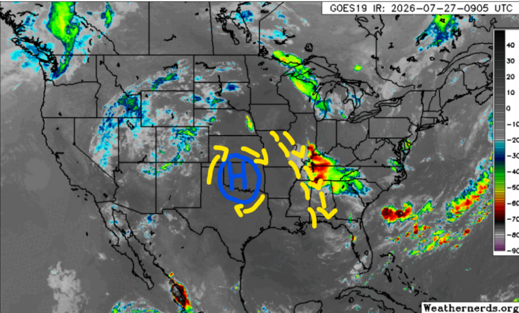
These storms across Alabama will be strong, and after this first band moves through, another line of storms could track southward. However, the second round is not expected to be as strong or make it as far south as the first. The Western side of our region will remain relatively dry and hot due to the effects of the western high-pressure system.
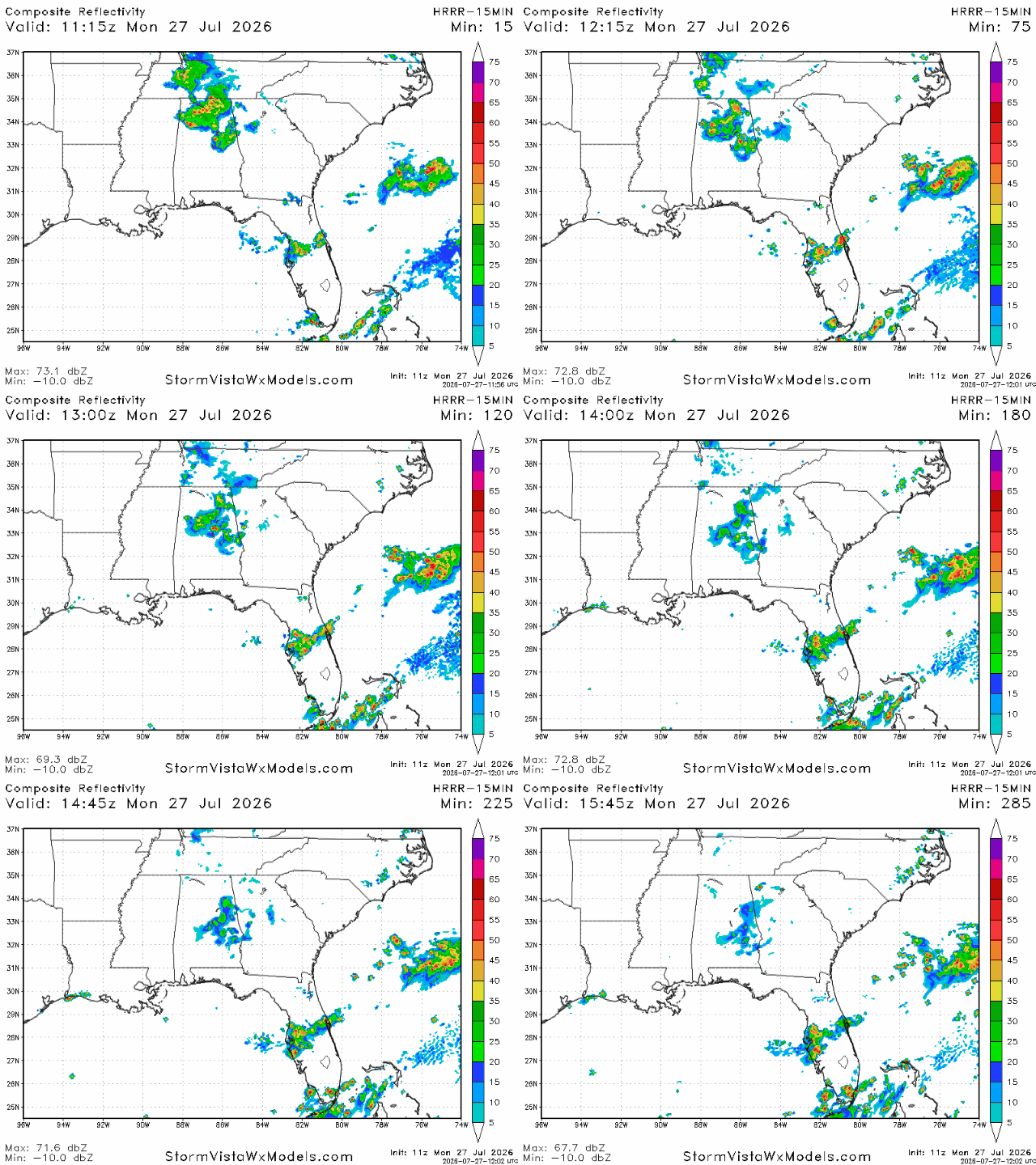
Above is the forecast for the afternoon. We see the potential for more storms to develop along that storm track throughout the day, but otherwise the day looks hot and dry for the western side of our region.
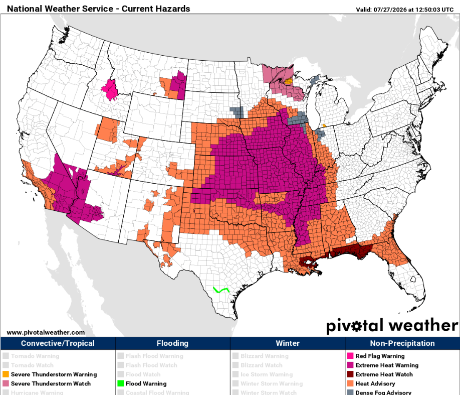
Temperatures will be very hot today, with a majority of our area under various heat-related alerts, including Extreme Heat Warnings and Watches. Real-feel temperatures will exceed 100 degrees across the area, so make sure to stay hydrated and cool, especially when participating in outdoor activities. Happy Monday!


