And you know… a few degrees can make all the difference. We are heading into a bit of a more active stretch, with scattered storms firing up each afternoon. These storms will help take the edge off the heat as temperatures trend a few degrees lower, although the high humidity will stick around.
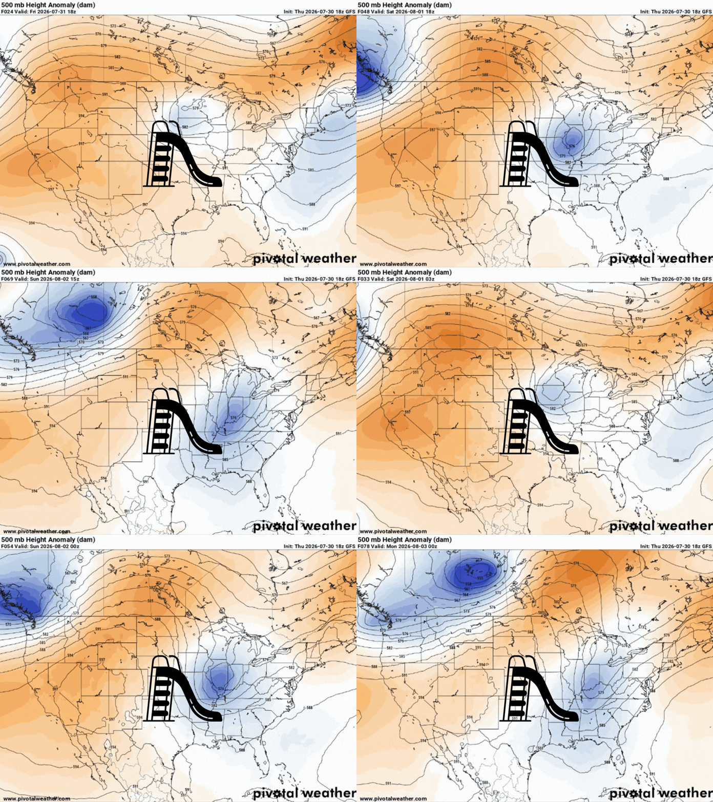
This weekend, a trough will slide down into the area. For us, this means daily chances for scattered storms and showers, with a surface cold front also pushing southward into the area on Sunday.
Be aware that some thunderstorms over the next few days could become strong to severe, with the main concerns being frequent lightning, heavy downpours, and gusty winds up to 40mph.

TONIGHT
Ongoing scattered showers and thunderstorms are popping up across Mississippi, sparked by the front that’s hanging around, shown below.
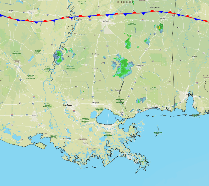
These storms should begin to decrease after sunset before settling into a partly cloudy night. There’s a good shot at fog tonight, especially in areas that have received rain this evening, so be cautious when driving!
TOMORROW
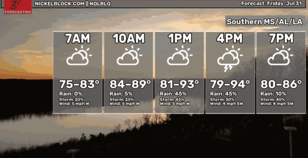
Friday looks like another repeat of today with plenty of moisture (indicated by the purples/pinks) behind the warm front shown below, fueling scattered thunderstorms and showers during the afternoon-evening timeframe.
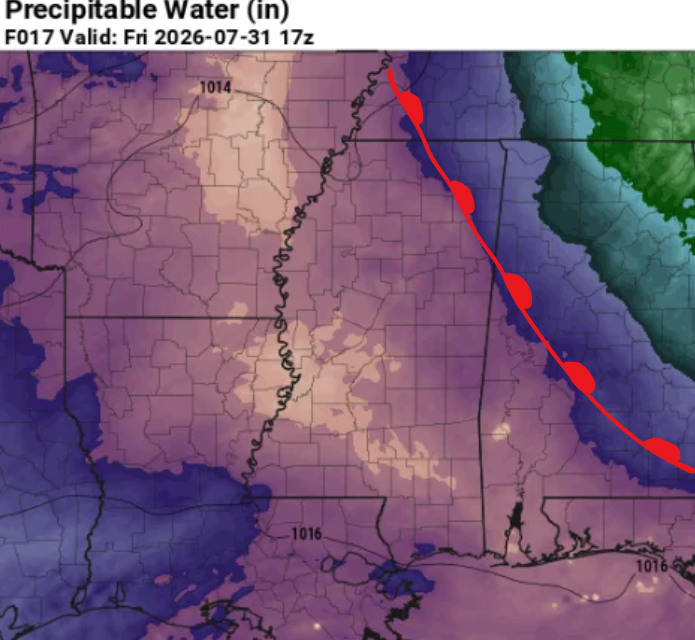
Short-range models keep most of the storms focused across Mississippi. Any stronger storms could produce strong to locally damaging wind gusts, and a brief weak tornado cannot be ruled out.
Also, heavy rainfall will be possible with these storms. Therefore, a marginal risk for excessive rainfall is in place, with isolated instances of flash flooding possible.
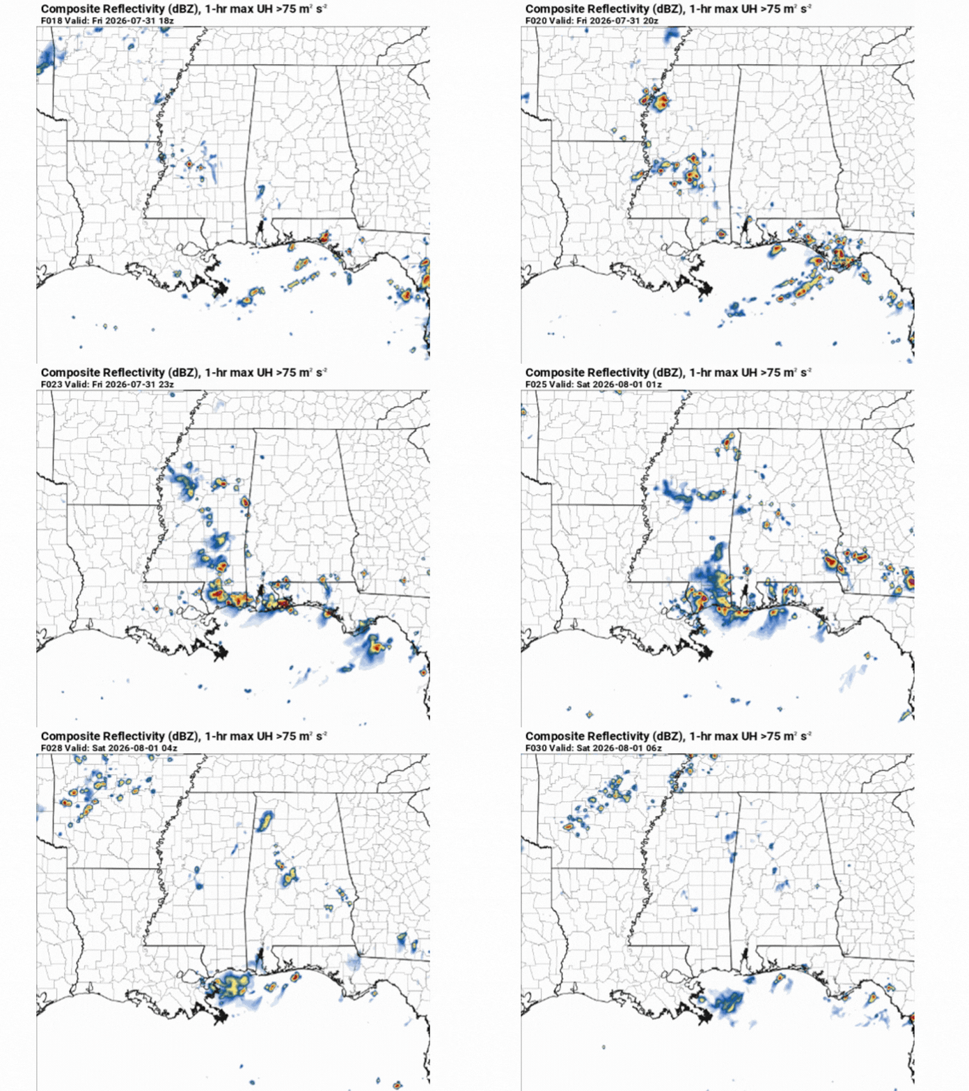
The overall threat from this remains fairly low for those in southeast Louisiana. Conditions are expected to stay hot and humid, with apparent temperatures peaking around 105 in the afternoon.

THE DAY AFTER TOMORROW
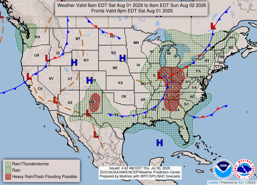
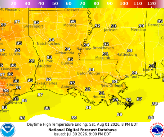
Saturday, there is a lower, but non-zero chance of scattered showers and thunderstorms. There is a better shot for rain near the Meridian area. Otherwise, mix of sun and clouds. Breezy day with winds blowing from the west at 10mph.

EXTENDED OUTLOOK
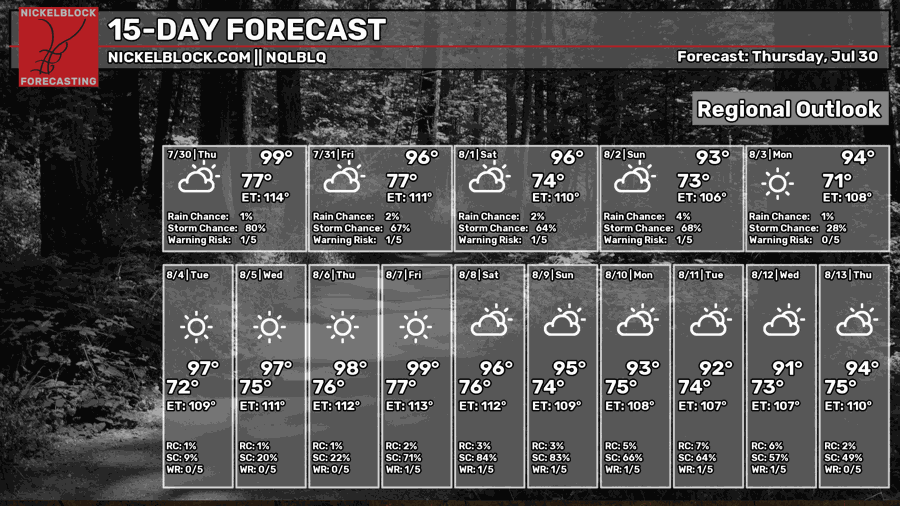
Wet weather returns Sunday as the trough slides south and a cold front enters the region. Severe storms appear possible, with showers and thunderstorms mainly focused along the coastal portions of LA/MS.
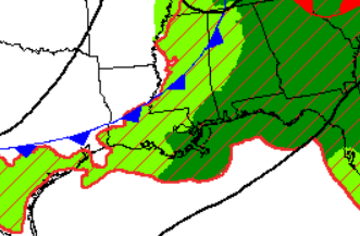
Looking ahead to next week, the trough will say goodbye and continue its journey eastward. As a result, we’ll return to temps in the upper 90s and plenty of sunshine!
DAY-BY-DAY FORECAST
Tonight – Settling into a partly cloudy night with areas of patchy fog as the wind will be light overnight. Lows ranging from 75 in Jackson to 79 in Houma. Rain chance: 30%
Friday –Patchy fog in the early morning. Mostly sunny and humid with a high of 92, feeling closer to 105.
Afternoon scattered showers and thunderstorms likely, with the better chance for those in Mississippi. Those in Louisiana should stay mostly dry. Light breeze from the west. Rain chance: 50%
Friday Night – Some storms lingering overnight before giving way to partly cloudy skies. Lows around 76. Light breeze from the south. Rain chance: 20%
Saturday – Scattered showers and thunderstorm possible. Otherwise, expect a mix of sun and clouds. Humid and hot, with a high near 94, but will feel closer to 105. A bit breezy with winds from the west at 10 mph. Rain chance: 20%
Saturday Night – Lows in the upper 70s. Partly cloudy with an isolated thunderstorm or shower possible. Winds blowing from the southwest at 5-10mph. Rain chance: 50%
Sunday– Wet weather returns for coastal LA/MS. Numerous showers and thunderstorms, mainly along the coast. Otherwise, sunny with highs near 93. Light breeze from the west. Rain chance: 60%
Sunday Night – A stray evening shower remains possible before skies settle into a partly cloudy night. Low around 74. Calm winds. Rain chance: 20%
Monday – A beautiful day with mostly sunny skies and only isolated afternoon showers/thunderstorms expected. Highs climb into the lower 90s. Light westerly breeze. Rain chance: 30%
Monday Night – A stray evening shower remains possible before skies settle into a mostly clear night. Low around 74. Calm wind. Rain chance: 15%
Tuesday – A typical summer day with sunny skies and only isolated afternoon thunderstorms expected, mainly between 1–4pm. High around 94 but will feel closer to 103. Calm winds. Rain chance: 20%
Tuesday Night – Lows around 75. Clear skies with calm winds.
Wednesday – A beautiful day with mostly sunny skies and only isolated showers/thunderstorms expected, mainly along the coast. Highs climb into the mid 90s. Light southerly breeze. Rain chance: 30%
Wednesday Night – Lows around 75. Clear skies with calm winds from the south.


