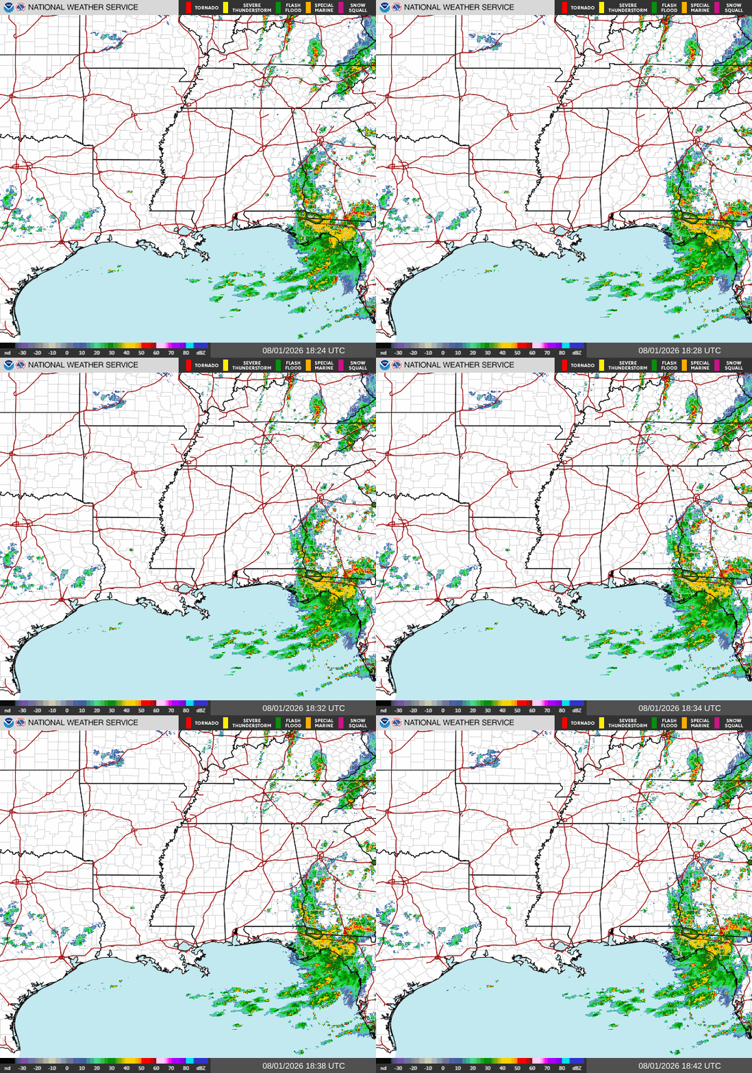
Good afternoon! As I’m writing this at 2p CDT, the eastern portion of our forecast area has a lot going on. Heavy showers and storms are lingering near the southern half of the Alabama/Georgia border as well as all throughout the Florida panhandle east of Panama City. There is currently a flash flood warning slightly to the northwest of Tallahassee, so if you’re in that area turn around and don’t drown and be aware of local weather alerts.
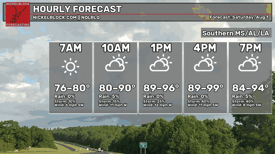
Like many days throughout the past couple of weeks, the afternoon high temperature will hit the upper 90s in many spots. If you plan on doing outdoor activities on your Saturday like going to the beach, make sure to wear sun protection, stay hydrated, and wear sensible clothing.
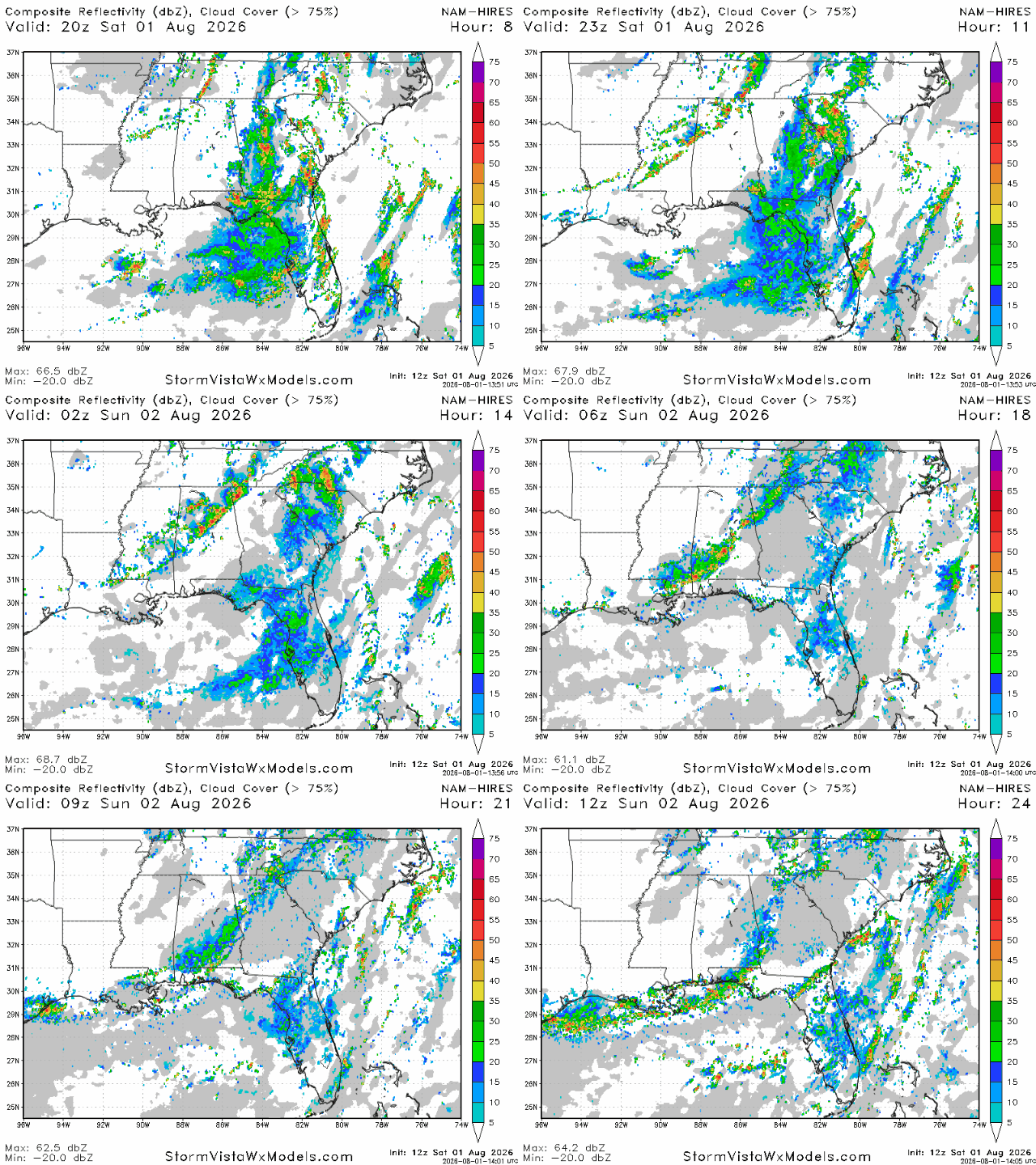
A line of storms associated with a cold front that will pass through the area tonight and tomorrow will bring periods of heavy rain, gusty winds, and lightning to us tonight. These storms will begin to fire up a bit later, around 4pm near the Mississippi delta region. By 7 pm, storms will reach the Starkville/Meridian area as well as the Birmingham area. By midnight to 1am , storms will reach the Mobile area, and will continue to move into Georgia and the FL panhandle in the early morning hours.
Rainfall totals will be highest in the Florida panhandle and southwest Georgia, where half an inch to an inch of rain could reasonably be expected. Totals will be higher in places hit directly by a storm. Further west in southern Mississippi and Alabama, totals between a tenth of an inch and a quarter of an inch can be expected, with higher totals in some localized spots.

Tomorrow
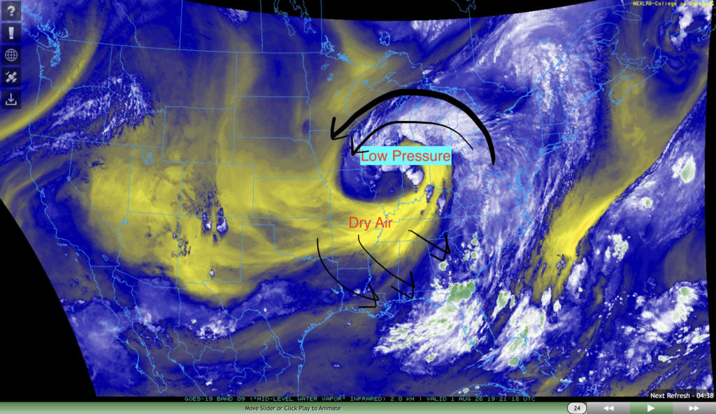
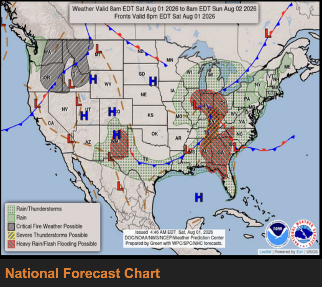
We’re in for a bit of a cool-down tomorrow, with a cold front likely to pass through the area tonight and into tomorrow. This cold front will bring cooler and drier air from the great plains and rocky mountains with it. It’s being ushered in by a low pressure center currently sitting over Illinois.
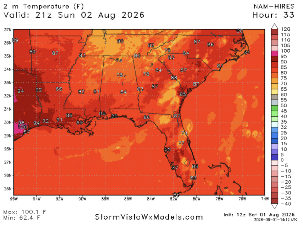
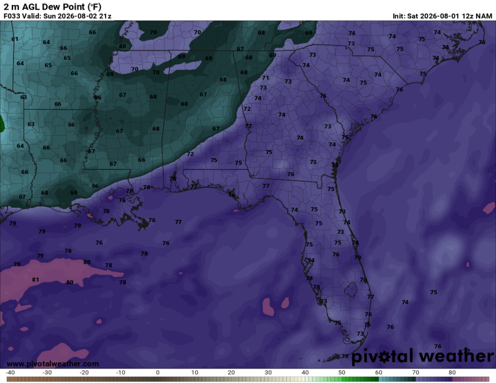
Afternoon high temperatures will range from the mid 80s to the low 90s tomorrow, which is cooler than normal for this time of year. There will also be a pretty significant moisture gradient between areas to the west of Mobile/Biloxi/New Orleans and areas to the east, but it depends on where the cold front is.
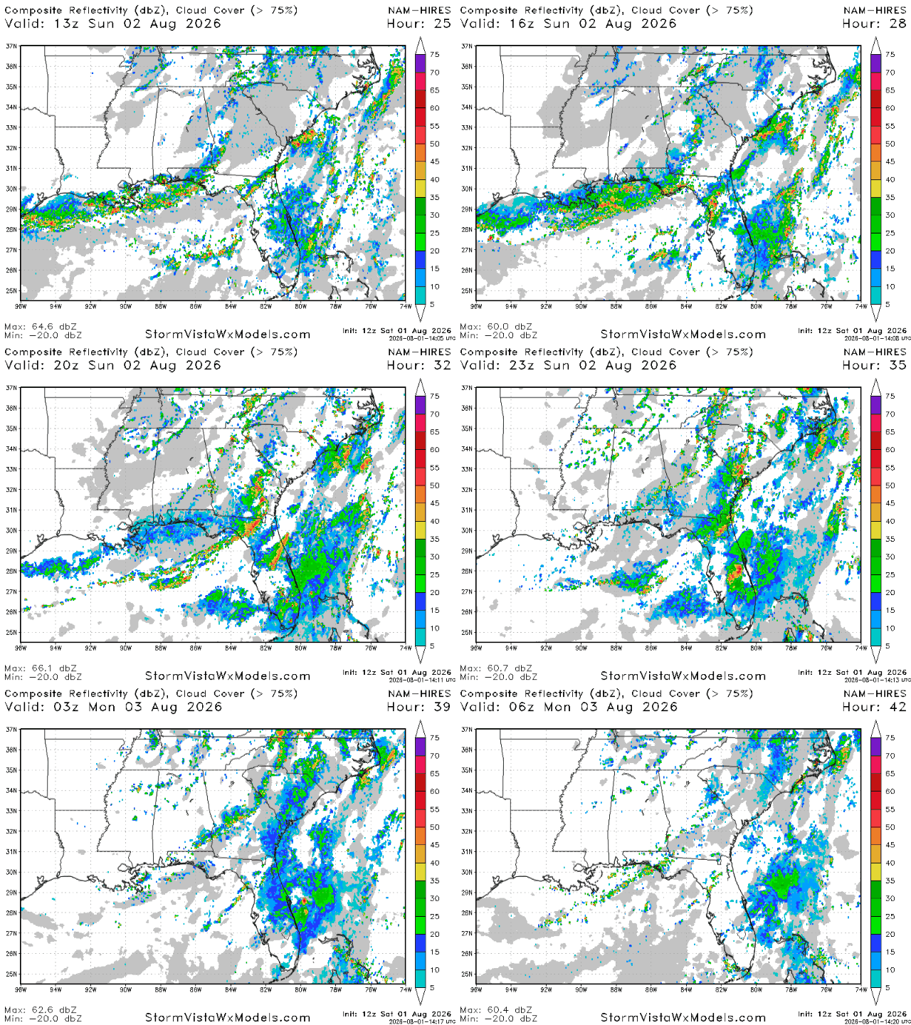
Storms tomorrow will generally be a continuation of the ones that will form overnight tonight. In the morning, widespread showers and storms can be expected throughout the Florida panhandle and central Florida. In the afternoon, a few more storms will form in northern Florida, southern Georgia, as well as southeastern Alabama, but no new storms are expected any further west than Tallahassee.
It’ll be a great time to get outside tomorrow evening throughout Louisiana, Mississippi, and most of Alabama as the humidity will be lower, skies will be sunny, and it won’t be too hot.
Monday
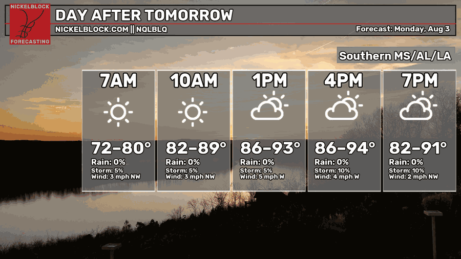
Moving into Monday, we’re expecting another day of seasonable temperatures with highs ranging from the mid 80s to the low-mid 90s. Morning lows will also dip into the low 70s, a bit cooler than they have been in the past couple of weeks.
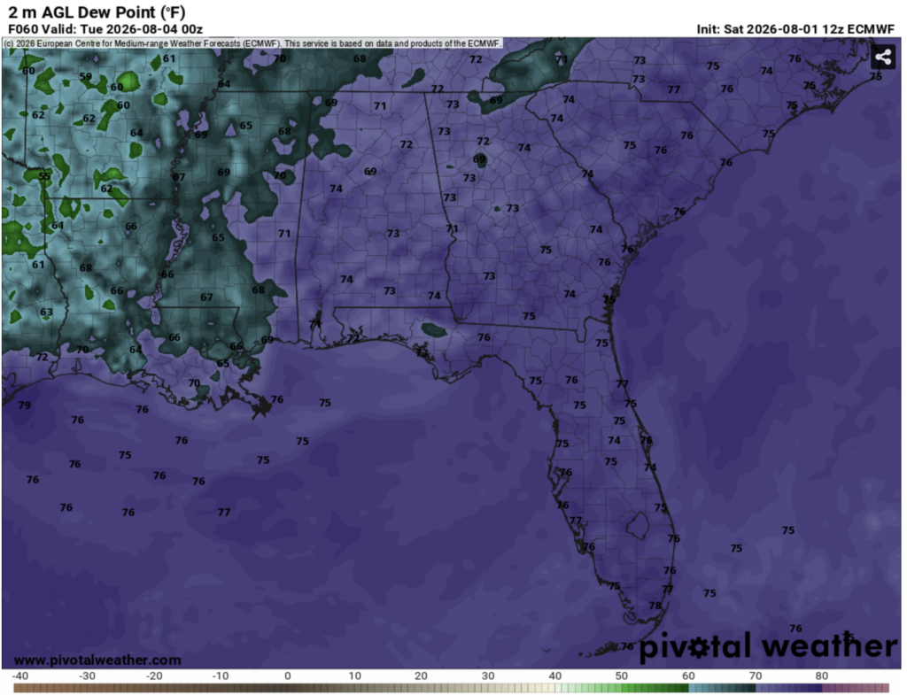
While temperatures will still be seasonably hot on Monday, the one saving grace is the humidity, which won’t be too oppressive for early August in the deep south. Many spots in Louisiana and western Mississippi have dew points in the upper 60s on Monday evening. If you go further to the east into Alabama and the FL panhandle, they’re in the lower-mid 70s.
It will still feel humid, but not nearly as bad as what we’ve experienced before.
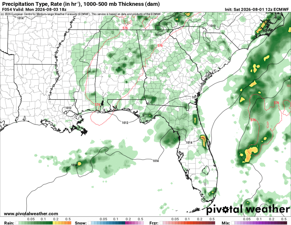
The ECMWF model is also showing slight potential for storms on Monday afternoon and evening, with spots generally east of Jackson seeing the highest likelihood of storms. I don’t anticipate that these storms will be anything major as they are mostly forming on the backside of a trough of low pressure centered over the midwest. In other words, their energy source isn’t the warm and humid gulf of Mexico.

Extended Outlook
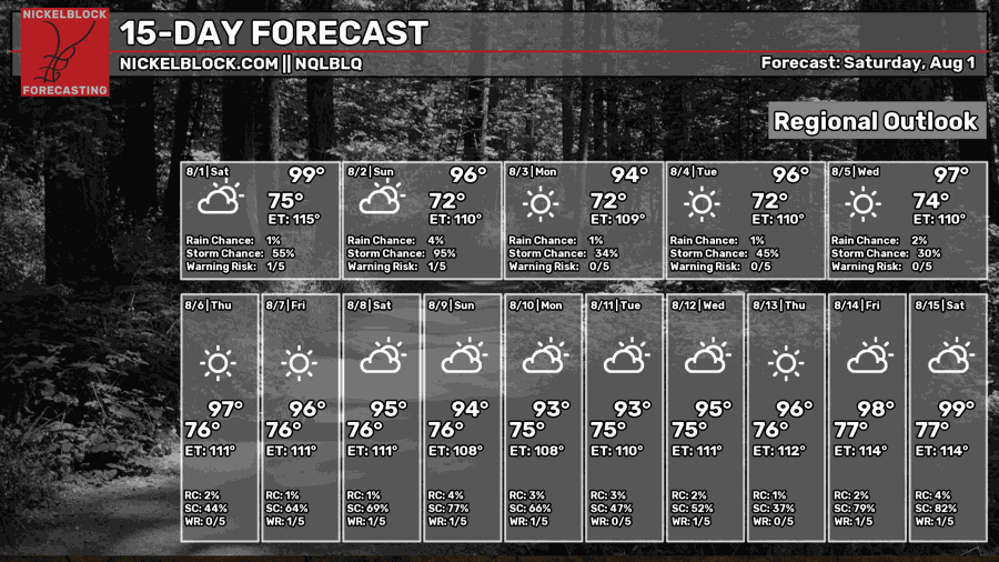
Over the next 2 weeks, we’re expecting a long stretch of above normal temperatures, with everyday from now until August 15th likely to see high temperatures in the mid and upper 90s.
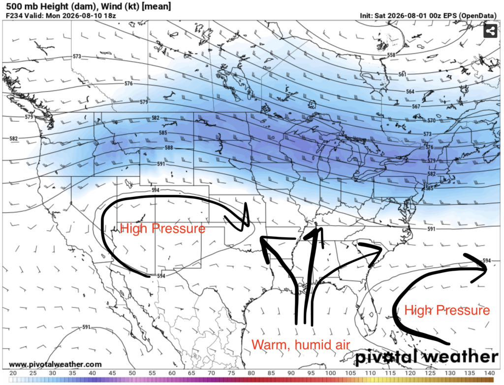
For much of the next 2 weeks, our area looks to sort of be in between two major ridges of high pressure. One over the southwest, and one to the northeast of the Bahamas. This will force air from the gulf of Mexico to travel northwards into our region, delivering more hot and humid conditions.
I also think there’s a good chance that we see above normal precipitation during this period, as that humid gulf air will certainly cause daily thunderstorms throughout our area.
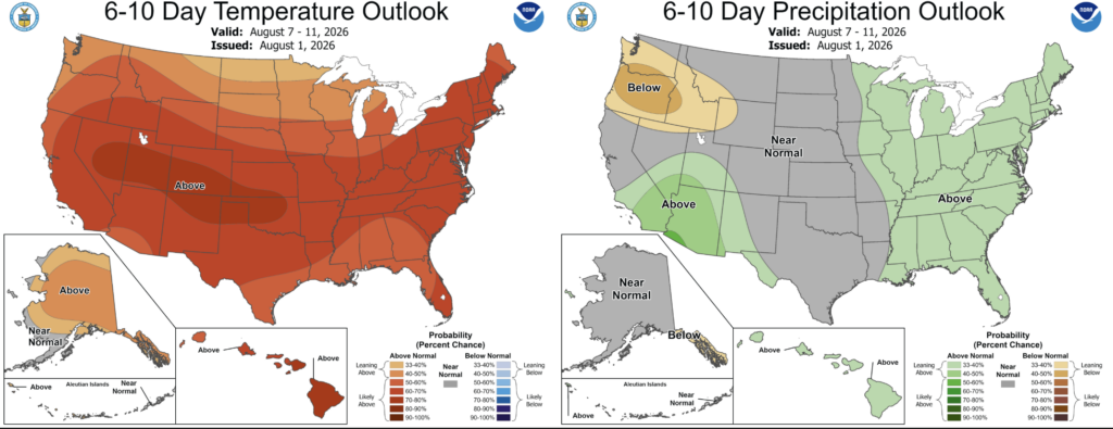
According to the NOAA CPC, above average temperatures are very likely from the August 7-11 period. Above normal precipitation is also fairly likely during that same time period.


