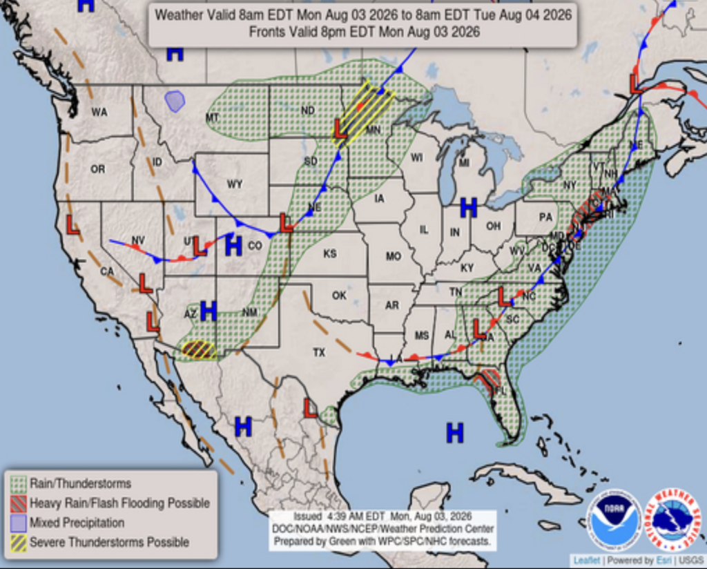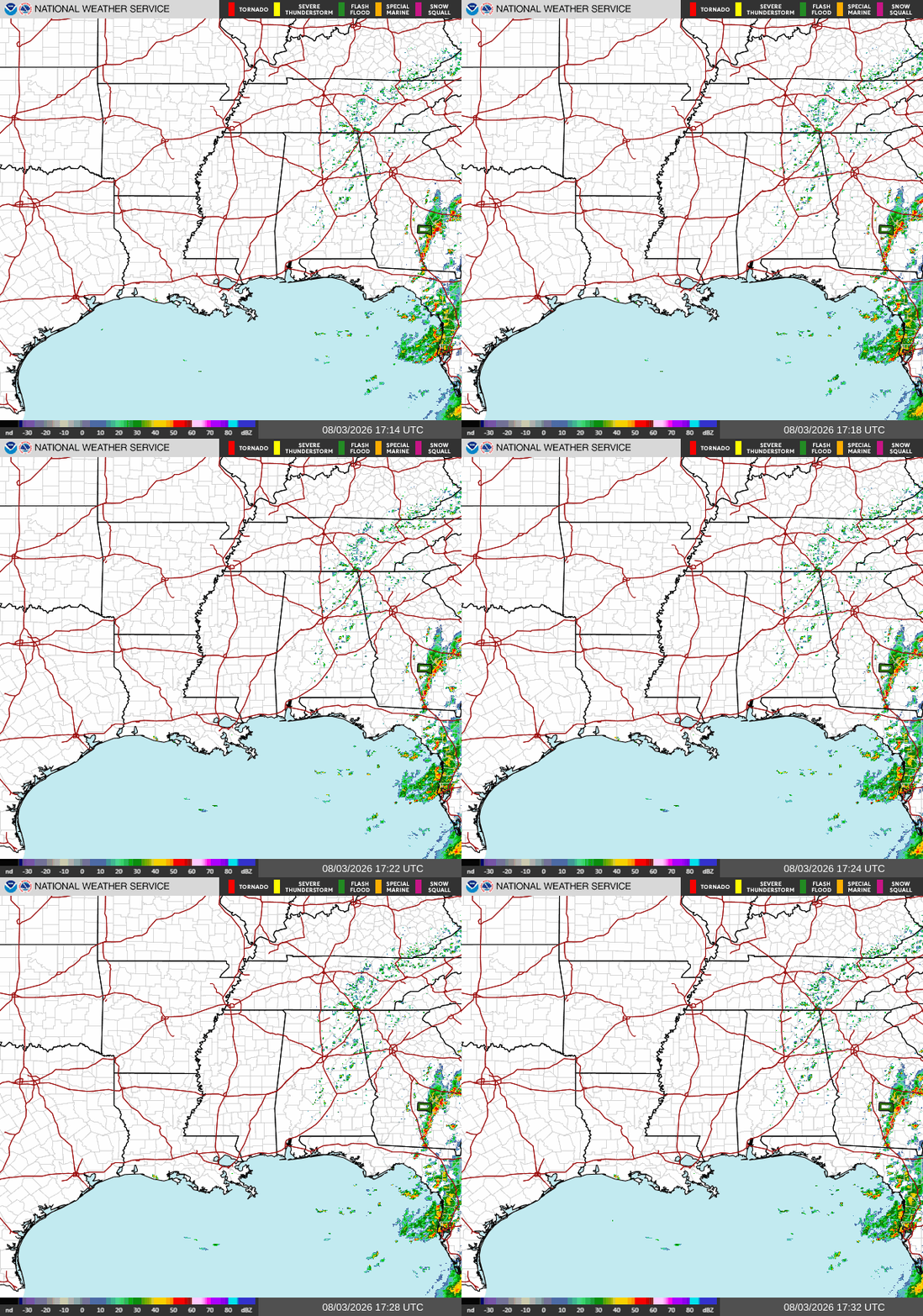
Good afternoon! As of 12:40p CDT, our radar is pretty quiet. Aside from a few scattered storms in the Tallahassee area, our forecast region is quiet right now.
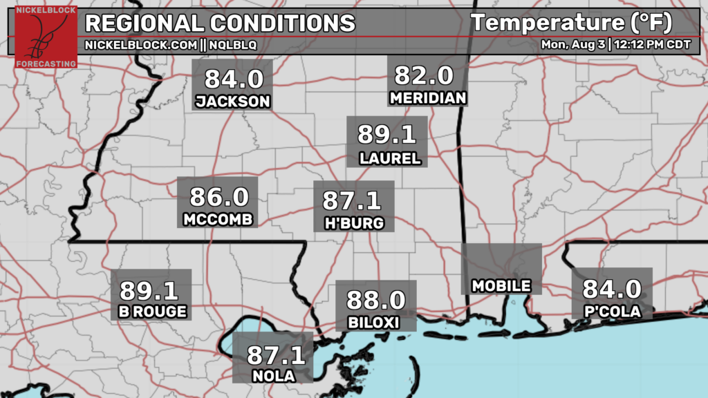
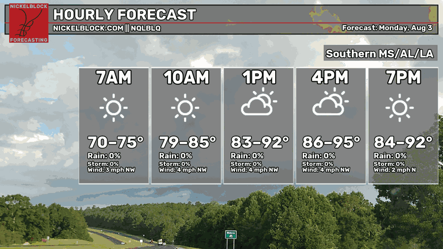
Temperatures in our region range from the mid 80s to the upper 80s as of noon CDT. This afternoon, they will rise a bit higher into the low-mid 90s for most places, which is around average for this time of year. The temperature forecast has not changed too much since yesterday.
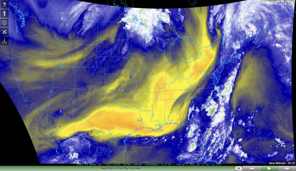
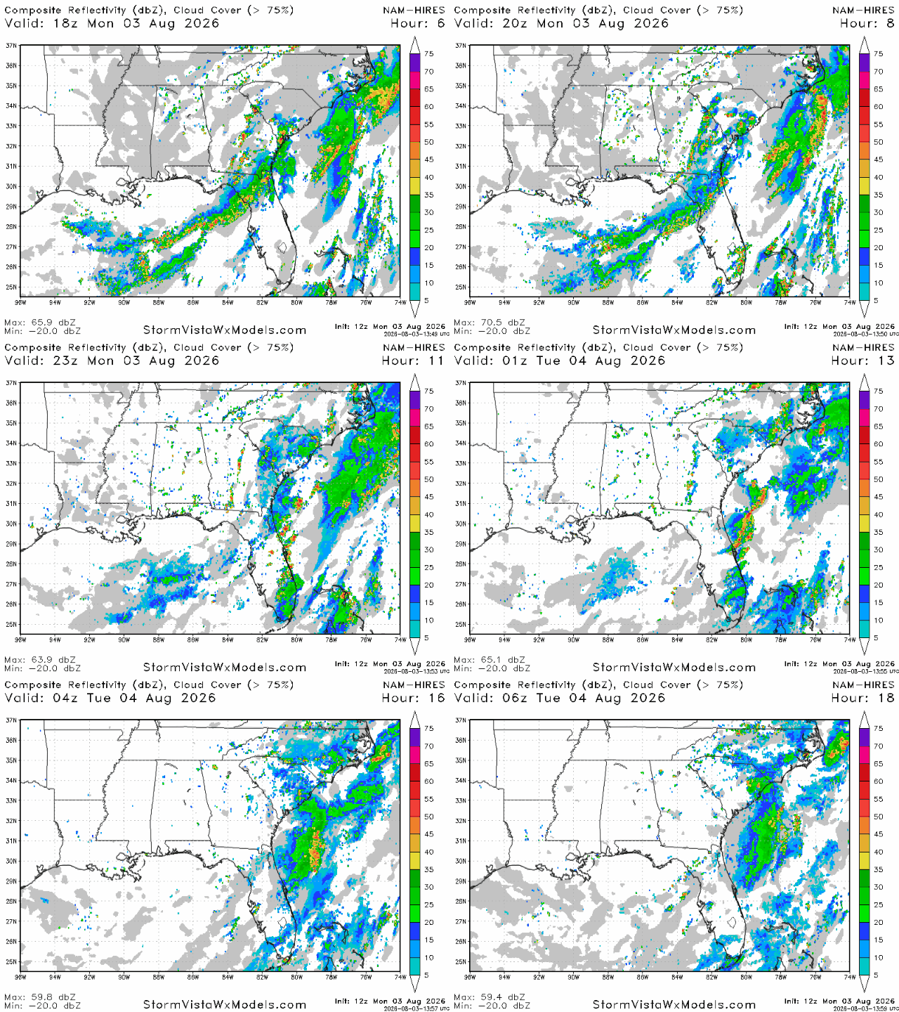
As you may or may not have noticed, the air feels a bit less humid today that normal. That is because we are currently under a thick layer of mid-level dry air. This dry air will prevent nearly all thunderstorms from forming this afternoon and evening, so tonight should be a good night to get outside and enjoy the air!
Tomorrow
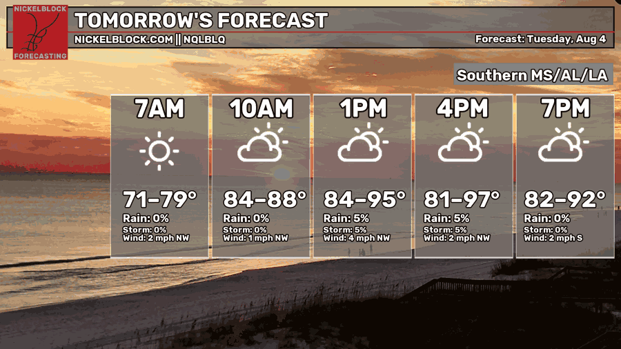
Temperatures tomorrow are expected to be a bit hotter than today, rising into the mid 90s for most and possibly even the upper 90s in a few spots. Morning lows will drop into the mid-upper 70s for most, while a few areas may see lows as cool as the low 70s.
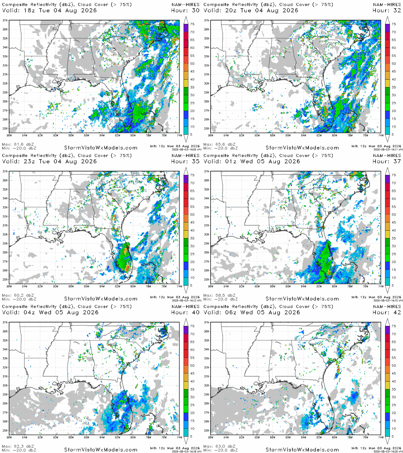
Much like today, the intrusion of dry air into the mid-levels above our forecast region will suppress almost all afternoon thunderstorm activity. The only places expected to see any storms in the south is south central Florida, eastern Georgia, and the Carolinas.
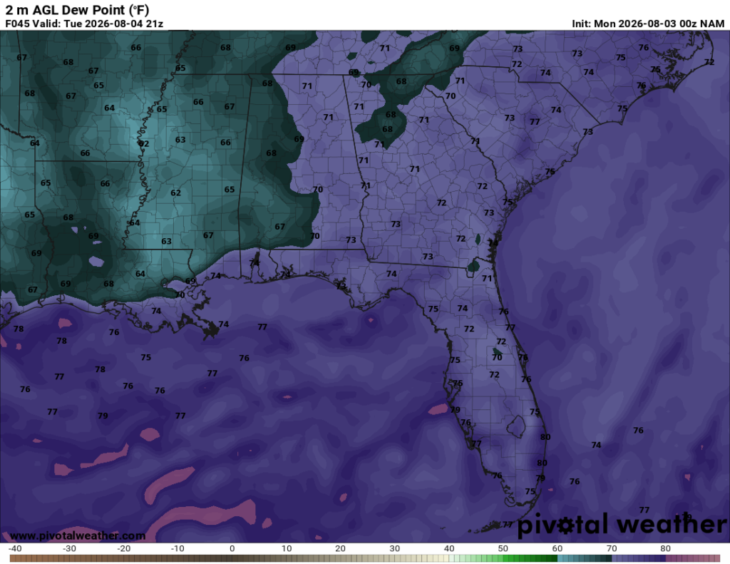
We’ll also be in for a bit of a “treat” tomorrow in terms of the humidity. Dew points will range from the low 60s to the low 70s for our area tomorrow afternoon, which is below normal for this time of year. Mississippi looks to be the winner tomorrow, with most of the state seeing dew points in the low to mid 60s, while dew points rise into the low 70s as you get further east into Alabama and the Florida panhandle.