Hey everyone! Let’s get into the national outlook for this week!
Today’s Overall Setup
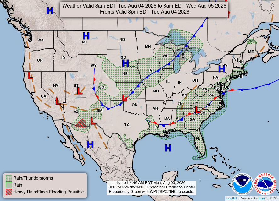
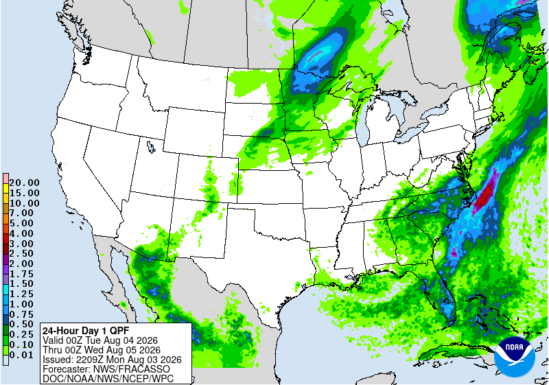
Looking at the overall setup today, there is a slow-moving cold front draped over the central Plains into the Upper Midwest, which will bring showers and thunderstorms to those regions. More rain is also expected across the Southeast and along the East Coast, with the bulk of the heavier rain over Florida, Georgia, the Carolina’s, and Virginia, which is right under a low pressure system and trough.
Some heavy rain and storms will continue across some of the Southwest, especially in southern Arizona, and southwest New Mexico, while much of the West stays hot and completely dry. The Nickelblock region looks to stay mostly dry and hot tomorrow, as some high pressure seems to win out.
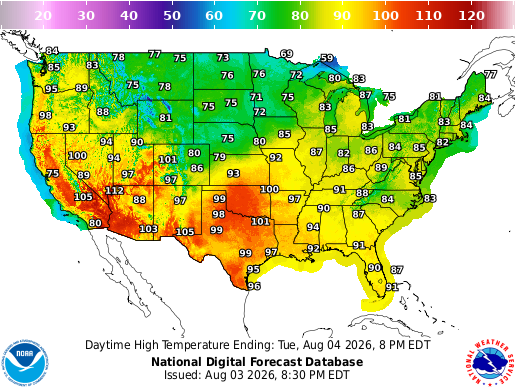
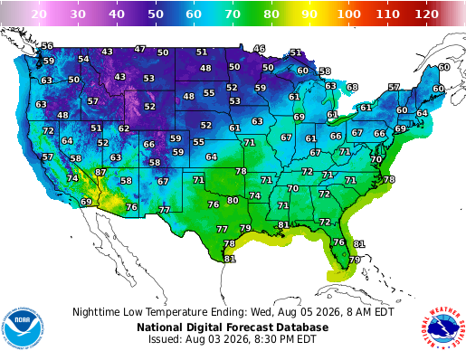
Talking temperatures, the rain in the Southeast and Midwest will keep temperatures from soaring into the 90s, with much of the East from Georgia to Maine reaching only the 80s today. Those in the northern Plains and northern Rockies will see highs only in the 70s, followed by a chilly night in the 40s and 50s behind the cold front! Highs will reach near or exceed 100 in Oklahoma and Texas, while much of the Desert Southwest climbs above 100.
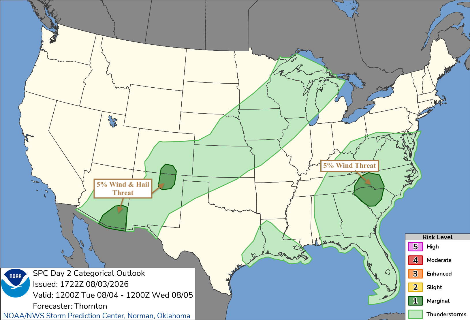
The overall severe weather threat remains low today, but a few stronger storms are still possible. A Marginal Risk is in place across southeastern Arizona and portions of New Mexico and Colorado, where storms may produce isolated damaging wind gusts and hail during the afternoon and evening.
Another Marginal Risk covers parts of the Carolinas. Scattered storms developing in the warm and humid air could produce locally damaging wind gusts, especially with any stronger downbursts.
Wednesday’s Weather
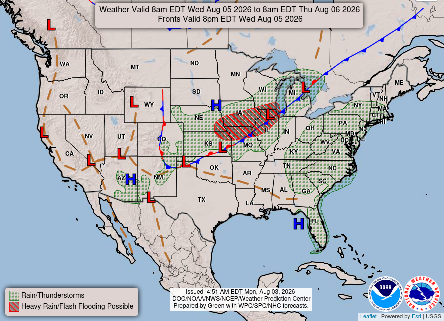
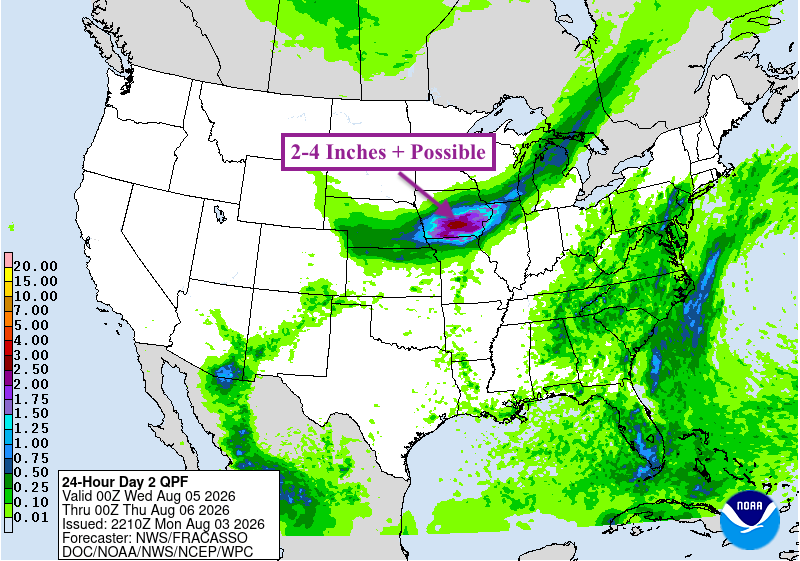
Looking ahead to tomorrow, the slow-moving cold front will push a little farther east, bringing more showers and thunderstorms from the central Plains into the Midwest and Great Lakes. Heavy rain will be the biggest concern, with 2-4 inches or more possible in some spots from Iowa into southern Wisconsin and northern Illinois, which could lead to flash flooding.
More scattered showers and thunderstorms will continue across the Southeast and along the East Coast, this time pushing further into the Northeast. There will also be some monsoon storms possible in the Southwest yet again.
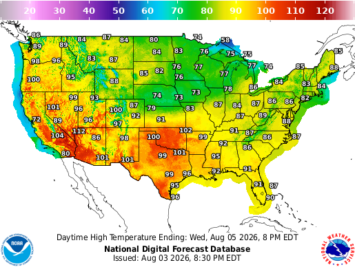
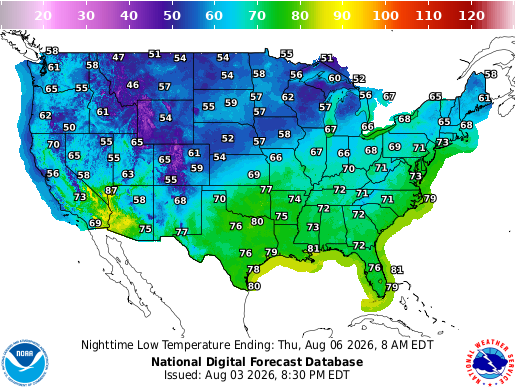
Temperatures will be pretty similar on Wednesday. The northern Plains and Upper Midwest will stay comfortable in the 70s and 80s, while most of the East warms into the 80s. The real heat will stay across the southern Plains and Desert Southwest, where plenty of spots will get close to or above 100 again.
Wednesday night will be pretty cool across the northern half of the country, with lots of 50s and 60s. Farther south, it will be another warm and muggy night, with temperatures only falling into the 70s.
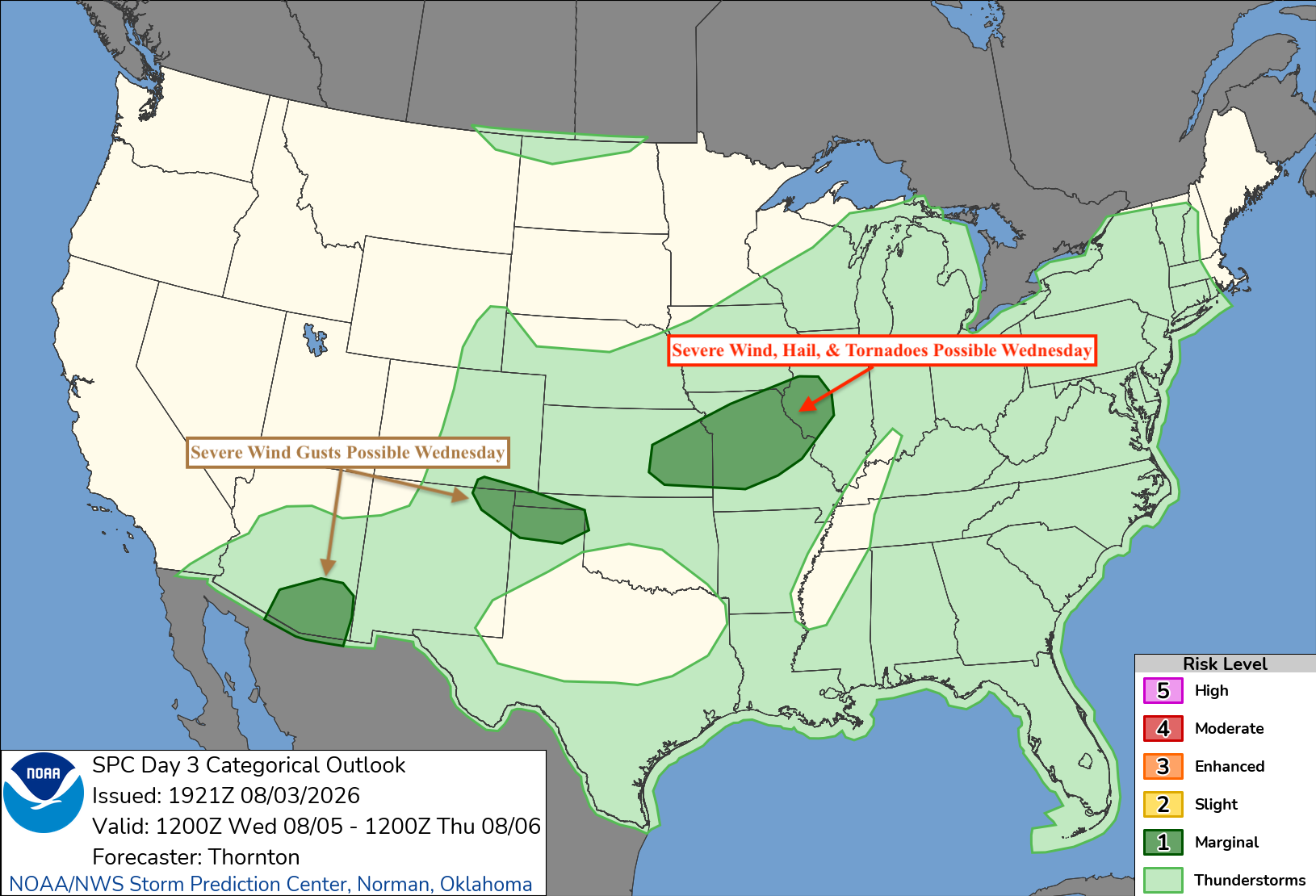
The severe weather threat will stay on the lower side Wednesday, but there are a few areas to watch. From eastern Kansas into Missouri and western Illinois, a few stronger storms could bring damaging winds, large hail, and possibly a tornado during the afternoon and evening.
Strong wind gusts will be the main concern with storms from northeastern New Mexico into the Texas and Oklahoma Panhandles. A few storms across southern Arizona could also produce isolated severe wind gusts.
CONUS Weekly Temperature & Precipitation Outlook
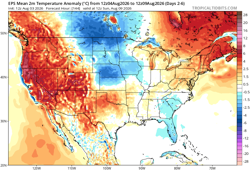
Here’s a look at the EPS modeled temperature anomalies through Sunday. Red indicates above-average temperatures on average for the week, white indicates average temperatures, and blue indicates below-average temperatures.
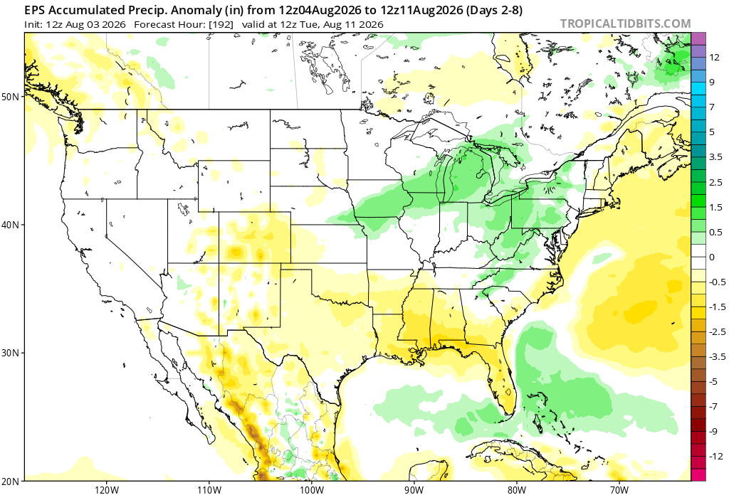
Here’s a look at the EPS modeled precipitation anomalies through next Tuesday. Green indicates above-average precipitation, white indicates average precipitation, and yellow indicates below-average precipitation. Let’s look into the details by region:
Weekly Outlook: Western & Central United States
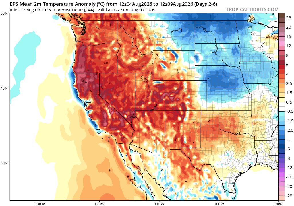
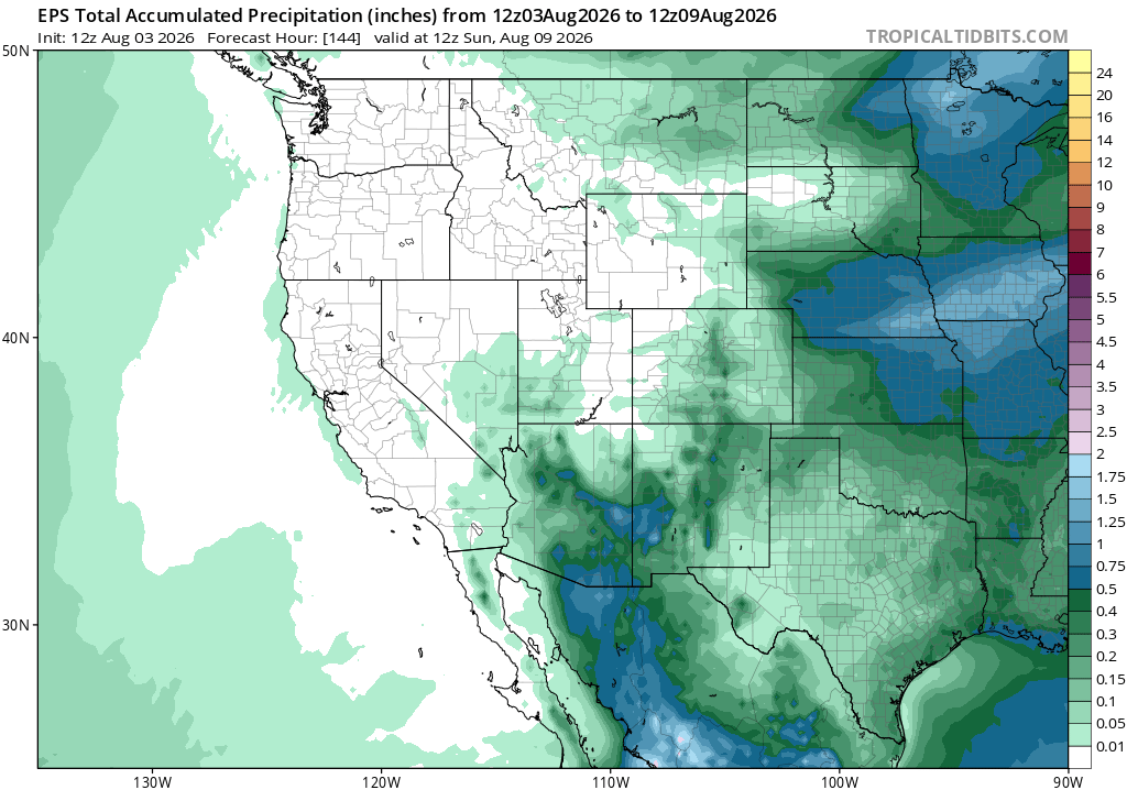
Looking at the week ahead, the heat will stay locked in across much of the West, with temperatures running well above average through Sunday. Most of the West Coast and Great Basin will stay pretty dry, but monsoon storms will continue to bring pockets of heavier rain to Arizona and New Mexico.
It will be a completely different story across the central U.S. Cooler-than-average temperatures will settle into the northern and central Plains, while the southern Plains remain on the hotter side. Several rounds of showers and thunderstorms could also bring a few inches of rain from the central Plains into the Midwest by the end of the week.
Weekly Outlook: Eastern United States
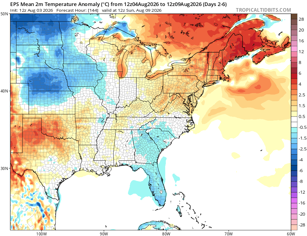
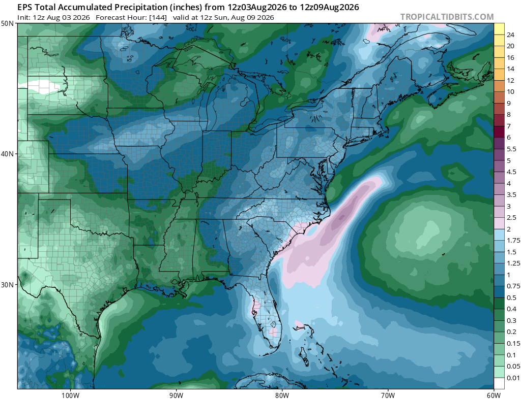
Across the East, temperatures will stay near or a little below average across much of the Southeast through Sunday, while the Great Lakes and Northeast run a bit warmer than normal. The coolest air will remain back across the central and northern Plains.
It also looks like a pretty wet week for many areas. Several rounds of rain and thunderstorms could bring a few inches from the Midwest into the Great Lakes, with more scattered rainfall stretching through the Ohio Valley and East Coast. The heaviest rain near the Southeast coast looks to stay mainly offshore.
Extended Outlook
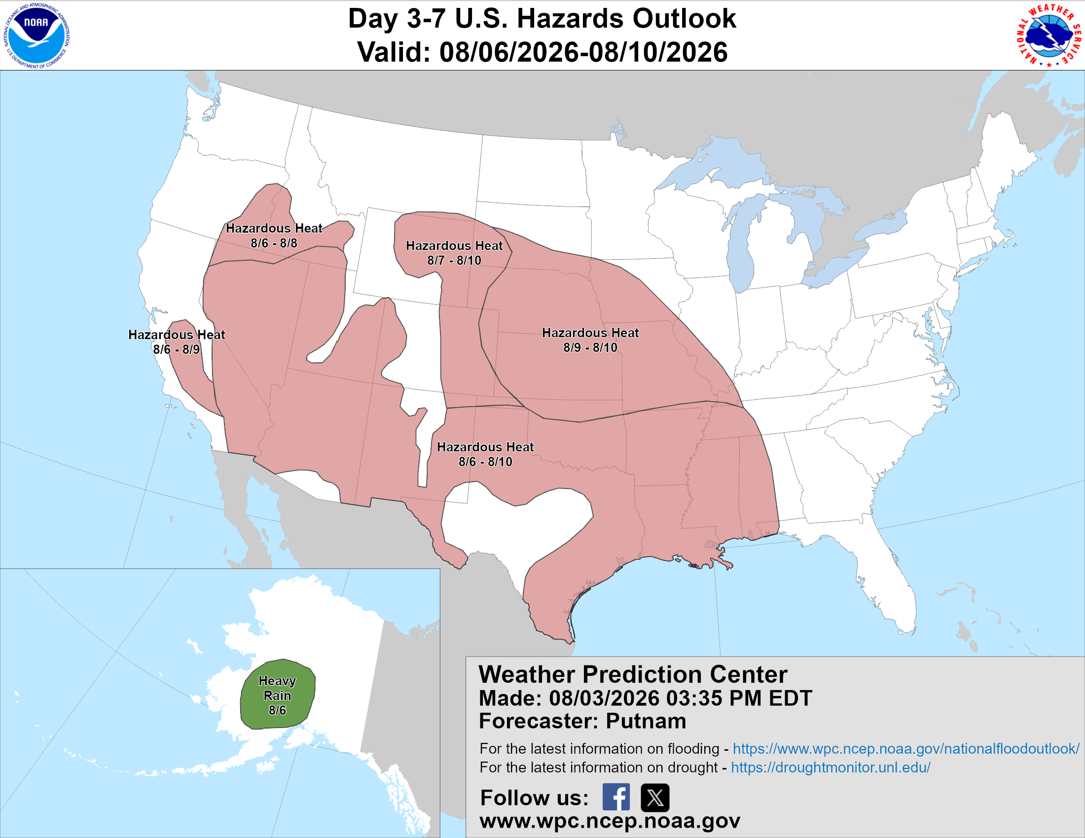
Above is a look at the U.S. Hazards Outlook from NOAA, highlighting areas of more impactful weather to be aware of over the next 3 to 7 days.
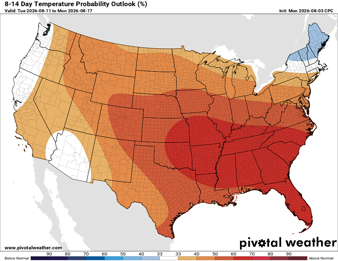
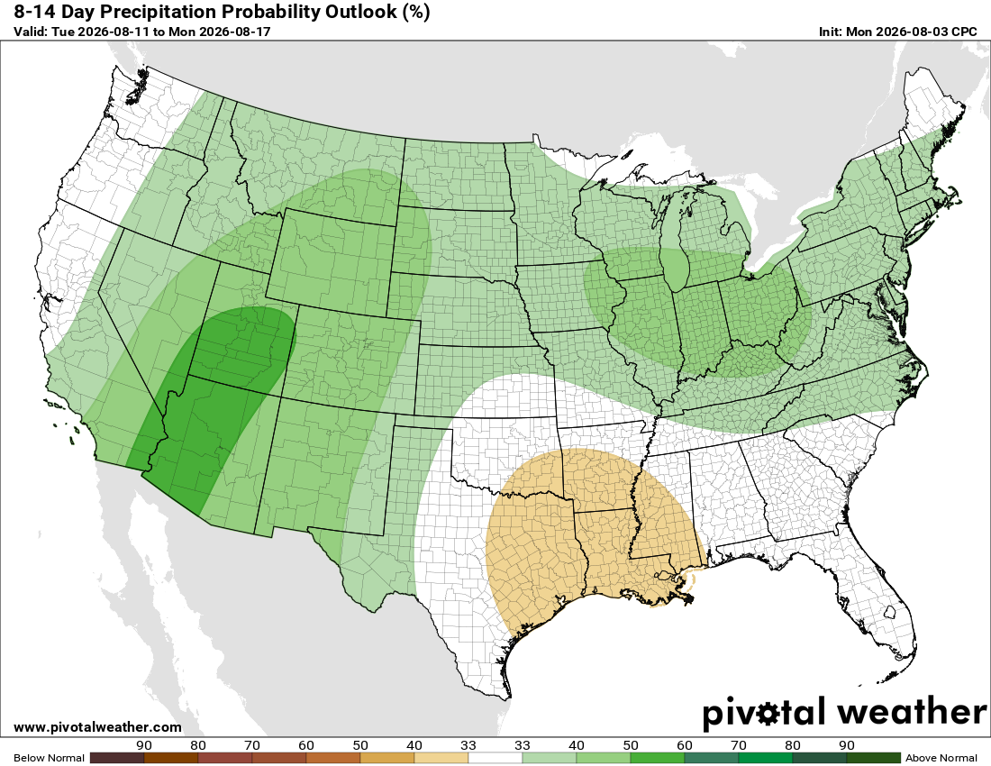
Looking even farther ahead to August 11-17, above-average temperatures are favored across nearly the entire country. The strongest signal for heat stretches from the southern Plains through the Southeast, while northern New England may actually turn cooler than average.
Above-average rainfall is favored across much of the West, Midwest, and Northeast, with the strongest chances around the Four Corners. Meanwhile, drier-than-average conditions may develop along parts of the central Gulf Coast and lower Mississippi Valley.
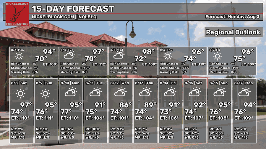
Thanks for tuning in to this National Forecast! Tune in to our local, tropical, and regional forecasts to stay up to date on the latest!


