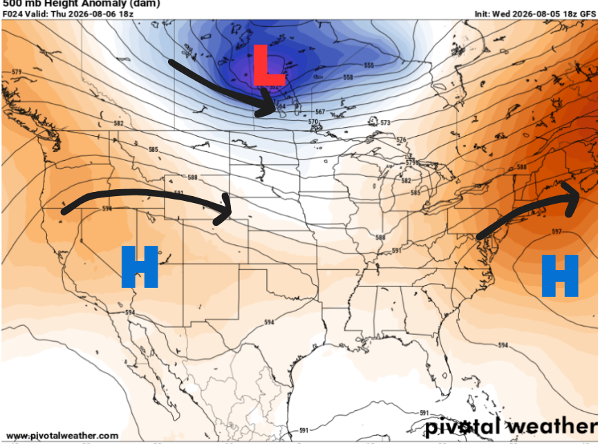
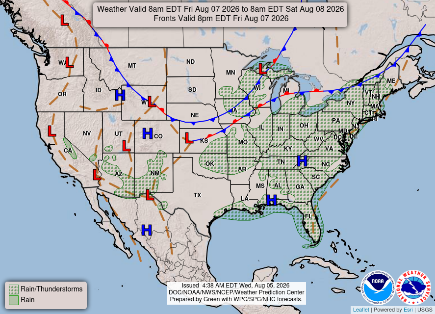
Just because we’re lacking synoptic forcing, like a cold front or low-pressure system, doesn’t mean storms are completely out of the picture. Looking at the 500 mb map below, high pressure is found both to our west and our east.
Instead, any storms that develop will be afternoon pop-up storms, with the bulk of them developing along the sea breeze boundary that moves inland during the afternoon. While severe weather isn’t expected, a few of the stronger storms could still bring heavy rain, gusty winds, and frequent lightning
Otherwise, through the end of the week, expect hot summer days with highs in the mid 90s and plenty of sunshine.

TONIGHT
Settling into a clear night with calm winds.
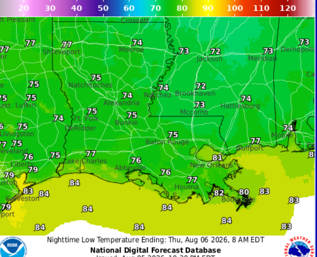
Temps dropping down to 72 in Jackson and 75 in Baton Rouge. Patchy fog likely for portions of central Mississippi overnight, mainly near Natchez and Jackson
TOMORROW
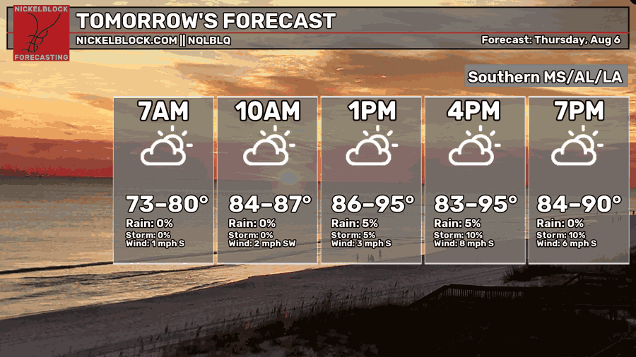
Thursday, patchy fog should clear out by mid-morning before giving way to a mix of sun and clouds. Humidity will be a bit higher, mainly across southern Louisiana. Afternoon highs will range from 94-97 degrees, with temperatures a few degrees cooler if a stray storm catches you.
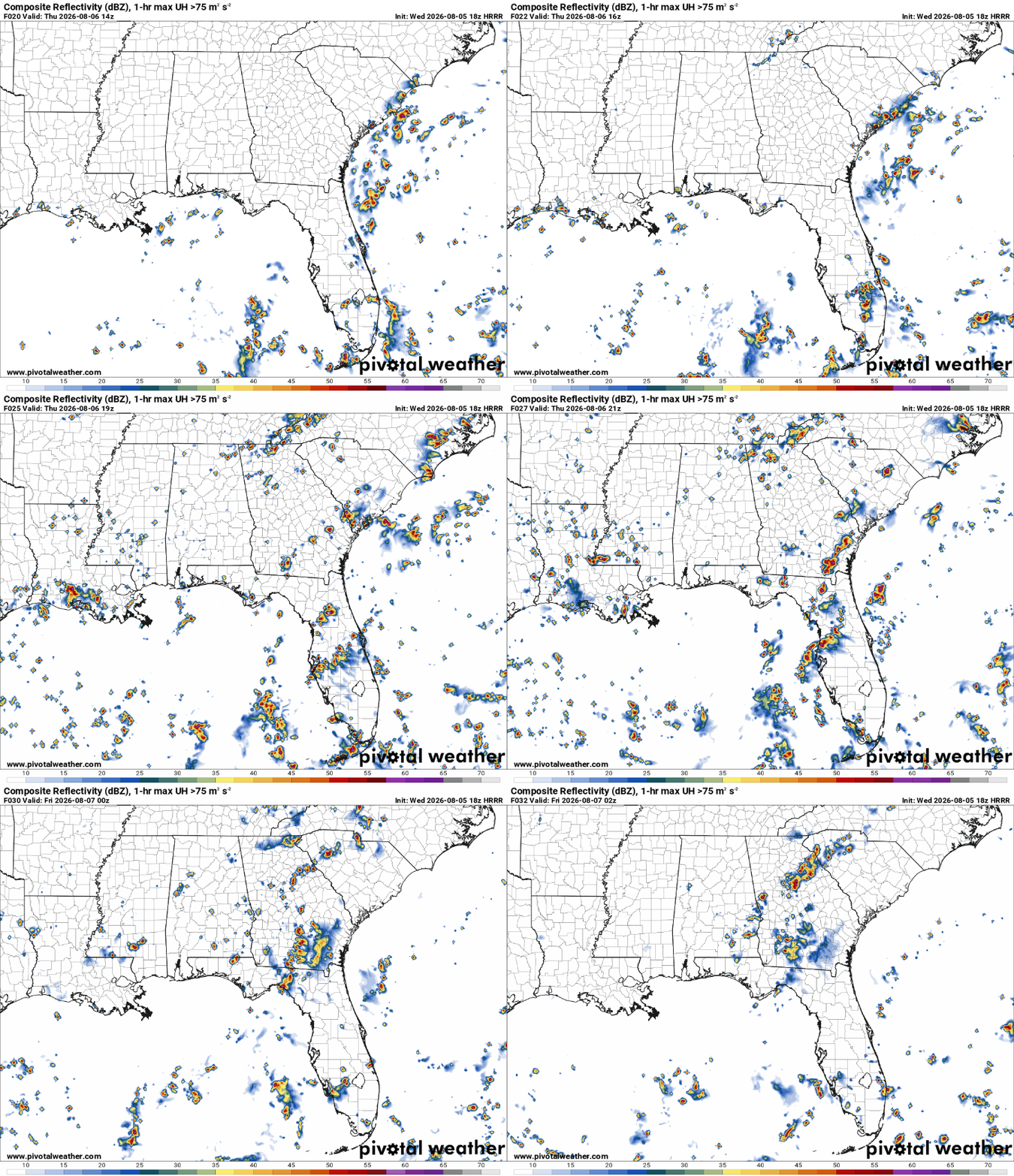
Be sure to watch the skies after lunchtime, as short-range models are showing pop-up storms scattered across the region. The highest rain totals are expected near Houma and Baton Rouge.

THE DAY AFTER TOMORROW
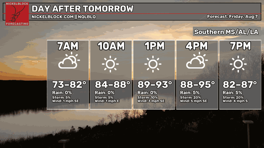
Friday, most areas will stay dry, however, a stray storm is possible in the afternoon. Humidity will be higher, making it feel closer to 100-105 degrees.

EXTENDED OUTLOOK
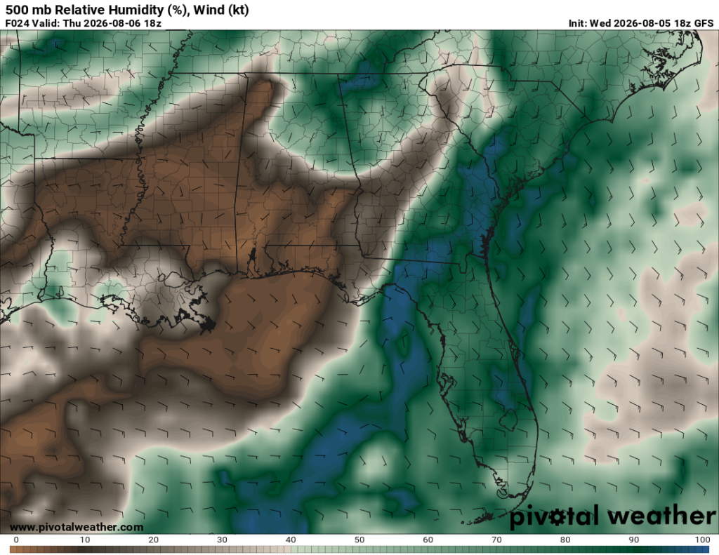
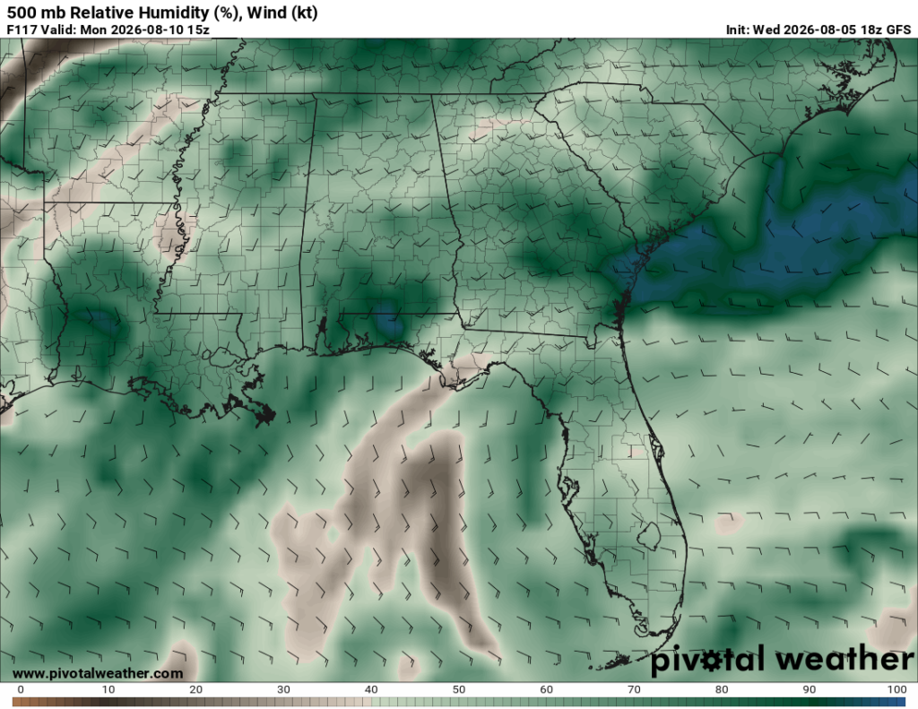
Currently, we have a drier air mass over the area shown by the brown blob (below, left). Fast forward to Monday, the wind is expected to shift south, funneling in tropical moisture. This will allow the air mass to slowly become more humid, shown by the greens and blues (below, right).
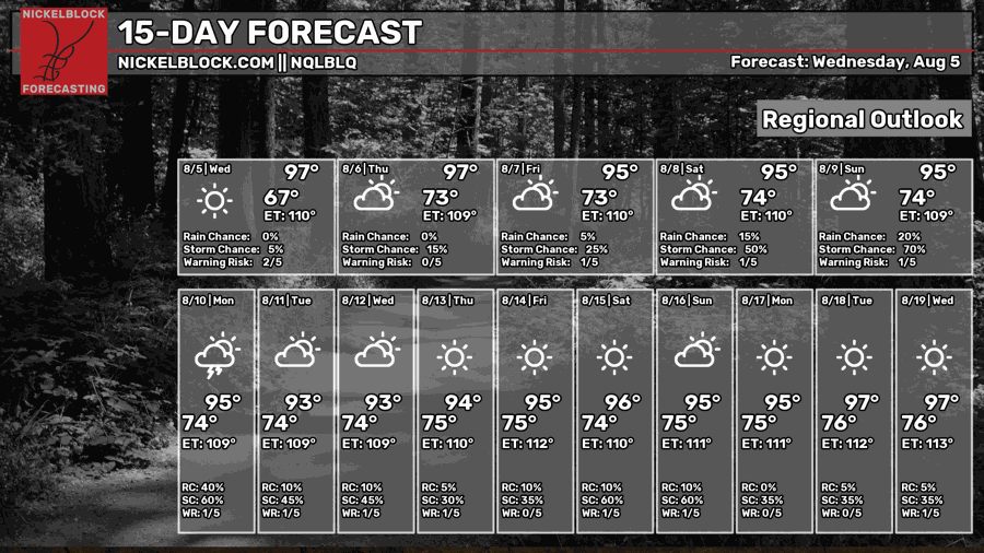
As a result, increasing storm coverage is expected, which is reflected in the graphic above, along with rising humidity during the Sun-Tues timeframe
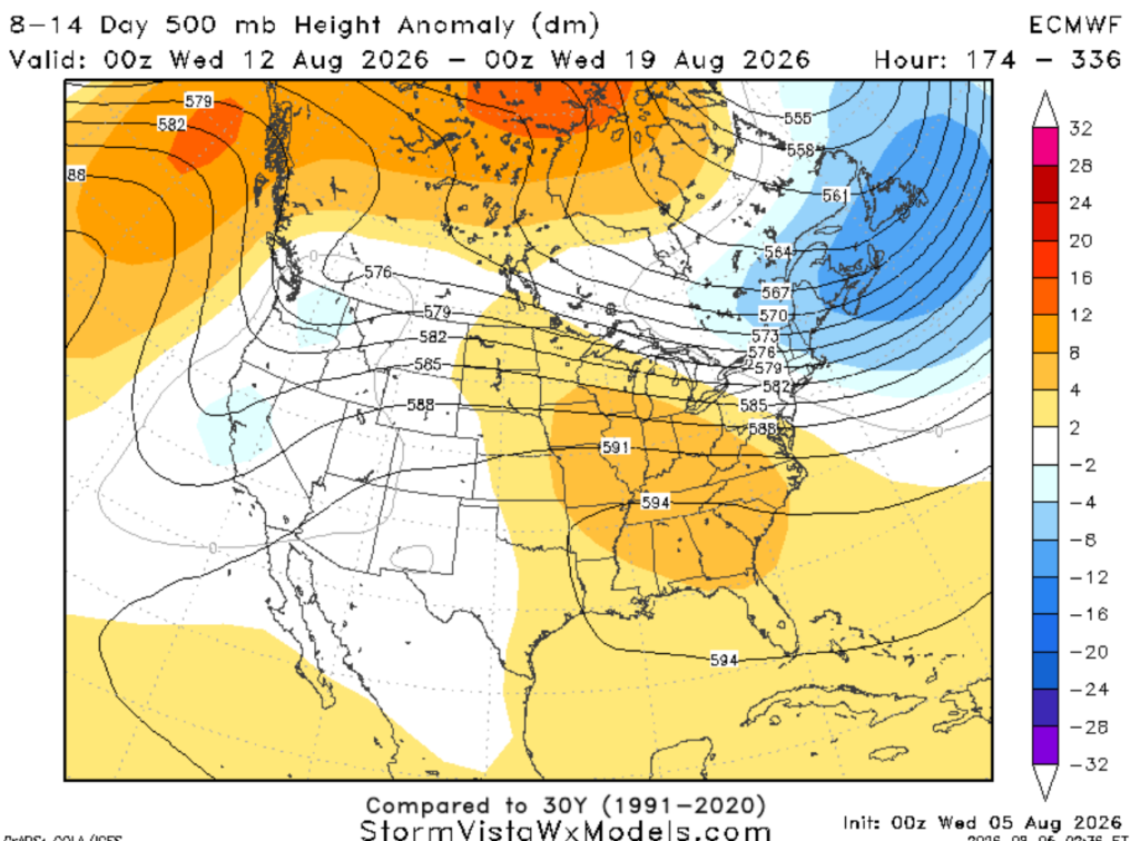
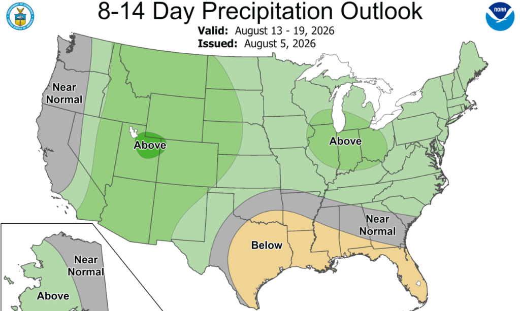
Beyond that, look at all those little sun icons! Ridging is our best friend, bringing us down to below-normal precipitation. That is, of course, if the Atlantic stays quiet…
DAY-BY-DAY FORECAST
Tonight: Spotty showers possible before settling into a clear night with calm winds. Temps dropping down to 72 in Jackson and 75 in Baton Rouge. Patchy fog likely for portions of central Mississippi overnight, mainly near Natchez and Jackson
Thursday – Morning fog fades quickly, followed by a mix of sun and clouds. Highs ranging from 90 to 97. Keep an eye on the sky during the afternoon. A few showers and thunderstorms may develop after lunchtime. Rain chance: 30%
Thursday Night – A stray evening shower remains possible before skies settle into a partly cloudy night. Low around 73. Light breeze from the south. Rain chance: 20%
Friday – Watch for fog in the morning in central Mississippi. Highs in the lower 90s, may feel closer to 105. Plenty of sunshine with a light breeze from the east. Stray storms possible in the afternoon along the coast. Rain chance: 20%
Friday Night – Mostly clear, with a low around 73. Calm winds.
Saturday – Plenty of sunshine with highs in the lower to mid 90s. Cannot rule out an afternoon stray storm. Light breeze from the east. Rain chance: 20%
Saturday Night – Mostly clear, with a low around 73. Calm winds.
Sunday– Starting the day off hot with mostly sunny skies. High near 94. Scattered showers and storms are possible in the afternoon. Light breeze from the east. Rain chance: 40%
Sunday Night – Partly cloudy skies. Temperatures dropping down to 74 with a light breeze from the southeast.
Monday – Better shot at rain. Highs in the lower 90s. Scattered afternoon showers and thunderstorms possible. Light breeze from the south at 5mph. Otherwise, mostly sunny. Rain chance: 60%
Monday Night – Partly cloudy, with a low around 74. Chance for rain or storms around 10% to 20%
Tuesday – Rinse and repeat. Highs in the lower 90s. Scattered afternoon showers and thunderstorms possible. Light breeze from the south at 5mph. Otherwise, mostly sunny. Rain chance: 50%
Tuesday Night – Partly cloudy and mild overnight with lows near 74. Winds blowing from the south at 5mph.


