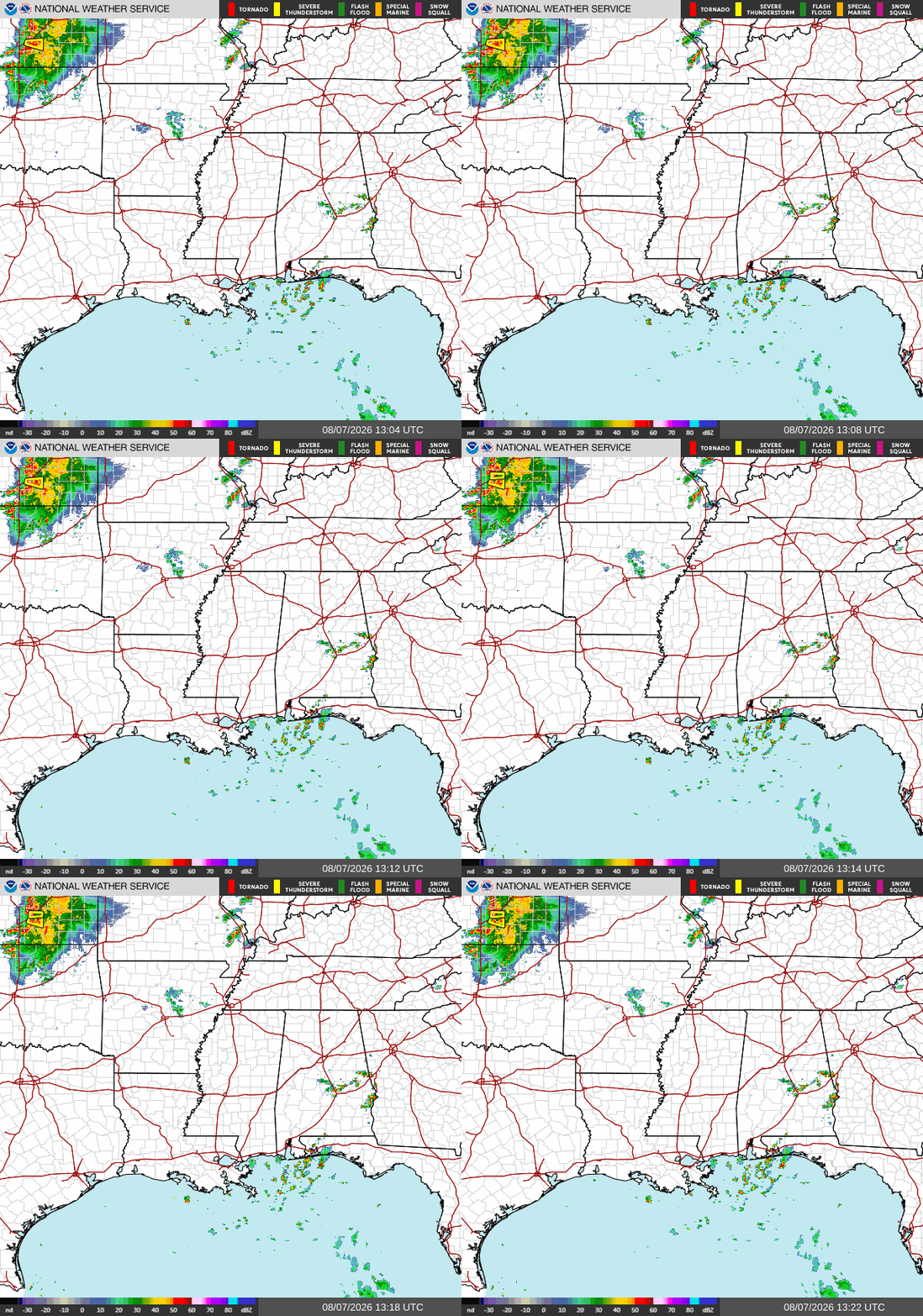
Happy Friday! Looking out at our radar this morning, we see a few strong thunderstorms over the Gulf and the southern edge of MS/AL/LA/FL. There are also a few isolated thunderstorms hanging around Central Alabama but those aren’t expected to bring any damage to the area.

Today
Currently across our area, we have isolated thunderstorms in the northern Gulf that may push ashore into coastal AL/MS/FL. Also, some short-lived thunderstorms over central Alabama should die out by mid-morning. In terms of precipitation for the rest of the day, expect isolated storms popping up into the afternoon, with nothing too organized in the forecast.
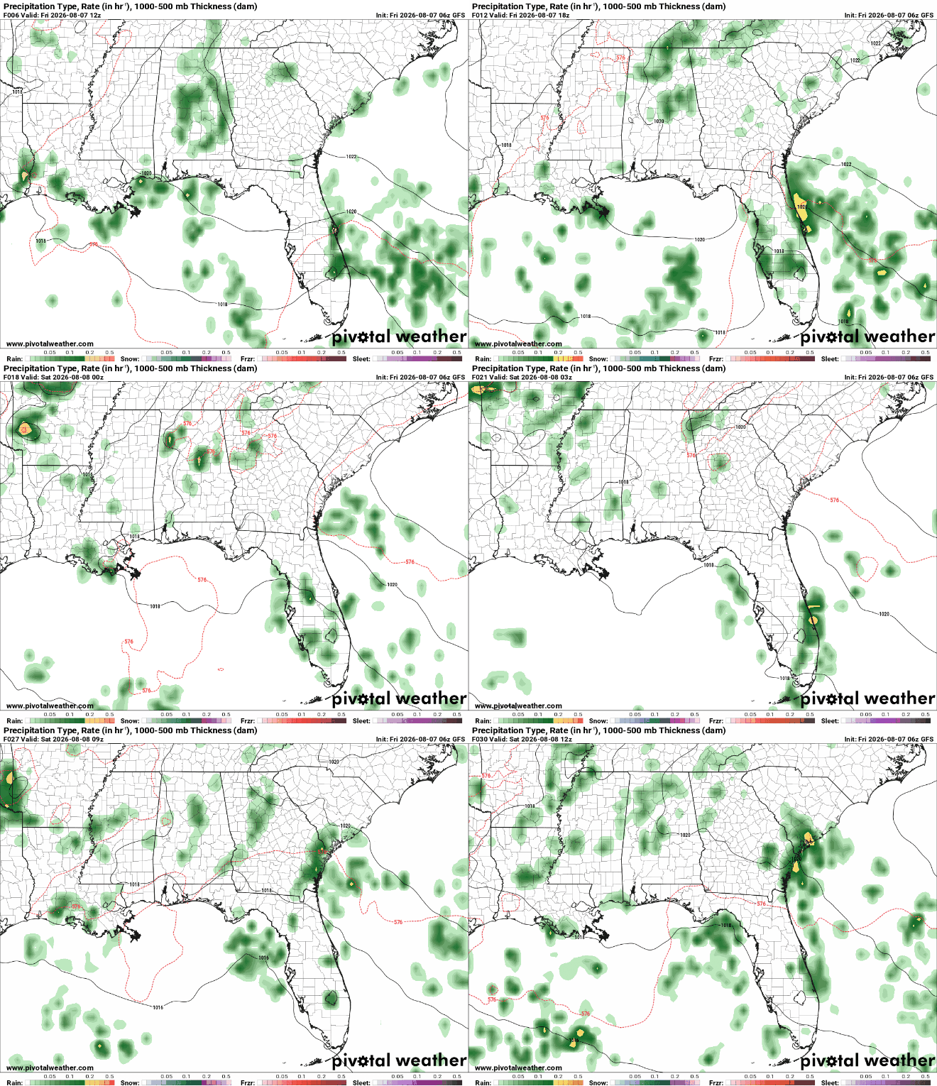
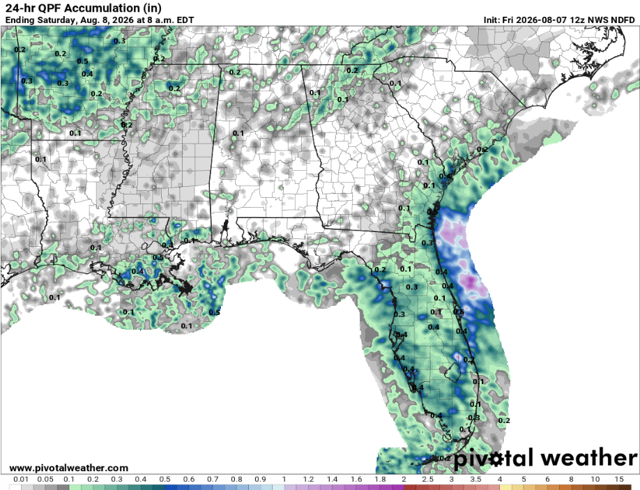
Below is our 24-hr QPF ending tomorrow at 8 am. We see isolated values of up to .5 inches of rainfall across southern Louisiana, which is the most our region is expected to receive today.
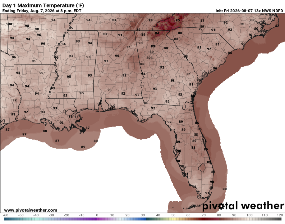
We currently have no NWS hazards impacting the region today, so expect isolated showers throughout the day with temperatures maxing out in the mid 90s, and just scraping 90 degrees across the coast. Sounds like a perfect beach day! Below is our NWS NDFD forecast showing that our max temperatures for the day will remain more comfortable for this time of year instead of unbearably hot.
Tomorrow
Kicking off our weekend, Saturday looks to remain warm and humid with scattered afternoon and evening showers and thunderstorms. Rain coverage will be highest closer to the Gulf Coast, while areas farther inland will see more isolated activity. High pressure near the northern Gulf will help maintain our typical summertime setup, limiting widespread convection while daytime heating provides enough instability for scattered storms to develop.
Temperatures tomorrow sure seem to me like beach temps. Looking at our max temperatures for tomorrow, the coasts will be a little cooler than inland, so listen to me and go to the beach tomorrow. You may catch a stray shower or two, especially heading into the mid-afternoon, but it will be a good day to get out and enjoy the sun.

Sunday
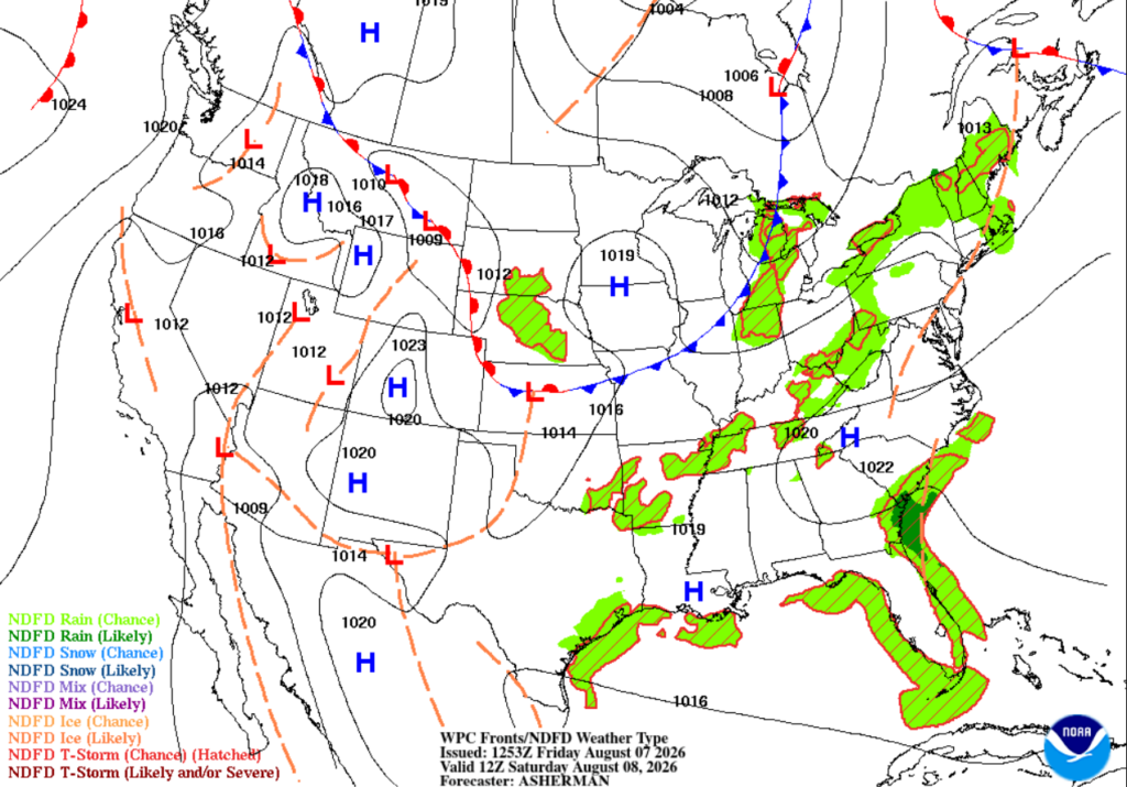
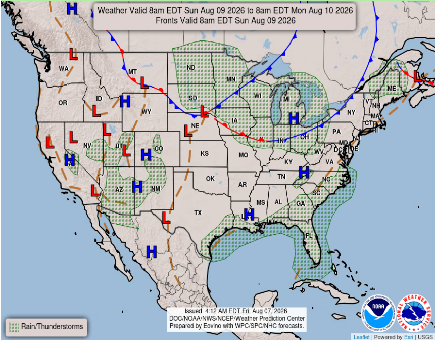
On our national forecast chart below, we see that our little area of high pressure is expected to clear things up across the region on Sunday. Although high-pressure systems are associated with sinking air and generally bring fairer weather, daytime heating and abundant moisture will still allow afternoon showers and thunderstorms to develop, especially along the coast. With more sunshine and moisture available, be prepared for another hot and humid day, with storm chances increasing near the coast throughout the afternoon. Don’t be surprised if real feel temperatures exceed 100 degrees as we finish off the weekend.
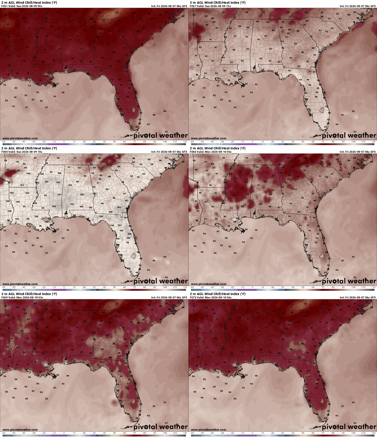
Looking below at our heat index values, we are seeing more moderate values across the coast and higher values inland. Especially leading towards the afternoon, we see spots popping up across the south where temperatures will be lower due to afternoon showers appearing due to daytime heating.

Extended Forecast
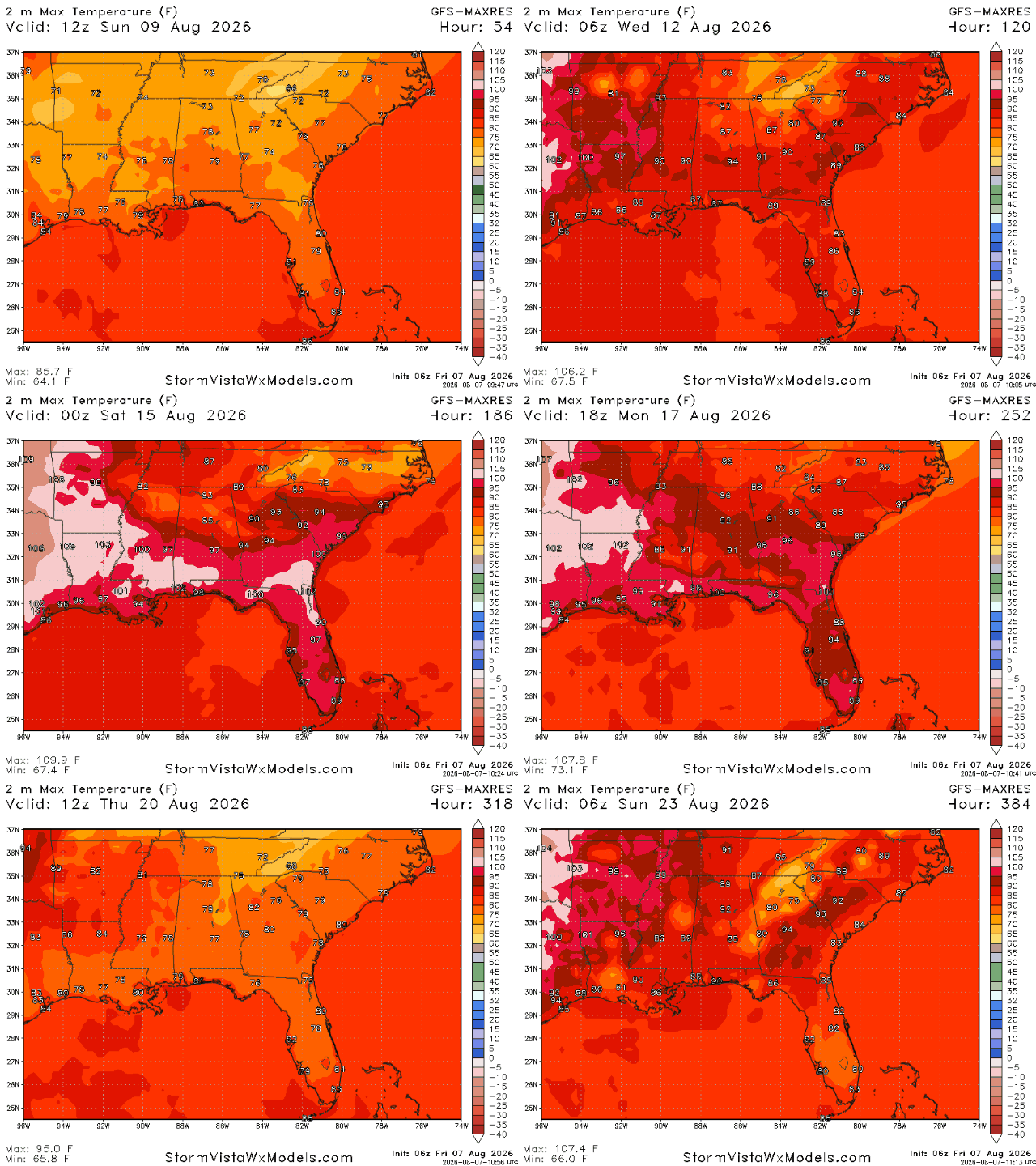
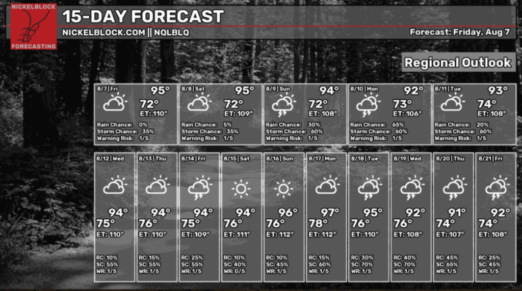
Looking ahead to our NickelBlock 15-day regional outlook, things are relatively average for this time of year. Afternoon thunderstorms and warm heat indices are the norm and that’s what were expecting for the next 15 days of August.
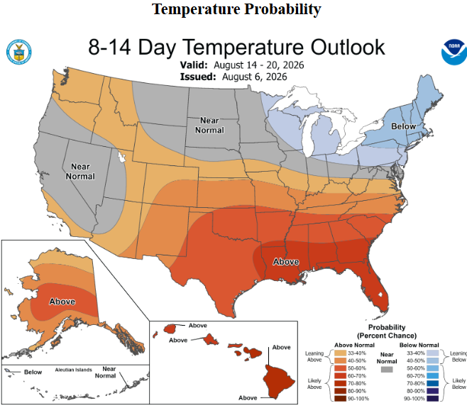
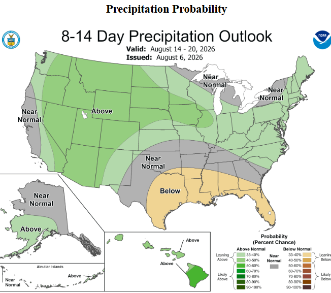
Interestingly enough, the WPC is forecasting below-average precipitation for our region in the next 8-14 days. This correlates well with the above-average temperatures expected for that time frame, as there will be less cloud coverage and fewer storm chances to bring down the temperatures. I guess we will see how the mid-August weather will turn out!