August is making us feel it.
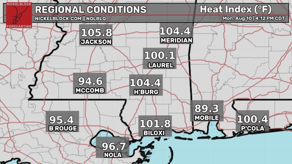
Some localities across the area have gotten lucky and been cooled off by some thunderstorms.
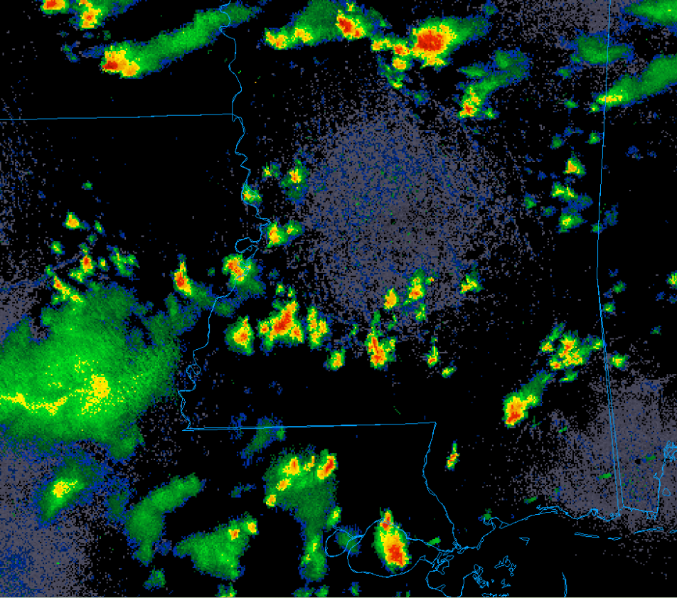
These storms are mainly pulse type and will be little more than heavy rain and lightning makers. The real storms are up in the corn belt with this ring of fire pattern. That means our are will remain locked in a very hot and humid but mostly dry regime.
This type of setup (repeated days of intense heat with little relief at night) tend to be the most dangerous and sometimes deadly. Unfortunately, it looks like the heat will be here awhile.

Tonight
The good news is that any remaining showers and storms should quickly dissipate after sunset. After that clouds should gradually diminish and we should be in for a calm night.
The bad news is that it will be humid.
Very humid.
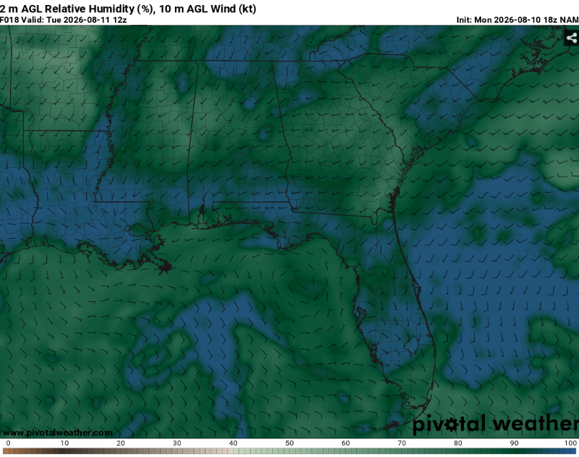
Given the weak winds and location of the ridge, at least patchy fog will be likely. This will be most common in low lying areas and places that have recently received rainfall. Use caution when encountering low visibility on the roadways.
Lows will be in the mid 70s. When combined with the extreme humidity, this will give little relief from the heat for outdoor animals and those without AC.
Tomorrow
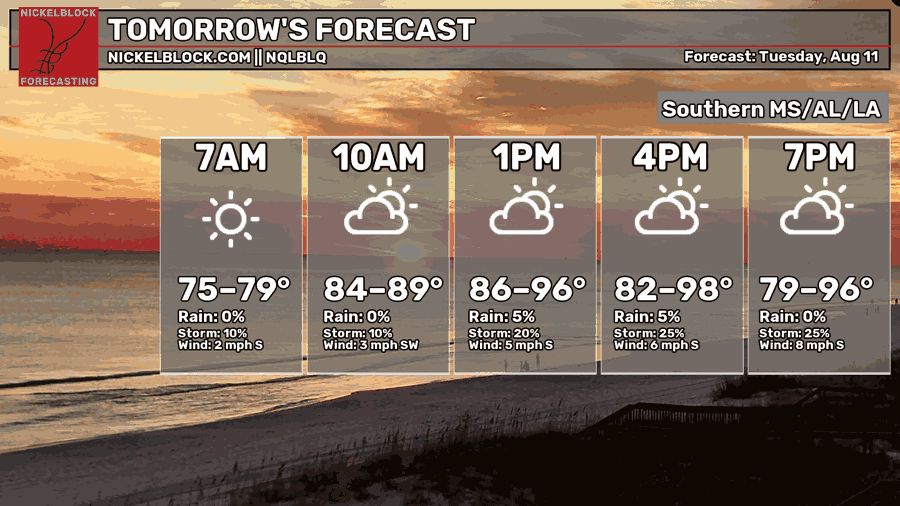
It’ll be a bit toasty tomorrow.
Temperatures will peak in the upper 90s. When combined with dew points in the middle 70s, heat indexes may exceed 105. Not a good day to mow the lawn in the afternoon.
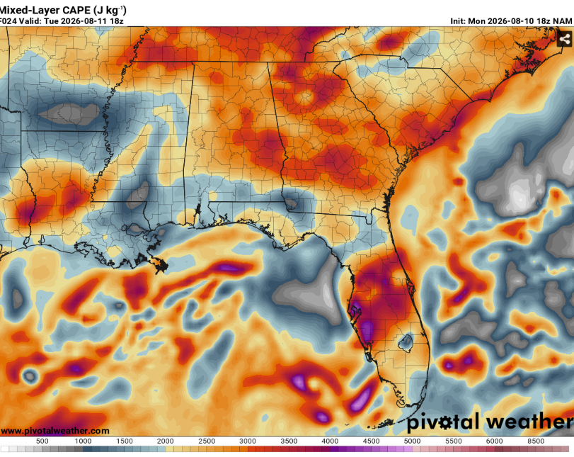
All that heat and moisture will allow strong instability to build. While most of the area will remain dry, a few locations may end up getting a pop up thunderstorm.
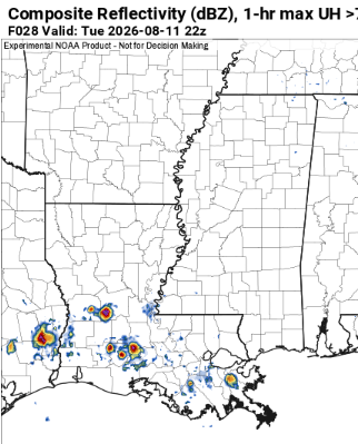
The storms will be basically stationary. Outside of some cloud to ground lightning and the typical downpours, these storms will be fairly benign. The vast majority of locations will remain dry however.
A typical summer day when you’re under a big ridge.

The Day After Tomorrow
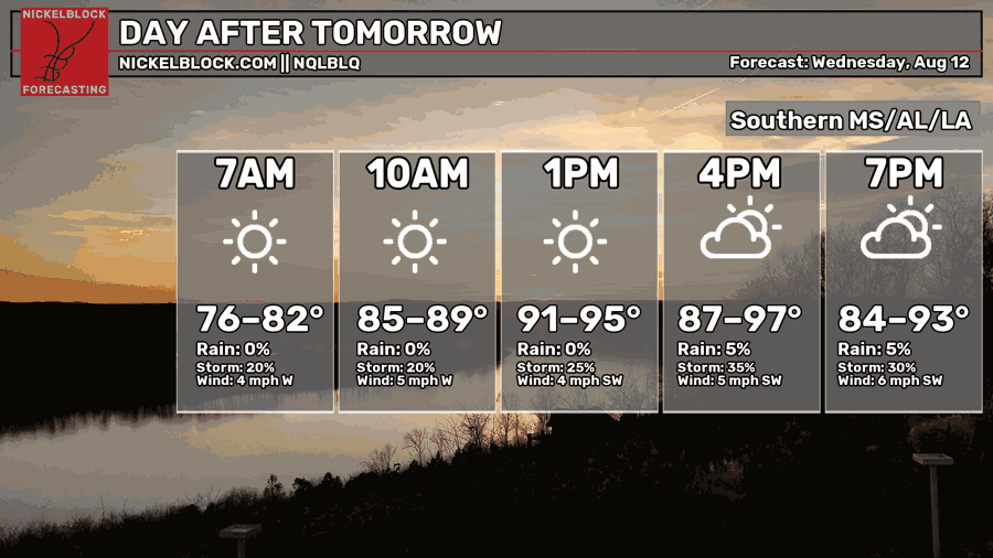
The heat ain’t going anywhere.
Of course the storm chances will decrease to just barely above zero.
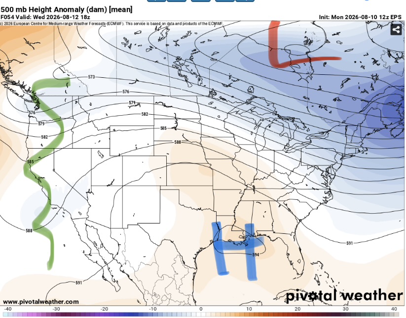
The mid level ridge will basically be centered right over us with a trough on the east and west coasts. This means a lot of very hot air sinking down onto us. As expected, this is unfavorable for convection and really any clouds.
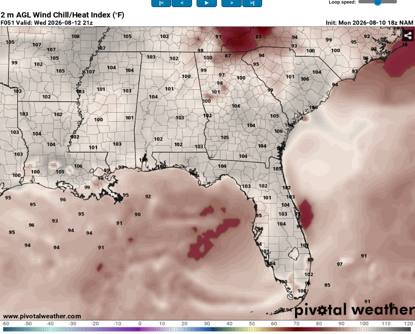
This type of pattern basically guarantees very hot weather and this one is no different. Heat indexes may exceed 105 with little relief from clouds along with a lack of a breeze. This pattern will be dangerous to everyone but especially the elderly and those with preexisting conditions.

The Extended Outlook
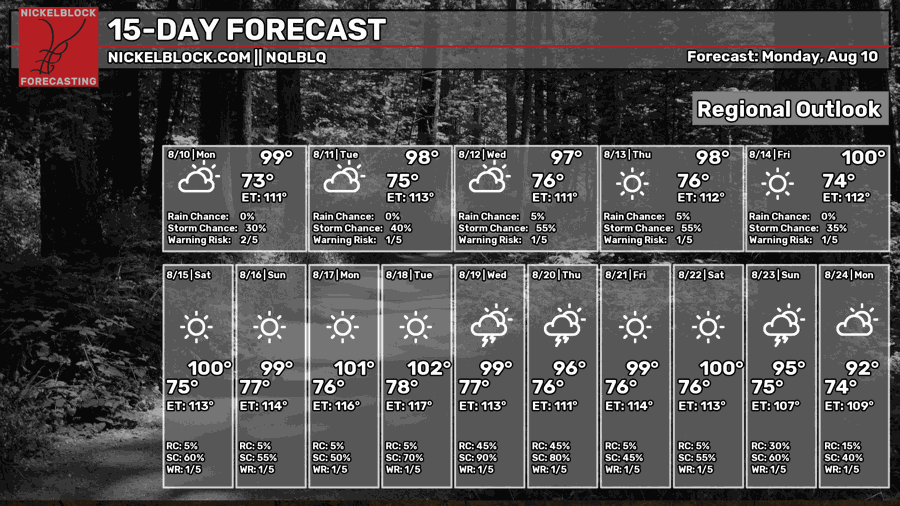
Mother Nature is leaving the burners on full blast. Highs may exceed 100 before factoring in heat index. This will be a very dangerous pattern given the lack of significant cool downs at night and the seasonably high dew points.
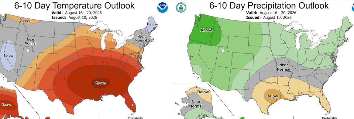
The Climate Prediction Center is expecting well above average temperatures and slightly below average precipitation. They have also outlined the region for a high risk of excessive heat from 8/18 through 8/21. This will mainly be driven by very warm nighttime lows and high moisture content versus outright afternoon highs (though they’ll still be very warm).
Precipitation is harder to forecast but the general pattern will allow for some pop up storms in the afternoon but widespread consistent rainfall looks unlikely.
Day-By-Day Forecast
Tonight- Thunderstorms die off early. Decreasing clouds with a low in the mid 70s. Fog is possible near sunrise.
Tomorrow- Sunny with a high in the mid 90s. A very low but not zero chance for an afternoon storm or two.
Tomorrow Night- Mostly clear with a low in the mid 70s. No rain but fog is possible in the am hours.
Wednesday- Sunny with a high in the mid 90s. No rain.
Wednesday Night- Low in the mid 70s and mostly clear. Dry but fog is again possible around sunrise.
Thursday- Sunny and dry with a high in the upper 90s.
Thursday Night- Mostly clear with a low in the mid 70s. No rain.
Friday- Sunny with a high around 100. No storms expected.
Friday Night- Dry with a low in the mid 70s. Minimal cloud cover.
Saturday- Sunny with a high around 100. No precip expected.
Saturday Night- Mostly clear with a low in the mid 70s with no rain.
Sunday- Sunny with a high in the low 100s. Isolated afternoon storms possible.
Sunday Night- Mostly clear with a low in the mid 70s. Dry but humid.


