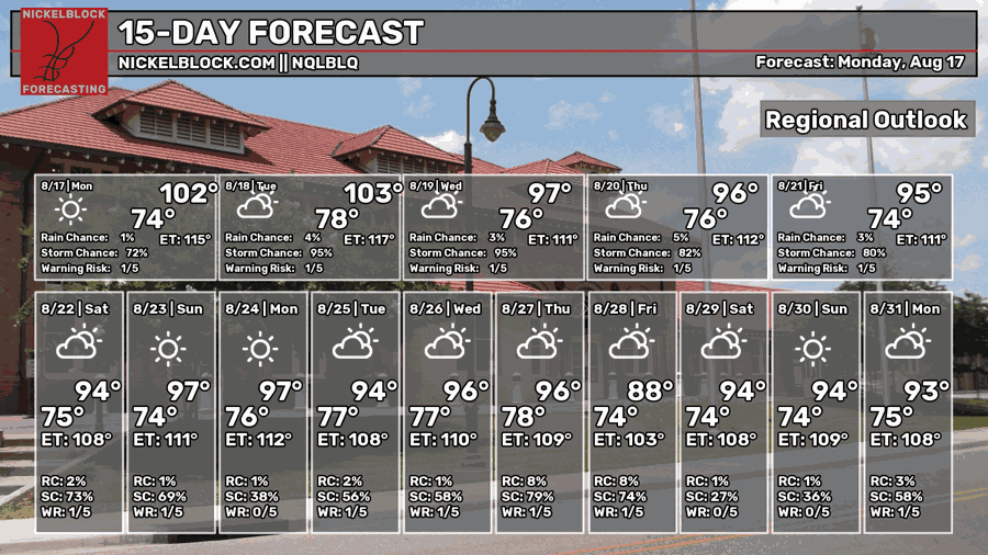
After coming out of my truck to go back to work, the amount of heat felt like a barely penetrable wall of air I was walking through to make it to the back door of the engineering building. Top that off with a lot of sun, it made for unbearable heat pretty early in the day. It’s August, and we know what to expect for this time of year, but you still feel it. Thankfully for us in the Pine Belt, a few thunderstorms have popped up with clouds to cool us down a bit before the sun sets. What I described is basically your entire upcoming work week.
It also reminded me of this scene from “Rookie of the Year”


Today and Tonight
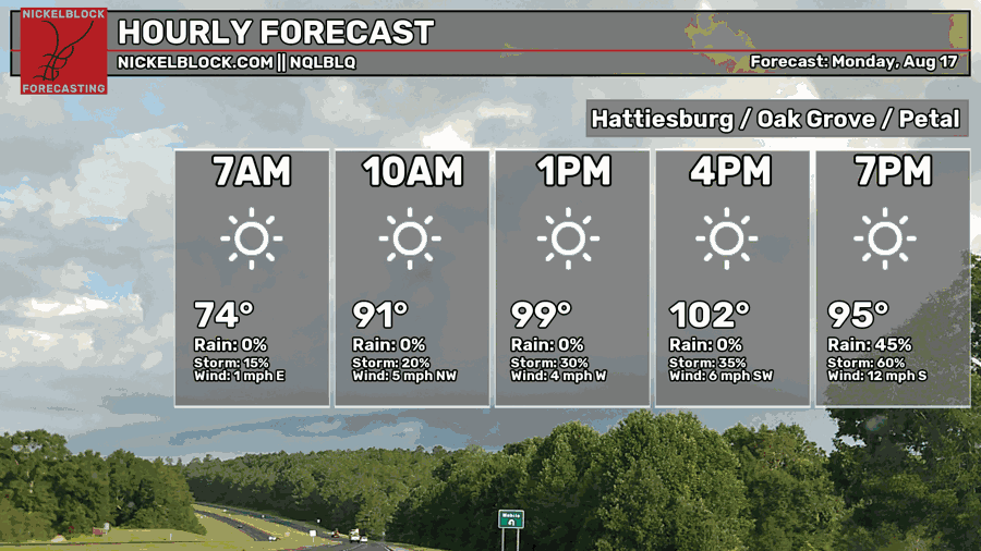
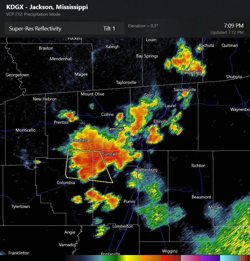
While the NQLBLQ model didn’t pick up on the the timing of the afternoon thunderstorms, I think it’s safe to say we hit the 100 mark today. Afternoon thunderstorms have formed over the past few hours and will rain themselves out around sunset. This has and will lower the overall temperature in some areas as the rain passes through. Afterwards, we’ll have a muggy night with the temperature in the mid 70s.

Tomorrow
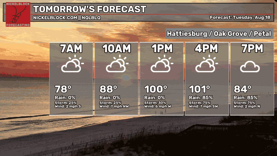
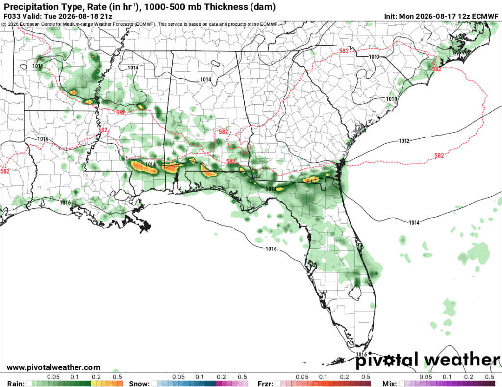
Another rinse and repeat day is likely tomorrow as we start off muggy with partly cloudy skies. The clouds won’t be enough to keep the heat away as we’ll reach the low 100s in most of the Pine Belt with the experienced temperature shooting to 110. Yeah, really hot! Dangerously hot! The wind won’t be much of a help either since it’s just blowing hot air around. By the mid-afternoon, we can expect another round of thunderstorms moving in from the coastline. The air in the upper levels will help drive the storms southward, but they’ll be scattered across much of the Pine Belt and the Coast. The storms will hang around and eventually dissipate by the late evening. Lows will fall into the mid to upper 70s.
Wednesday
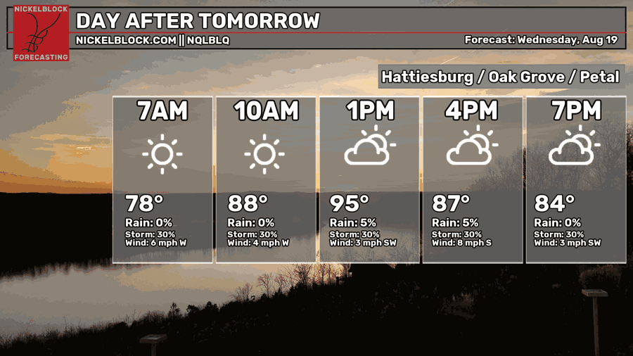
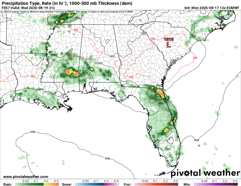
The temperature will vary a bit across the MS/AL/LA coastline depending on where the thunderstorms develop. Overall temperatures will be in the upper 90s with the heat index in the upper 100s, so still a hot day. Afterwards, another round of storms will develop from the sea breeze and move their way into the Pine Belt in the mid-afternoon and hang around until sunset. Lows in the mid 70s.
Heading to the Weekend
Not much is going to change for us in terms of heat, but a stationary front we’ve been dealing with will be replaced by another stationary front. The tail end of the front will push storms in from the northeast. Otherwise, the high temperature will reach the mid to upper 90s each day with the heat index in the mid 100s.
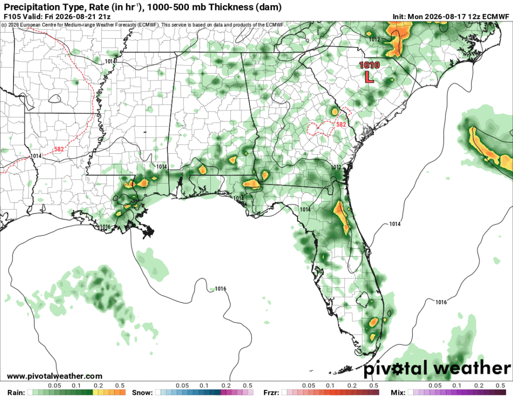
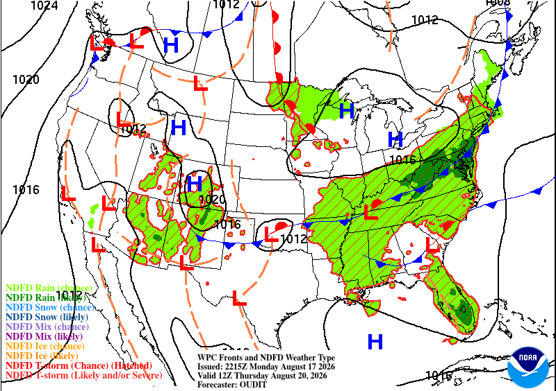
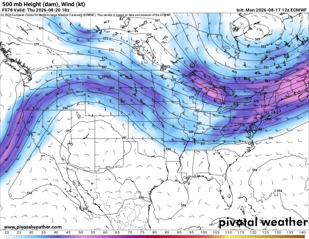
Looking at both maps above, there isn’t going to be much of a pattern shift for a while and that ridge you see over Arizona and New Mexico won’t be moving much either. It’ll ebb and flow across the southwest, but won’t make any significant movement for a while. That means we’ll be stuck in a pattern of dry upper levels and humid low levels, feeding our hot and daily thunderstorm cycle for several more days.