Hey everyone! Let’s get into the national outlook for this week!
Today’s Overall Setup
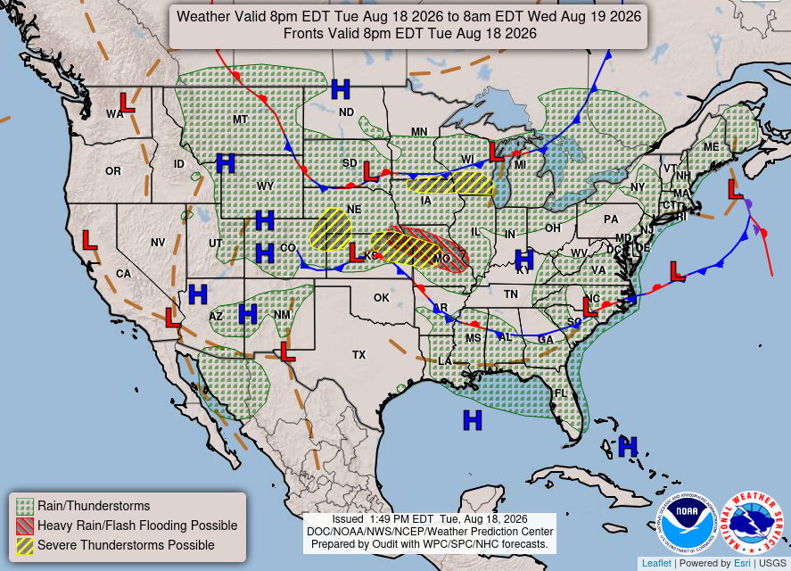
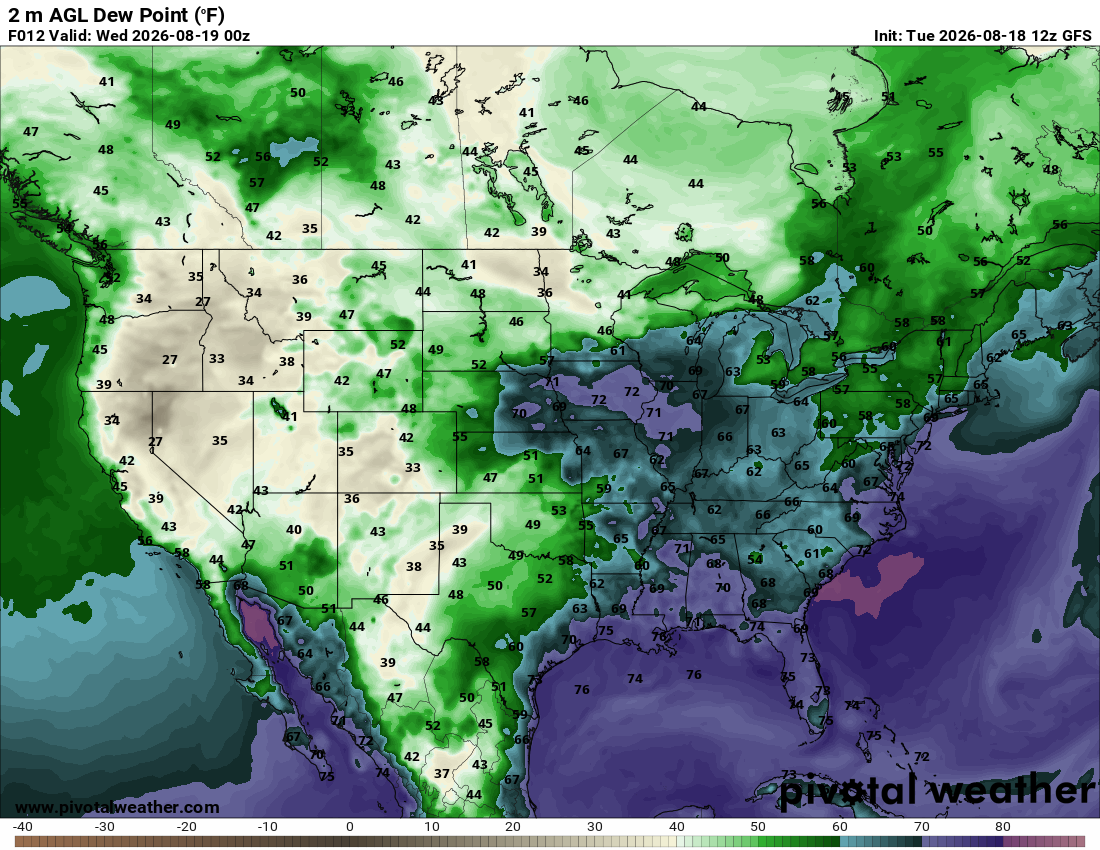
We have a pretty active setup across much of the country today. Showers and thunderstorms will stretch from the northern Rockies through the Midwest and into the Northeast. Some of the stronger storms could turn severe from Nebraska into Iowa, Kansas, and Missouri, with damaging winds and large hail possible. Heavy rain could also cause some localized flash flooding, especially across eastern Kansas and Missouri. Farther south, scattered storms will develop along a stalled front across the Southeast, while much of Texas and the West Coast stay mostly dry.
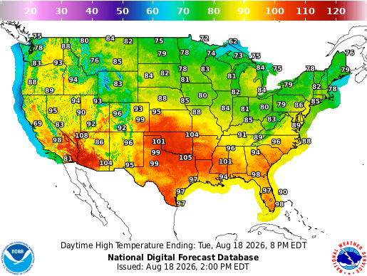
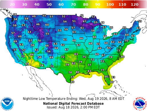
Temperatures will be all over the place today. The hottest weather will remain across the southern Plains and Southwest, where highs will climb into the upper 90s and low 100s. Much of the Southeast will reach the upper 80s and 90s, while cooler 70s and 80s settle across the northern tier. Tonight, lows will drop into the 40s and 50s across parts of the Rockies and northern Plains, with mild and muggy 70s lingering across the South.
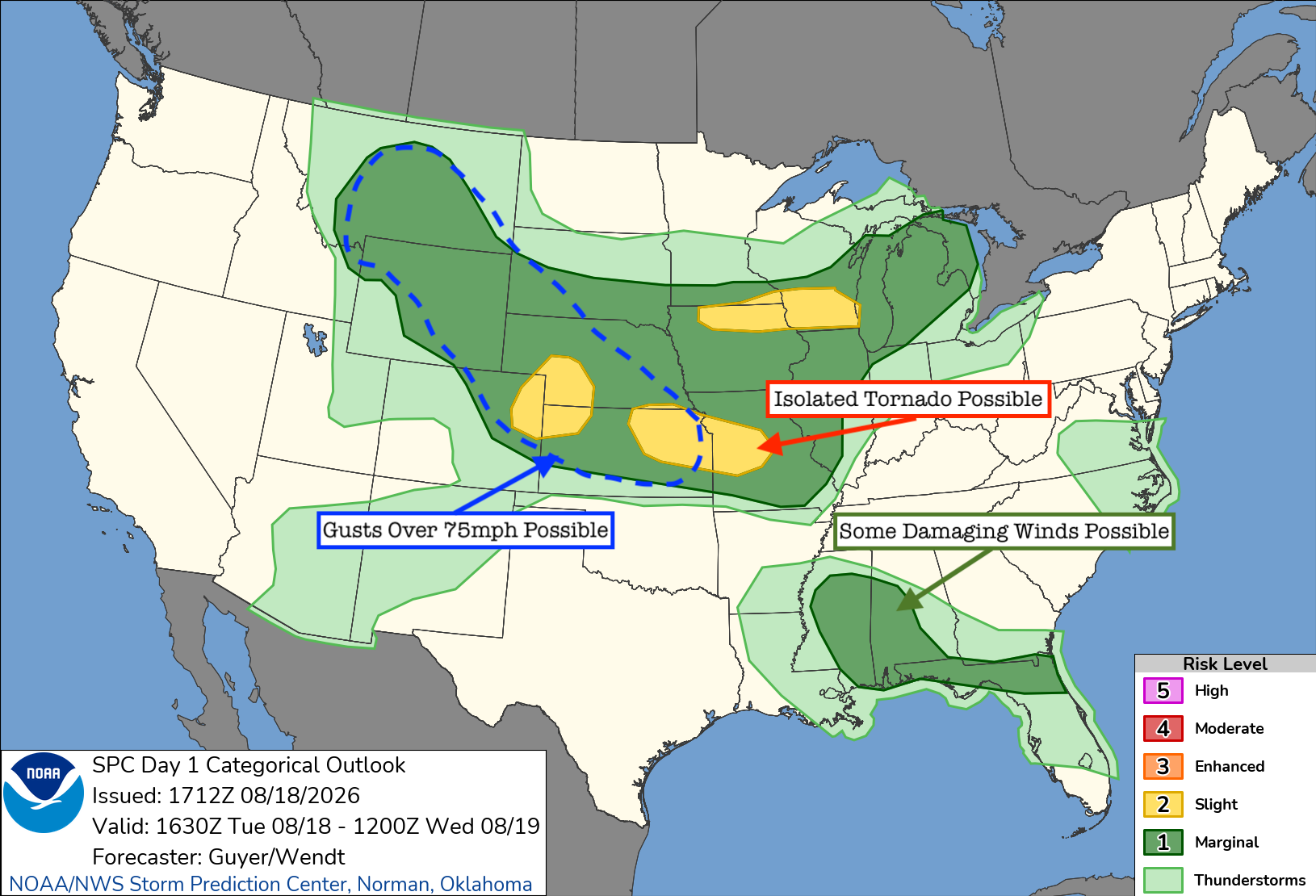
There are a few areas to watch for severe weather later today. The main focus will be from Kansas, northeastern Colorado, and Nebraska into Missouri, where storms may organize into a larger complex this evening. Damaging winds will be the main concern, along with large hail and an isolated tornado.
That hatched blue area above, which goes from Kansas to Montana, shows an area where gusts up to 75 mph are possible, stretching far from the level 2 risk. When this happens, it means that the SPC has some uncertainty about whether storms will fire and produce damaging winds, but thinks that if they do, they could be very strong.
Another round of strong to severe storms is possible across Iowa, Wisconsin, and Michigan. Farther south, scattered storms across Mississippi, Alabama, and northern Florida could produce some locally damaging wind gusts.
Wednesday’s Weather
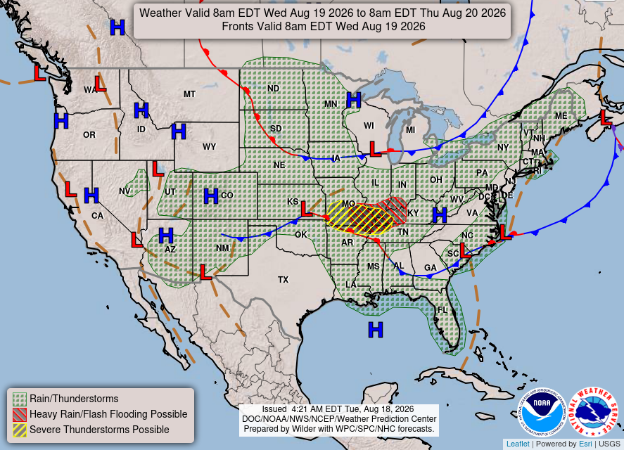
Heading into Wednesday, the main focus will shift into Missouri, Kentucky, and Tennessee, where more storms are expected along a stalled front. Some of these storms could become severe, with heavy rain also leading to a flash flooding threat. Elsewhere, showers and storms will be scattered from the northern Plains into the Northeast, across parts of the Southeast, and throughout the Four Corners. Much of the West Coast and Texas will stay dry once again.
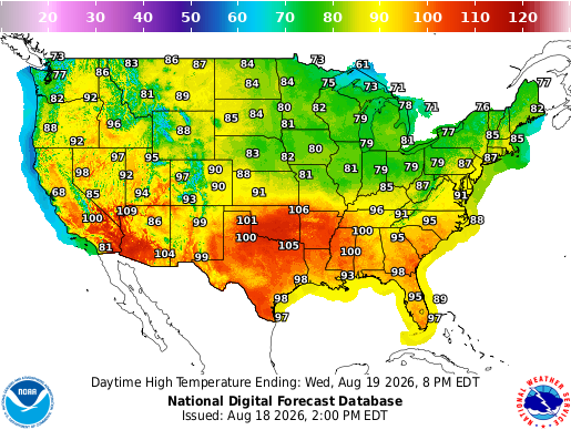
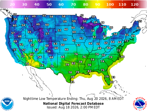
The heat will continue across the southern half of the country on Wednesday. Highs will reach the upper 90s and low 100s from the Southwest through Texas and into parts of the Deep South. Temperatures will be a little more comfortable farther north, with mostly 70s and 80s from the northern Plains into the Great Lakes and Northeast. Wednesday night will be cool across the northern Rockies and Plains, while warm and muggy conditions continue across the South.
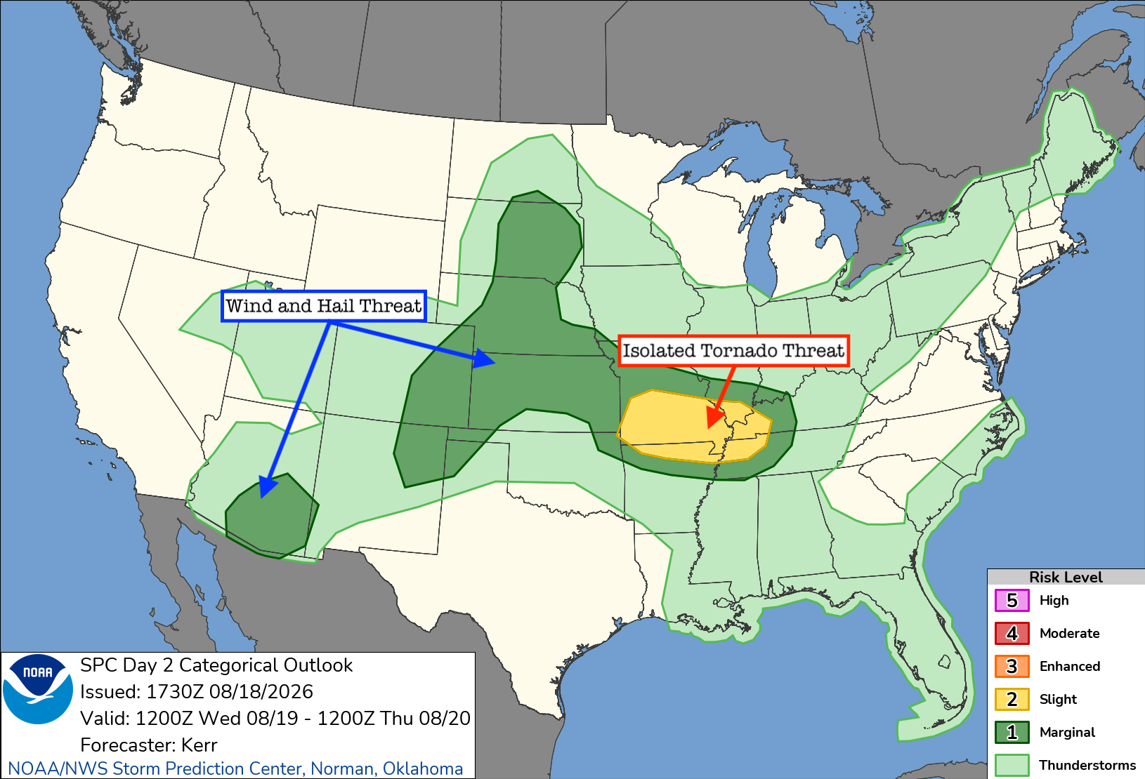
For Wednesday, the main area to watch will be from southern Missouri and northern Arkansas into southern Illinois, western Kentucky, and Tennessee. One or two clusters of storms may develop and track through the region, bringing the potential for damaging winds, hail, and an isolated tornado, especially near where that warm front lifts north. Strong storms will also be possible from the central Plains into the Rockies, along with parts of Arizona, where gusty winds and hail will be the main concerns.
CONUS Weekly Temperature & Precipitation Outlook
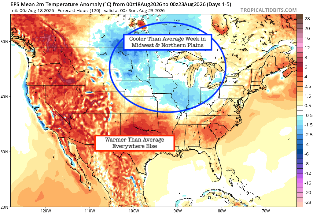
Here’s a look at the EPS modeled temperature anomalies through Sunday. Red indicates above-average temperatures on average for the week, white indicates average temperatures, and blue indicates below-average temperatures.
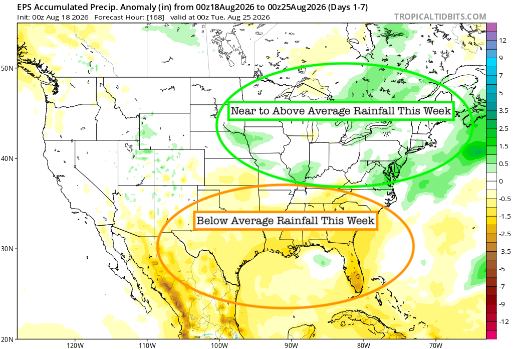
Here’s a look at the EPS modeled precipitation anomalies through next Tuesday. Green indicates above-average precipitation, white indicates average precipitation, and yellow indicates below-average precipitation. Let’s look into the details by region:
Weekly Outlook: Western & Central United States
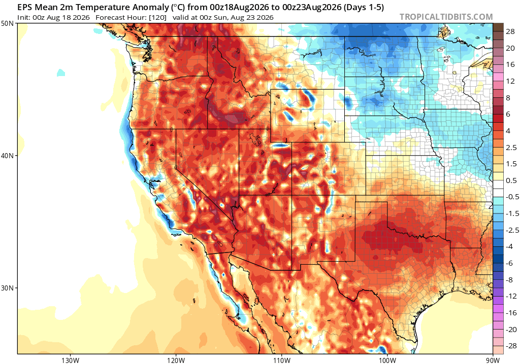
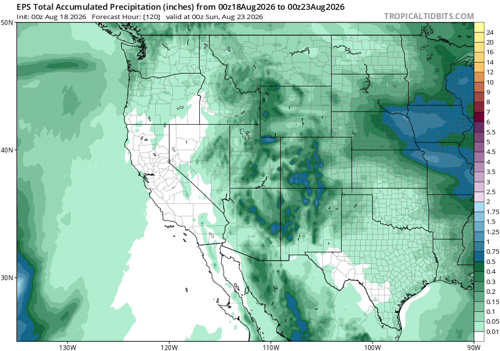
The heat will stick around across much of the West and southern Plains through the rest of the week, with temperatures running well above normal. Monsoon moisture will also increase across Arizona and the Four Corners, bringing better chances for storms and some strong wind gusts. Farther east, rounds of showers and storms will continue from the Rockies into the central Plains, with some areas picking up decent rainfall through the weekend. Cooler-than-normal weather will settle into parts of the northern Plains.
Weekly Outlook: Eastern United States
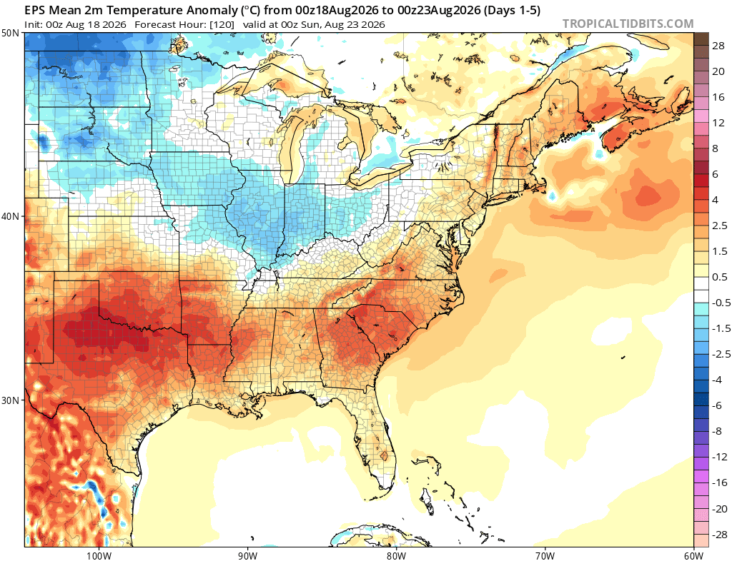
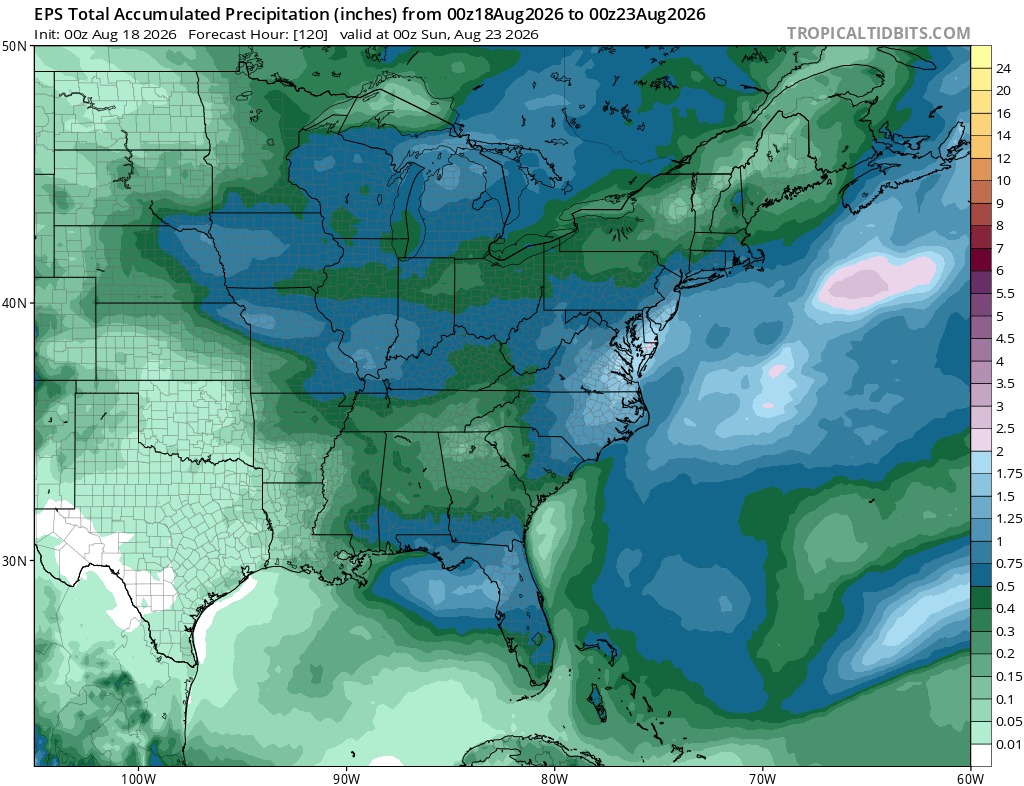
Across the eastern half of the country, troughing across the north will dip farther south through the week, bringing cooler-than-normal temperatures into the Midwest, Great Lakes, and Ohio Valley. The heat will hold on longer across the Southeast, where temperatures will remain above normal. Rounds of showers and storms will also move through the Midwest and Ohio Valley, with additional scattered storms across the Southeast through the weekend.
Remember, just because a region is considered “below average” for the week, it does not mean that there will not be rain, or even daily rain… It just means that the total of all of the rain that does fall will be less than usual, so we can still have daily hit-or-miss thunderstorms!
Extended Outlook
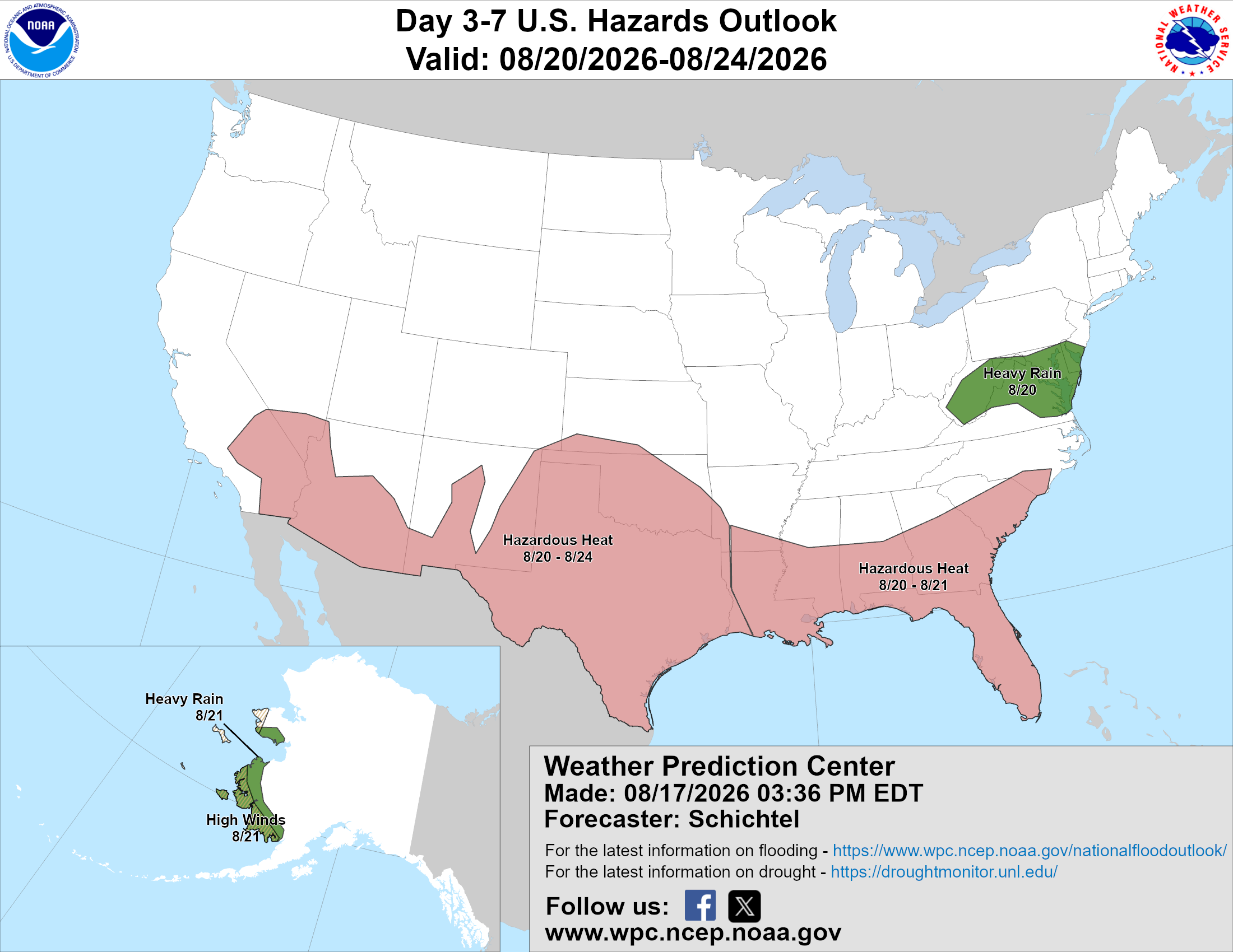
Above is a look at the U.S. Hazards Outlook from NOAA, highlighting areas of more impactful weather to be aware of over the next 3 to 7 days.
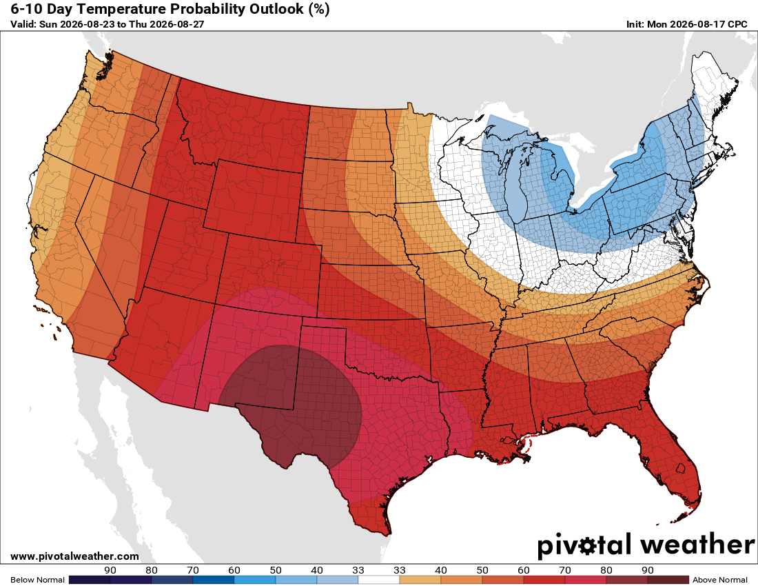
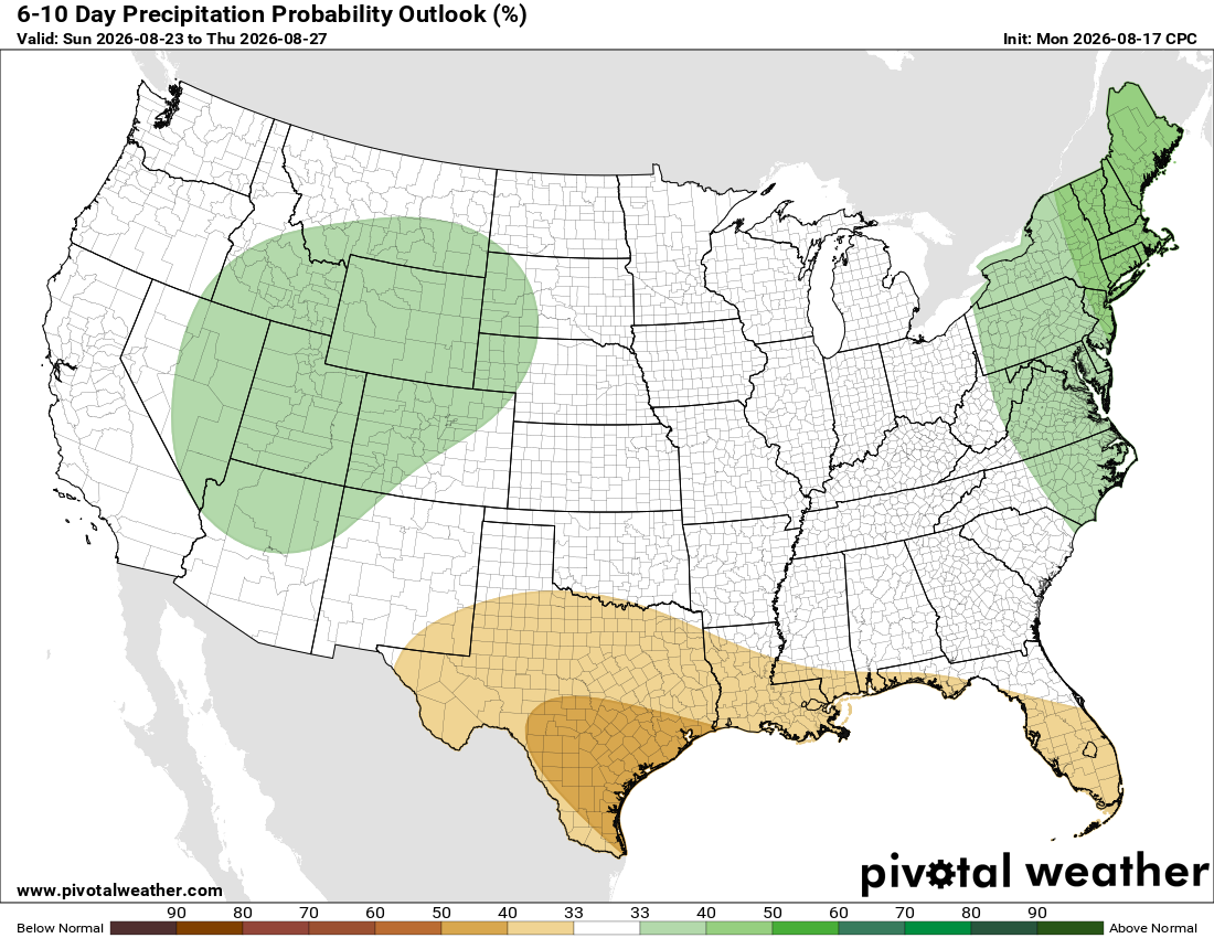
Looking ahead to next week, ridging across the West will favor above-normal temperatures across much of the West and South. Meanwhile, troughing dipping into the East will bring cooler-than-normal temperatures around the Great Lakes and Northeast. Wetter conditions are favored across the Rockies and East Coast, while drier weather is more likely along the Gulf Coast.
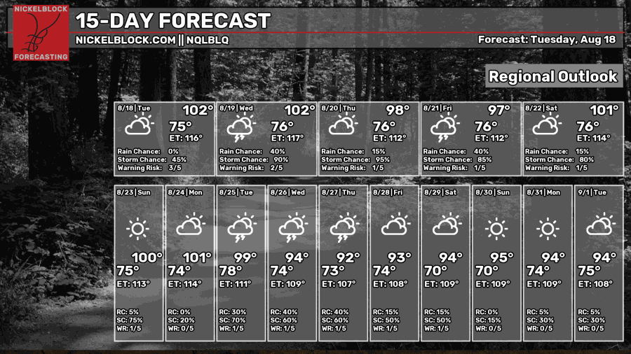
Thanks for tuning in to this National Forecast! Tune in to our local, tropical, and regional forecasts to stay up to date on the latest!


