Hey everyone! Now that the interns are done with their hard work for the summer, Noah and I are back to giving you all the local forecasts!
The Setup
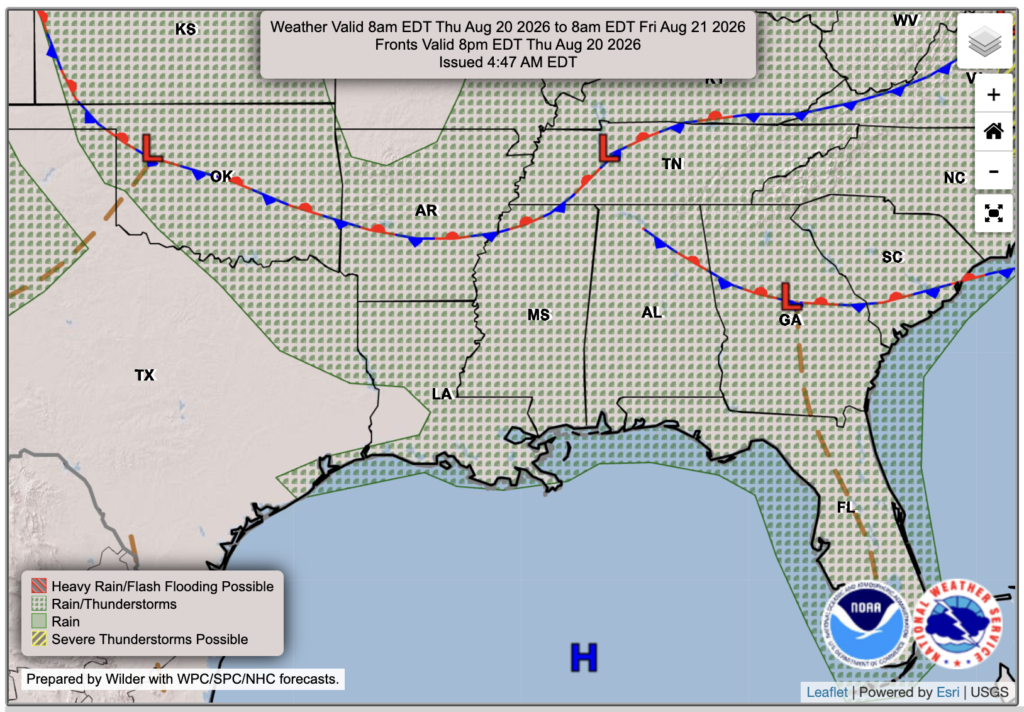
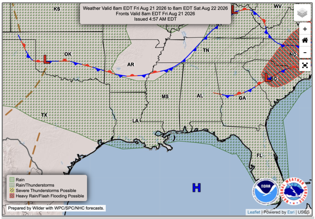
The overall setup for the Southeast includes a stalled frontal boundary over the Lower Mississippi Valley, with a lot of moisture on the south/warm side. Through the afternoon and into the evening today, moisture convergence and daytime heating will bring scattered pop-up thunderstorms to our region, bringing the risk of some severe wind gusts and heavy downpours. A similar setup is in play for Friday, since the front doesn’t really move an inch!
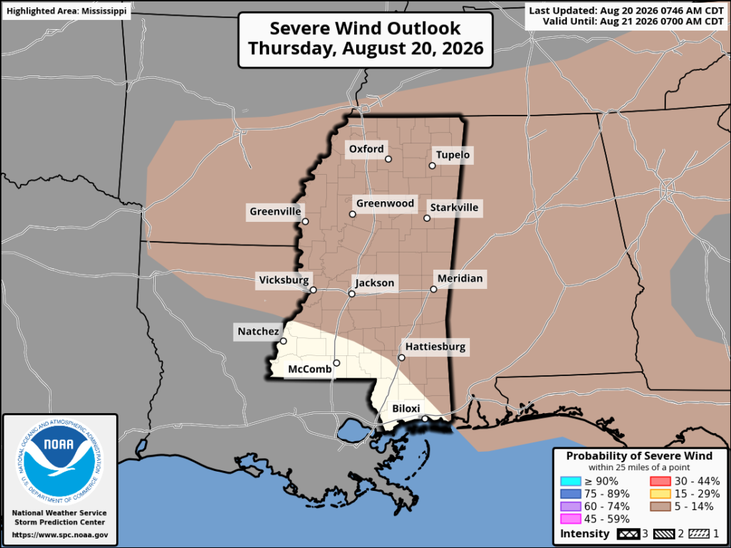
The SPC has our region under a Marginal (level 1 out of 5) risk of severe weather with those storms later today, but it’s primarily wind-driven risk. We are under a small 5-14% probability of severe wind within 25 miles of a point; small, but still possible with stronger storms. Tornado risk looks very slim, but wind and maybe some hail, along with downpours, are possible later today.

Today’s Forecast
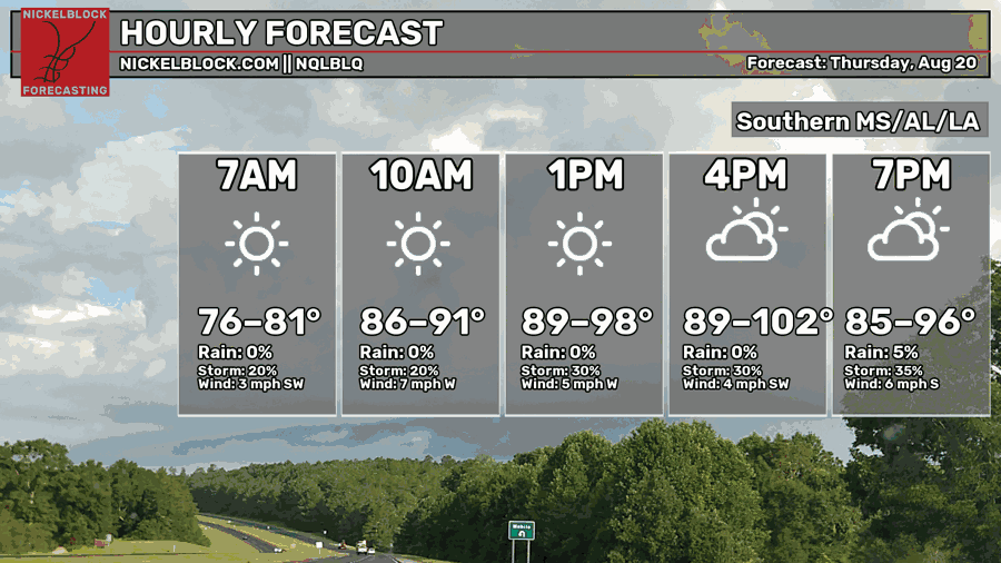
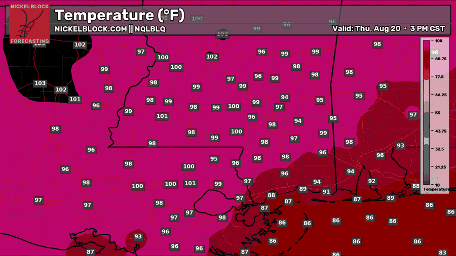
Temperatures will soar above average again today, prompting the NWS to issue a Heat Advisory for our region. Mainland temperatures will reach around 100, with heat indices up to 110 in some spots. That’s dangerous heat, and you don’t want to be out for long periods without hydrating and keeping your body cool.
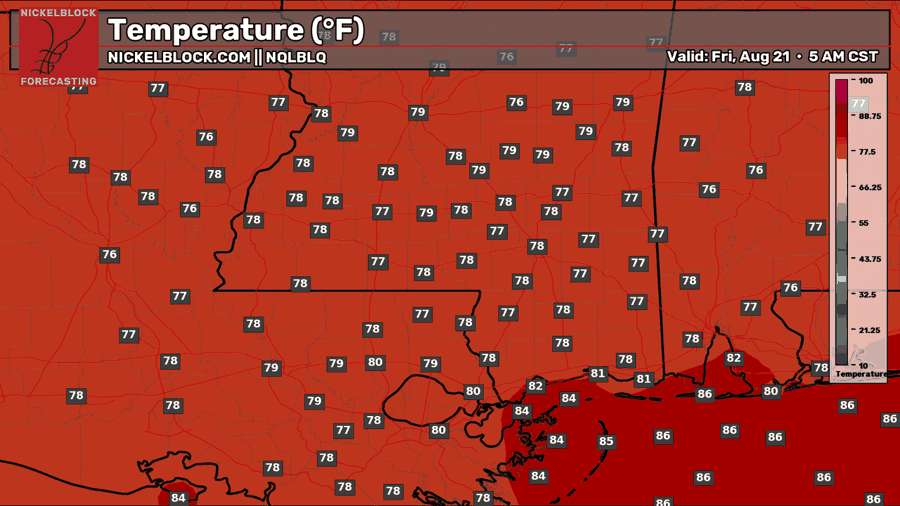
We’re all sun with some clouds for the start of the day into the early afternoon, but after 3 or 4 PM is when we could get those pop-up thunderstorms. It is a fairly isolated threat, but if you happen to be under one of these cells, you know how it could affect any outdoor plans you have. Keep an eye out on our app and the radar!

Tomorrow’s Forecast: Friday, August 20th
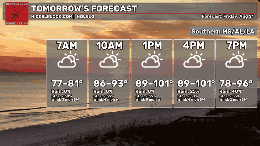
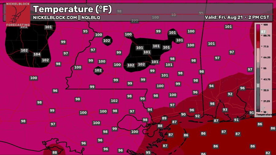
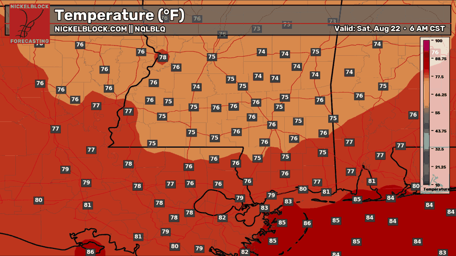
We’ll see temperatures in the low 100’s yet again tomorrow, with a similar chance of thunderstorms after 3 PM. The SPC doesn’t have any severe outlook for our region, but I can see them adding a small wind risk again for tomorrow. It looks like there will be a little more storm coverage than today, but it will still be sunny before they roll in. You may need to bring your umbrella to any outdoor plans tomorrow evening.
Saturday’s Forecast
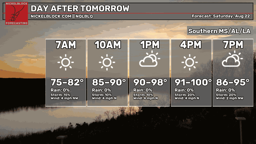
Saturday looks bright, sunny, and still hot! Some isolated storms are possible in the afternoon and evening, but the chance is much lower than today and tomorrow. Looks like a great beach day to me!

Extended Local Outlook
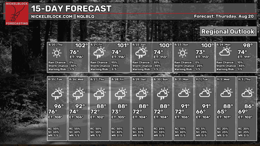
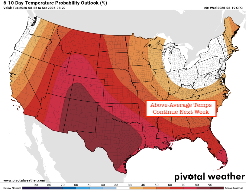
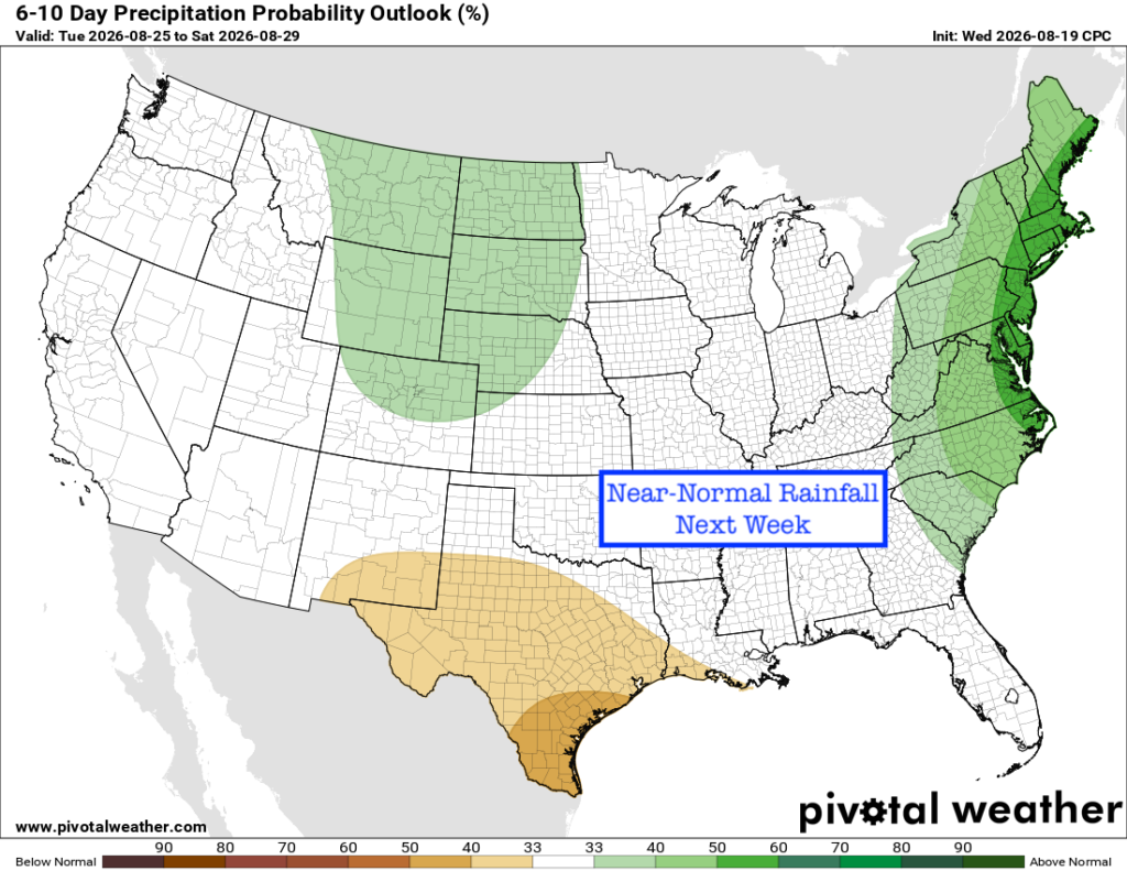
Looking ahead to next week, the ridge to our west isn’t going anywhere, allowing temperatures to continue to soar above average. As for rainfall, there isn’t a signal for any repeat rainmakers, so the typical summertime thunderstorm chance is there pretty much every day next week. We will fine-tune as we get closer.


