Current Watches and Warnings
Isaias is now a tropical storm in the Gulf, and we have a few watches to talk about. Hurricane watches are in place for parts of coastal Mississippi, southwestern Alabama, and the Florida Panhandle. Tropical storm watches are also in place for parts of southeastern Louisiana, the western Mississippi coast, and Florida’s Big Bend. A storm surge watch covers portions of the coastline from southeastern Louisiana through the Florida Panhandle and Big Bend. I’ll talk more about the forecast and what this means for us below.
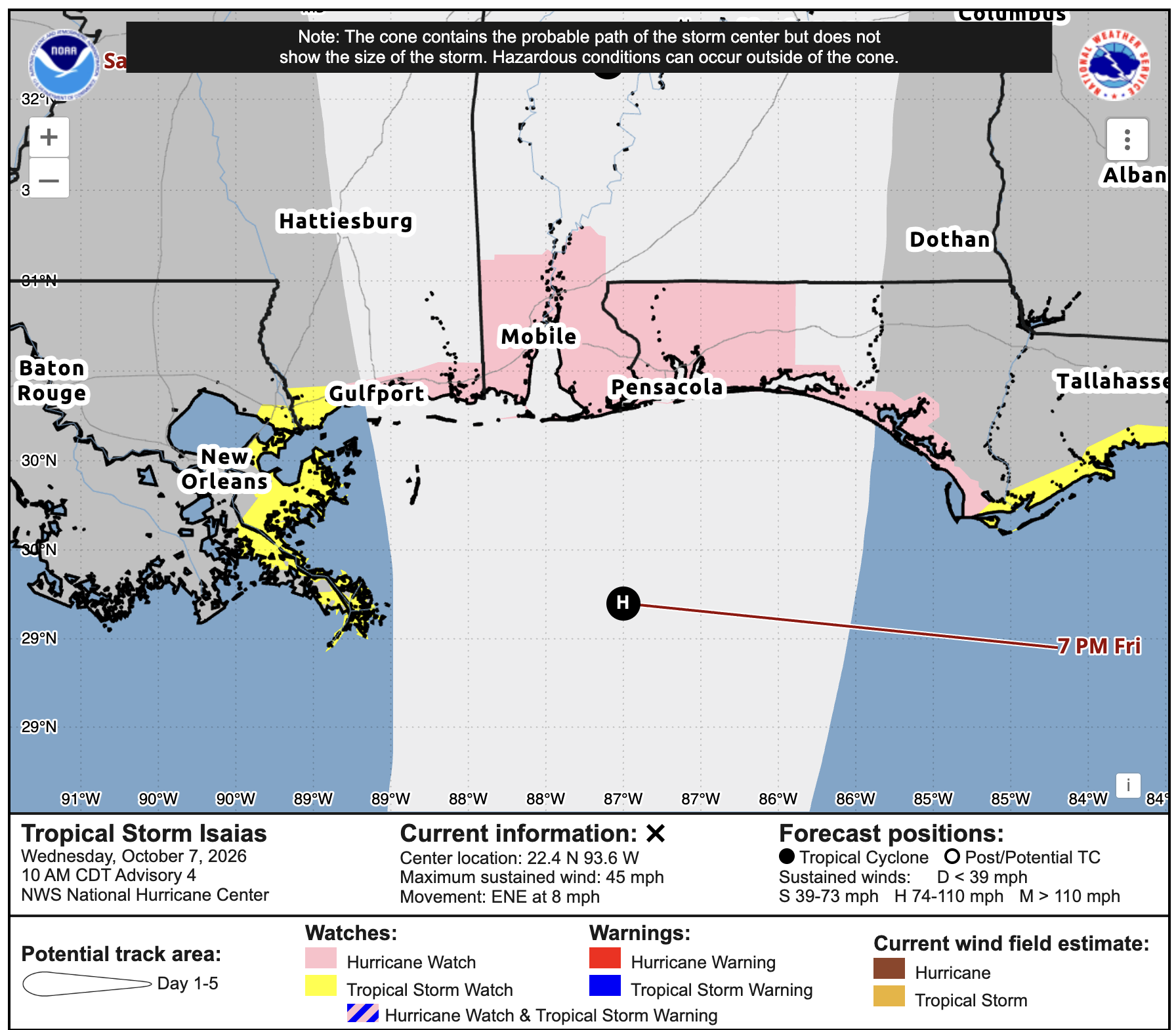
TROPICAL STORM ISAIAS
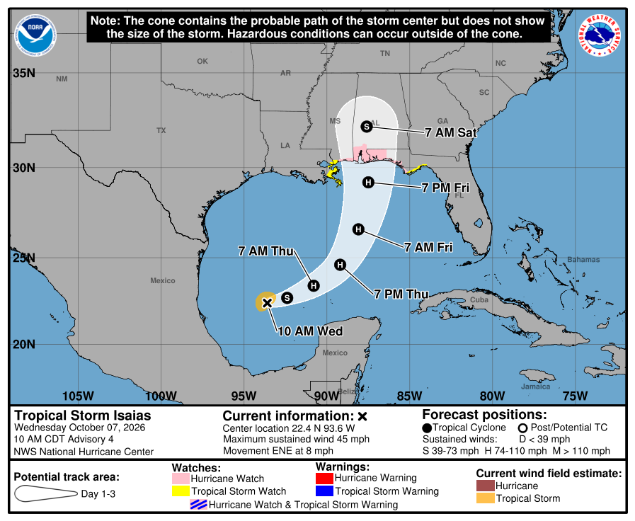
As of the 10 AM CDT update, Isaias has sustained winds of 45 mph and is moving east-northeast at 8 mph. The National Hurricane Center expects it to strengthen into a hurricane by Thursday morning, then turn north toward the northern Gulf Coast on Friday.
The current forecast brings the center toward the coast Friday night into early Saturday, but the exact landfall location is still uncertain. Remember, the cone only shows where the center could track. Rain, wind, and storm surge can affect areas outside of it, too.
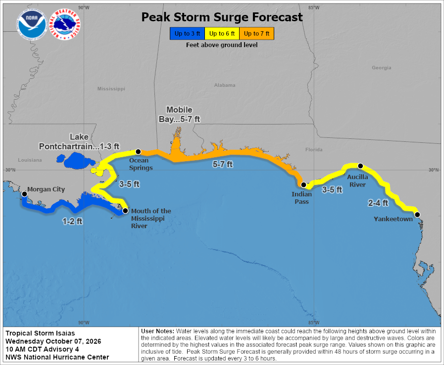
Storm surge is something we’ll need to watch along the coast, too. Right now, the forecast calls for 5–7 feet of water above ground level from Ocean Springs to Indian Pass, including Mobile Bay. Farther west, 3–5 feet is possible from the mouth of the Mississippi River to Ocean Springs, with 1–3 feet around Lake Pontchartrain.
These numbers could change depending on where Isaias tracks and how strong it gets. A shift in the track could move the highest water levels farther east or west, so we’ll keep an eye on that as the storm gets closer.
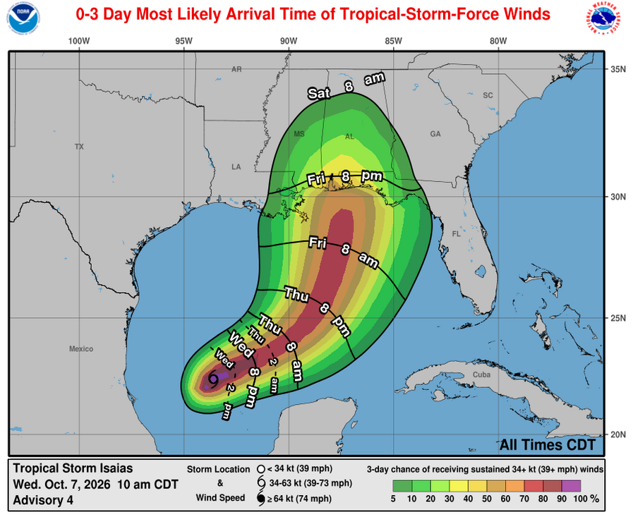
As for timing, tropical-storm-force winds would most likely reach parts of the Mississippi and Alabama coast and the Florida Panhandle Friday evening, then spread inland overnight into Saturday morning.
That timing could still change depending on how fast Isaias moves and where it tracks. This map shows when those winds are most likely to arrive, so don’t treat Friday evening as a guaranteed start time.
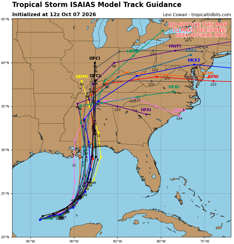
The model tracks have shifted a bit east, more in line with the NHC’s forecast cone, with most now bringing Isaias toward coastal Mississippi and Alabama. There’s still some spread in where it comes ashore, and further shifts could change who sees the strongest winds and highest surge.
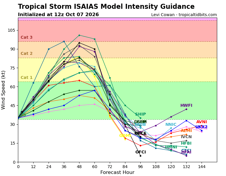
There’s more disagreement on strength. Several models bring Isaias to Category 1 or 2 strength, while others keep it weaker or take it higher. For now, the NHC expects it to become a hurricane, but we’ll need to watch how it organizes over the next day or two.

Tomorrow’s Forecast: Thursday, October 8th
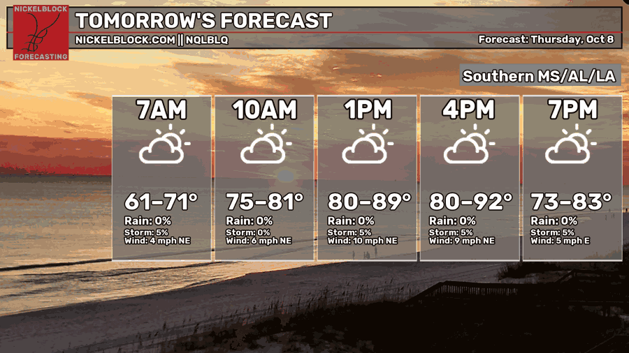
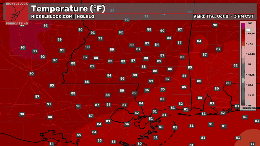
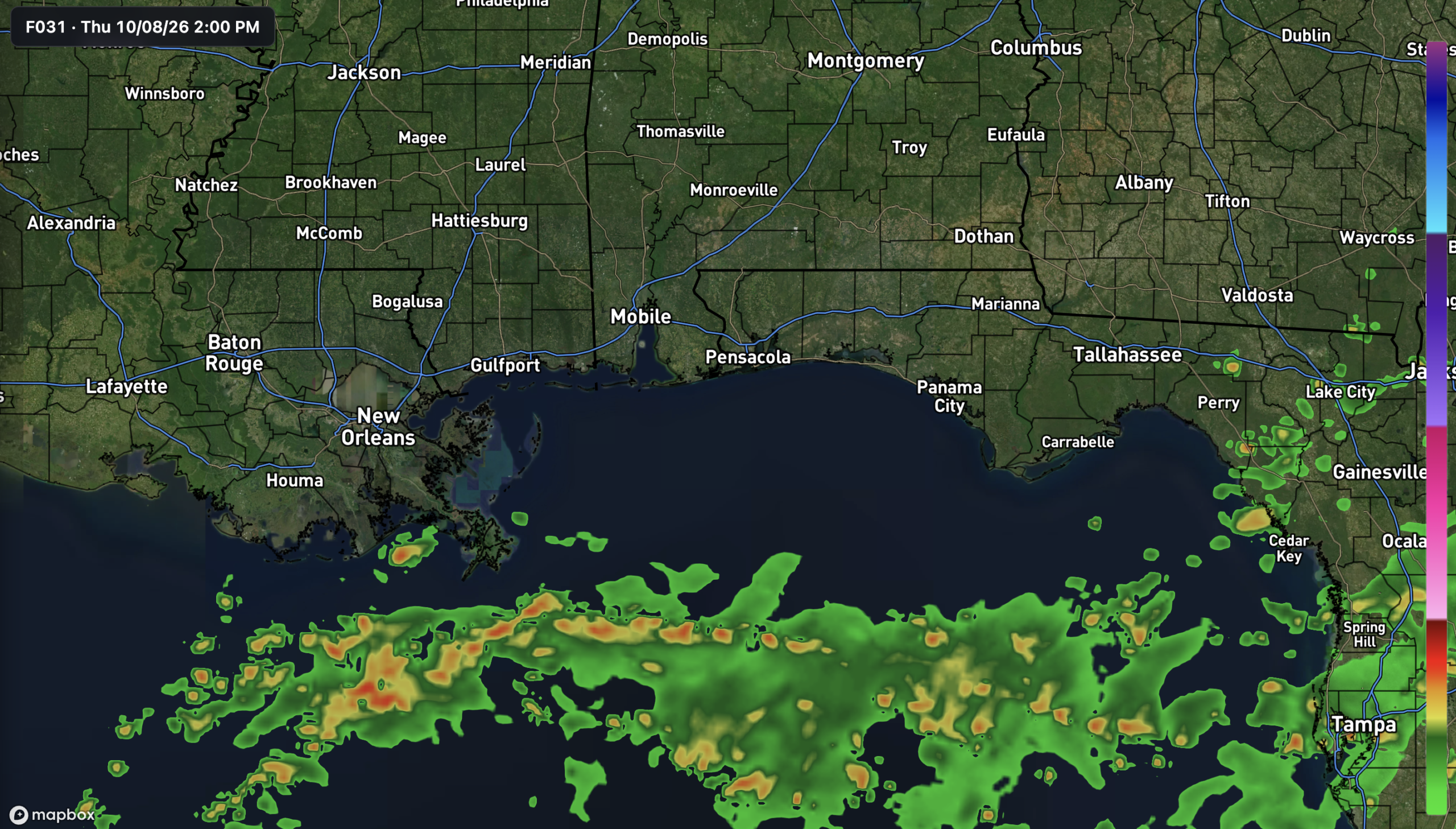
Thursday looks pretty quiet before Isaias gets closer, with a mix of sun and clouds and most showers staying offshore near the stationary front. Highs will reach the upper 80s to low 90s inland, while coastal areas stay closer to the low 80s. With most of us staying dry, it’ll be a good day to get any storm preparations taken care of.

Friday’s Forecast: October 9th
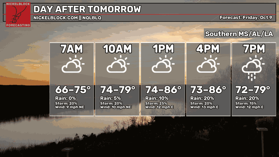
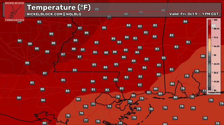
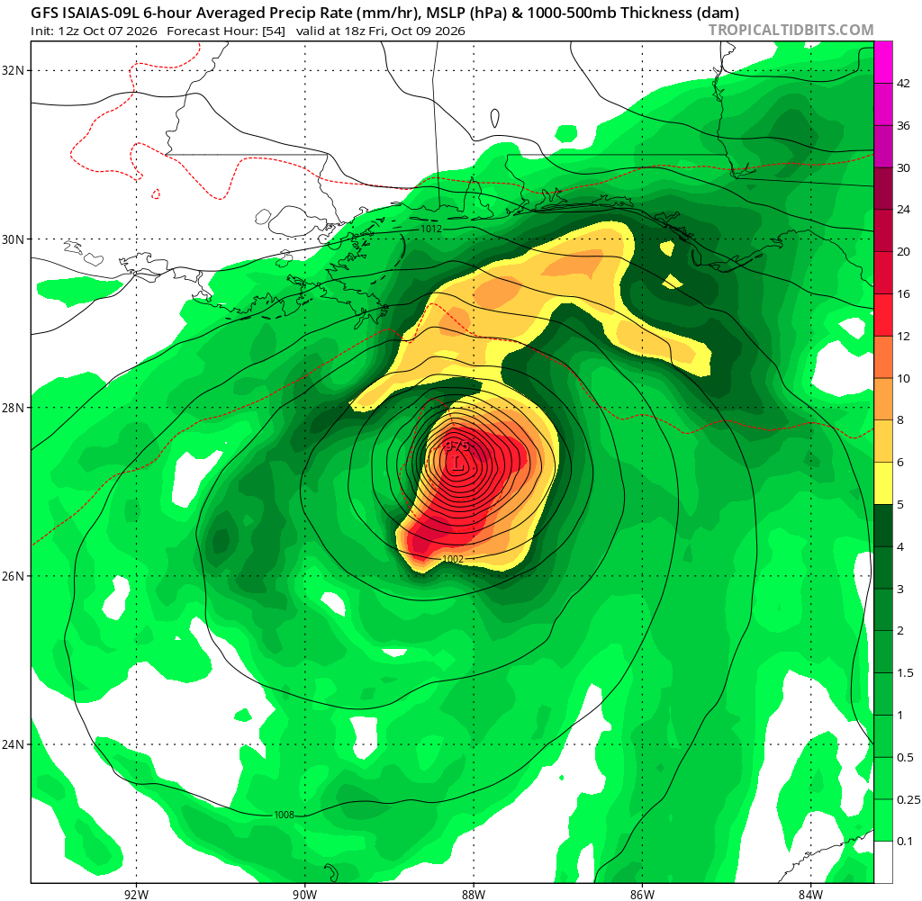
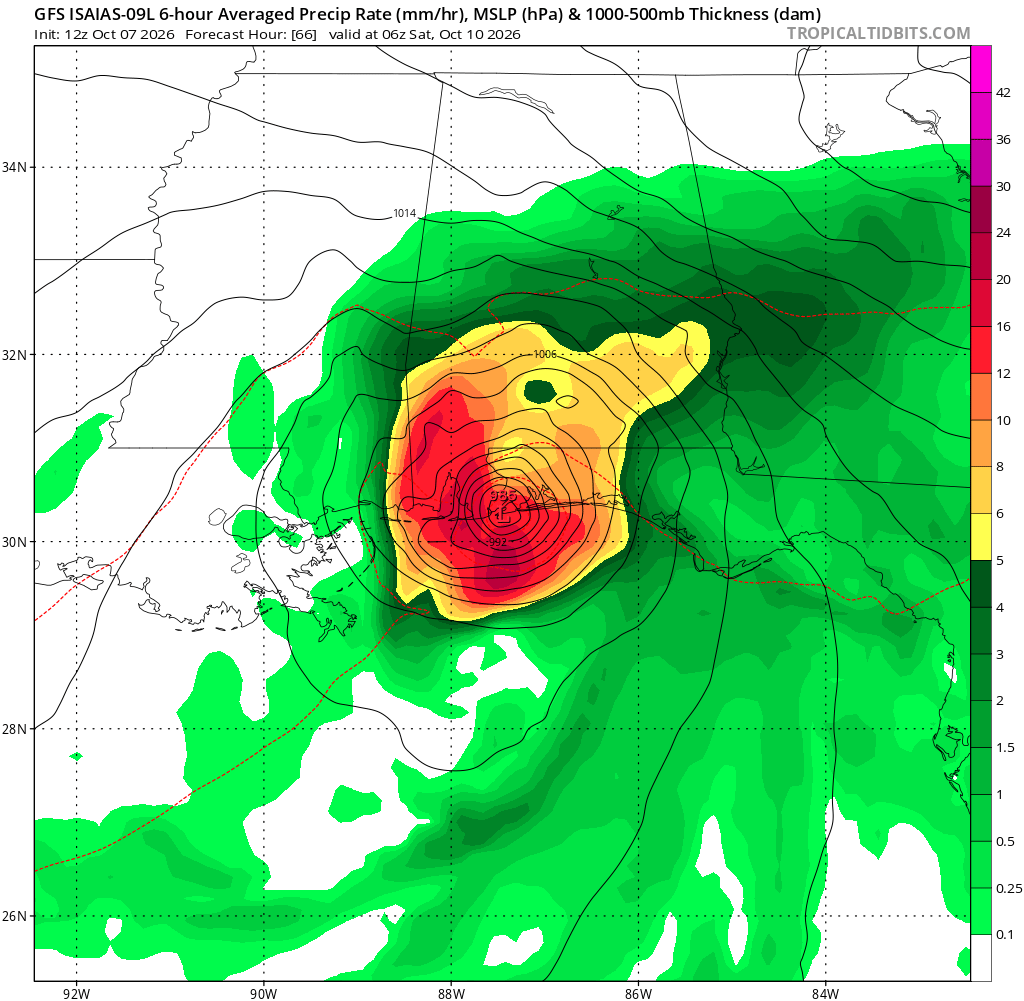
Friday is when things start to change as Isaias gets closer. Highs will be in the low to mid 80s for most of us, with showers spreading inland and winds picking up as we head into the afternoon and evening. The GFS brings heavier rain toward coastal Mississippi and Alabama Friday night, but exactly where that sets up will depend on the track. Conditions could worsen overnight near landfall, so don’t let a quiet start to Friday fool you.
Extended Local Outlook
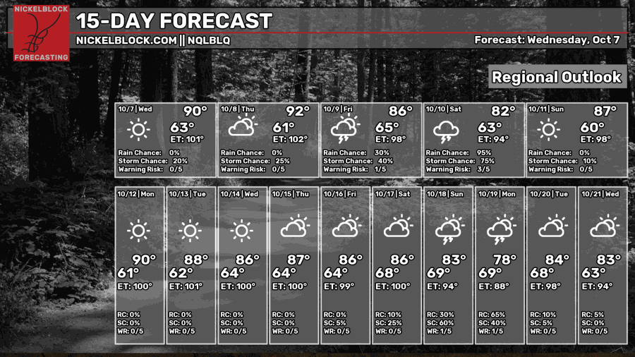
Saturday will likely be a wet and windy day as Isaias moves inland. Heavy rain and tropical-storm-force winds are possible, with hurricane-force winds closer to the coast depending on how strong it gets and where it comes ashore.
We’ll also need to watch for a few tornadoes, mainly east of the center where more unstable air and stronger wind shear could help storms rotate. A lot still depends on the track, but things should improve as Isaias moves away, with sunshine returning Sunday and a mostly dry start to next week. Stay with us through the week, and ensure you are making necessary preparations!


