As Matt and I have mentioned already, there’s not a lot of rain to speak of for our area and there’s a few reasons why. A strong high pressure system from the low to the upper atmosphere will hinder any type of convective development (i.e, rain and thunderstorms) for a while. And I mean a while. It’s not a huge surprise considering October is typically one of our driest months, but considering the drought we already have, it’s more concerning. A strong eastern ridge for this time of year is not great for our average temperatures, but the wind of change (great song by the way) is upon us.

Today
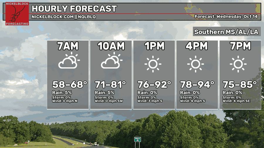
One big thing I missed on Monday’s forecast was the possibility of fog for the next few mornings. We started off with some patchy dense fog across much of the Coast and the Pine Belt this morning that dissipated by mid-morning. This afternoon, the clouds will clear out again and we’ll be back to highs in the upper 80s to low 90s across the region. Winds will be light and variable, mostly out of the south. Overnight, temperatures will fall back into the mid 60s with patchy dense fog likely.

Tomorrow
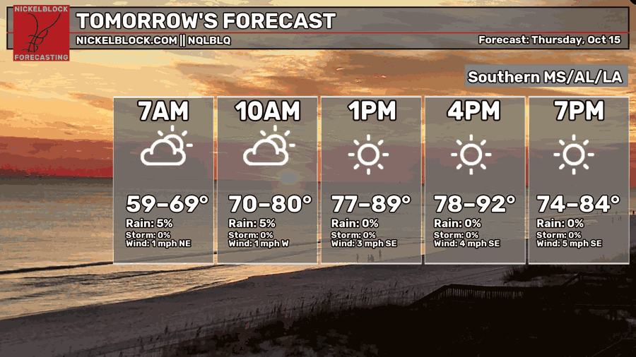
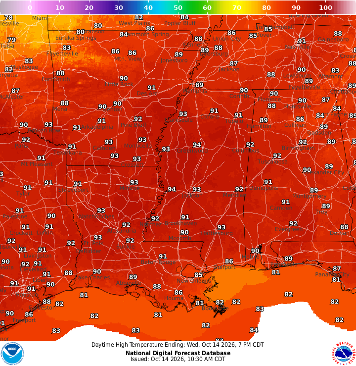
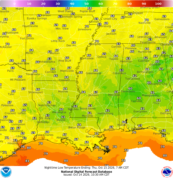
Another foggy morning is upon us on Thursday, so be careful if you’re commuting as some areas can see visibility down to less than a 1/4 mile. Otherwise, it’s a bit more of the same tomorrow with sunny skies and highs in the upper 80s to low 90s. It’ll be another mild night with temperatures falling into the mid 60s and a chance of fog overnight.
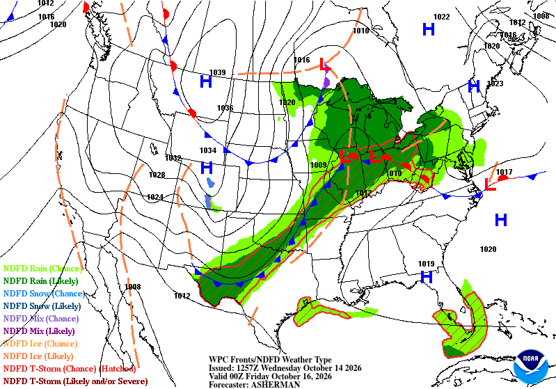
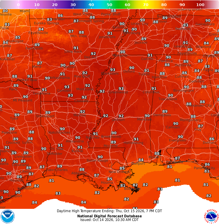
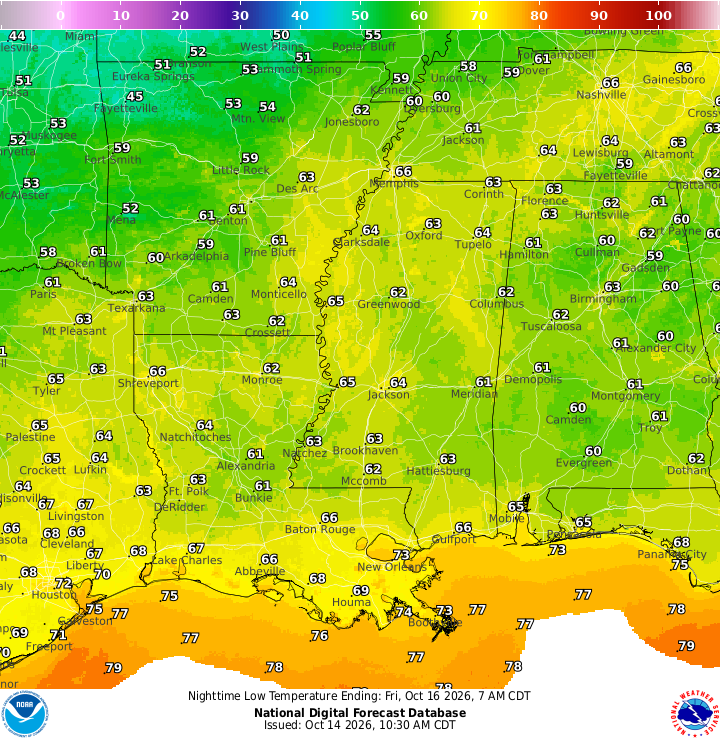
If you look at the Weather Prediction Center map above, you’ll notice a swath of rain that stretches from west Texas to the eastern Great Lakes states. This front is stuck between two large high pressure systems and the moisture will be squeezed out before it reaches the southeastern US. Unfortunate for us, but the high pressure at the surface and the accommodating upper level ridge is quite literally stacked against us. It will move out by Friday and be replaced by the high pressure system in the Rockies.
Friday
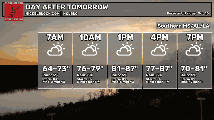
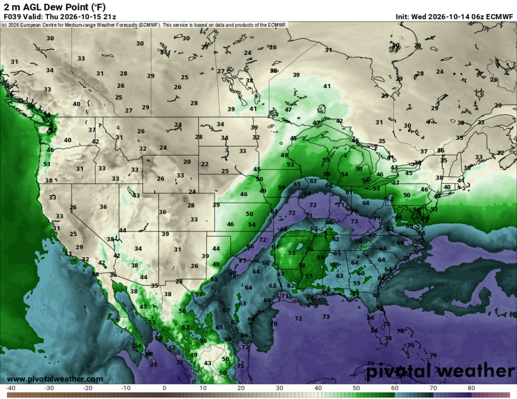
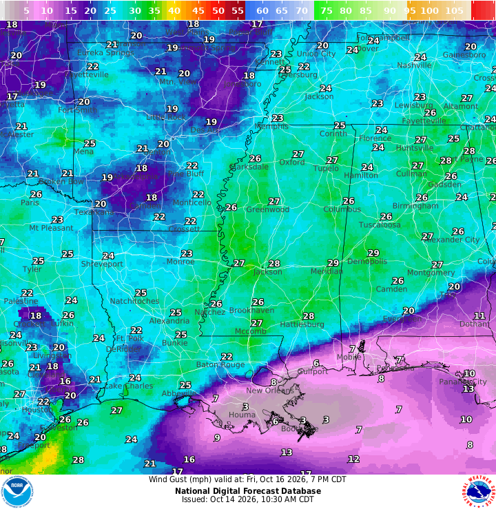
Now Friday is where things get more interesting. The clouds will begin to roll in as the remnants of the system that didn’t make it down here, but the wind will also gust in letting you know this is a bonafide cold front. By the afternoon, the winds will begin gusting into the 20s, so if you’re out and about, bring the jacket or windbreaker! Also depending on where the football is being thrown, you’ll get a decent headwind or tailwind. We’ll feel a decent temperature difference as well. Highs will top out in the mid 80s, but begin to drop as soon as the cold front moves in. Lows in the 50s, y’all!
Blustery Weekend
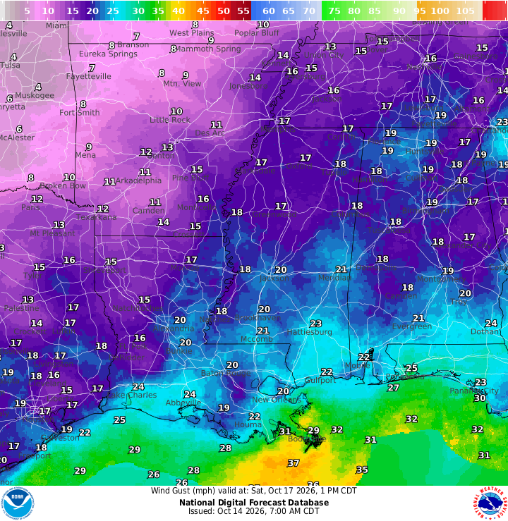
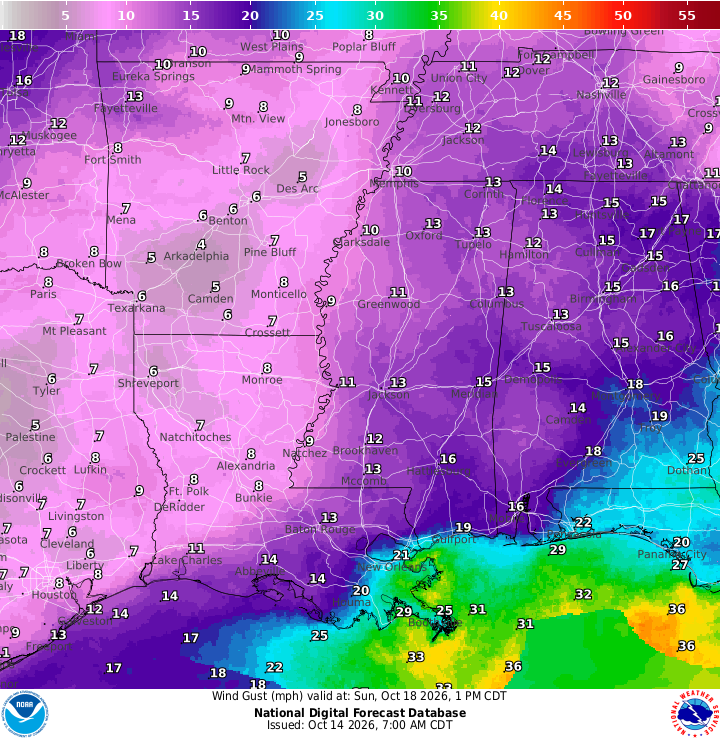
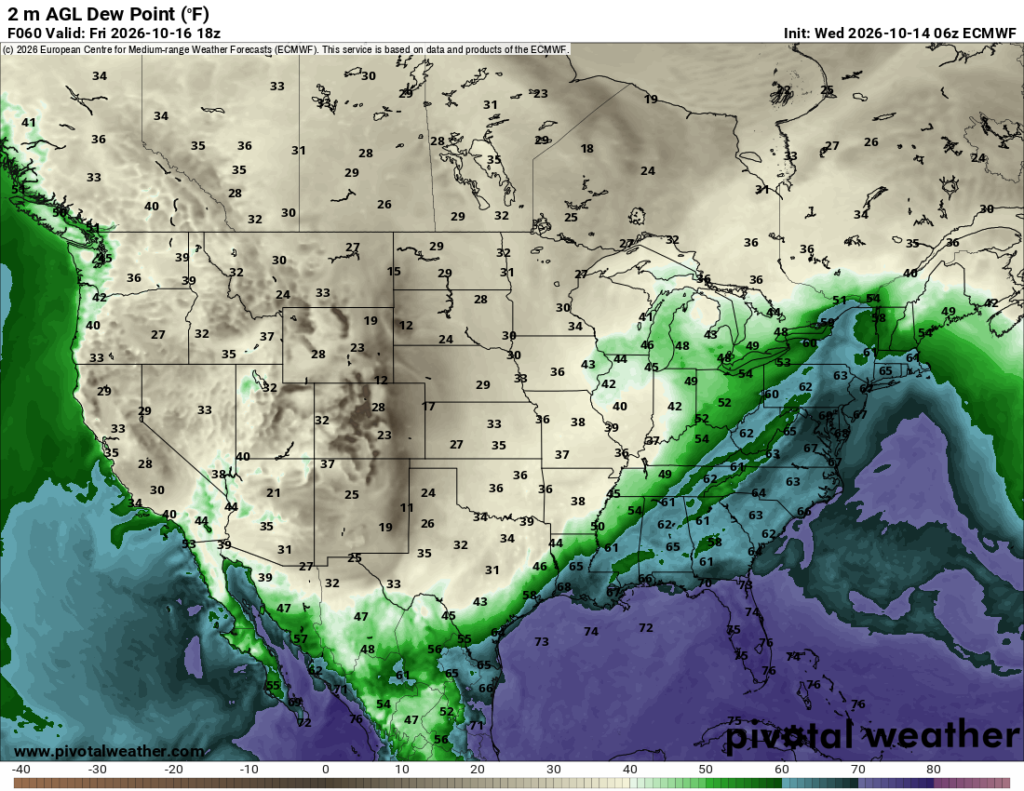
As the front moves out pretty quickly over the next 48 hours, the temperature will shift down about 10 degrees from where we were during the week. From the 80s/90s during the day to the upper 70s/low 80s and that means the wind will blow in from the north. Expect some consistent 5-15mph winds Saturday and Sunday with wind gusts in the 20s-30s. The gusts will die down a bit on Sunday, but we’ll still feel a bit of crispness in the air. Lows will also fall into the 50s and maybe even the upper 40s for some of us! It’ll feel like Fall! For a few days at least.
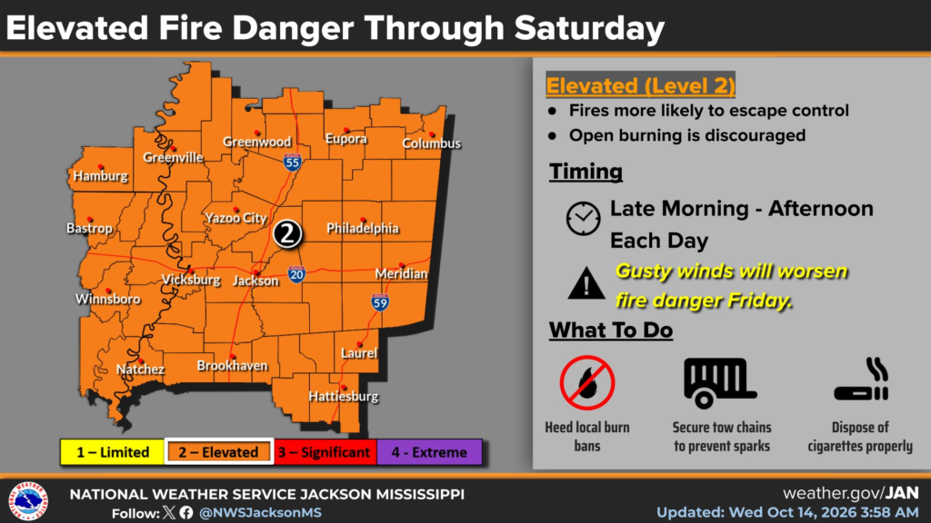
One big problem with the gusty winds is the possibility of fire. Fire can spread with some stronger winds and I wouldn’t be surprised if there’s a red flag warning that goes out for our County Warning Area. Be sure not to burn anything over the weekend that can catch something else on fire! The vegetation is already pretty dry, so it’s pretty easy fuel.
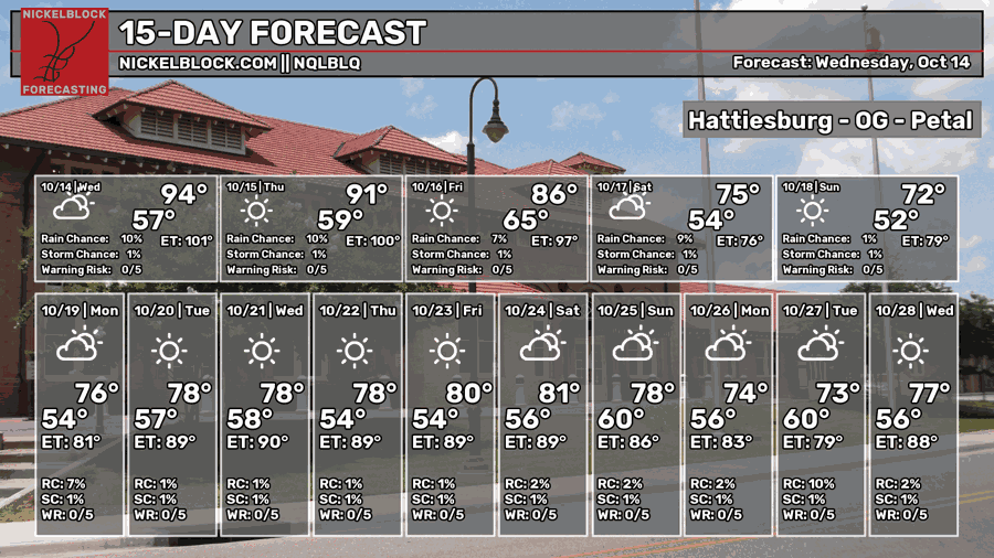
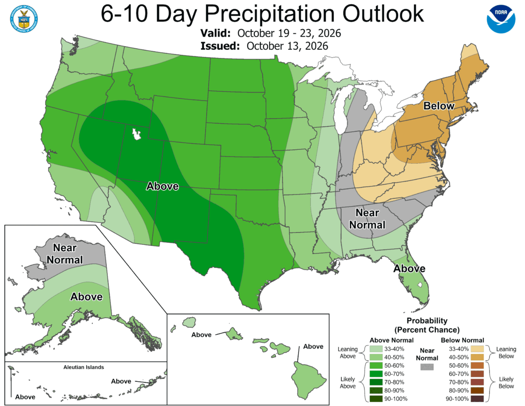
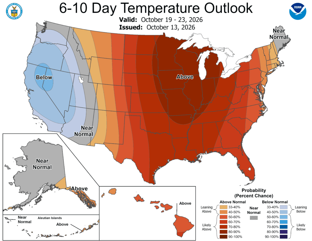
While the NQLBLQ model may not show it, we’re likely going to be back in the 80s again next week thanks to another high pressure system replacing the one we shed this week. It’ll hinder rain chances and bring warmer than average weather for us this time of year. Looking at the extended Climate Prediction Center forecast, we notice that the rain chances are further to the southwestern US and that’s due in part to a developing low pressure system in California which may be Hurricane Simon weakening and becoming extratropical. Either way, the new high pressure in the eastern US will block off a lot of the moisture we would normally see and funnel it towards the southern Plains to Great Lakes region again.


