Current Conditions
It’s a sunny, fall-like afternoon across the region, with dry air making it feel pretty comfortable outside. High pressure is keeping things quiet, with little cloud cover and no rain to worry about. A nice day to spend some time outdoors!
The Setup
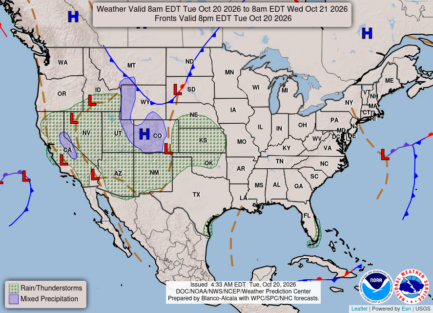
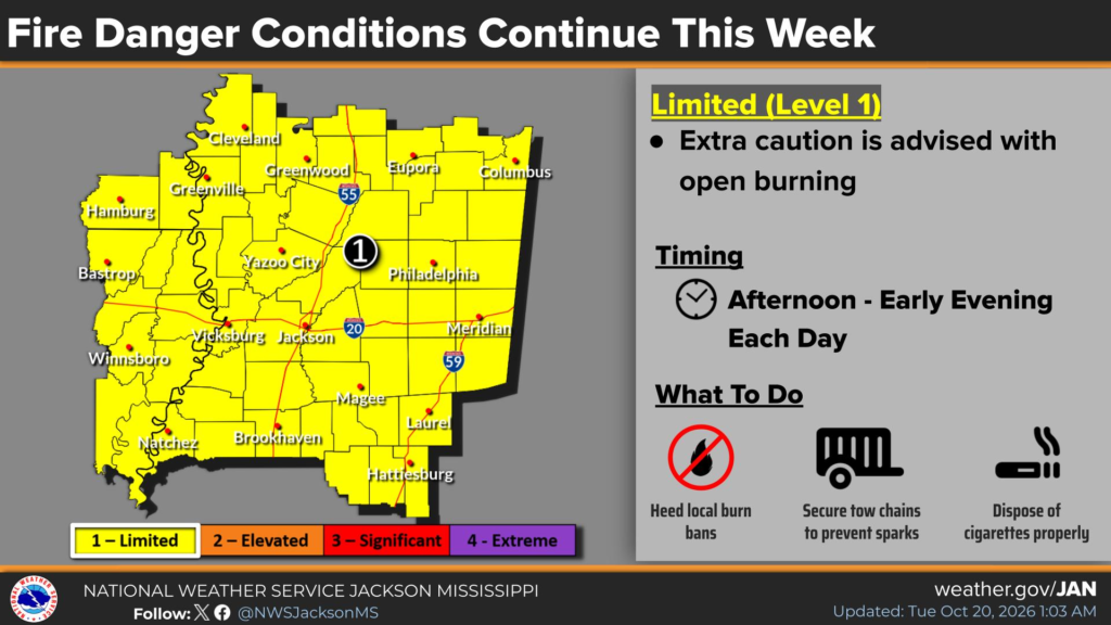
High pressure is sticking around, so there’s still no rain in sight for the rest of the week. A ridge building to our west will keep winds out of the north and northwest aloft, keeping moisture from returning to the area. While winds will be lighter, the dry air and lack of rain will keep fire concerns around, especially during the afternoon. Be careful with anything that could spark a fire and keep an eye on local burn bans.

Today’s Forecast: October 20th
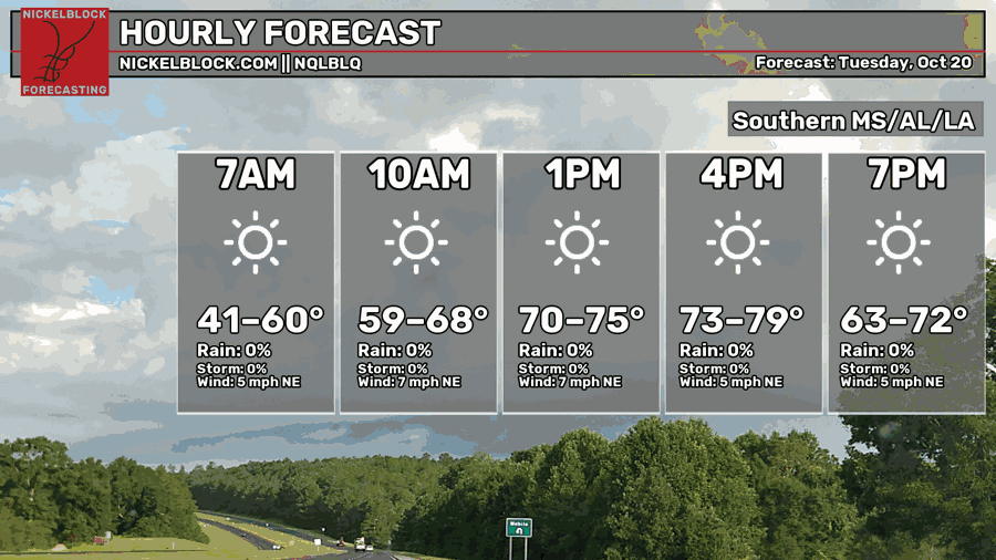
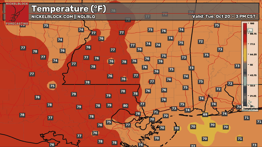
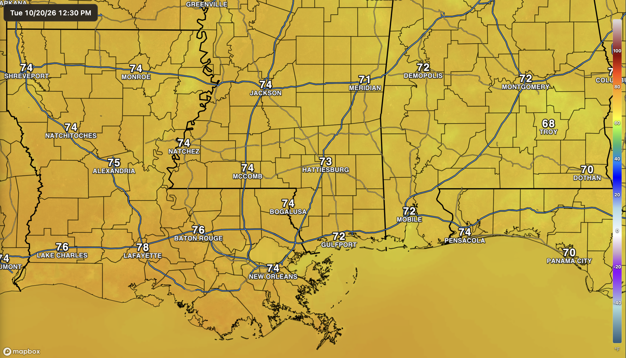
After a chilly start this morning, temperatures will climb into the mid-to-upper 70s this afternoon with plenty of sunshine. A few spots in Louisiana could reach 80, while areas closer to the coast and farther east will stay a little cooler. Northeast winds will stay light at around 5-7 mph, and temperatures will fall back into the 60s to low 70s this evening. Just a great fall day if you ask me!
Tomorrow’s Forecast: Wednesday, October 21st
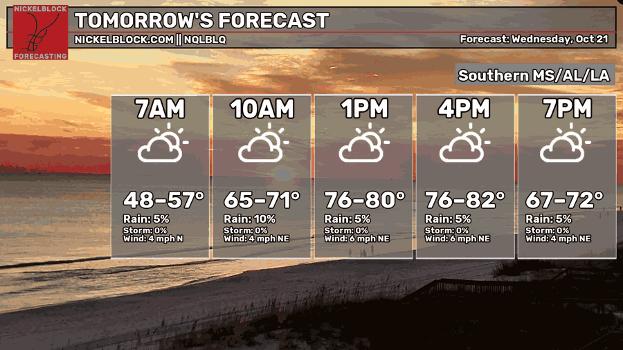
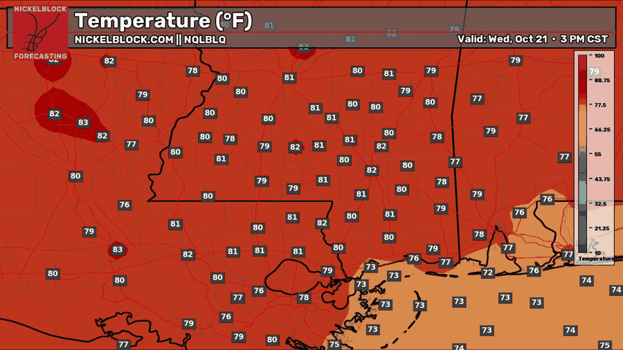
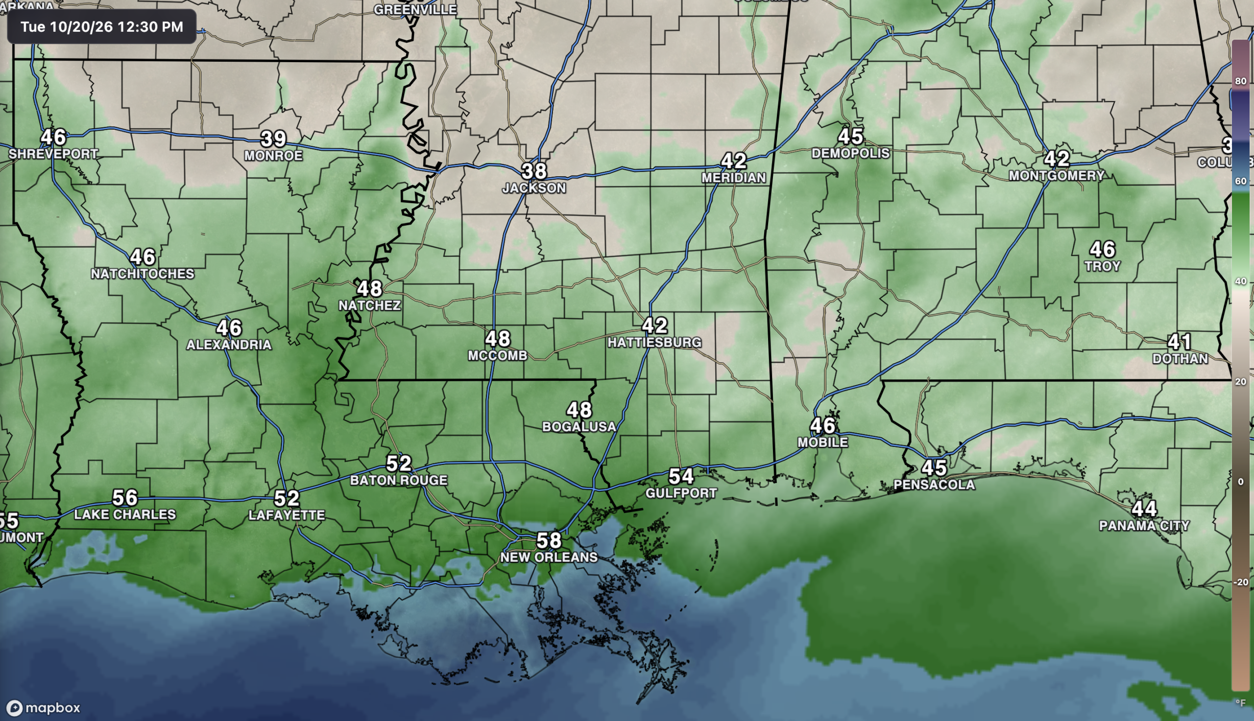
Tomorrow will start off cool again, with temperatures in the upper 40s to 50s as you head out the door. We’ll warm up pretty quickly through the morning, reaching the upper 70s to low 80s by the afternoon, a few degrees warmer than today. Areas closer to the coast will stay a little cooler, mainly in the mid to upper 70s. There will be a few more clouds around, but we’re still looking at another dry day with light north to northeast winds. If you have plans tomorrow evening, temperatures will fall back into the upper 60s to low 70s around sunset and continue cooling after that.

Thursday’s Forecast: October 22nd
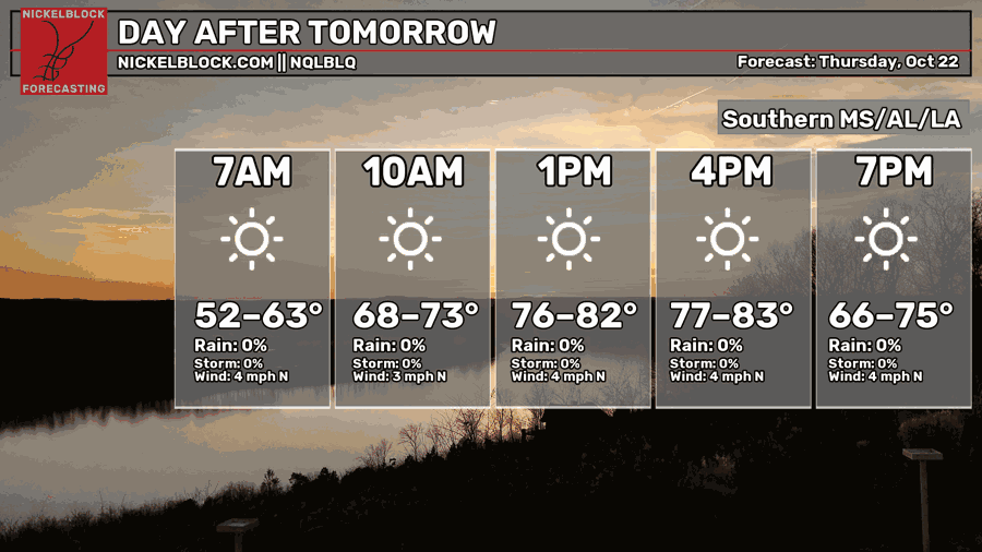
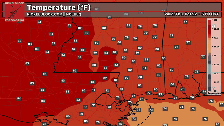
I’m starting to repeat myself here, but get used to it because this pattern isn’t going anywhere anytime soon! Thursday brings another sunny, dry day, with morning temperatures in the 50s to low 60s warming into the upper 70s to low 80s by the afternoon. A few spots farther west in Louisiana could reach the mid-80s, while the coast stays a little cooler. Temperatures will fall back into the 60s to mid-70s during the evening.
Extended Local Outlook
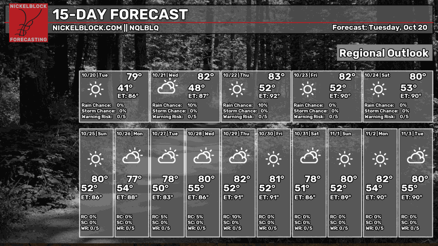
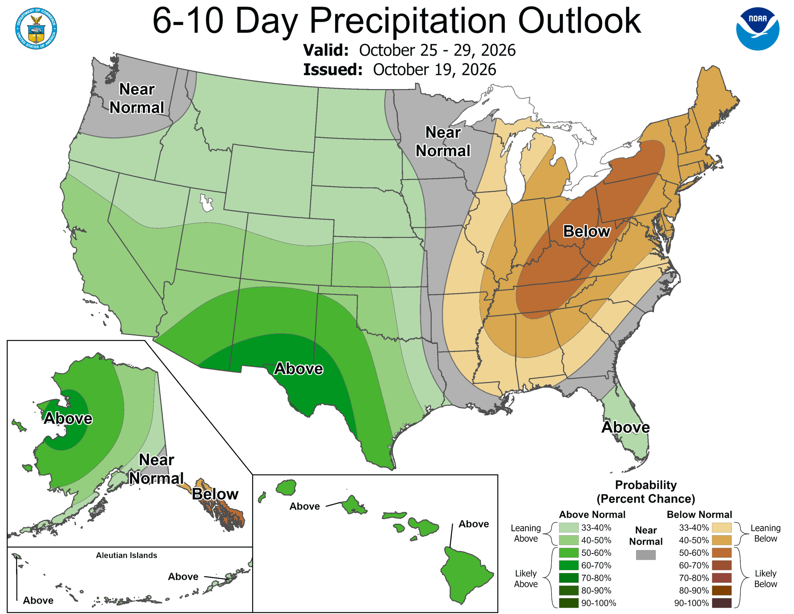
Looking ahead, there really isn’t much change to talk about. Highs stay mainly in the upper 70s to low 80s, with cool mornings in the 50s and plenty of sunshine through the weekend. That same pattern looks to continue into next week, with no meaningful rain chances right now.
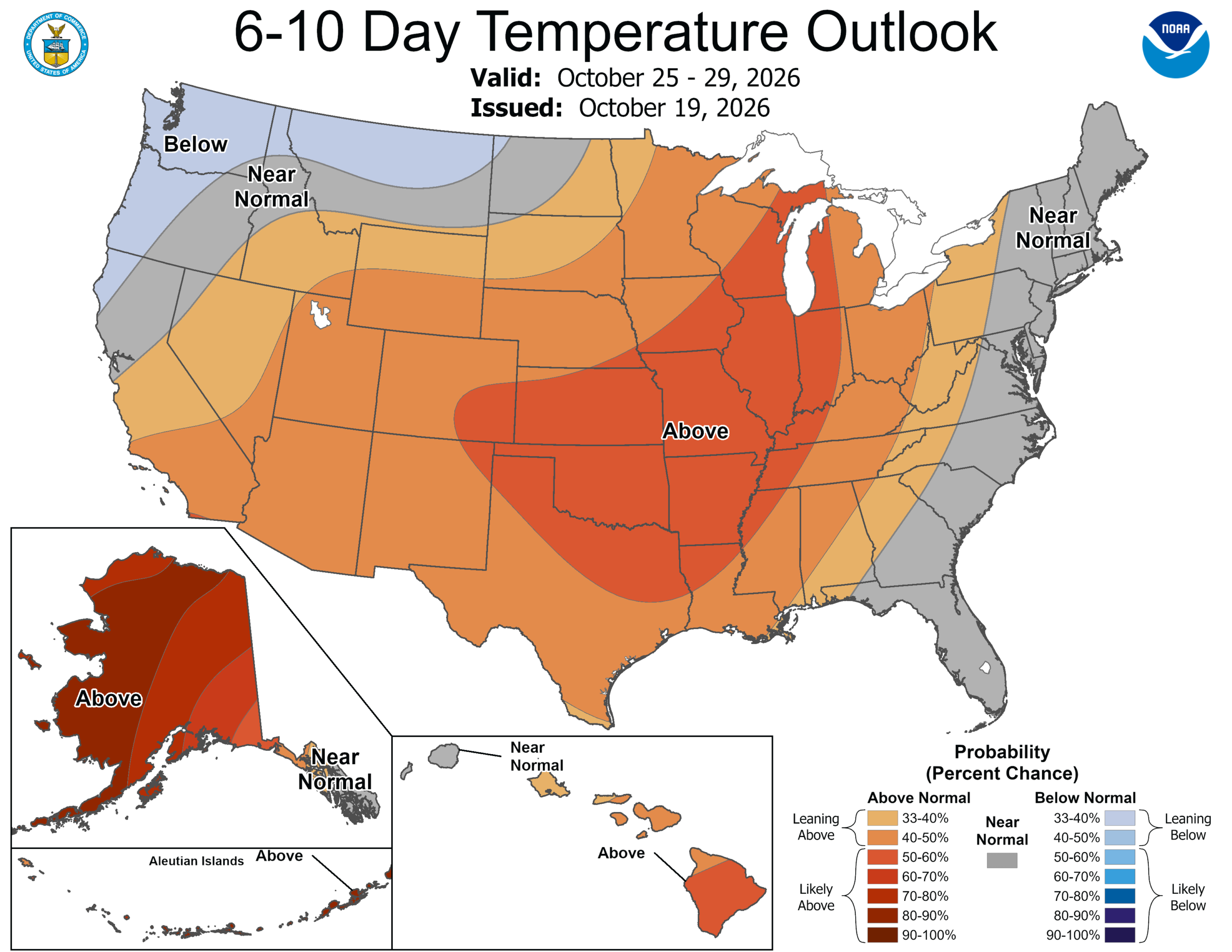
Above-normal temperatures will try to sneak back up, at least according to the CPC outlook for October 25-29, which also favors above-normal temperatures across our area, with rainfall leaning below normal for much of our area. The details farther out can still change, but for now, we’re looking at more warm afternoons, cool nights, and little relief from the dry conditions.


