Current Conditions
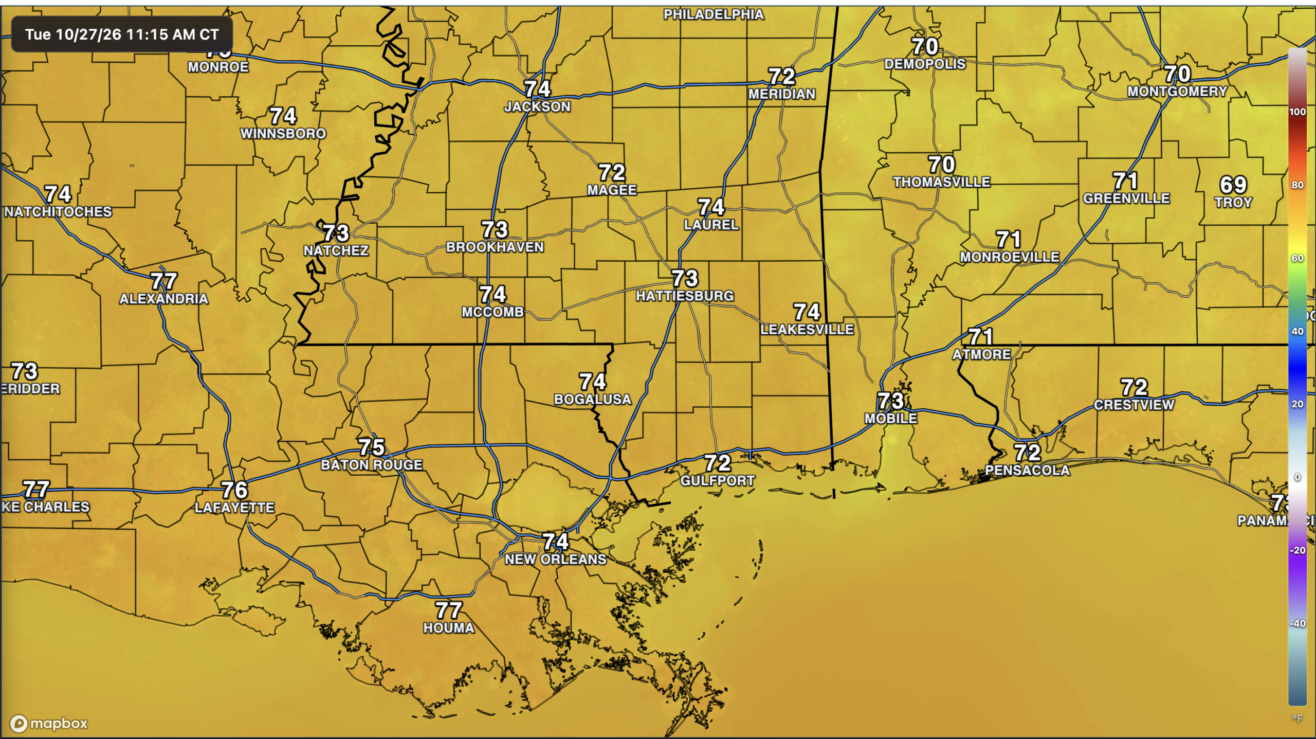
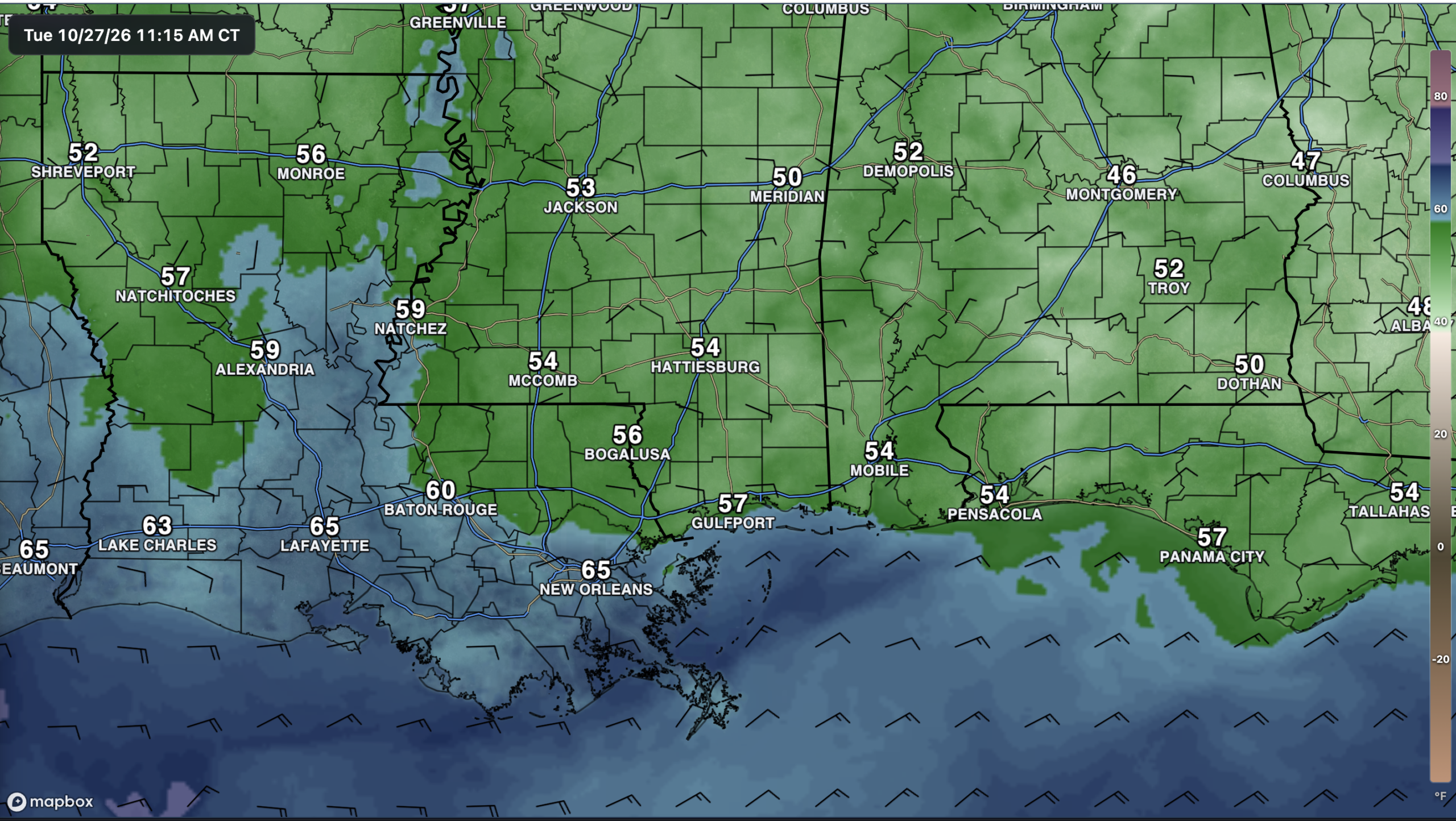
Little is happening across our region this morning, with plenty of sunshine and temperatures already in the lower to mid 70s. Dew points are mostly in the 50s, keeping things comfortable, though Louisiana still has a bit more moisture. Looking west, the cloud cover over eastern Texas and western Louisiana appears tied to a weak upper-level trough lifting northeast through the Plains. For now, high pressure is still keeping our area dry and quiet.
The Setup
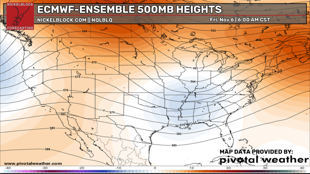
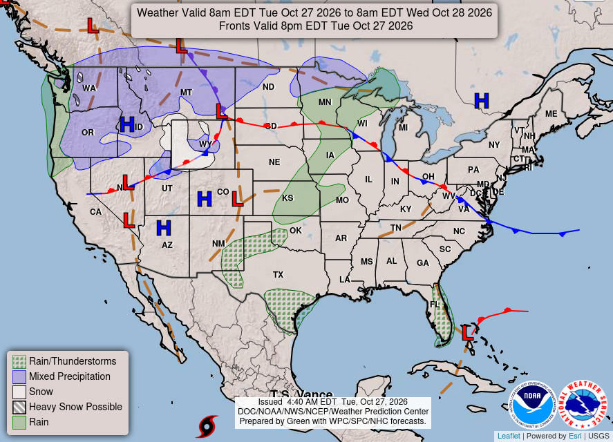
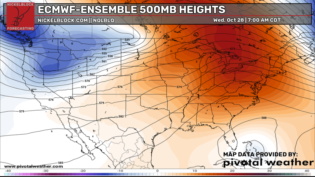
We’re still stuck in the same pattern, with a ridge over the eastern U.S. keeping us warm and dry while the more active weather stays out West. There aren’t any fronts coming through our area over the next few days, so expect more of the same through Thursday. By Friday, a disturbance moving into Texas will start to pull in moisture from what is currently Tropical Storm Vance in the eastern Pacific. That could finally give us a chance for some much-needed rain over Halloween weekend, but we still have a few things to work out with the timing and how much rain we’ll actually get.

Today’s Forecast: Tuesday, October 27th
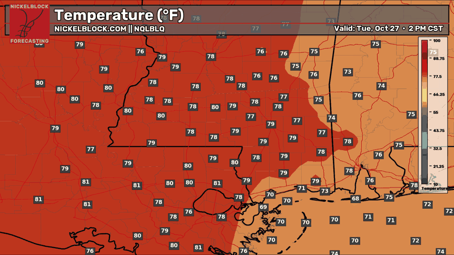
Expect mostly sunny skies today with highs in the upper 70s to lower 80s. Winds will be out of the northeast around 5 mph, and comfortable dew points will keep the humidity in check. Another nice day to get outside, but keep the elevated fire danger in mind and follow any local burn bans.
Tomorrow’s Forecast: Wednesday, October 28th
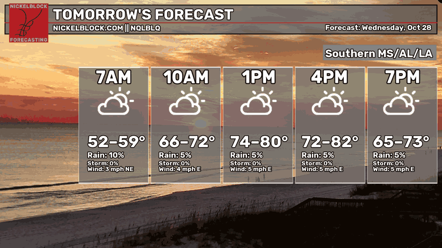
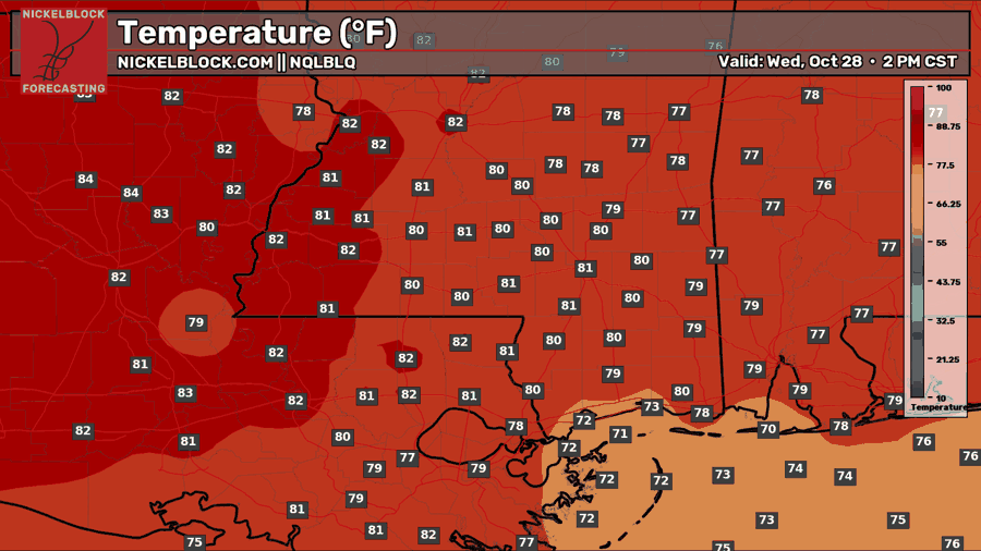
Tomorrow looks pretty similar, just a couple of degrees warmer. We’ll start in the lower to upper 50s before warming into the upper 70s to lower 80s during the afternoon. Expect a mix of sun and clouds with light easterly winds around 5 mph and little chance for rain. Temperatures will fall back into the mid 60s to lower 70s by early evening, so it should be another nice day for outdoor plans.

Thursday’s Forecast: October 29th
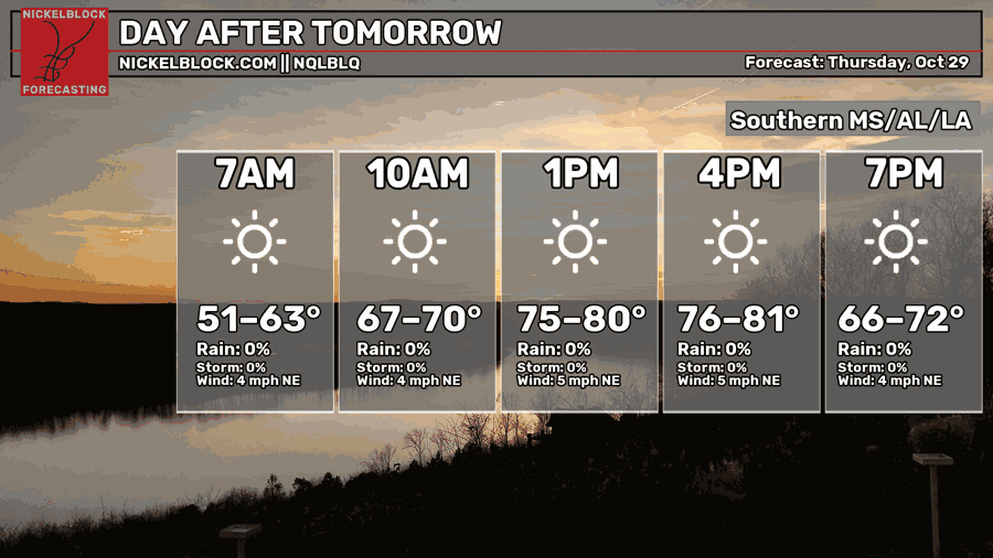
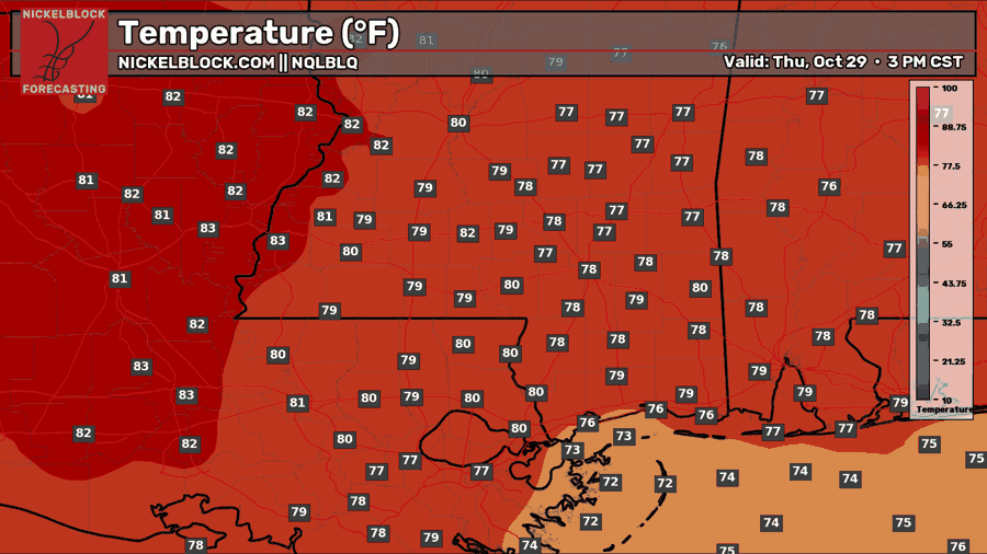
Thursday won’t offer much help with the drought, but you’ll have plenty of sunshine for anything you need to get done outside. Temperatures will climb from the 50s and lower 60s in the morning into the upper 70s to lower 80s by afternoon, with northeast winds around 5 mph. We’ll stay dry through the day, once again.
Extended Local Outlook
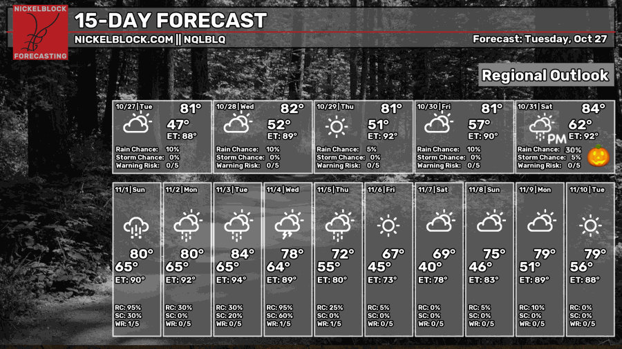
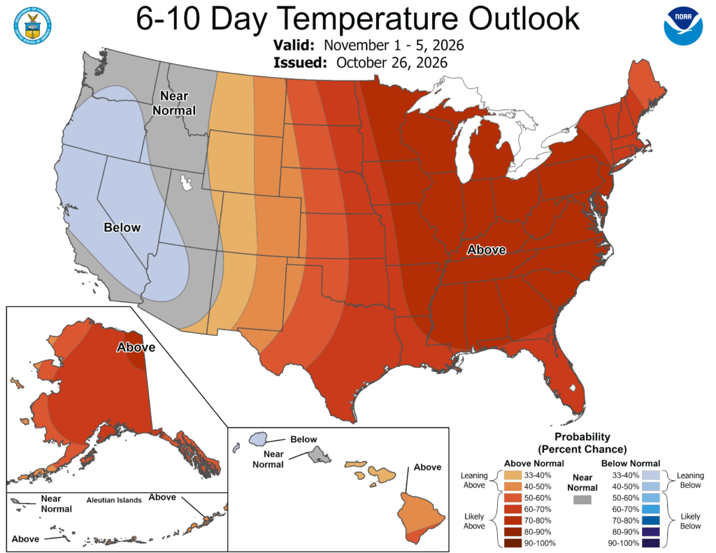
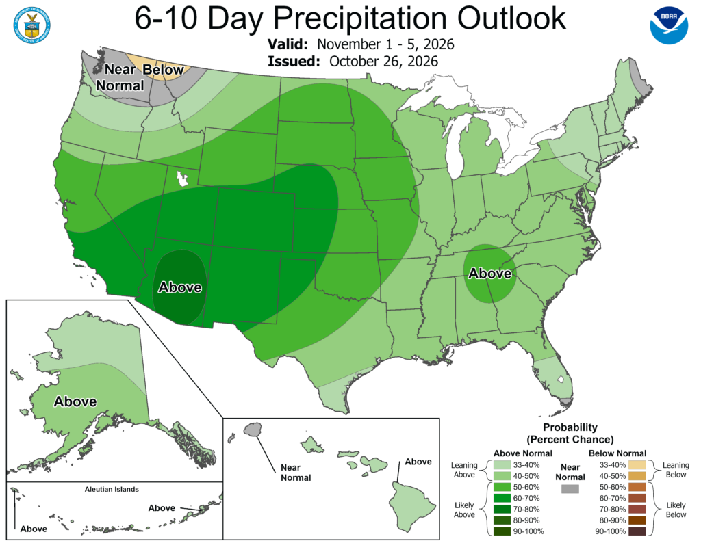
Rain chances finally return over Halloween weekend, with showers and a few storms possible Saturday into Sunday. We still need to work out the timing, so keep an eye on the forecast if you have Halloween plans. Highs will stay in the lower to mid 80s, with warmer nights as moisture returns. Early November looks more active, and the CPC favors warmer and wetter than normal conditions for November 1-5. A stronger cold front could bring another round of rain around the middle of next week, followed by cooler air. Highs may drop into the upper 60s to lower 70s with lows in the 40s later next week, but there’s still room for those numbers to change.