It was a rainy trick-or-treating for quite a few of us around Highway 84 and south as a line of storms pressed northward on Halloween. A more humid Sunday followed as the moisture flow stayed. It’s looking like a slightly rainy Tuesday evening for us before the main line moves in, but it looks like most of the severe weather is out of our path and further north.

Today
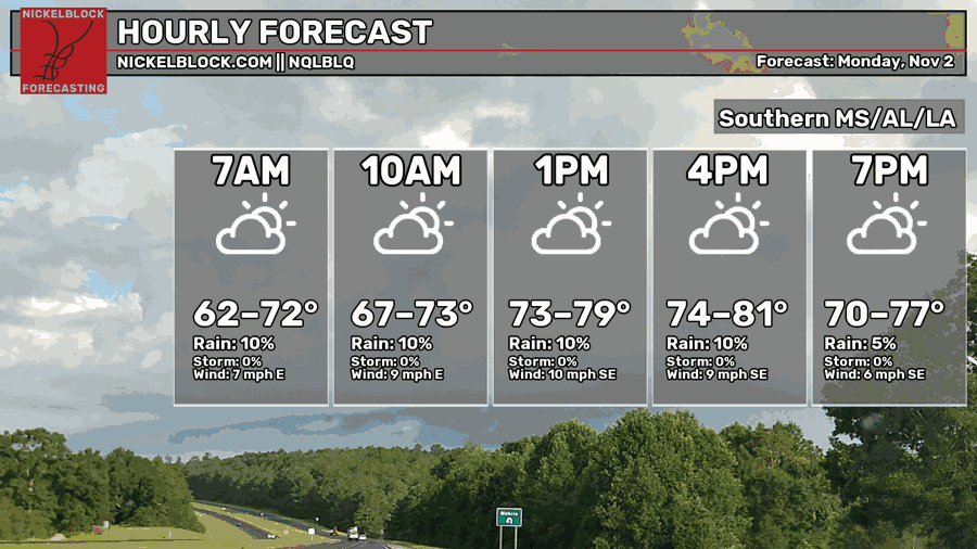
We started off today with overcast skies, soon changing to mostly sunny. The clouds are back again keeping things warm and somewhat muggy. Winds are shifting to the southeast around 5-10mph with a high in the upper 70s to low 80s. Overnight, temperatures will fall back into the low to mid 60s.

Tomorrow
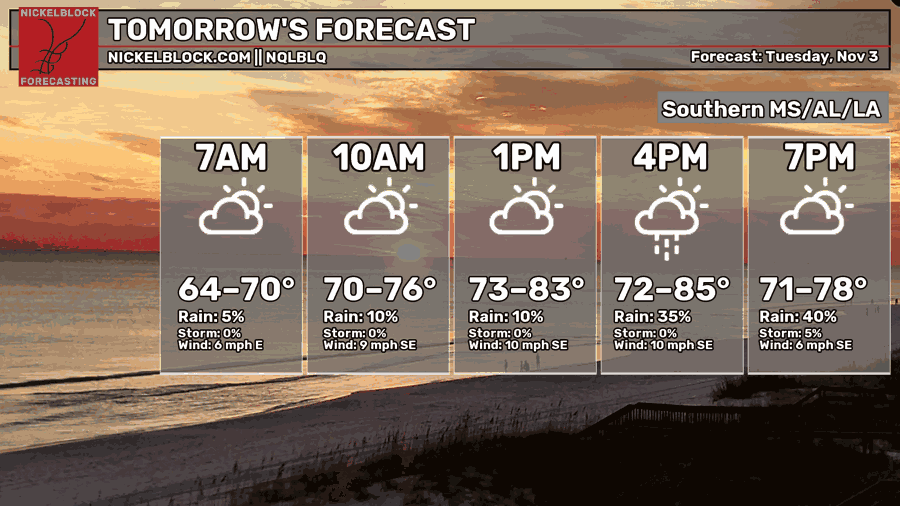
Winds will be shifting towards the southeast again by the mid-morning. Clouds will increase by the mid-morning as well and the rain will begin moving through by the mid-afternoon hours. A few thunderstorms are possible with the developing cells, however they look somewhat hindered in the mid-levels.
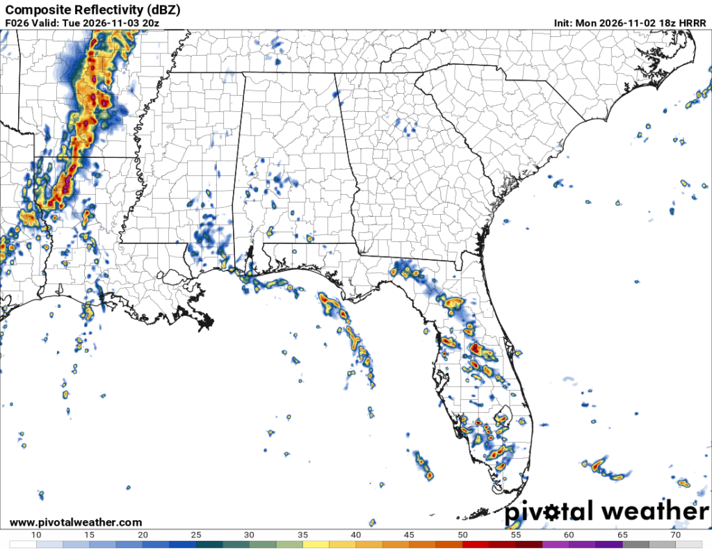
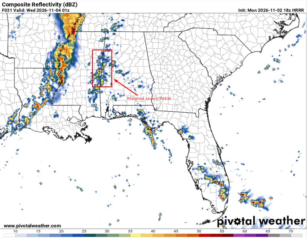
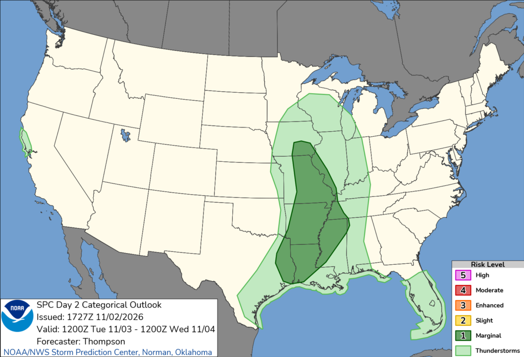
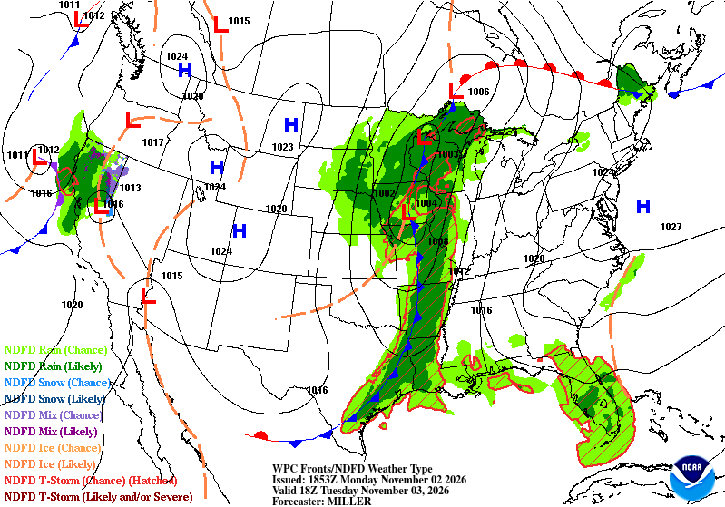
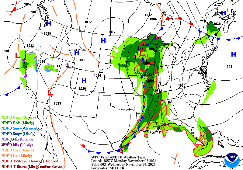
The front begins to occlude far south keeping most of the severe weather potential to the north end of Mississippi on Tuesday afternoon. A few severe storms are possible towards the south, however the risks are looking much further towards the MS/AL border. The severe potential also hovers around Louisiana and Arkansas on Tuesday afternoon with a few discrete cells ahead of the main line especially west of the Mississippi River. A few tornadoes may be possible with the systems in north Mississippi and Louisiana. After dark, the line begins to weaken a bit and eastern Mississippi sees the remnants of the warm front.
Wednesday
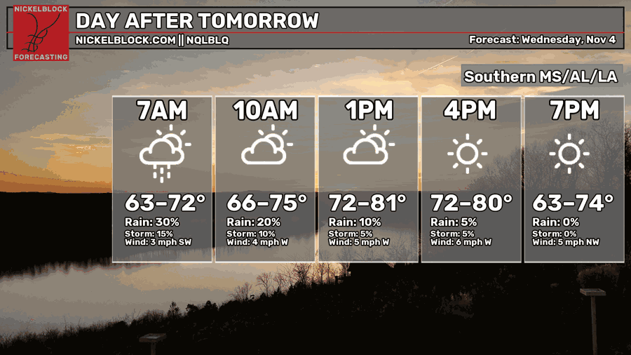
The remnants of the storm system will pass through in the early morning hours and bring some scattered rain and thunderstorms to much of southeastern Mississippi and Louisiana into the early afternoon. Afterwards, the winds will shift towards the northwest indicating the cold front’s passage. Highs will top out in the mid to upper 70s and lows will be in the low 50s.
The Week’s End
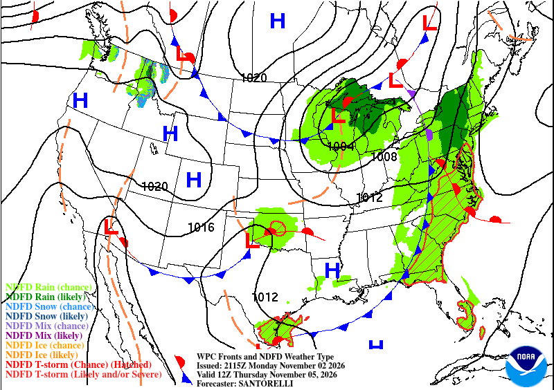
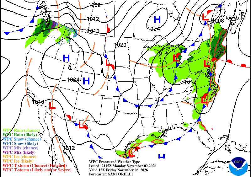
We’ll stay relatively stable for the next few days as the atmosphere begins to churn a bit. A not so powerful dry front will move in this weekend lowering temperatures into the low to mid 70s for us which is quite nice considering we’re on the downhill of Fall at this point. For Thursday and Friday, some weak westerly to northerly winds will move in, but temperatures will remain in the mid 70s to around 80. Overall, conditions will be fairly dry and the lows will also begin to drop into next week.
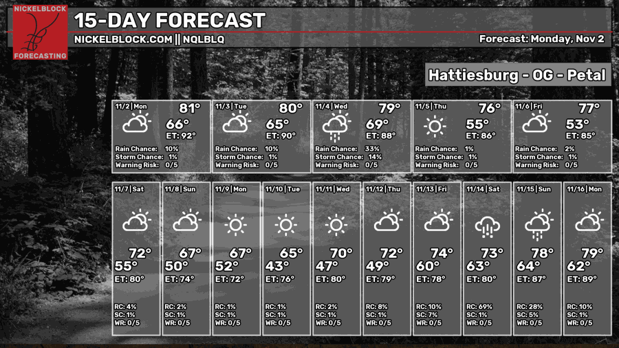
While the NQLBOT model drops temperatures into the upper 60s, I don’t think we’ll get there quite yet. I do believe we’ll stay in the low 70s for a few more days before another front moves in.


