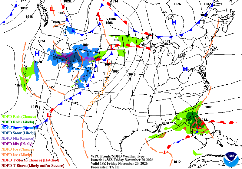
We’ve had some mild mornings and warm afternoons here in the Gulf South and it’ll stay that way for a few more days! The high pressure dome is moving out enough for a little bit of rain to move in next week. Temperatures will soon drop as well with an incoming trough moving in by mid-week next week.

Today
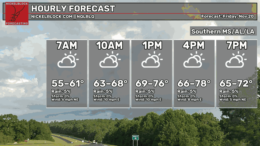
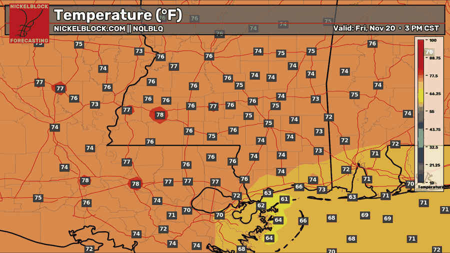
Another partly to mostly cloudy day is ahead today as upper level clouds pull from the south keeping conditions somewhat warm but overall good! Temperatures will be in the mid 70s across the area and winds will be out of the east. Overnight, lows will be in the mid 50s to just around 60 with mostly cloudy skies.

Saturday!
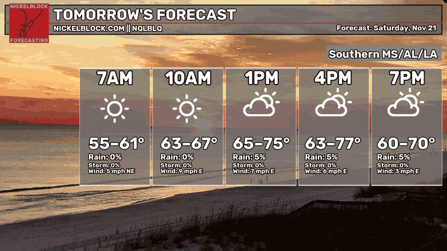
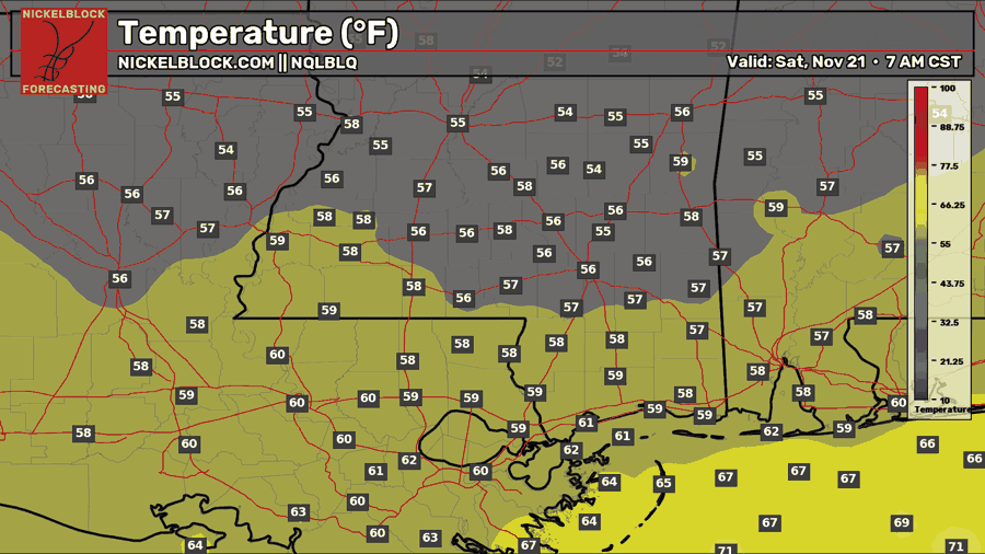
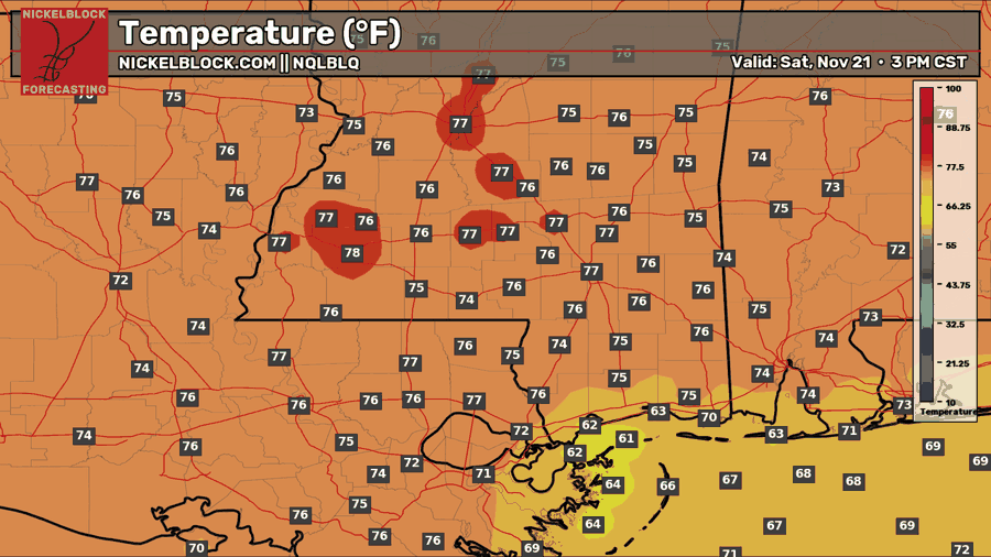
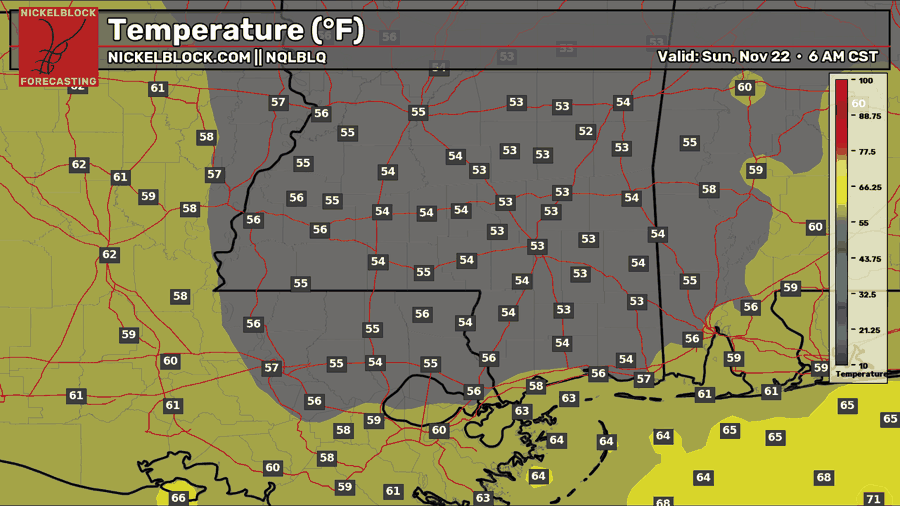
We’ll have some intermittent clouds as the Gulf disturbance moves further out towards the Atlantic. It’s going to be another warm one outside with highs in the mid 70s. If you’re out at the game tomorrow afternoon, it’ll be a pretty comfortable day game! Winds will be steady around 5-10mph during the day out of the east. Lows will be in the mid to upper 50s with mostly clear skies.
Sunday
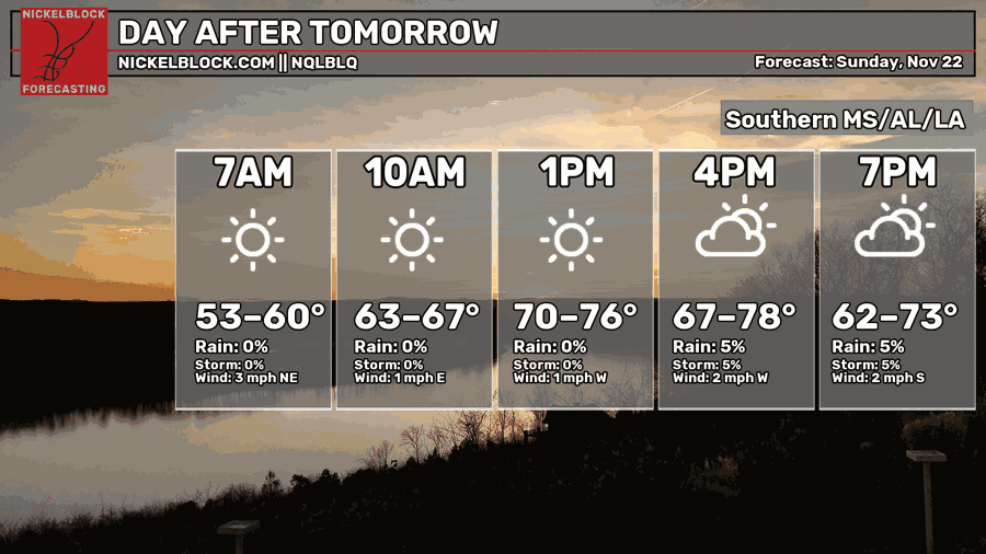
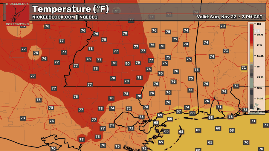
The wind begins to shift as an approaching front moves in from the west on Sunday. We’ll rotate from east to west to south by the evening. More clouds will move in with the front by the afternoon. It’ll be another warm day to end off the weekend! Highs in the mid to upper 70s and lows in the low to mid 50s.
Rain? Since When?
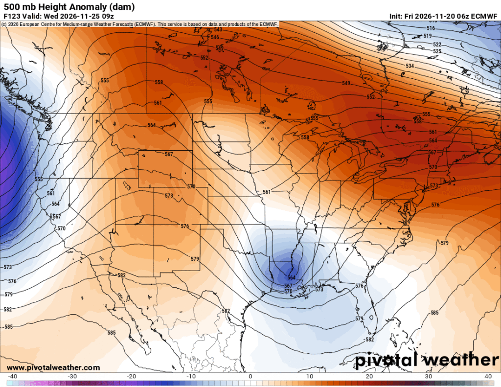
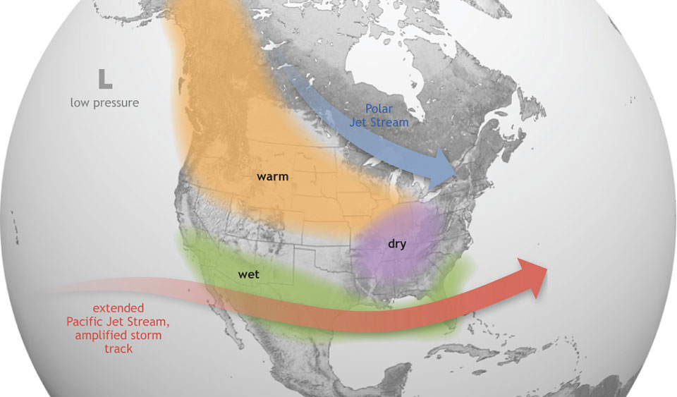
We’ve been stuck between a rock and a hard place lately for any semblance of rain moving in. Unfortunately, it’s still difficult to get a decent setup for the rain due to the synoptic (think more nationwide scale) and global atmospheric setup. In a more neutral or La Nina year, we get more meridional (north-south) systems that pull up Gulf moisture, dump a load of rain, thunderstorms, and tornadoes. The polar jet stream has also been moved further east. With the Super El Nino year we’ve had, it’s shifted a lot of that type of atmospheric dynamic. More blocks like the high pressure systems we’ve had lately have put a major damper on the usual dynamic we receive and with it, makes it harder to get more rain.
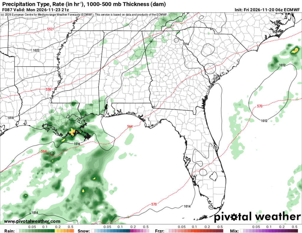
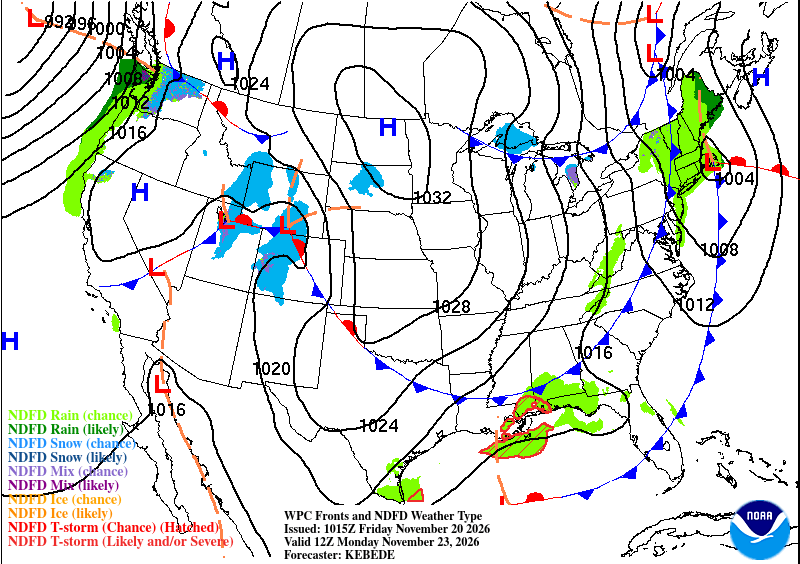
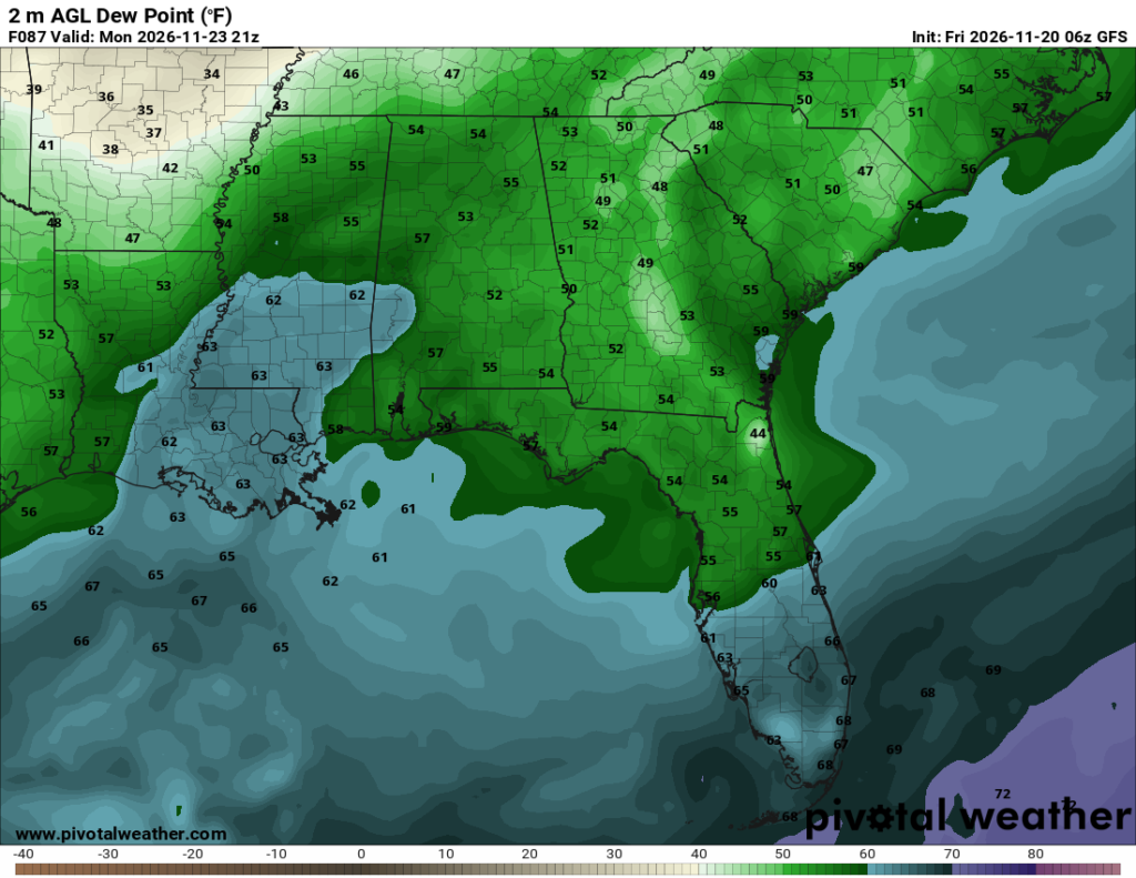
Anywho, let’s talk about Monday. As we can see with the maps above, the first cold front is moving in. There is a small window where the rain can move in during the day and judging by the front map (right), a limited area. The GFS and ECMWF (left) models already imply that the rain will stay closer to the MS/AL coastline and southeastern Lousiana. Enough moisture pokes out from the Gulf to bring a little bit of rain and then moves out.
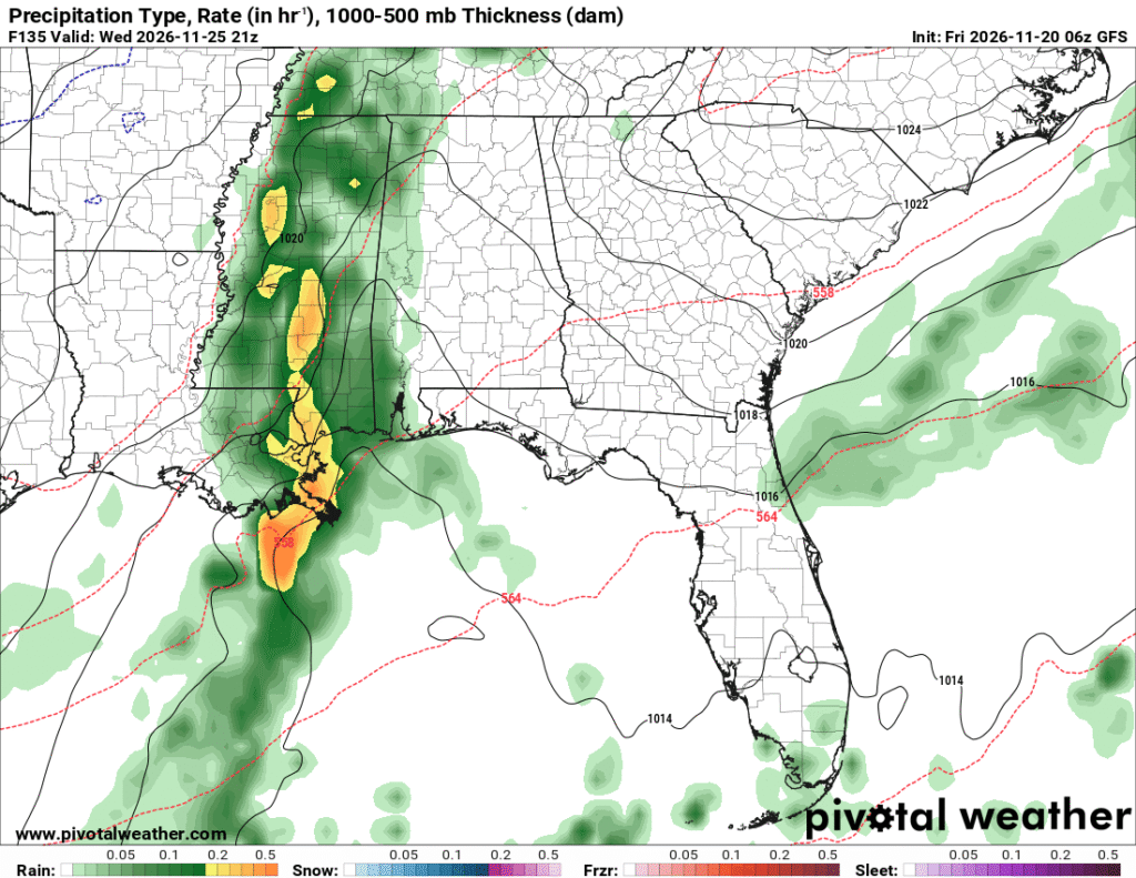
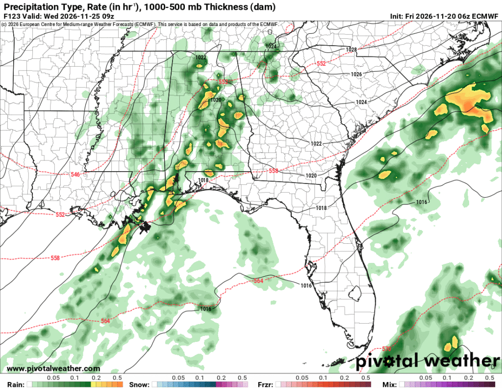
Another qualm is the deviation from the GFS and ECMWF models for Wednesday’s possible rain. The GFS (left) model pushes harder for rain to move in by the afternoon and bring in a lot more moisture. The Euro (right) model rushes the front through with little moisture to procure any sort of storm development. The Weather Prediction Center (below) looks to favor the Euro model guidance. It’s a toss-up as to how much rain we will receive until the models update closer to the short range.
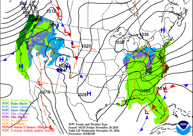
What I do know we can expect is a cooler than average Thanksgiving! Temperatures will already drop into the 60s by the early week and to the mid to upper 50s by Thanksgiving Day. Lows won’t quite hit the freezing mark for us, but it’ll be close! It’ll slowly get warmer as we go into Thanksgiving weekend.
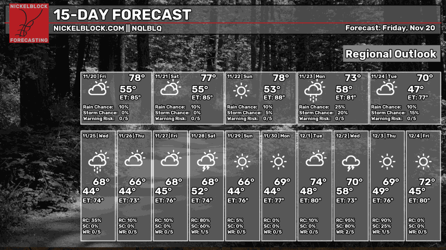
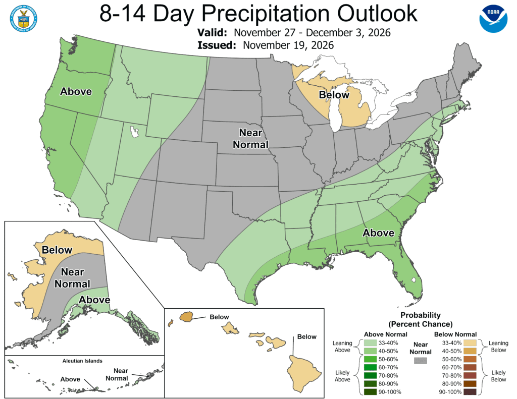
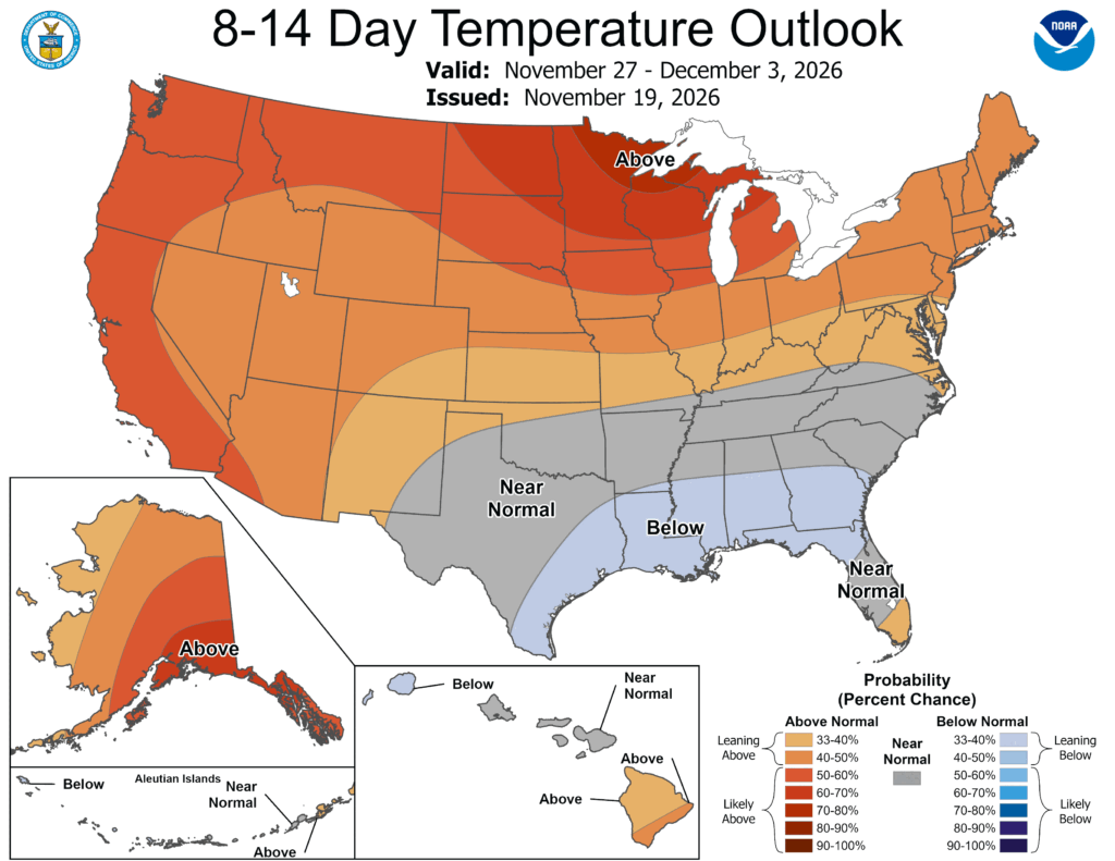
Looking at the extended forecast, we’re actually in the below average category for temperatures! The above average precipitation for the next week is due to a system that may develop in the Gulf again bringing a chance of rain by Thanksgiving weekend.


