Mid-September isn’t looking too bad compared to the last couple of weeks. For temperatures in the low 90s, it’s been fairly pleasant. We’ll see a continuation of that for the next several days with a slight chance of rain and even temperatures reaching the upper 80s by the end of the week.
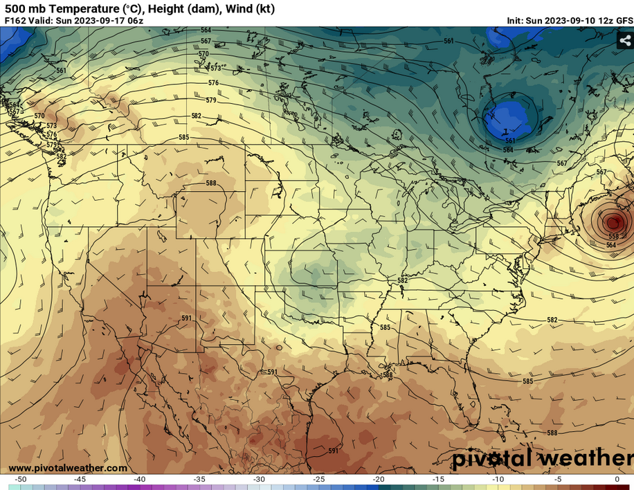
Upper Levels
Over the week, the upper levels will become more linear towards the Southern US keeping us fairly dry for the first few days. Come Wednesday and Thursday, a trough near the Great Lakes will propagate eastwards towards the Atlantic. Near the weekend, another trough will develop from the Rockies and dig Southeast.

Temperatures
Temperatures will range around the low to mid 90s for most of the week. Heat indices look to be down to the mid and upper 90s which is good news for us. Conditions will be mostly dry with dewpoints in the upper 50s to mid 60s. Low temperatures will be in the low 70s. Near the end of the week into the weekend, temperatures will stay in the upper 80s to low 90s with low temperatures reaching the upper 60s.
Rain Chances
Conditions will stay pretty dry until Thursday. Some northwesterly flow from the cold front will bring some possible rain on Thursday and Friday. Come Sunday, another chance of showers with the other trough moving in.

[wpcode id=”41179″]
Regional Day-to-Day Forecast
This Afternoon – Sunny, with a high near 93. Calm wind becoming north northwest around 5 mph.
Tonight – Mostly clear, with a low around 69. North wind around 5 mph.
Monday – Sunny, with a high near 95. Calm wind becoming east southeast around 5 mph in the afternoon.
Monday Night – Mostly clear, with a low around 72. South southeast wind around 5 mph becoming calm.
Tuesday – Sunny, with a high near 95. Calm wind becoming west around 5 mph in the afternoon.
Tuesday Night – Partly cloudy, with a low around 72. West northwest wind around 5 mph becoming calm.
Wednesday – A 20 percent chance of showers and thunderstorms after 1pm. Mostly sunny, with a high near 94. Calm wind becoming north around 5 mph in the afternoon.
Wednesday Night – Partly cloudy, with a low around 70. West northwest wind around 5 mph becoming calm.
Thursday – A 20 percent chance of showers and thunderstorms after 1pm. Mostly sunny, with a high near 91. Calm wind becoming east northeast around 5 mph in the afternoon.
Thursday Night – Partly cloudy, with a low around 69.
Friday – A 20 percent chance of showers and thunderstorms. Mostly sunny, with a high near 89.
Friday Night – A 20 percent chance of showers and thunderstorms. Partly cloudy, with a low around 68.
Saturday – A 30 percent chance of showers and thunderstorms. Mostly sunny, with a high near 90.
[wpcode id=”41149″]


