A well occluded low in the eastern plains is bringing rain to the Deep South, mainly Louisiana and Mississippi, today. The warm front is providing plenty of rain to southwestern Mississippi, however, this looks to move out in favor of the cold front by the time it reaches the Pinebelt and the coast. By this, a stronger low in the Gulf of Mexico looks to graze the coastline and combine with the leftover rain and move east towards Florida.
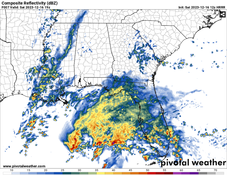
Looking at the HRRR and NAM CONUS models, both show some stratiform (not severe!) rain showers through south Mississippi during the afternoon. Most of this looks to happen after noon until after sunset. The rain chances look to lessen the further east they go, however there will still be some scattered showers especially closer to the coast as the afternoon progresses.
Side note: the low in the Gulf looks insane, almost fully formed like a mid-latitude cyclone! Keep an eye out for that in the next few days.
Overnight, temperatures look to stay in the 50s with the rain chances going away. The cold front will pass through and bring our more seasonably cool weather with lows in the upper 30s by Sunday night. Rain chances will be slim to none afterwards.
Keep an umbrella with you for Saturday!
[wpcode id=”41179″]
Regional Day-to-Day Forecast
Today – Rain likely, mainly between noon and 5pm. Mostly cloudy, with a high near 61. East wind around 5 mph. Chance of precipitation is 70%. New precipitation amounts between a tenth and quarter of an inch possible.
Tonight – A 40 percent chance of rain before midnight. Patchy fog after midnight. Otherwise, cloudy, with a low around 50. Calm wind becoming north northwest around 5 mph after midnight.
Sunday – Cloudy through mid morning, then gradual clearing, with a high near 59. North northwest wind 5 to 10 mph, with gusts as high as 20 mph.
Sunday Night – Clear, with a low around 38. Northwest wind 5 to 10 mph.
Monday – Sunny, with a high near 60. North northwest wind 5 to 10 mph, with gusts as high as 20 mph.
Monday Night – Clear, with a low around 31. North northwest wind 5 to 10 mph, with gusts as high as 20 mph.
Tuesday – Sunny, with a high near 54. East northeast wind around 5 mph.
Tuesday Night – Partly cloudy, with a low around 31. East wind around 5 mph.
Wednesday – Mostly sunny, with a high near 59. East southeast wind around 5 mph.
Wednesday Night – Partly cloudy, with a low around 36.
Thursday – Mostly sunny, with a high near 62.
Thursday Night – Mostly cloudy, with a low around 40.
Friday – Partly sunny, with a high near 64.
[wpcode id=”41149″]


