Things remain calm and seasonably cool. Highs are running a few degrees below normal the next few days. Our next shot for rain arrives Monday as we kick off 2024.
Don’t expect much from the clouds, though, as the quick moving system will basically zoom through at highway speeds on Monday morning. I don’t think many spots will pick up more than 0.25″ of rain as it zips by. On top of that, we won’t even get much of a temperature change, either.
The next system beyond that may pack more of a punch.
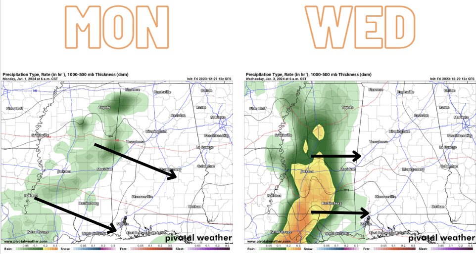
That will slide through Wednesday morning with a stout inversion in place. That will limit the risk for severe weather, but will leave us with a pretty cold rain. Highs on Wednesday will only be in the mid 50s and that will likely be before the rain starts. While the rain is falling, temperatures will likely be in the 40s.
No snow is expected at this time. In fact, I would argue that snow is highly unlikely with this round of precipitation given the inversion in place. Sleet and freezing rain is also pretty unlikely.
BUT! I will say that as we move through the next few weeks, the overall pattern is generally conducive to producing some sort of wintry weather for the southeast. If we can specifically get the setup that produces wintry weather as close to the Gulf as we are is still TBD.
And spekaing of wintry weather… I know this thing is making the round on social media:
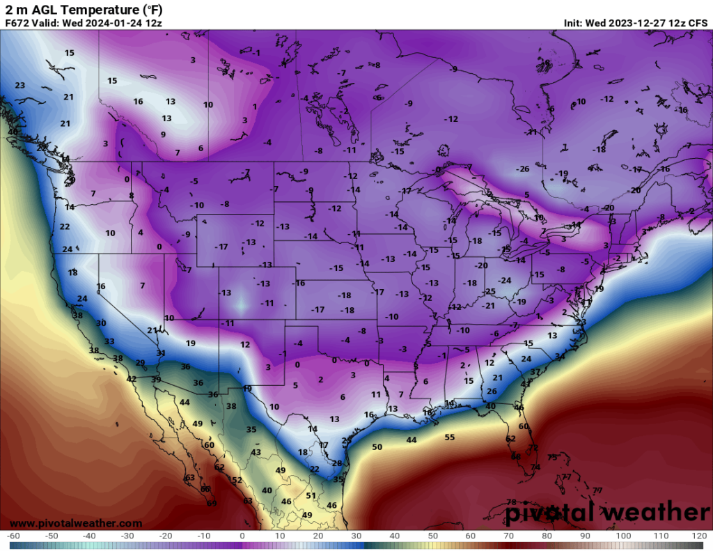
Before you get too excited for cold (or worried), know that this is a global sub-seasonal model that is known within the meteorological community for exaggerating cold (and heat in the summer) because it is intended to be guidance for “big picture” stuff, not specifics like the temperature in your backyard.
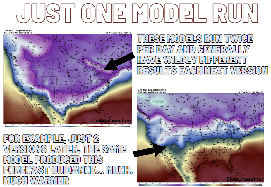
And the model runs twice per day and often flip flops around when you look out more than a week. But that is by design, in a sense, because it isn’t made to produce an accurate local temperature forecast.
So, again, don’t stress about the potential for this kind of cold (or make plans to go sledding). Could it be cold in late January? Sure. Could it be very warm? Also, sure.
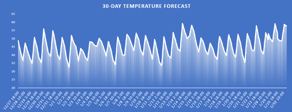
Looking at the more reliable EC-VAREPS model, the 30-day temperature forecast for the region shows values between 30F and 55F – none near 10F. Again, not to say it *won’t* happen, but rather that it is highly unlikely.
For now, just keep tabs on the forecast. It looks like we are in a setup that should give us a few wintry weather potentials for the southeast int eh coming weeks. We will see how many shake out for our region in particular.
REGIONAL DAY TO DAY FORECAST
Friday: Sunny. Highs in the lower 50s. West winds 5 to 10 mph.
Friday Night: Clear, cold with lows in the lower 30s. West winds around 5 mph.
Saturday: Sunny. Highs in the upper 50s. West winds around 5 mph.
Saturday Night: Clear. Lows in the lower 30s. Light and variable winds, becoming southwest around 5 mph after midnight.
Sunday: Sunny. Highs in the mid 60s.
Sunday Night: Mostly clear in the evening, then partly cloudy with a slight chance of showers after midnight. Not as cool with lows in the mid 40s. Chance of rain 20 percent.
New Years Day: Mostly sunny. A chance of showers, mainly in the morning. Highs in the mid 60s. Chance of rain 50 percent.
Monday Night: Partly cloudy. Lows in the mid 30s.
Tuesday: Sunny. Highs in the mid 50s.
Tuesday Night: Partly cloudy in the evening, then mostly cloudy with a slight chance of showers after midnight. Lows in the upper 30s. Chance of rain 20 percent.
Wednesday: Mostly cloudy in the morning, then becoming partly sunny. A 50 percent chance of showers. Highs in the mid 50s.
Wednesday Night: Mostly cloudy. A chance of showers, mainly in the evening. Lows in the upper 30s. Chance of rain 40 percent.
Thursday: Mostly sunny. Highs in the mid 50s.


