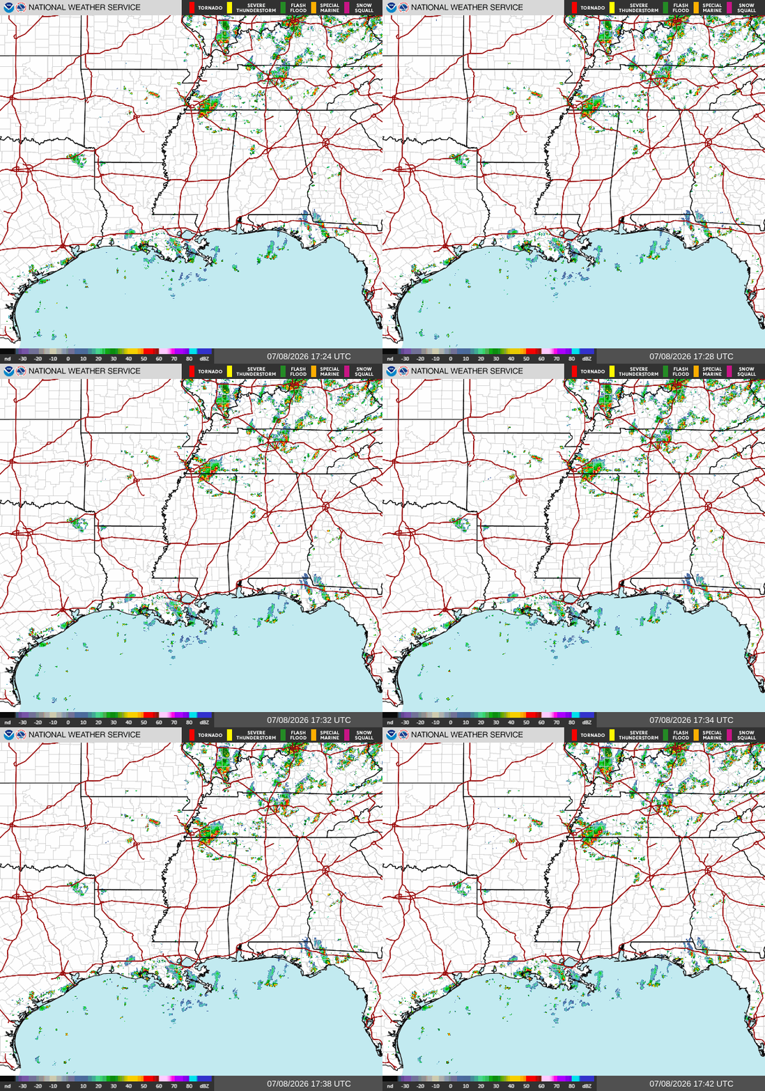
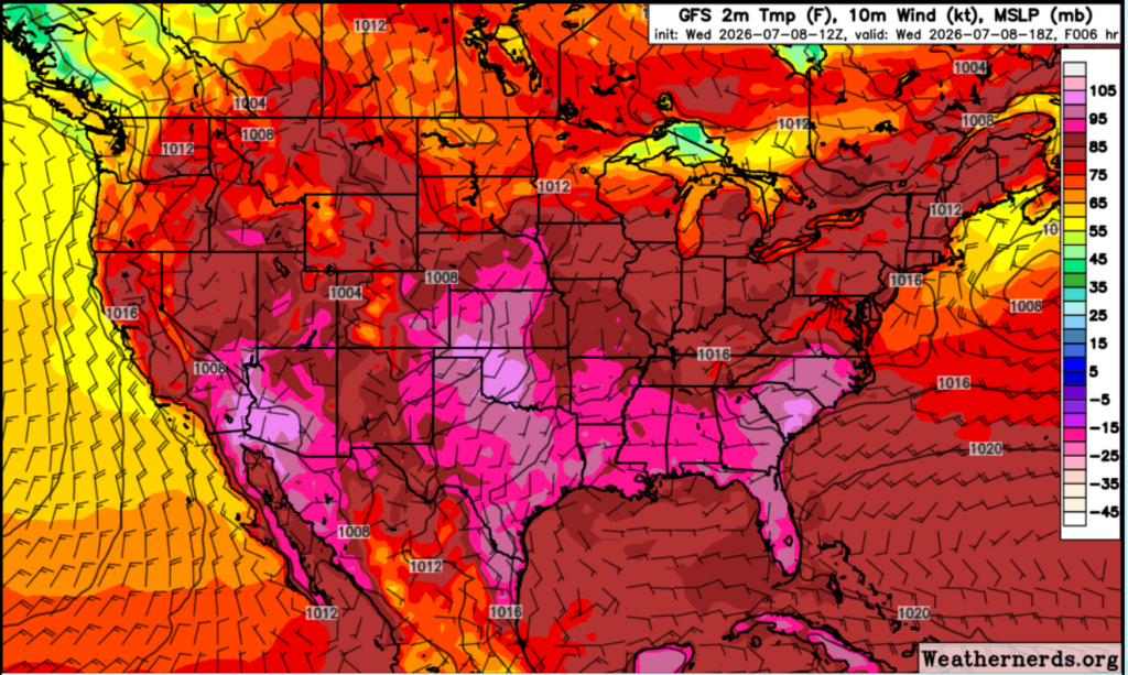
This afternoon, temperatures have climbed into the lower to mid 90s across much of southern Louisiana, Mississippi, and Alabama. Dewpoints remain well into the 70s, making it feel closer to 100 degrees in some areas. The skies started mostly sunny this morning, but cumulus clouds and potential storms are beginning to build as daytime heating increases.

Today
For the rest of our Wednesday afternoon, expect another classic Gulf Coast summer day. Highs will reach the low to mid 90s with oppressive humidity throughout the afternoon. Scattered thunderstorms will develop after lunchtime, first along the coastline then moving inland through the evening. Not everyone will see rain, but storms could pop up quickly with the humidity and heat we are seeing across the area.
Looking at our daytime temperature forecast, temperatures will climb to around 95 degrees by 1 PM, making it the hottest part of the day before slowly cooling into the evening. This, combined with the high humidity, will create real-feel temperatures of over 100 degrees in some areas.
Tomorrow
We will see very few changes heading into tomorrow. Another hot and humid day is expected, with highs once again in the low to mid 90s. Afternoon heating and the sea breeze will spark another round of scattered thunderstorms, following a pattern nearly the same as today.
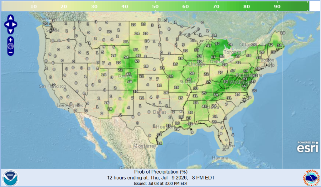
The chance for precipitation remains low across most of our area, with higher chances in NE Alabama and SE Louisiana. With the high temperatures and humidity, don’t rule out an afternoon shower as storms develop quickly during the summertime.
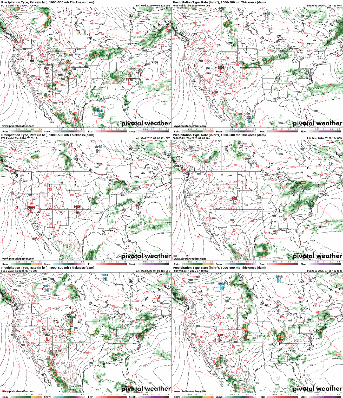
The above forecast shows storms across Central Louisiana tonight, leading into a clearer pattern tomorrow. Expect isolated storms in the afternoon due to daytime heating, which will trickle out by the overnight hours.
You see, maps like the one above are hard to read when it comes to timing since it is measured in Zulu/ Coordinated Universal Time instead of Central Time. It is simple to look up the conversion for charts like these, but the general rule is that Z time is 5 hours ahead of CDT, and 6 hours ahead in the winter. 00z converts to 7pm on the day before, which is why the above graphic shows storms Thursday morning at 00z, even though those are actually the storms from tonight since it is timestamped at 7pm Central.

Friday
Finishing off our workweek, temperatures and conditions will remain consistent with how things have been the past few days. High temperatures, high heat stress, and humid with afternoon storms seem to have been the norm for this week as we continue to sink into our typical summer pattern.
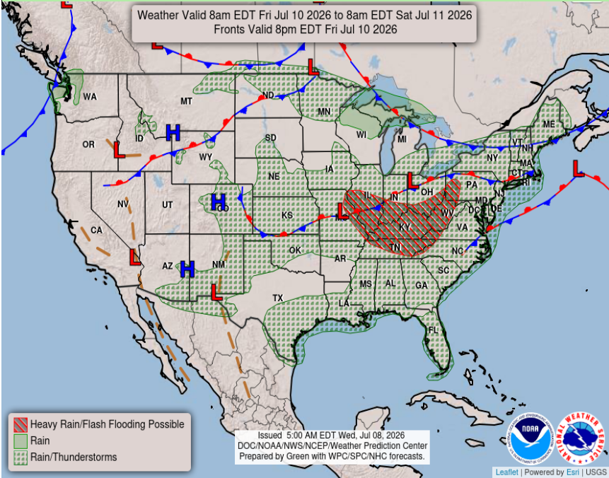
Our Friday national forecast chart shows a chance for rain and thunderstorms across most of the South which is nothing out of the ordinary for this time of year.
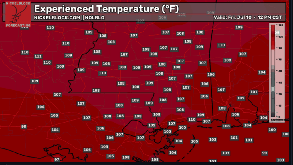
Taking a look at our experienced temperatures, which display the physical and psychological sensation of the temperature on your body, we are seeing dangerously high real-feel temperatures. Now this may seem a little less crazy compared to last week’s heat wave, but trust me, it’s going to feel hot and stifling during the day, so be sure to stay hydrated and take breaks from outdoor activities.

Extended Forecast
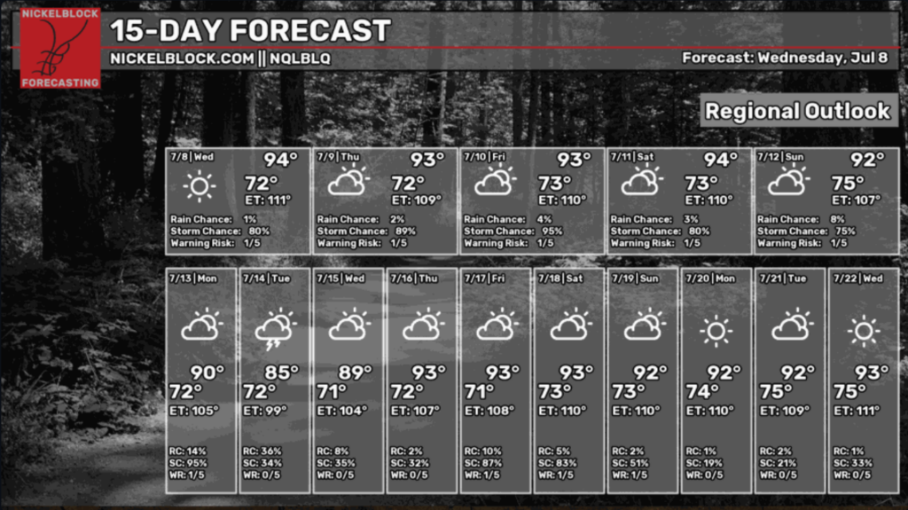
Looking ahead to our NickelBlock 15-day regional outlook, we can expect a similar trend over the next few days, but wait? That’s right. We see a small drop in temperatures in the beginning of next week because of a cold front associated with a trough pushing into our area.
Below we see the predicted low-pressure/trough moving into our area early next week. This will bring stormy weather and a slight decrease in temperature before it blows over and we head back to the summertime pattern later in the week.
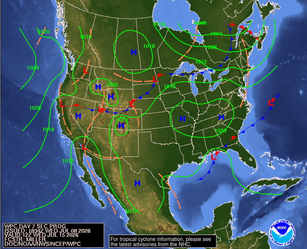
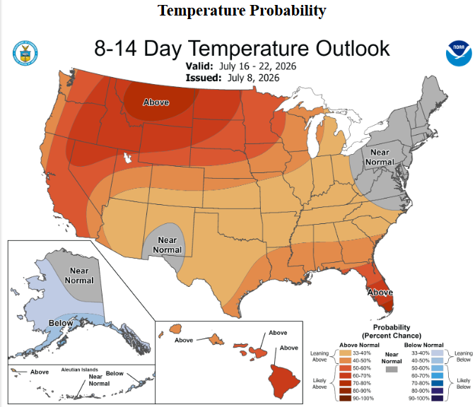
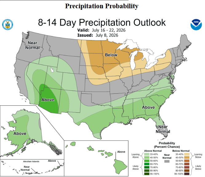
For our 8-14 day outlooks, things seem to be pretty average temperature-wise, although we will see an increase in precipitation for the South with the associated trough bringing rainfall to our area next week.
Video Forecast
Now if all this reading is too much for you, Summer has created a video forecast highlighting everything you need to know for the next few days. Thanks Summer!


